
By Joe Berk
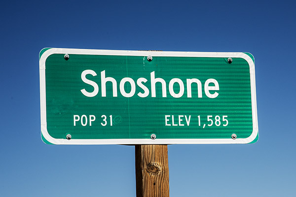
I guess I like Death Valley, because when Sue and I learned we had to use or lose some of our airline miles (and that we could use them for a hotel stay), we opted for a couple of nights at the Shoshone Inn in Shoshone, California (Shoshone is a little town just below Death Valley’s southern edge). Plus, I wanted to play with the N70 Nikon (a film camera) a little more and compare some of its photos to the digital pics from my Nikon D810.

The plan was to roll in to Shoshone through Baker, and hit Dante’s View, Zabriskie Point, Artist’s Palette, Badwater Basin, the Ashford Mill ruins, and then head back to Shoshone. If we had enough time, we wanted to explore other points of interest, too.
Dante’s View
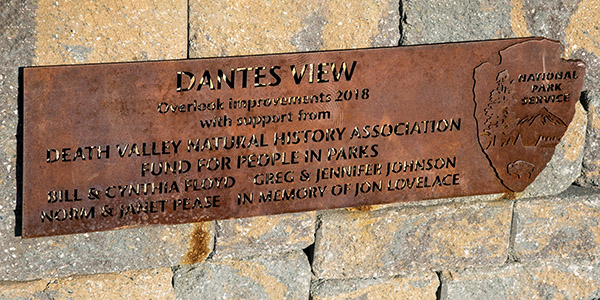
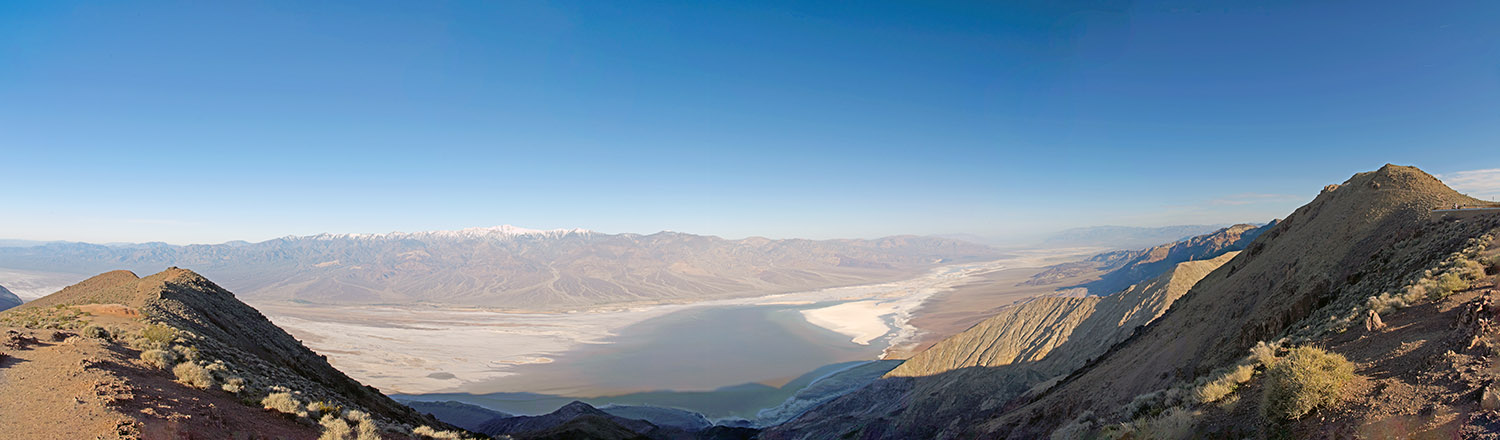
Our first stop the next morning was at Dante’s View. This spot gives a good overview of nearly the entire Death Valley basin and the surrounding mountains. Here’s the view looking northwest:
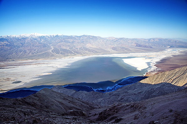
The vantage point at Dante’s View is really a panorama from nearly due north to nearly due south. I took several photographs from that vantage point and stitched them together in Photoshop. The photo below is a link. If you click on it, it will open a larger version.
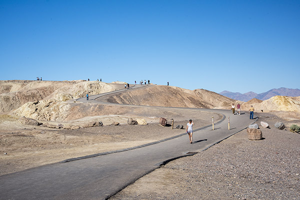
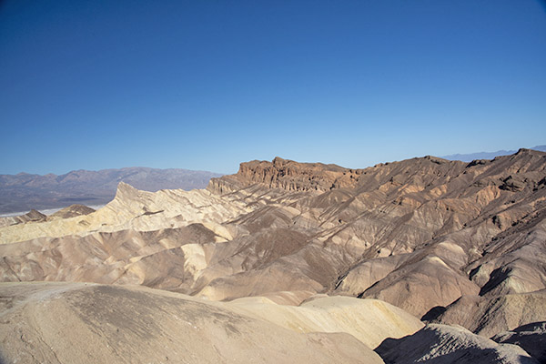
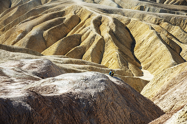
Zabriskie Point
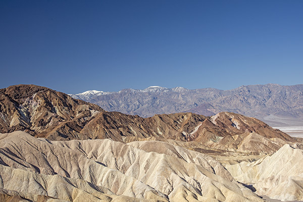
From there, it was on to Zabriskie Point. We backtracked from Dante’s View back to Highway 190, turned left, and then headed to Zabriskie Point. The ride through the rolling desert was nice, and the views were spectacular.
Artist’s Palette
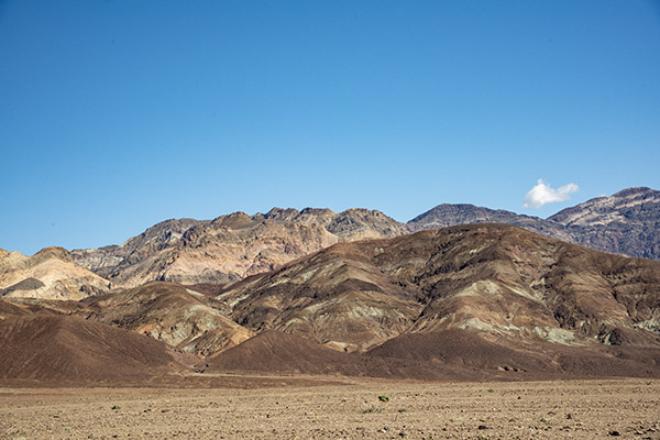
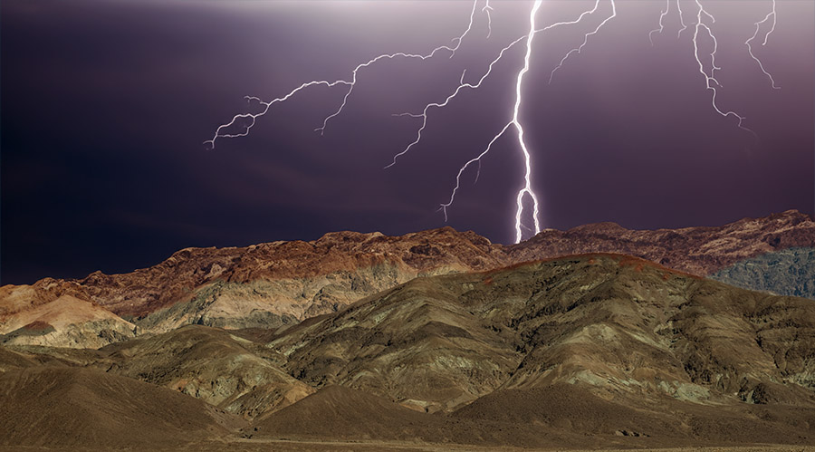
From there it was on to Artist’s Palette and then Badwater Basin. Artist’s Palette is a on a road that cuts off of Badwater Basin Road. The name is based on the fact that the hills in that area are multicolored. I plan to do another blog in the near future just on Artist’s Palette and the geology that gives the place its many hues.
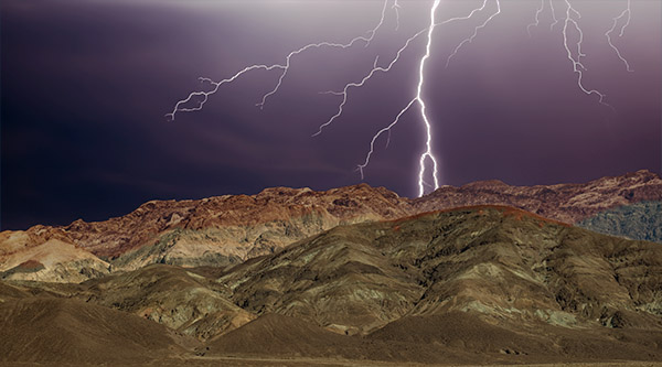
You might be wondering about the photo at the very top of this blog (I repeated here so you wouldn’t have to scroll up). No, I didn’t just happen to trip the D810 Nikon’s shutter when lightning struck. This is the same photograph of Artist’s Palette two pics up, but I had a little fun with a c0uple of PhotoShop features. I used the program’s artificial intelligence selection feature to select the sky (which, as you can see from the earlier photo was nice and sunny), and then I told PhotoShop to replace the sky with dark clouds and lightning. PhotoShop gave me three options; I selected the one you see here. What’s kind of cool is that it also shaded the mountains a bit, as they would appear under a dark and cloudy sky. I’m still on the fence on this topic of artificial intelligence and its uses. I’d prefer just plain old actual intelligence in more of my fellow mammals, but hey, I’m a grumpy old man who likes to shout at the clouds. What’s nice is now I can use AI to make the clouds appear whenever I want to.
Badwater Basin
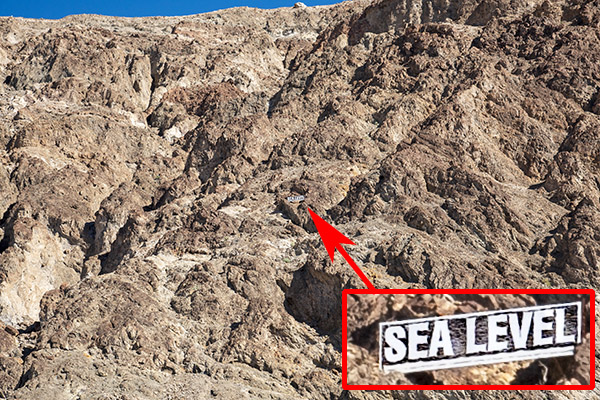
After Artist’s Palette, we were back on Badwater Basin Road, headed south to Badwater Basin. Death Valley, as most folks know, is below sea level. As you ride through different parts of Death Valley, there are signs showing how far you are below sea level. It’s cool. Badwater Basin is the lowest of the low at 282 feet below sea level.
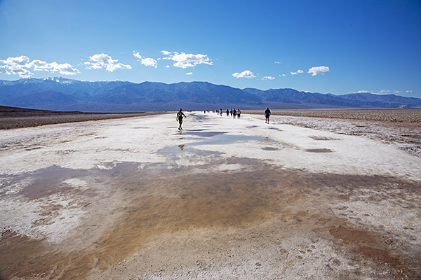
We had a lot of rain in southern California this winter, and in Death Valley, that resulted Badwater Basin being submerged. There was enough a couple of weeks before our visit that the National Park Service allowed kayaking in Badwater Basin. By the time of our visit, though, the Park authorities had put a lid on that. There was still water present, but it had receded enough that people would have to walk through the muck at the edges, which would damage the area. It’s too bad; a photo of folks kayaking in Badwater Basin would have been cool.
One of the nice things about traveling to places like Death Valley is that you meet people from all over the world. We had a nice conversation with a young guy from Beijing who was an exchange student in the Cal State system. I asked where he was from and he was hesitant to tell me at first, which I chalked up to nervousness induced by the tense(r) situation between the US and Chinese governments. I told him about our travels through China and that broke the ice. He was impressed.
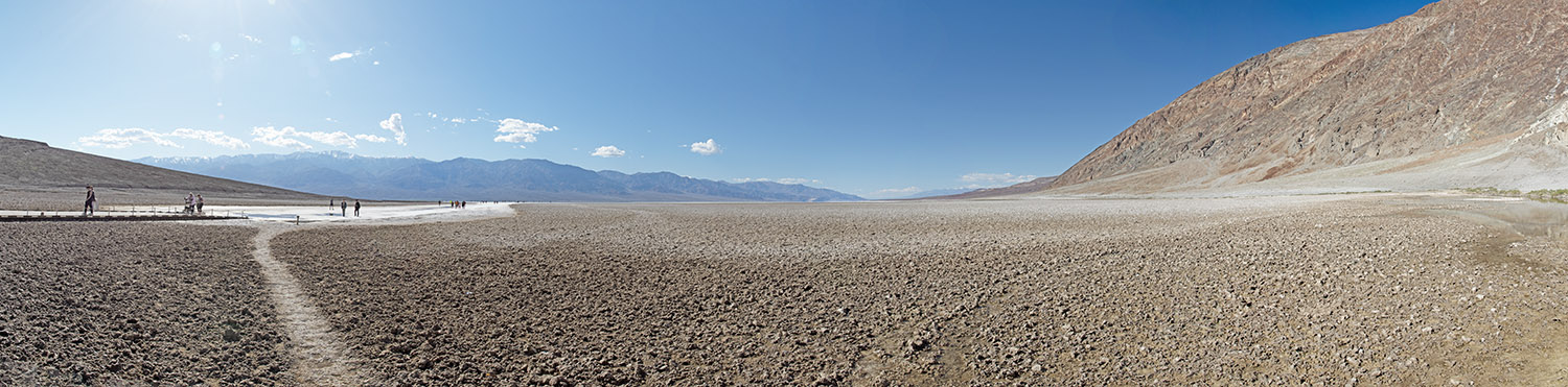
When you stand at the edge of Badwater Basin, there are mountains to the left and mountains to the right. I took nine photos and stitched them together in PhotoShop, just like I did for the Dante’s View panorama above. If you click on the photo below, it will open a larger version, which gives a small hint at the grandeur of the Badwater Basin vantage point.
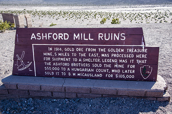
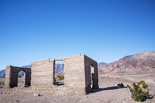
Ashford Mill Ruins
There’s not much to the Ashford Mill Ruins. It’s the shell of a building that processed gold prior to shipment out of Death Valley. It was on the road back to Shoshone, so we stopped to grab a few photos.
We wrapped up our ride through Death Valley late in the day, continuing south on Badwater Basin Road and then east as it became Highway 178. It was back to Shoshone for us, with dinner that night in Tecopa Springs. I’ll tell you more about that hopping locale in the next blog.
Never miss an ExNotes blog:
Don’t forget: Visit our advertisers!

God Bless America ! Death to Iran !
I agree, however I would specify death to the Iranian nazi radical “leadership” rather than the whole of Iran .
Very interesting area.
You realize of course, by peoples republic of China law , all Chinese citizens in USA are required to be spies.
If they have infiltrated even Death Valley one can imagine how they have infiltrated Washington DC.
Maybe that could very well be the source of your friends nervousness?
International intrigue aside ,
Artificial Intelligence has always worked well on Exhaust Notes.
Great job on the imaging .
Death Valley has been on my yearly vacation list for a long time it is indeed a beautiful place. I have traveled most of the roads leading to most of the mines and settelments in the valley.I believe that “snow covered mountain ” is Mt Whitney on the other side of Lone pine.
Thanks, Duane.