Cool Stuff Near Death Valley

By Joe Berk

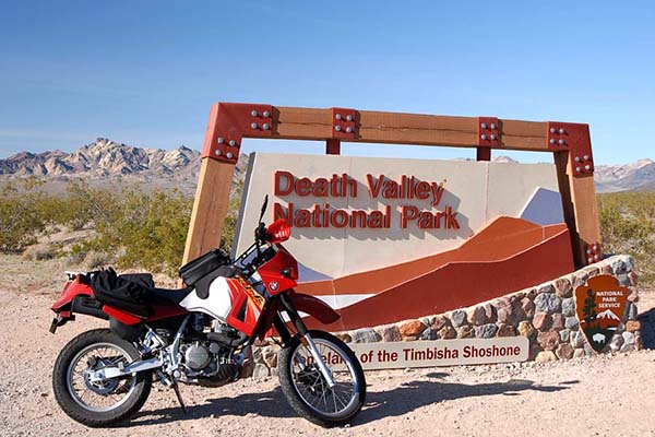
I recently posted a couple of blogs about Death Valley, including a recap of my several visits over the last decade.  This blog is a little bit different.  it’s about some of the cool stuff near Death Valley.  I didn’t have any hard rules about how close “near” means.  I’m including the places I’ve visited and thought were worth a mention.  If you think there should be more, leave a comment and tell us about it.  We love hearing from you and we love when you click on the popup ads, so don’t forget to do so (and when you see that donate button at the bottom of this blog…well, you know what to do).

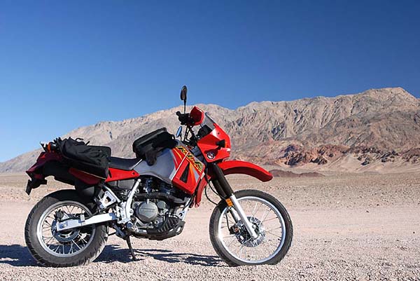
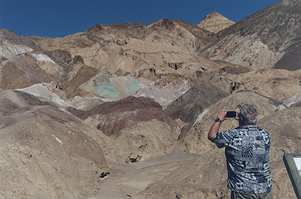
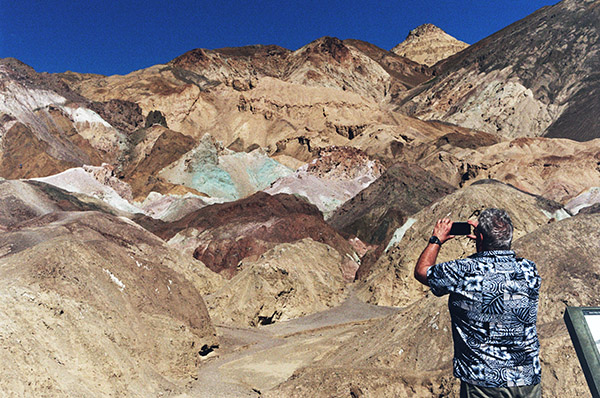
I shot most of the photos in this blog with my Nikon D810 and the 24-120 Nikon lens.  A few were with the Nikon N70 film camera I recently wrote about, and where that is the case, I’ll say so in the photo caption.

Baker

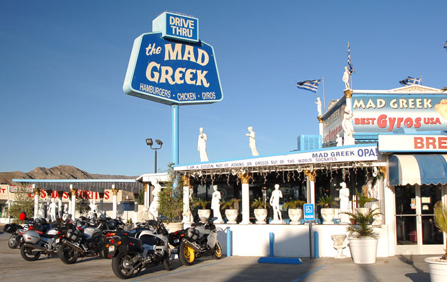
When visiting Death Valley from the south (as in southern Calilfornia), it’s likely you’ll pick up Highway 127 in Baker, just off Interstate 15.  There used to be a hotel in Baker, but it’s gone.  There are a couple of gas stations a couple of tacky fast food franchises, but don’t waste your time eating in a fast food franchise.  What you want is the Mad Greek.

The Mad Greek restaurant in Baker, California.

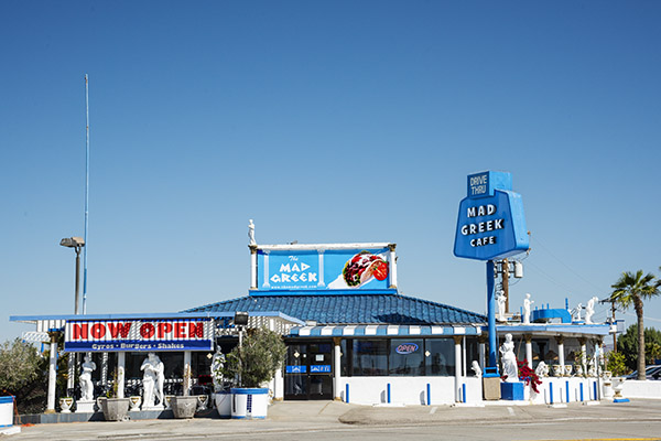
I didn’t eat at the Mad Greek on this trip (either coming to or leaving Death Valley).  Sue decided several trips ago she didn’t like the place, so I deferred to her wishes.  I never know when I might want to buy more reloading components, another gun, another watch, or another motorcycle, so we took a pass on the Mad Greek (Sue is of Greek ancestry; maybe that has something to do with it).  When I ever pass through Baker on my own, though, the Mad Greek is a sure thing.

The Baker thermometer. If you are going to visit Death Valley, the winter months are very comfortable (it was 68 degrees when I took this photo). It gets warmer in the summer.

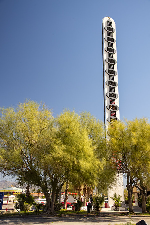
The other thing Baker is famous for is its thermometer.  It’s 134 feet tall, in honor of reaching that record temperature in 1913 (I guess we had global warming back then, too).  If you go through Baker, you have to get a photo of the Baker thermometer.  It’s a rite of passage.
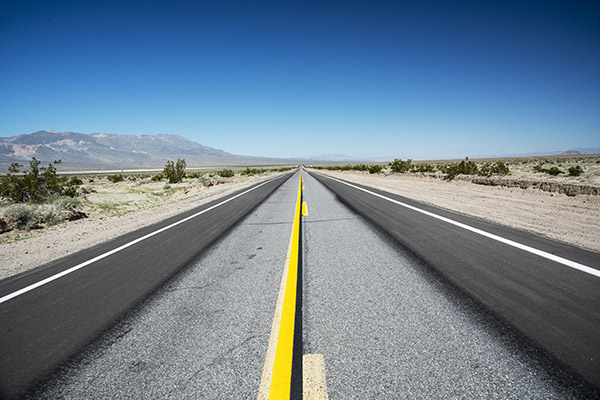
Highway 127

The signs are new; the Old Spanish Trail is not.

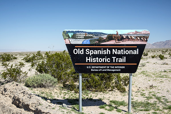
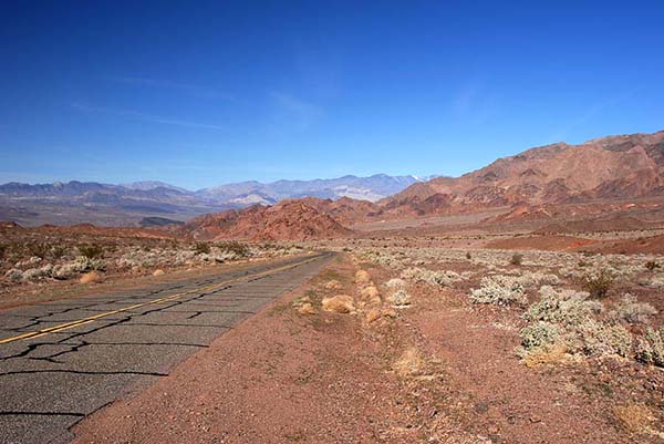
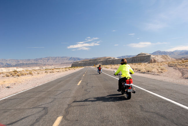
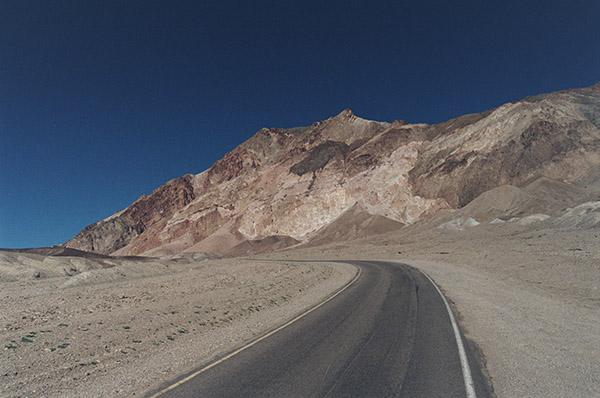
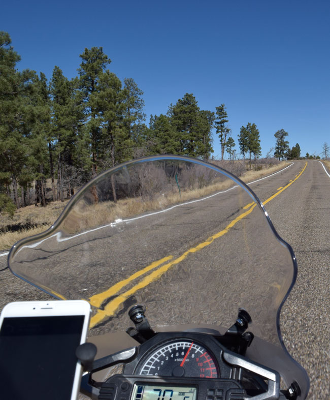
The ride north through the California desert from Baker to Death Valley is both beautiful and historic.  It follows the Old Spanish Trail, something I had never of until I saw the signs and did a little research.  Established in 1829, the Spanish Trail is a 700-mile long road that runs from Santa Fe to southern California.  It traverses New Mexico, Colorado, Utah, Arizona, Nevada, and California.  John C. Fremont and Kit Carson used it.  Serapes and other woven goods went to California from New Mexico; California’s horses and mules went to Santa Fe.  Indian slaves, contraband, and more used this same route.
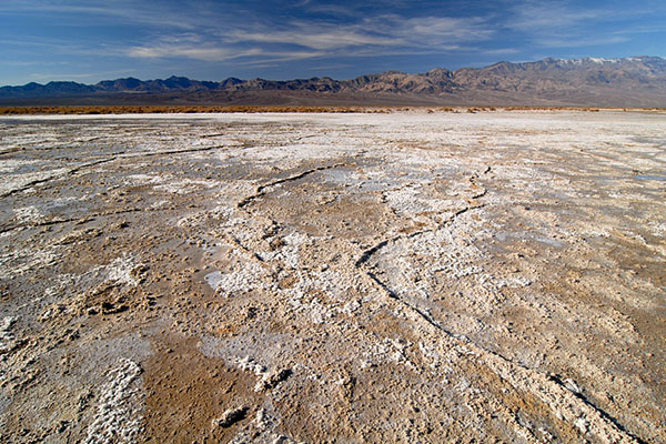
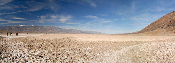
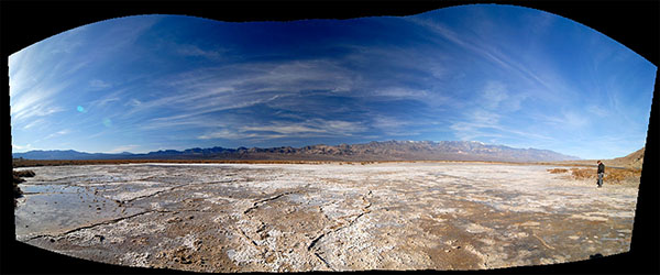
Looking north on California Highway 127 after leaving Baker. You probably think I cranked up the saturation on this photo, but I didn’t. The CalTrans folks had recently repainted the yellow and white lines.  The dark blue skies are due to the polarizing filter I had on my 24-120 lens.

Shoshone

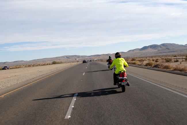
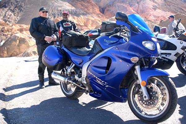
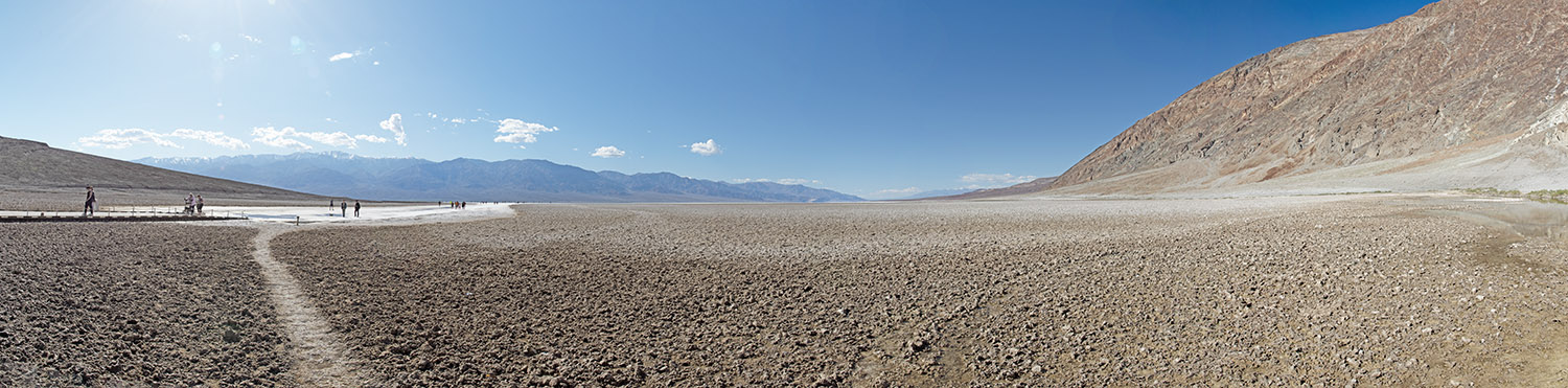
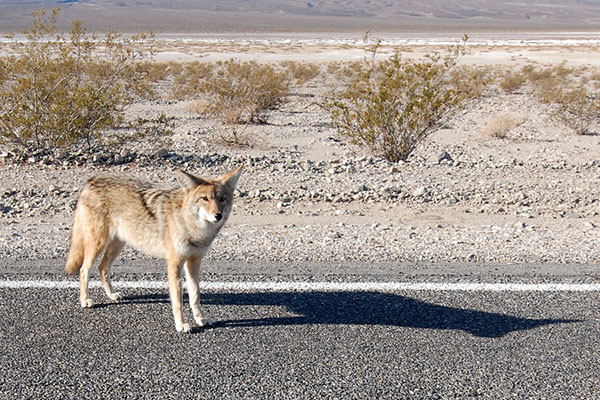
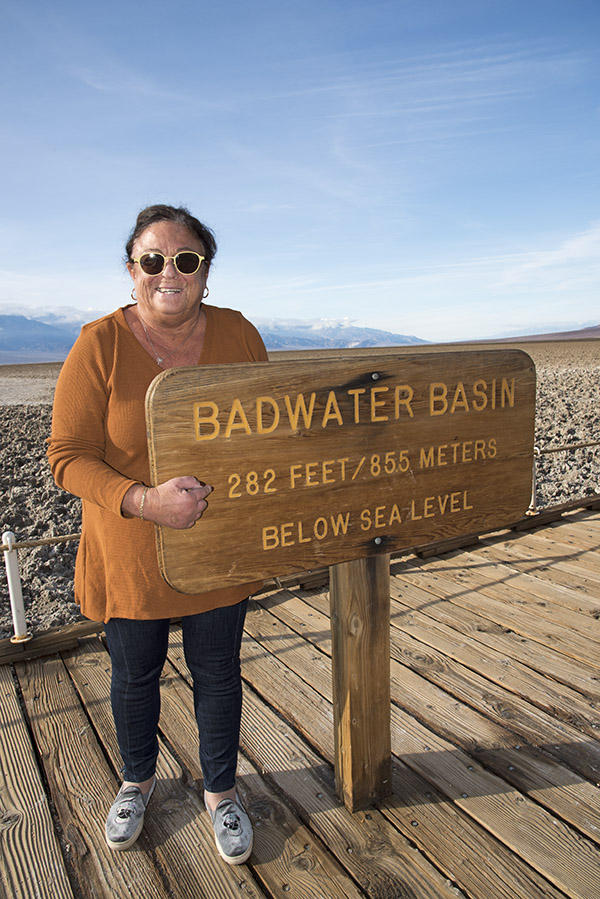
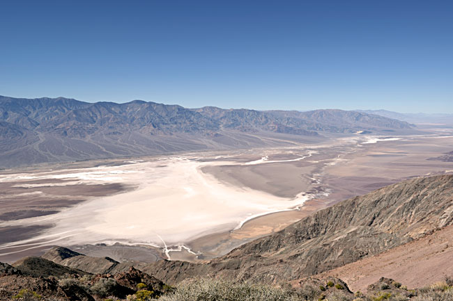
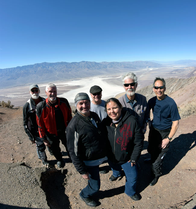
The first time I ever visited Shoshone was on the Destinations Deal ride.   I remember well the terror I felt on that stretch of road, leading a group of other riders after a long day through Death Valley.   We were heading south on Badwater Basin Road and I was relying on my cell phone and Waze to guide me.  I was worried about running out of gas, keeping one eye on the gas gage and the other on the road.  I should be okay, I kept thinking, but I’d never been this way before and I didn’t know.  Then my Waze program quit.  It had been running on stored info because I had no cell phone reception for the last 60 or 70 miles.  The gas gage was nudging closer to the “no more” line and I was sweating bullets.  It sure was remote out there.

Finally, Highway 178 ran into Highway 127 and a sign pointed to Shoshone.  I felt better, and then I realized I didn’t have the Shoshone Inn’s address where we would spend the night.  “How will I find it?” I wondered.  It wouldn’t be easy leading other riders while looking for the place (I’ve had to do this on other rides).  Then I was suddenly in Shoshone and I started to laugh.  You can’t miss the Shoshone Inn.  It’s one of only three or four buildings.  I’d say Shoshone was a wide spot in the road, but California 127 was no wider there than it was anywhere else.

Shoshone was founded by Ralph Fairbanks in 1910; initially, it was primarily a mining town (old Ralph was a Death Valley prospector and entrepreneur).  Charles Brown (yep, Charlie Brown) married Fairbanks’ daughter.  Charlie and Stella moved away, but they returned in 1920 and further developed the town.  Charlie became a California state senator and he turned ownership of Shoshone over to his son (who was also named Charles Brown).  I guess you might say Shoshone is a Charlie Brown kind of place.  I been there a few times, always looking for a girl named Lucy, but so far, I’ve had no luck.

The sign lies.

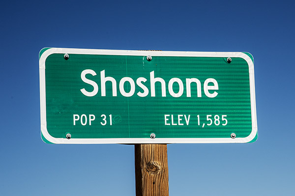
As I mentioned in an earlier blog, the Population 31 sign lied.  It’s only 13 people now.  The lady who runs the hotel (Jennifer, not Lucy) commutes from Pahrump (Pahrump is about 45 minutes east on the other side of the Nevada state line).  She told us about the sign lying.  The rest of the people either died or moved away.  None of them were named Lucy.

Shoshone is the last town before the southern entrance to Death Valley National Park.   One woman, a Mrs. Sorrells, inherited the town.  There’s a school that handles kids from K through 12th grade, some of whom commute from up to 120 miles away.  There’s a general store (including a gas station), a museum, a restaurant (the Crowbar Cafe and Saloon), a nature trail, an RV park, and an unmanned airstrip.  I guess if you are flying to Shoshone, you have to make a pass or two over the runway to make sure it’s clear.

The Shoshone Inn

A film photo taken with the Nikon N70 and tweaked in Photoshop.

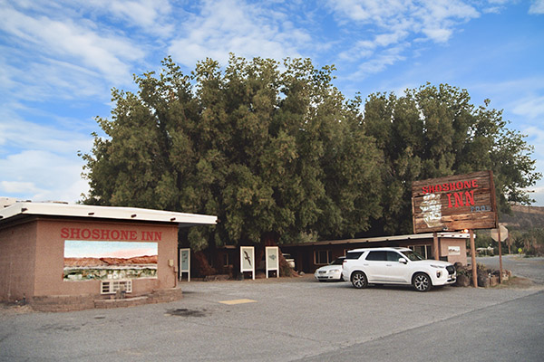
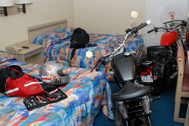
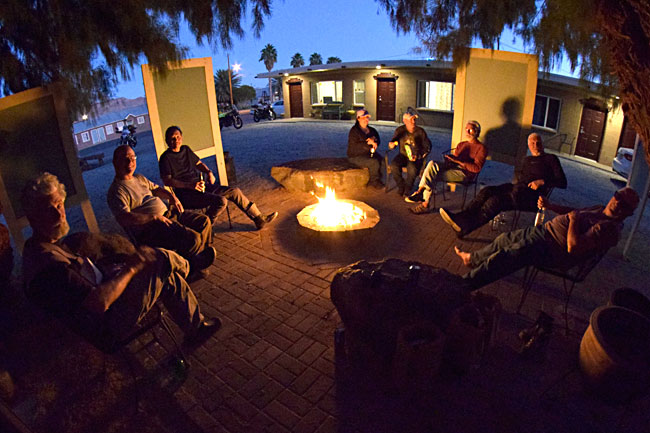
The Shoshone Inn is surprisingly nice, although it’s probably time for it to be refurbished.  There’s a gas-fired fire pit outside in the unpaved parking lot; when I rode into Shoshone with the Destinations Deal crew we spent a nice evening drinking Joe Gresh’s beer, which he bought from Shoshone’s next-door Charles Brown general store.

I got up early the next morning to take pictures with my film camera (the N70 my sister gave to me) and I saw that the fire pit was still going; I think the Shoshone Inn desk clerk may have forgotten to turn it off (they will be surprised when they get their gas bill).

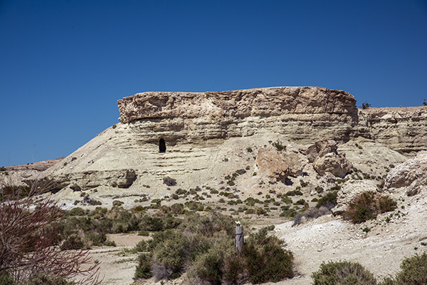
The Charlie Brown Rocks

A view of the Charlie Brown rocks.

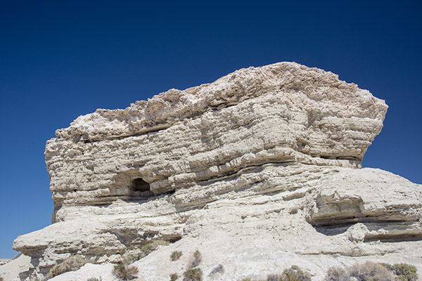
When I Googled what else was around Shoshone, the Charlie Brown rocks appeared.  Highway 178 east intersects with Highway 127 right at the southern edge of Shoshone.  When I saw the Charlie Brown rocks on Google, I wasn’t sure how far east on 178 I’d have to go, but when I approached Shoshone, I saw it was not far at all.  The rocks are what appear to be sandstone formations and they are kind of in your face as you approach Shoshone.   I could see the cave openings I’d read about, but there were signs to ward off trespassers and I didn’t want to wander in.  A few photos were good enough.

A shot from Highway 178.

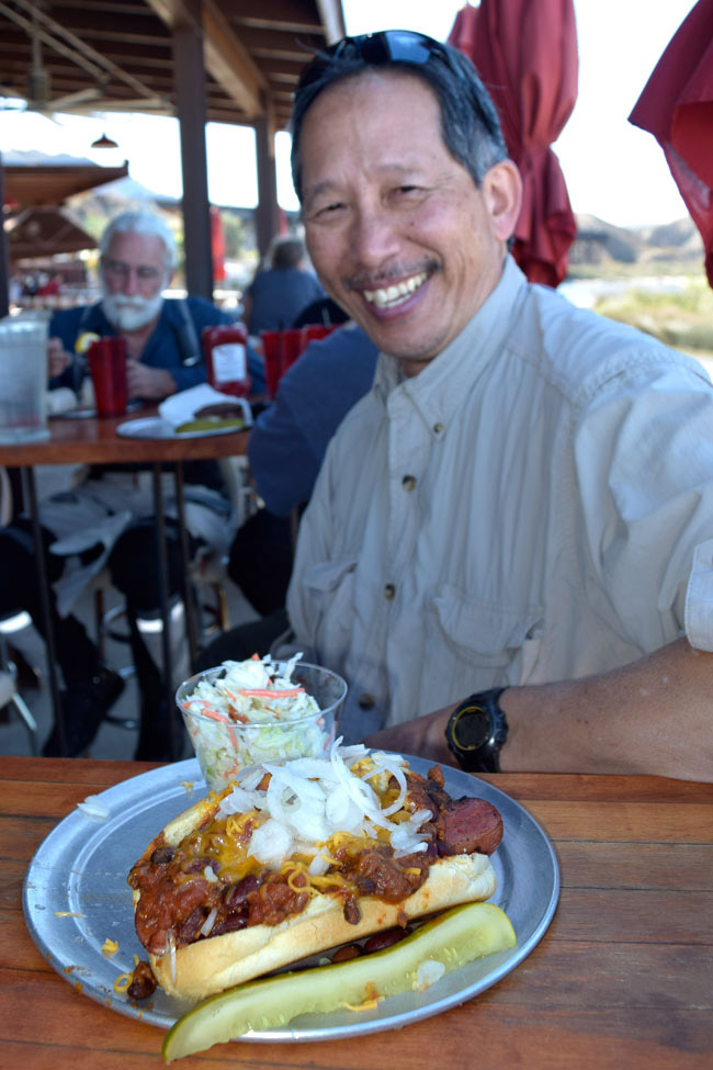
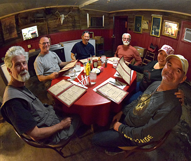
The Crowbar Cafe and Saloon

An N70 photo of the Crowbar Cafe and Saloon. It’s diagonally across the street from the Shoshone Inn.

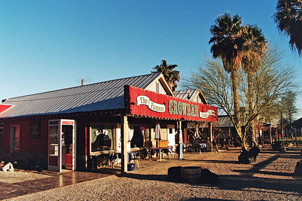
Sue and I had two meals in the Crowbar.  As I had experienced on previous visits (especially if you get there later in the day) it’s good to have three or four meal choices ready when the waitress takes your order.  Hamburgers?  No hamburgers, we had a busload of Chinese tourists come through and they ate all the hamburgers.   Trout?  No trout.  Tacos?  Yep, the Crowbar had tacos and they were surprisingly good.

The same restaurant, but with the D810 Nikon. Digital is superior to film. Duh.

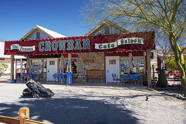
When we left after lunch that first day, we spotted a small airplane on the runway at the town’s southern edge (the runway is tucked into the southeastern corner of the Highway 127/178 intersection).  There’s no tower or buildings or anything else there, and you only see that it’s a paved runway when you look (you wouldn’t notice it otherwise).  We think the four young guys who were sitting one table over from us at lunch flew in from somewhere to eat at the Crowbar.

We sat at the bar the next night and the one-man-band lady who handled everything (waitressing, barmaiding, dishwashing, etc.) asked if I wanted a beer.   You bet, I answered.  There were four taps, all unmarked.  She didn’t know which tap had which beer, so she poured me a small sample of each and I opted for a craft-brewed dark beer.  The bartender/waiter/dishwasher told me was made in nearby Tecopa. It was good, as were the chicken fajitas Sue and I shared for dinner.

The Shoshone Museum

An N70 photo of the Museum. Not too bad for an old film camera.

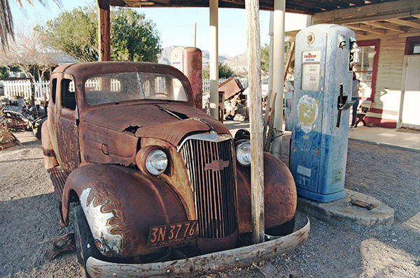
We didn’t go into the Shoshone museum because it was closed the two times we visited the Crowbar (it’s right next door).  It didn’t look as if there was much there; it was all housed in a very small building.  I took a picture of an old Chevy, an old fuel pump, and a bit of junk in front of the museum.  I’m guessing the museum used to be a gas station.  I’ll bet Charlie Brown owned it.

Tecopa Springs

Tecopa Springs is short drive east of Shoshone on Highway 178.   We went there twice.  We saw quite a few RVs but we only saw a few people in front of Tecopa’s two restaurants.  A young fellow we spoke to at the Crowbar the previous night told us he lived in Tecopa for six months each year and worked remotely (he was a digital nomad like Mike Huber).  I imagine he spent winters in Tecopa and found someplace cooler in the summer.  He said he came into Shoshone once a week for dinner because he wanted fried food and he couldn’t make fried food in his RV.

The two restaurants in Tecopa are a barbeque place and a combined bar and pizza place.   The digital nomad we spoke with in the Crowbar said Wednesday (the day we rolled into Tecopa for dinner) was the best night at the barbeque place, but that restaurant was closed when we rode by.  We rode on to the beer and pizza palace. When we entered, I asked the guy at the bar about the dark beer I’d had the night before in Shoshone (which was made in Tecopa), but they didn’t serve that brew there.  He gave me a small sample of their dark beer (also brewed in Tecopa).  It had kind of a peanut flavor to it and I thought it was okay, but the beer the previous night was better.  The bar only had two seats; there were other people drinking and smoking at tables outside the restaurant.

What can I say? Folks in Tecopa don’t have a lot to do, I guess.   This is an N70 photo.

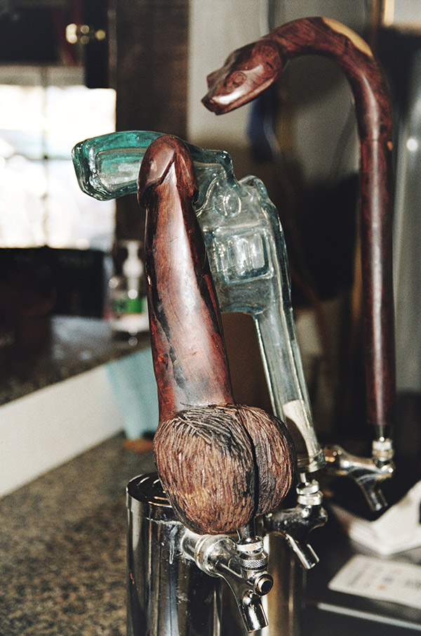
When I asked about their dark beer, the one guy who was seated at the bar told me,”it’s this one…the dick.”  I wasn’t sure I heard him correctly until I looked at the tap (which I hadn’t noticed).  It was, indeed, a dick.  I had to grab a photo.

Tecopa pizza, via the N70. There’s a whole lotta PhotoShop tweakin’ goin’ on in this photo.

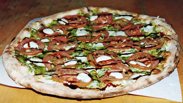
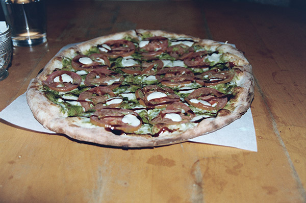
We ordered a pizza that seemed to take forever.  When the guy finally brought it out, it was cold.  It had probably sat for a while. Trust me on this: You wouldn’t want to make the trip to Tecopa for the pizza.  Maybe the photo ops, but not the pizza.

There’s also a date farm somewhere beyond Tecopa.  Sue and I rode out there after dinner, but it closed at 5:00 p.m. and we were too late.  They had date shakes and I was looking forward to one, but that will have to wait until my next visit.

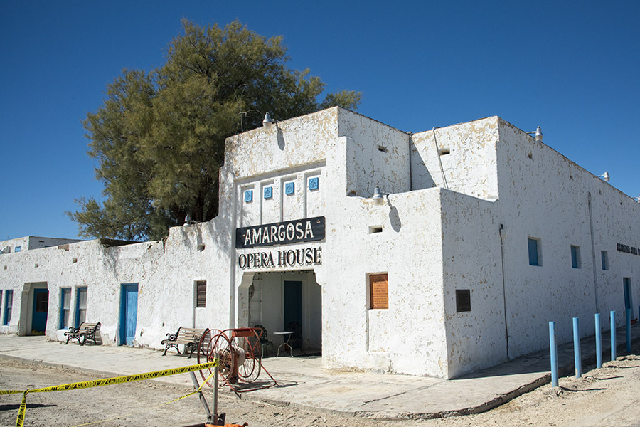
The Amargosa Opera House

After poking around a bit more on the Internet, I read about the Amargosa Opera House in Death Valley Junction.   It was 50 miles north of Shoshone.  The pictures on the Internet looked like the Opera House theatre’s interior would make for an interesting photo stop, so I called a couple of days before.  I mentioned that I was doing this for the ExhaustNotes website and possibly, a travel article for Motorcycle Classics magazine.

My free photo. Saved $500 on that one, I did.

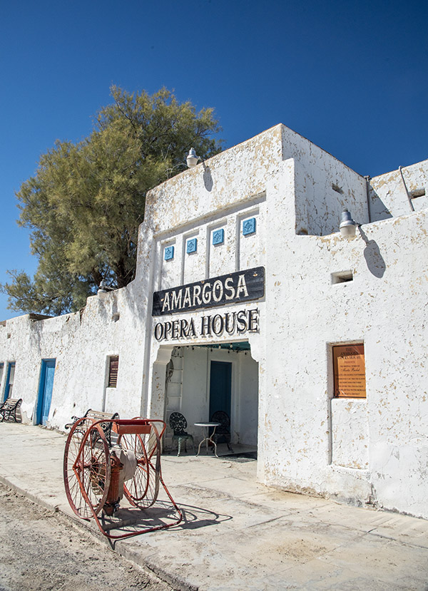
A young lady answered the phone and told me I needed to email their Director of Operations.  She promised he would get back to me that day.  That sounded like a plan and the Director of Operations did indeed get back to me with this message:  I could take their daily tour (at a cost of $15 per person) or I could pay $500 for one hour to photograph the theatre.  Gulp.  I can’t remember ever paying anyone anything for something like this.

Sue and I rode to Death Valley Junction anyway, and I grabbed a few photos from the outside.  When we first saw the place, it looked run down.  It’s hard to believe anyone would stay their hotel, but I guess people do.  A few photos and a $500 savings later, we were back on the road.

Pahrump

After spending another half day in Death Valley National Park, we decided to head over to Red Rock Canyon National Conservation Area.  That’s near Las Vegas.  On the way over, we crossed into Nevada and entered Pahrump.  Pahrump is a much bigger town than anything around Death Valley.  It has been one of the fastest growing towns in the entire U.S., with 15% year-over-year population growth for each of the last several years.  We thought Pahrump would be a good place to have lunch, and we were right.

Mom’s: A great restaurant in Pahrump.

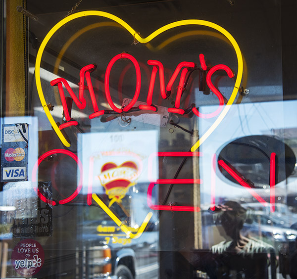
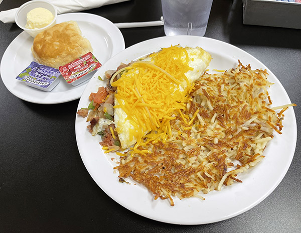
Sue found a place called Mom’s on her cell phone, it had great reviews, and we had to wait a few minutes to get in (which is always a good sign).  Trust me on this:  If you ever find yourself in Pahrump, Mom’s is where you want to eat.

I had a corn beef hash omelet for lunch at Mom’s. It was magnificent.

As I mentioned above, we went through Pahrump on our way to the Red Rock Canyon National Conservation Area.  I was going to squeeze that in here, too, but this blog is getting a little long.  I’ll save Red Rock for another blog.

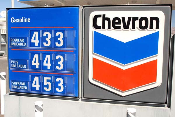
On the ride out of town on our way back to Shoshone, we stopped for gas in Pahrump.  It was $3.68 per gallon.  That’s a good two bucks cheaper than what we pay in California.  After filling up and on the way out of town, we saw a gun store creatively named Pahrump Guns and Ammo.  Sue won’t let me drive past a gun store without stopping, so we did.  It was a small place and we had a nice visit with the two guys who worked there.  I told them we were from California and we were collecting campaign contributions for Hillary Clinton.  We had a good laugh.  People in Pahrump have a sense of humor.

Barstow’s Del Taco Restaurants

You probably think I’m crazy including the Barstow Del Taco restaurants in this blog.   I’m listing it here because if you’re going to Death Valley from southern California, it’s a safe bet you’re going to pass through Barstow, and if you’re going to pass through Barstow, you need to stop at one of the three Del Tacos there.

There’s a story behind this.  About 15 years ago I had a bad motorcycle crash and I had to spend a month in the hospital.  One of the guys I shared a room with was the son of Ed Hackbarth, the entrepreneur who founded the Del Taco restaurant chain.

One of the three Barstow Del Taco restaurants.  Trust me on this: You want to stop at Del Taco in Barstow.

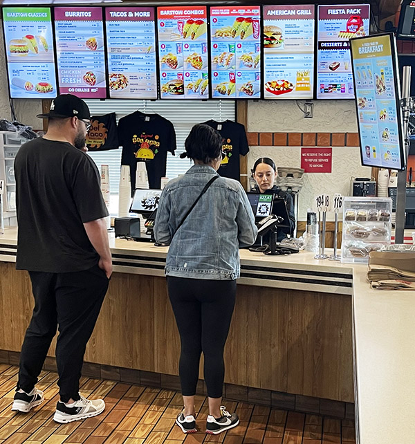
Ed Hackbarth is a real prince of a guy.  He started Del Taco in Barstow, the restaurant chain was riotously successful, and it spread all over the U.S.  Ed sold the Del Taco chain way back in 1976 to a group of investors and it continues to thrive.  But there’s a big difference between the rest of the Del Taco empire and the three Del Tacos in Barstow.  When Ed sold Del Taco, part of the deal was that he kept the original three Barstow Del Tacos.  Ed would continue to use the Del Taco name on those three restaurants, but he didn’t have to use the Del Taco menu and he could serve food the way he wanted.  And that’s what Ed does.  The portions are bigger (they’re huge, actually), everything is fresh (nothing is ever frozen), the restaurants are immaculate, and the staff is super friendly.  The Barstow Del Tacos have some of the best tacos and burritos I’ve ever had.  We won’t drive through Barstow without stopping at one of Ed’s three Del Tacos, and there’s been times we’ve made the 80-mile trek from my home to Barstow just for a taco.  You should try one.  You can thank me later.


Never miss an ExNotes blog:


Don’t forget: Visit our advertisers!


Death Valley 2024

By Joe Berk

I guess I like Death Valley, because when Sue and I learned we had to use or lose some of our airline miles (and that we could use them for a hotel stay), we opted for a couple of nights at the Shoshone Inn in Shoshone, California (Shoshone is a little town just below Death Valley’s southern edge).  Plus, I wanted to play with the N70 Nikon (a film camera) a little more and compare some of its photos to the digital pics from my Nikon D810.

The 2024 Death Valley Adventure Run route. We took a couple of days to do this and more. You could cram it all into a single day, but what be the point?

The plan was to roll in to Shoshone through Baker, and hit Dante’s View, Zabriskie Point, Artist’s Palette, Badwater Basin, the Ashford Mill ruins, and then head back to Shoshone.  If we had enough time, we wanted to explore other points of interest, too.

When we checked in to the Shoshone Hotel on this visit, I asked about the 31 people who lived there. The hotel clerk told me the sign lied. The current population was 13 (not 31) people.

Dante’s View

The sign up at Dante’s View, nicely oxidized.

Our first stop the next morning was at Dante’s View.  This spot gives a good overview of nearly the entire Death Valley basin and the surrounding mountains.  Here’s the view looking northwest:

You can see that Death Valley was flooded, and that the floodwaters in the basin were receding. No kayaking allowed by the time we arrived.

The vantage point at Dante’s View is really a panorama from nearly due north to nearly due south.  I took several photographs from that vantage point and stitched them together in Photoshop.   The photo below is a link.  If you click on it, it will open a larger version.

Go ahead and click on this photo…I dare you.

Zabriskie Point

From there, it was on to Zabriskie Point.  We backtracked from Dante’s View back to Highway 190, turned left, and then headed to Zabriskie Point.  The ride through the rolling desert was nice, and the views were spectacular.

Walking up to Zabriskie Point. This is another scenic location, with lots of California and Death Valley geology on display.
A view of the different strata at Zabriskie Point.
Looking across Death Valley to the snow-capped mountains on the other side.
Zabriskie Point badlands. You can have a lot of fun with a camera at Death Valley. This was a good time of year to be there, too.

Artist’s Palette

Artist’s Palette. There are different elements present in these mountains, which provide an array of color.

From there it was on to Artist’s Palette and then Badwater Basin.  Artist’s Palette is a on a road that cuts off of Badwater Basin Road.  The name is based on the fact that the hills in that area are multicolored.  I plan to do another blog in the near future just on Artist’s Palette and the geology that gives the place its many hues.

PhotoShop, artificial intelligence, fake lightning, and Artist’s Palette.

You might be wondering about the photo at the very top of this blog (I repeated here so you wouldn’t have to scroll up).  No, I didn’t just happen to trip the D810 Nikon’s shutter when lightning struck.  This is the same photograph of Artist’s Palette two pics up, but I had a little fun with a c0uple of PhotoShop features.  I used the program’s artificial intelligence selection feature to select the sky (which, as you can see from the earlier photo was nice and sunny), and then I told PhotoShop to replace the sky with dark clouds and lightning.  PhotoShop gave me three options; I selected the one you see here.  What’s kind of cool is that it also shaded the mountains a bit, as they would appear under a dark and cloudy sky.  I’m still on the fence on this topic of artificial intelligence and its uses.  I’d prefer just plain old actual intelligence in more of my fellow mammals, but hey, I’m a grumpy old man who likes to shout at the clouds.  What’s nice is now I can use AI to make the clouds appear whenever I want to.

Badwater Basin

After Artist’s Palette, we were back on Badwater Basin Road, headed south to Badwater Basin.  Death Valley, as most folks know, is below sea level.  As you ride through different parts of Death Valley, there are signs showing how far you are below sea level.  It’s cool.  Badwater Basin is the lowest of the low at 282 feet below sea level.

Looking up from Badwater Basin at the mountains to the east. Our location was 282 feet below sea level.
Fellow tourists walking out into Death Valley’s Badwater Basin.

We had a lot of rain in southern California this winter, and in Death Valley, that resulted Badwater Basin being submerged.  There was enough a couple of weeks before our visit that the National Park Service allowed kayaking in Badwater Basin.  By the time of our visit, though, the Park authorities had put a lid on that.  There was still water present, but it had receded enough that people would have to walk through the muck at the edges, which would damage the area.  It’s too bad; a photo of folks kayaking in Badwater Basin would have been cool.

One of the nice things about traveling to places like Death Valley is that you meet people from all over the world.  We had a nice conversation with a young guy from Beijing who was an exchange student in the Cal State system.  I asked where he was from and he was hesitant to tell me at first, which I chalked up to nervousness induced by the tense(r) situation between the US and Chinese governments.  I told him about our travels through China and that broke the ice.  He was impressed.

Sue and I hamming it up with the cameras. The guy next to her is the young man from China mentioned above.

When you stand at the edge of Badwater Basin, there are mountains to the left and mountains to the right.   I took nine photos and stitched them together in PhotoShop, just like I did for the Dante’s View panorama above.  If you click on the photo below, it will open a larger version, which gives a small hint at the grandeur of the Badwater Basin vantage point.

Go ahead…make my day: Click on this photo.

Ashford Mill Ruins

There’s not much to the Ashford Mill Ruins.  It’s the shell of a building that processed gold prior to shipment out of Death Valley.  It was on the road back to Shoshone, so we stopped to grab a few photos.

All you ever wanted to know about the Ashford Mill ruins.
What’s left of the Ashford Mill. Working here in the summer must have been brutal.

We wrapped up our ride through Death Valley late in the day, continuing south on Badwater Basin Road and then east as it became Highway 178.  It was back to Shoshone for us, with dinner that night in Tecopa Springs.  I’ll tell you more about that hopping locale in the next blog.


Never miss an ExNotes blog:


Don’t forget: Visit our advertisers!


A Recap: Previous Death Valley Visits

By Joe Berk

As I mentioned in a recent blog, Sue and I recently spent a couple of days in Death Valley.  I love the place.  I lived in California for 30+ years before I ever made the trip out there on my KLR 650, and since then, I’ve been back several times.  Here’s a short recap of those previous visits.

The Teutonic Twins Run

asdf
My KLR in Death Valley on that first visit. I loved my KLR; it was a great motorcycle.
asdf
Good buddy Dennis, who won the chili-eating contest at Brown’s BMW.

That first ride on the KLR 650 didn’t just happen because I decided to finally get out there to see the hottest place on the planet.  It came about because the guys at Brown BMW had a chili cookoff and eating contest followed by a two-day ride to Death Valley.  If it hadn’t been for that, I wouldn’t have made it out there.  I was the lone KLR rider; all the other guys were on big BMW twins.   I’d ridden with those guys before and they were too fast for me.  Nope, I was happy as a clam poking along on my 650cc single.  I left right after the chili cookoff because I planned to meander along through other parts of the Mojave before spending the night in Baker, which was to be our jumping off point the next morning.   It was fun, that ride out to Baker was.  Just me and the KLR.   I explored the desert around Kelbaker (southeast of Baker) and the old train depot there.

The next morning, we all had breakfast at the Mad Greek (a Baker and southern California icon), and then rolled out on California State Route 127 to the lower end of Death Valley.  That’s a good highway that cuts through the desert.  There’s nothing else out there, and the Teutonic twin crowd quickly left me in the dust.  They were running well over 100 mph; the KLR might touch 100 on a good day.  But I didn’t need to run at those speeds that day.  I was enjoying the ride.

adsf
The charcoal kilns in Death Valley, I’m sure glad I didn’t skip seeing them on that first Death Valley foray.

When I left Death Valley on that first trip, I left through the northwestern part to pick up the 395 back down to southern California.  That was a good thing.  I saw a sign for Wildrose Canyon Road and another sign for the charcoal kilns pointing down a dirt road.  I was by myself and I was in no hurry.  I didn’t have any idea what the charcoal kilns were all about, but I was interested in learning more.  I took that road, and I’m glad I did.  Every time I’ve been in Death Valley since that first trip, the road to the charcoal kilns was closed, including on this my recent trip.  If you are ever out there and the road is open, you might consider seeing them.   The kilns are interesting, and Wildrose Canyon Road (as the name suggests) is a beautiful ride.

The Hell’s Loop Endurance Run

Following Arlene and TK on 150cc California Scooters into Death Valley.

Another ride in was when good buddy TK, good buddy Arlene, and I rode in the Hell’s Loop endurance rally on the 150cc California Scooters.  That was a challenging day.  We rode 400 miles into and through Death Valley and then returned to Barstow.  It was cold and the hardtail CSC 150 beat me up, but it was fun.  That little 150 never missed a beat.

asdf
We had lunch at the Furnace Creek Inn, and shortly before turning off the road, we saw this guy. He is obviously well fed.
As soon as we sat down for lunch at the Furnace Creek Inn, this guy landed a couple feet away. We had just seen the coyote. I asked the roadrunner if he owned anything made by Acme, or if he was being chased by old Wiley. He responded with but two words: Beep Beep.

My next Death Valley adventure was a photo safari with Sue.  We did that one in my Subie CrossTrek in a single day.  It was a long day, but the photo ops did not disappoint.  What was kind of cool about that trip is that when we rode through Badwater Basin, we saw a coyote loping along the road headed north, and a short while later when we stopped at the Furnace Creek Inn, a roadrunner landed right next to us as we enjoyed lunch on the patio.  Was the roadrunner running from the coyote? Cue in the Warner Brothers: Beep beep!

The Destinations Deal Tour

The Destinations Deal crew overlooking Death Valley from Dante’s View. We covered a lot of territory on that trip.

A few years ago we rode through Death Valley on RX3 motorcycles.  That was part of a promotion we ran when I was working with CSC.  We took a half dozen riders through a handful of southwestern states, and Death Valley was the last of several national park visits.  It’s where I first met Orlando and his wife Velma.   Joe Gresh was on that ride, too.  It was fun.

The “My Sister Eileen” Trip

A 20-mule-team borax train.
Just like the theatrical title: My sister Eileen. We had a great time on that trip.

After the Destinations Deal run, Sue and I and my sister Eileen had a road trip through California and Nevada, with a run down the 395 through a major league snowstorm.  We went through Death Valley the next day (the snowstorm had ended) and it was awesome.  I didn’t do a blog on that Death Valley visit (I have no idea why), but trust me on this:  Like all trips to and through Death Valley, it was awesome.


That gets me caught up on my prior Death Valley visits.   If you want to see more photos and read more about those earlier visits, here are the links:

Watch for a series of Death Valley blogs.  The first will be about our most recent visit, and then I’ll post blogs about Death Valley history, Death Valley geology, things to do around Death Valley, Shoshone, nearby Red Rock Canyon National Park, and maybe more.   Stay tuned.


Never miss an ExNotes blog:


Don’t forget: Visit our advertisers!


Nikon’s N70 Film Camera: Part 2

By Joe Berk

This is a follow up to the recent post on my recently reacquired Nikon N70 film camera.


In the prior blog, I mentioned the N70’s rear door gooification issue and that I had read on an Internet forum it was a common issue.  My camera’s rear door was like fly paper, with all kinds of debris stuck to it.  I used the approach the forum commenter mentioned:  A shop rag and alcohol, a little elbow grease, and the goo came off.  The plastic underneath has a nice glossy black finish that matches the camera’s other exterior surfaces.  It looks good.  Here’s a pair of before and after photos:

Good buddy Greg spotted me three rolls of ISO 400 35mm film.  He told me the film was 6 or 8 years old, but he thought it still might be good.  I loaded a roll in the N70.

I don’t like UV filters and that’s what the Tamron 28-105 lens had on it when I took it home from New Jersey.  I prefer a polarizer unless I’m shooting at night or using the flash.  At one point I probably had a 62mm polarizer, but I tossed a bunch of camera debris and detritus a few months ago and if I ever had a 62mm polarizer (which is what the Tamron takes), it went out with that batch.  No problem; I found a 62mm polarizer and a 62mm lens cap on Amazon.  I ordered both, along with three rolls of ISO 200 35mm film.  I figured if the film Greg gave didn’t work out, this film would because it was brand new.  Even if Greg’s film was good, I’d need more eventually.

You know, it’s not easy to find 35mm film in stores like it used to be.  Costco used to have a big area stocked with all kinds of 35mm from Fuji and Kodak, ranging from ISO 100 to ISO 1600 (with everything in between).  They also had a huge section for processing film and making enlargements.  The Costco film developing and printing services were inexpensive, they did a great job, and they turned it around in under an hour.  It’s all gone now.  Wiped clean from the face of the earth, as they say.  Sometimes I feel like turning around, walking out, and shouting at the clouds.  I’m an old man, so I can do it.  But I don’t.

Anyway, to get back to the Nikon story, I shot up that first roll of expired ISO 400 film.  Just silly stuff…pictures of the house (which immediately caused my neighbor to come over and ask if we were listing the house), my office area, and a couple of motorcycles.  The roll of film provided just 24 exposures and it went quickly.  When I shoot digital, I might take a hundred shots in a single stop.  Shooting film, though, is like shooting a single-shot  rifle.  You think more.  You have to make each shot count.

A quick Google search on film developers near me showed that there weren’t too many, but there was a guy across the street from Costco.  I had used him once before to get some older negatives scanned for a magazine article, so I knew he was good.  I rolled over there and to my surprise, I had to stand in line.  What do you know?  There are other people who still shoot film.  As I patiently waited my turn, I thought that this guy probably doesn’t mind Costco exiting the film business.

When I was my turn, David (the guy behind the counter) remembered me.  He asked if I wanted the negatives and the prints.  At first I said yes, but then I remembered I have gobs of old prints and negatives stuffed away all over the house.  So I said no, I just want the scanned images.  David’s shop scans in either of two resolutions (medium or high); he didn’t know what the DPI (dots per inch) for either.  My digital Nikon shoots at 300 DPI, but I have to knock the images down to 72 DPI in PhotoShop for the ExNotes blog (everything you’ve ever seen on the blog is 72 DPI).   David told me the digital images (scanned from my negatives) would be in my Dropbox account the next day (he actually delivered them that same night).  The medium resolution images were at 256 DPI.

When I opened the scanned images, at first I thought that the expired film may have, in fact, expired.  The images were faded, and because I was shooting ISO 400 film, they were also somewhat grainy. Okay, so the film guys were serious about that use by date.  I played with one, though, to see if I could bring it to life.  Here’s what it looked like initially:

Here’s what it looked like after I worked on it a bit in PhotoShop:

The next step was to try the new ISO 200 film.  Sue and I spent a couple of days in Death Valley, and I tossed the N70 into my overnight bag for that trip.

I don’t think it’s possible to have a bad stay in Death Valley, although I understand that the folks who named the place might have thought otherwise.  I love it there.  This time, we explored the surrounding areas, including Tecopa Springs a few miles away.  Tecopa Springs sounds a lot more exotic than it really is.  There’s a bar and pizza place so I ordered one of their craft beers and a pizza.   I took a photo of it before we dug in and when I received the scan after I returned home, it was depressingly bland.  Here’s what it looked like:

The scan with this roll of new 35mm ISO 200 Fuji film, as delivered, looked about the same as the stuff I had shot with the expired film.  Maybe the developer didn’t automatically tweak it to highlight the colors.   I opened the scan in PhotoShop, cropped it, adjusted the levels and curves, cranked in a little vibrance, deleted the distractions in the upper left corner, and hit it with the shadows feature to brighten the image’s upper half.  That brought it to life a little better.

Here’s another set of before and after images in Death Valley’s Artist’s Palette area.  This is the photo on the road heading there before any PhotoShop trickery:

Here’s that image with its levels and curves adjusted:

In the photo above, the mountains and the road look exactly as I remember them.  The sky is a bit too vibrant, but that’s the polarizer earning its keep.

This is another pair of images at Artist’s Palette.  The first is the scan as I received it from the developer:

This is the image above with its curves and levels adjusted:

Again, the sky is too deep, but the rest of the image is true to how I remember it.    The guy in the image is using his iPhone, which probably returned the bright colors you see in the PhotoShop-tweaked photos without him doing anything.  That’s because the iPhone does all the mods automatically.

So what’s the bottom line?  Digital, my brothers.  Film photography is fun, but for me it’s a huge step back.  I’ll take my Nikon D3300 or D810 over film any time I’m out.  The N70 is interesting, but it’s digital all the way for me.  With two or three exceptions, and those are the other film cameras I brought back from New Jersey, including a very nice Honeywell Pentax ES (if I can find the right size battery for it).  Stay tuned.


Never miss an ExNotes blog:


Don’t forget: Visit our advertisers!


Phavorite Photos: Orlando and Velma

We started this Phavorite Photo series a short while ago at Python Pete’s suggestion, and while going through a few of my favorites recently the photo you see above popped out.  That’s my good buddies Orlando and Velma on their CSC RX3 headed up to Dante’s View, a natural overook that provides what has to be the best view of Death Valley (the view is shown in the photo below).  We were on the Destinations Deal tour, and Orlando and Velma bought their RX3 motorcycle specifically to go with us on this ride.  The Destinations Deal was a grand ride, and Orlando and Velma are great traveling companions.

I grabbed that photo of Orlando and Velma with my little Nikon D3300, its kit 18-55mm lens, and a polarizer. The D3300 was a superb traveling SLR.  The photo needed a little tweaking in PhotoShop to bring it up (they almost all always do).  A bit of cropping, a correction in levels, another correction in curves, eliminating an unsightly sign that was in the background, and just a little bit of vibrance and saturation enhancement.  Here’s what the original looked like:

I was particularly impressed with Orlando’s RX3 motorcycle. This was the second time I led a CSC tour with folks riding two up on an RX3. Orlando had no difficulty hanging with the rest of us (we were all riding solo), and surprisingly, his bike returned the same fuel economy.  There’s a lot to be said for small bikes.  I’ve said some of it before.

I have more than a few favorite photos.  You’ll see more here on the ExhaustNotes blog.


Something we’ll do in each one of these Phavorite Photos blogs is show our prior favorites.  Just click on the photo to get to each earlier blog.  There’s only one so far; there will be more.


Never miss an ExNotes blog….sign up here for free:

The Destinations Deal Ride: One of the best ever!

When I wrote the blog for CSC Motorcycles, we organized several multi-day rides (trips through Baja, the western US, China, Colombia, and more).   One of my favorite rides was the Destinations Deal tour.  It started out as an idea by the real marketing whiz in the CSC organization (who likes her anonymity, so I won’t mention her name), with directions to include some of the best destinations in the southwestern US.  As I organized the ride, I realized all the spots I selected were featured in stories I wrote for Motorcycle Classics magazine.  CSC wanted to offer a discount on any new bike purchased for the event, the Motorcycle Classics columns were all titled Destinations, and the ride quickly became known as the Destinations Deal Tour. 

The ride was awesome:  Topock, Laughlin, Oatman, the Grand Canyon, Route 66, Zion, the Extraterrestrial Highway, Tonopah, Death Valley, Shoshone, Baker, and then home.  Just over 1500 miles in 6 days on 250cc motorcycles…it would be exactly what the doctor ordered.

The Destinations Deal was one of the best rides I ever did.  Old friends and new friends, great weather, great stops, great roads, and great stories combined for an awesome week.  The roads, the riders, the restaurants, the camaraderie…it all clicked on this one.  But don’t take my word for it.   Take a look at the photos.

Leighton and a killer hot dog in Topock on the Colorado River just as we crossed into Arizona. You get a discount coupon for the local coronary care unit when you order this meal.
A few of the boys and their RX3s in Oatman. Clark Gable and Carole Lombard stayed in this hotel back in the day.
Wild jackasses roam the streets in Oatman.   I could have a lot of fun captioning this photo.
On our first night, we stayed in the Colorado Belle, a riverboat hotel on the Colorado River in Laughlin, Nevada.  It was our first day and we rode through three states already.  Gresh and I closed the bar that first evening. They had a live group doing ’60s Motown hits and the music was fantastic. Or maybe we just had a few too many cervezas. Or maybe it was both. The trip was off to a great start.
Day 2 on the way to the Grand Canyon. The weather was perfect for the entire ride.
Velma and Orlando, who rode two-up on a brand-new blue RX3. Orlando taught me Spanish on this ride: El naranja es el color más rápido.
Another shot of the most photogenic couple you’ll ever see on an adventure ride, this time using a super-wide-angle lens on my Nikon.  You can actually see the curvature of the earth in this photo.
Good buddy Rob, with who I’ve ridden several times in the US and Mexico, buys a drink for a new friend at the Grand Canyon.
On the road to Zion along Arizona’s Highway 89A after visiting the Grand Canyon. This was a glorious ride.
Marble Canyon in Arizona as we re-crossed the mighty Colorado River.
Zion, the Crown Jewel of our National Parks. This was shaping up to be one of the best trips ever.  From left to right, it’s Dan The Man, Orlando and Velma, Gary in the back, Leighton, Willie, and Rob.  Add Gresh and yours truly, mix well, and you have the makings of a grand adventure.
My buds in the rear view, as we waited for a group of big horn sheep to cross the road. You could say the delay was baa-aa-aa-ad, but it was worth it to see those magnificent big horns.
The next day it was on to Nevada for the long trek to Tonopah. We took the world-famous ExtraTerrestrial Highway. Here’s a shot of shot ET after he phoned home.
Selfies in Rachel, Nevada, where Joe Gresh made friends with an elderly waitress. She schooled Uncle Joe on the finer points of place settings, ketchup assignments, and more. You had to be there to fully appreciate the training session.  It was funny as hell.
On the ET Highway, headed toward Tonopah. The riding was incredible; the camaraderie even better.  We set a sedate pace to conserve fuel.  Everyone did over 70 mpg (even Orlando and Velma, riding two up).  Folks commented that they liked the slower pace.  I did, too.
After a night in Tonopah, it was on to Death Valley (entering from the northeast) the next morning. It was awesome. That’s Willie, Dan, and Gary.
The entire valley, as seen from Dante’s Peak. Death Valley is an exceptional destination.  If you’ve never been to Death Valley, you need to go.
The crew (from left to right) included Gary, Willie, Orlando, Rob, Velma, Dan, Leighton and me (I was on the other side of the camera).  Gresh was there, but he spun off to see Stovepipe Wells in Death Valley that afternoon.  He had his reasons.
We stayed in Shoshone our last night. The Shoshone Inn had a fun firepit outside. Gresh bought the beer. It had been a grand ride and it would end the next day.  I think we doubled the population the night we were in Shoshone.
Dinner in Shoshone. Like every meal on the road, it was awesome.
Back through Baker after a freezing early morning ride, breakfast at the Mad Greek (another great meal and a popular motorcycle stop), and then home. What a week!

We did a lot of grand trips at CSC, and it did a lot to help publicize the RX3.  Baja, the Western America Adventure Ride, the China ride, the Colombia ride, and more.  I did a similar ride for Janus Motorcycles (Janus makes another great 250cc motorcycle) through northern Baja with a couple of their execs and it, too, was awesome (you can read about that one here).  There’s a lot to getting these rides organized and there are always things that can go wrong (personalities, bike issues, etc.), but I’ve been lucky.  Every one has been a hoot!


This is a good time to buy a CSC or Janus motorcycle.  Both companies are running awesome Thanksgiving sales.   Check out both motorcycles; you’ll be glad you did!

Death Valley III: A Photo Safari

Whoa, it’s another photo safari in Death Valley!  It was to be a Subie CrossTrek adventure this time, and we did it in single day…up early in the morning, a 200-mile run to Death Valley, and then a long ride home.  I told good buddy Greg about our plans, Greg mentioned that even though he is a California native he never been to Death Valley, and we were off at 4:00 a.m. on a dark and cold morning a couple of days after Christmas in 2013.  I had just bought the CrossTrek, and it was a good way to put on a few breakin miles.  I could give you a detailed itinerary for our ride, but I’ll let the photos and a few short captions speak for themselves.

The Gleesome Threesome…yours truly, Susie, and good buddy Greg rolling into Death Valley on a cold and bright December morning.
A scenic and iconic Death Valley photograph: Badwater Basin. Look up 300 feet, and you’ll see the photo below.
282 feet above my vantage point. I must have used a telephoto lens.
The lowdown at Badwater Basin.
Exercising Photoshop. I stitched together a few photos from Badwater Basin to create this shot.
Another stitched-together photo from Badwater. That’s Greg off on the right. I should have left the polarizer off.
Somewhere in the Valley.
Greg pondering stacked rocks out on the desert floor. You see this (stacked rocks) frequently. I need to Google what it represents.
A road shot with the camera just a few inches off the highway. These sell. Go figure.
The CrossTrek at Artist’s Palette. The CrossTrek was a great car. I put about 120,000 miles on it and then traded it in on another Subaru.
We had lunch at the Furnace Creek Inn, and shortly before turning off the road, we saw this guy. He is obviously well fed.
As soon as we sat down for lunch at the Furnace Creek Inn, this guy landed a couple feet away. We had just seen the coyote. I asked the roadrunner if he owned anything made by Acme, or if he was being chased by old Wiley. He responded with but two words: Beep Beep.
Another panoramic shot I stitched together of the Death Valley desert floor.
Panamint Springs petroleum larceny.
A final splash of color as we left the Death Valley area headed for Highway 395 and the long run home.

I’m a fan of Death Valley National Park, and if you’re into this sort of thing and you enjoy photography, Death Valley is a magnificent destination.  That December day back in 2013 was long but colorful, and I’d do it again in a heartbeat.


Check out our other Death Valley stories here:

Death Valley:  The Prelude
Death Valley:  The Chili Cookoff
Death Valley:  The Day Hell Froze Over

Death Valley 2011: Hell Froze Over

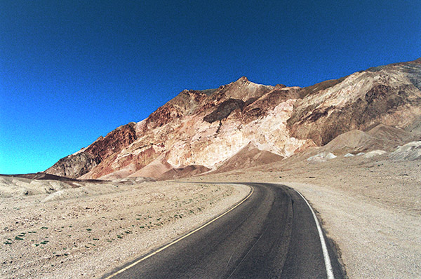
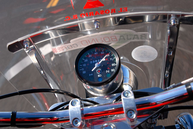
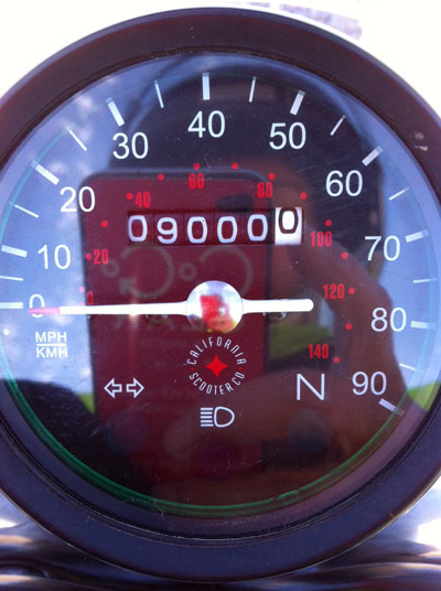
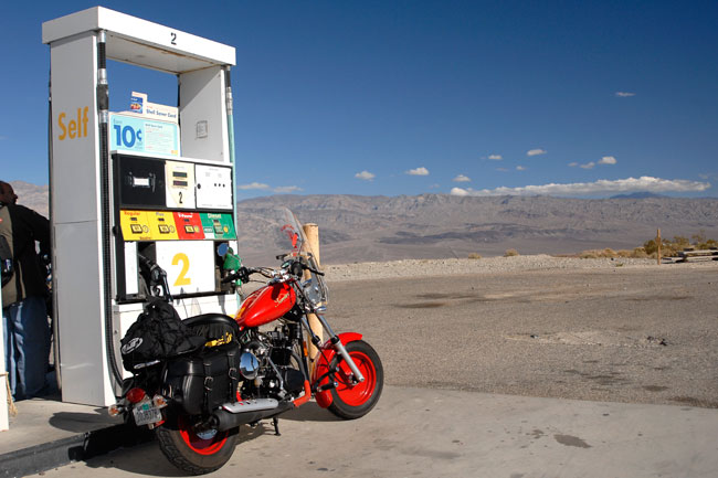
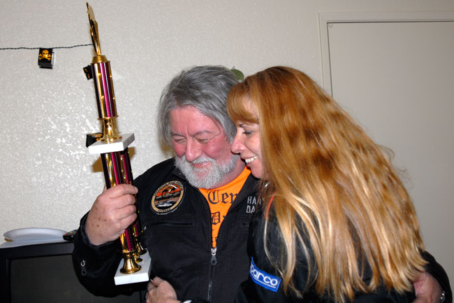
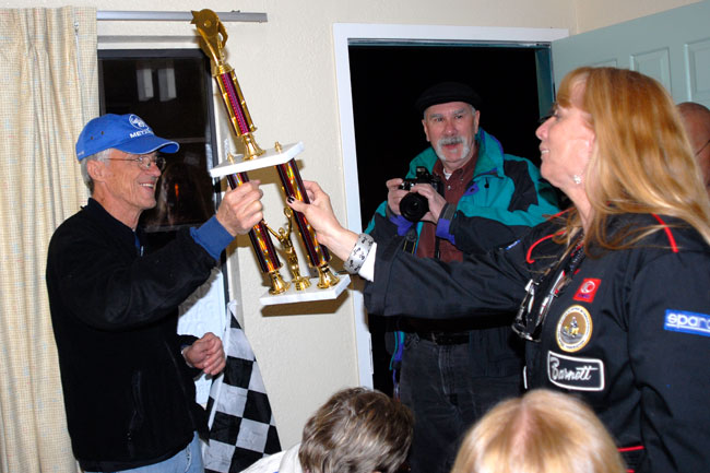
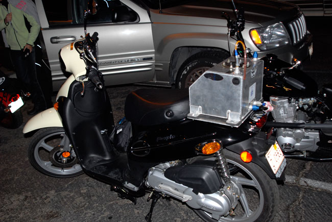
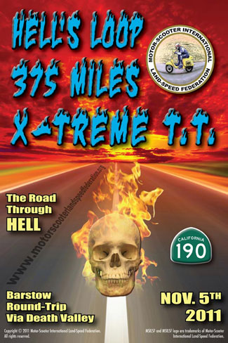
This is the next installment of our series on Death Valley, and it’s about the Hell’s Loop Rally organized by Alan Spears and the Motor Scooter International Land Speed Federation.   We rode it in November of 2011, and while it was sunny that day, it was plenty cold.  It was a scooter endurance run of 400 miles in a single day.  You might be thinking that’s not too many miles.  Try it on a 150cc scooter and tell me if you still feel the same way.

I was working with CSC Motorcycles at the time and the thought was we could ride the event with our 150cc Mustang replicas.   The team included good buddies TK, Arlene, and yours truly.  It was grand fun and CSC garnered good exposure from that event.   I had a blast, and for me, it nailed three birds with one stone:  A great motorcycle ride, another chance for a ride through Death Valley, and a chance to get more cool stuff to write about (and photograph) for the CSC blog.

With that as a backdrop, here’s the story.


A Cold Day In Hell

Arlene B (of Go Go Gear fame, and a California Scooter rider) and TK. TK and I both worked at CSC Motorcycles. That’s my red CSC 150 motorcycle.

Hell’s Loop, that is…the Motor Scooter International Land Speed Federation (MSILSF) and Alan Spears’ latest event. You’d think an event named after a place known for warmer temperatures would offer toasty riding, but it sure was cold!

The Death Valley Loop

This event was all about endurance riding, and Alan and the MSILSF team sure outdid themselves on this one. The route took a big round trip from Barstow, California, east on the 15, north on the 127 along the eastern edge of Death Valley (think Ronald Reagan, the old Death Valley Days television show, and 20-mule teams hauling borax), west on 190 through Death Valley, a long loop down through Death Valley’s center to a delightful little town called Trona (just kidding about that one, folks), back to the 395 south, and then Highway 58 back to Barstow.

The Hell’s Loop event was billed as an endurance rally, but in actuality it was a race. You and I both know you’re not supposed to race on public highways, but on scooters and small motorcycles, “racing” is not what it would be on bigger bikes.  We ran this event with our throttles wide open a good 95% of the time. No kidding. The twist grips were pegged. That doesn’t mean we were speeding, though. Sometimes a wide open throttle meant 65 miles per hour when we were on the flats with no headwinds, and sometimes it meant 35 mph when we were climbing a long grade. Another aside at this point…the bikes performed flawlessly. This was another event in which we beat the, uh, Hell’s Loop out of our California Scooters, and they ran great.

The guy who won the event, Tom Wheeler, won it on a 49cc Kymco motor scooter. Yep, you read that right. 49 cubic centimeters! We’re sure not in the business of publicizing other brands, but hey, we’re more than happy to give credit where credit is due. Tom drove out from Arkansas for this event and he finished first on his 49cc Kymco, beating machines with nearly 10 times the engine displacement.

The Ride

The weekend started with TK and I rolling into Barstow Friday afternoon for a great lunch at Del Taco. Those of you who know Del Taco might be tempted to laugh (it’s a fast food Mexican chain not usually known for their fine food), but the Del Taco restaurants in Barstow are different. Ed Hackbarth is the entrepreneur who started Del Taco, and he did so in Barstow. Ed sold the Del Taco chain to a conglomerate after building it up into a huge business, but he kept the original three Barstow restaurants. Here in southern California, we know that if you want good Mexican food, Barstow’s Del Tacos are unlike any others. Everything is fresh, everything is bigger, and it’s not unusual to see Ed himself working in the kitchen preparing your lunch. Trust me on this one, folks….if you’re ever passing through Barstow, you need to stop for a meal at Del Taco.

Our Motel 6 room…where old Tom Bodette left the light on for us…$35 a night, and it might have been the most expensive hotel in Barstow! It was raining and we didn’t want to leave the bikes out in the cold, wet weather. A lot of the Hell’s Loop riders slept with their bikes Friday night.

On Friday we had a bitter cold rain, but the forecast was for sunny warm weather on Saturday.  Well, they got half of it right. I once heard one of those radio political talking heads say that the reason economists exist is to make weather forecasters look good. I think that guy might have had it backwards. It was sunny, but wow, was it cold when we woke up on Saturday morning. I wasn’t too worried…I had my California Scooter motorcycle jacket, a pair of warm motorcycle pants, and my Haix Goretex boots (they’re made in Austria and they’re great), but it was still cold. Really cold.

After a great 6:00 a.m. breakfast at IHOP Saturday morning, we rolled out onto Interstate 15 on our California Scooters and headed north.  Wow, was it ever cold!
On California 127, headed into Death Valley.  We rode under beautiful blue skies along Highway 127…it was a glorious day to be out on a motorcycle!

It sure was cold Saturday morning.  As in maybe 40 degrees. Teeth chattering cold. I know all of our friends on the east coast would view this as something of a heat wave, but I gotta tell you, when you do 400 miles in one day through this kind of weather, it’s cold.

Before I get too much further, let me give you a warning about the photos. They’re not my best ever. We didn’t stop to smell the roses on this one, boys and girls, and most of these shots were from the saddle of my CSC motorcycle at high speed. That’s why a lot of the angles are off, and it’s why they might be a bit fuzzy. This ride was all about getting back to Barstow first. We stopped for fuel and restroom breaks, and that was it. We didn’t even eat. 400 miles on a motorcycle, in 40-degree weather, with no messing around. Riding…that’s what this run was all about. And in the cold weather, our CSC motorcycles were running strong. We thought we were gonna set the world on fire, until we heard about Tom Wheeler on that 49cc scooter. But I’ll come back to that.  So after rolling along on Interstate 15 for about 60 miles, we took a left at Baker and headed toward Death Valley. The skies were clear, the riding was glorious, and we froze our tootsies off.

A 60-mph shot from the saddle…riding through the Mojave Desert!

We weren’t too sure about where we’d be able to buy gas, so we each carried a spare gallon or two. Turns out we didn’t need the extra gas, but we stopped nearly every place we saw a gas station just to make sure.

When we rolled into Shoshone, I was blown away by the gas prices. Believe it or not, these were not the highest gas prices we saw on this trip! I was sure glad I was riding a 100mpg California Scooter when I saw those prices. Ah, the glory of price gouging.

Every time I see something like what the photo above shows, I want to confront the owner and ask him if his mother knows what he does for a living, but I know it would be a futile gesture. And another 100 miles up the road, we paid prices that made what the photo above shows seem cheap.

Barney Fife

While we were topping off in Shoshone, I saw a National Park Service HumVee that I thought was pretty cool. I had never seen one of these in use by a law enforcement agency, so I snapped a quick photo of it while I was on my California Scooter. I guess the NPS ranger who was in it didn’t like that. As I kid, I always had a mental image of park rangers as pretty cool guys who took care of the bears and stuff like that. This guy was decidedly unfriendly…there’s no nice way to say it. Maybe it was a slow day for him and he wanted to harass some rough-looking bikers like me, Arlene, and TK. He wanted to know about Alan, who rolled through Shoshone earlier on his two-stroke Kymco burning “exotic fuels.” A park ranger. I chalked it up to another instance of our tax dollars at work. Go figure.

A National Park Service Hummer.

Continuing the Ride

After the fuel stop in Shoshone, we were on the road again. Here are a few more shots from the saddle.

On the floor of Death Valley, about 100 feet below sea level.
After we climbed out of Death Valley’s floor, it was a fast downill run west…you can see the flare from shooting into the sun
Heading west to Panamint on the western edge of Death Valley. The bikes were running just great in the cold weather. Here’s a quick shot of my speedometer as we rolled through Death Valley. Smoking right along on the Baja Blaster!
Arlene’s California Scooter ticked over the 9,000-mile mark on this ride, and we stopped for a quick photo.

9000 miles, including great California Scooter rides up and down the California Coast, the Sierra Nevadas, the entire length of Baja, and Death Valley!  Arlene may well be our highest mileage California Scooter rider.

Our next stop was Panamint. There’s a gas station and a convenience store out there (but not much else). This place set a new record: $5.79 per gallon! It’s the most I’ve ever paid for gasoline in my life!

$5.79 a gallon….but what a cool photo op!

Wildrose Canyon Road and Trona

While we were stopped, I pulled out an extra T-shirt and added it to the several layers of clothing I already had on under my California Scooter motorcycle jacket. To my surprise, that one extra layer did the trick. I stayed relatively warm for the next 130 miles back to Barstow.  After our Panamint gas gouging, we turned the bikes east for a quick three miles back down the road to Wildrose Canyon. That was our route out of Death Valley, and here’s a shot looking east across the valley floor.

Death Valley’s floor, as seen from the saddle, looking east from Panamint

We negotiated Wildrose Canyon Road, fought the wind downhill, and then we rolled into Trona. Trona is a mining town (they mine potash or some other such chemical), and there isn’t too much else out there. And I gotta tell ya, when they built “no place” they must have centered it around Trona (because that town sure is in the middle of no place). It’s an interesting place, though…a collection of white chemicals, brown hills in the distance, blue skies, and industrial processing equipment.

A late-in-the-day, shot-from-the-saddle photo of Trona. Some day, I’d like to ride out to Trona just to take photos.

Returning to Barstow

After Trona, we cranked the bikes wide open for the run home. It was a burst out to the 395, a speed run down to Highway 58, and then a left turn for the last 32 miles back to Barstow. We pulled in to the Motel 6 parking lot just after dark. And it was even colder. Did I mention earlier that it was cold?

Alan Spears, his friend Kathleen, and Dennis did a great job organizing this event.

When we returned to the Motel 6 rally headquarters, the good folks from MSILSF had good food and drinks waiting, and that was a good thing. We hadn’t eaten all day, and I was hungry. And cold. It sure was nice to return to a warm welcome. And it sure was interesting to learn about the winning bike and rider…that would be Tom Wheeler from Arkansas.

Tom Wheeler, a Kymco dealer from Arkansas, accepting one of his trophies for the Hell’s Loop Endurance Rally.

The Winner:  A 49cc Kymco!

As I mentioned earlier, Tom won the event on a 49cc Kymco. Good Lord! A 49cc Kymco! My first thought was that the bike had to have had a couple of superchargers and maybe it was running on nitro, but no, that wasn’t it at all. Tom is obviously an experienced endurance rider, and he had the problem sorted. When I asked Tom about the top speed on his 49cc sizzler, he told me that it might see 45 mph on a flat road under ideal conditions. We sure didn’t have ideal conditions, and what that meant to me is that Tom ran a lot of the day’s 400 miles at something between 30 and 40 mph. The trick is to not have to stop. Tom had an auxiliary gas tank on his Kymco, and he only had to make one stop for gas.

Alan and crew sure did an outstanding job pulling this event together, which didn’t surprise me at all. MSILSF is the same outfit that organized the November 2009 Land Speed Record trials and last year’s Salton Sea Endurance Rally, and both of those events were wonderful.

I am more than a little intrigued by all of this, and by MSILSF. You might be, too, folks. Think about it. Motor competition. Real competition. Speed trials. Endurance rallies. All with scooters. You can get into it, real motor competition, for peanuts. And a California Scooter is a great way to do so.

Here’s a shot of Tom Wheeler’s winning 49cc scooter. 400 miles in one day on a 49cc motor scooter! Can you imagine!

So that was it, folks. 400 miles in one day, we won the 150cc class, and we had a great time.


We just returned from a trek through Death Valley a few days ago, which prompted our series of blogs about prior Death Valley trips.  You can read the first two Death Valley blog installments here.

Death Valley:  The Prelude
Death Valley 2008:  My First Visit

And, oddly enough, the Los Angeles Times ran a story in 2017 about a trip that almost exactly described the ride you see in this blog.  You can read that one here.


Read a few of our other great motorcycle rides here!


Never miss an ExNotes blog…sign up here:

Death Valley 2008: My first visit

A Trip To Death Valley!

Brown Motor Works in Pomona, California, hosted a chili cookoff in March 2008, which was immediately followed by a weekend trip to Death Valley.  At the time, I’d been a California boy for 30 years, but I’d never been to Death Valley. I always wanted to go. And, I love chili.  Free chili…lots of photo ops…good weather…and a motorcycle ride to a place I’d never been before.  It seemed like a no-brainer to me.  It was a ride I had to make.

Kawasaki’s KLR 650

I had purchased a 2006 KLR 650 a year or two earlier from my good buddy Art at the Montclair Kawasaki dealer, and something strange happened:  I found I was enjoying the little KLR more than the other big roadburners I owned.  At that time, I had gone way overboard in acquiring motorcycles.  I had a TL1000S Suzuki, a Harley Softail, a Honda CBX, a Triumph Daytona 1200, and a Triumph Tiger 955 (and I think I owned them all at the same time).   There was something about the KLR, though, that I liked, and I found myself riding it more often than not.  All the guys I rode with either had BMWs, Harleys, or Triumphs, and my KLR was the smallbore of the bunch.  I didn’t care.  I liked riding it.  To my surprise, I found that riding a smaller bike was more fun.

A lone KLR in a sea of BMWs. Nearly all of my friends rode BMW motorcycles in those days. I had a lot of fun with my KLR.

The Chili Cookoff

Good buddy Dennis, shown here immediately after taking top honors in the chili-eating contest. Dennis is an Iron Butt rider and he rides a BMW. The rules were different than what I expected. You weren’t allowed to lift the bowl off the table, so the serious competitors simply dove in. BMW riders are a particularly sophisticated bunch.

On To Mojave

The guys at Brown Motor Works planned to leave at the end of the day, but I didn’t want to hang around until then.  Immediately after grabbing a few photos from the chili contest, I was on the KLR headed east and then north into the Mojave Desert.

I took my KLR and found my way along Old Route 66 into the Mojave Desert.
I took I-40 over to Kelbaker Road and then headed into the Mojave National Preserve. The group planned to meet in Baker, and I figured if I timed it right I would get there right about nightfall.
I grabbed this photo along the Kelbaker Road. I didn’t know too much about motorcycle photography. This is the shot magazine editors always hate…the motorcycle by the side of the road.

Baker and The Mad Greek

Baker is a wide spot in the road along the I-15, and it’s a jumping off point for Death Valley.  It is a funky place with a couple of poorly-maintained and overpriced gas stations, the world’s tallest thermometer, and a cool restaurant called The Mad Greek.  The Mad Greek is a place that seems to always show up in any movie about a road trip to Vegas.  I have yet to find a Greek in the place, but the food is good and the staff is friendly.

We had dinner at the Mad Greek in Baker along the I-15. We spent the night in Baker, and then had breakfast at the Mad Greek the next morning, too.

Into the Valley of Death

After a breakfast at the Mad Greek the next morning, we road north toward Death Valley.  There’s nothing out there but great roads and the Mojave for the 80 miles or so to the park entrance, and the Beemer boys were riding at speeds well in excess of 100 mph so I couldn’t keep up.  The KLR might see 100 on a really good day, but I didn’t care.  I wanted to stop, smell the roses, and get good photos.  Riding by myself didn’t bother me at all.  I preferred it.

Entering Death Valley the next morning.
My reaction was simple upon entering Death Valley: Wow! It was what I hoped it would be.
Another shot of my KLR.
At some ruins in Death Valley.
My friend Eddie and his GS.

Artist’s Palette

One of the cool spots to stop in Death Valley is a hilly area called Artist’s Palette.  Each hill has a different dominant mineral (and a different color), and the result is something that looks like an artist’s palette.  It’s a very cool thing to see.

Artist’s Palette in Death Valley.
My friend Joseph and his Triumph Sprint.

High Prices and Photo Ops

Death Valley’s claim to fame is that it’s one of the lowest spots on the planet.   It’s also in one of the more remote places on the planet, which meant that fuel costs were unusually high.   All made for interesting photos.

This was a gas station in Furnace Creek. At the time (this was in 2008), the gasoline prices here were the highest I had ever seen.
An obligatory shot along the road in Death Valley.

Wildrose Road and the Charcoal Kilns

My friend Bob told me about Wildrose Road, a road that cut through some canyons on the way out of Death Valley.
It was a great ride. While I was on Wildrose Road, I saw signs for the Charcoal Kilns, so I took a short detour. On the way up to the Charcoal Kilns, I stopped to take the picture above. A guy and his wife were coming from the other direction and he asked if I wanted a picture of me with my KLR. Death Valley was cold. I had on every piece of clothing I brought with me.
The Charcoal kilns. These were built in the 1870s. They are 25 feet tall and 30 feet in diameter.
Wildrose Road. You could probably get through it on any motorcycle, but I was glad I had the KLR. Bob was right…Wildrose Road was a great ride.

The Gear

I had a Nikon D200 digital camera when I did this trip and the first-generation Nikon 24-120 lens with a polarizer, and it did a good job for me.  I think it was a 10 megapixel deal and that seemed like a lot in those days.  I kept the D200 for a long time and I had a lot of fun with it.  I used it for all of the photos you see here.  It was big and bulky, and as I recall, it took all of the space in one of the Kawasaki saddlebags I used with my KLR.  It was only a weekend trip, and the other saddlebag was enough for my other stuff.  I like to travel light and the arrangement worked fine for me.

Death Valley:  The Bottom Line

If you’ve ever thought about taking a ride to Death Valley, do it.  Take a camera, too. Trust me on this: You won’t be disappointed. As a rider and a photography enthusiast, I had a great time. The KLR 650 was more than enough motorcycle, I felt it was a good bike for a trip like this, and I concluded that Death Valley is doable on just about any motorcycle (especially if you mostly stick to Death Valley’s paved roads, as I did).  The photo ops in Death Valley are stunning.  If you live in southern California, it’s an easy weekend trip.

One day was not enough, though.  There was a lot of Death Valley left to see, and I knew I’d be back.


There’s more coming on Death Valley and a bunch of other great rides.  Sign up here and never miss an Exhaust Notes blog!

Death Valley: The Prelude

Leaving Death Valley headed to Shoshone, California.

I just returned from a road trip and our last day was in Death Valley, California.  I’m embarrassed to admit that I had lived in California for more than 30 years before I ever made the trek to Death Valley (that first trip was on my KLR 650).  I’ve been there five times now, traveling on different bikes and in different cars.  Death Valley is probably my favorite California destination.  I thought I would do a blog about this latest trip and then I realized:  Death Valley is a story that takes more than a single blog.  To get things started, here’s a link to a Destinations piece I did on Death Valley 11 years ago for Motorcycle Classics magazine.   There’s lots more coming, folks, so stay tuned.


Want to stay up to speed on the latest ExNotes rumblings?  Subscribe here: