By Joe Berk
Legends Motorcycle Museum in Springville, Utah, is not just a museum; it is a compound, consisting of three retro-industrial-themed buildings and numerous motorcycle-related shops and eateries. And if that’s not enough good news, it’s located in one of the best riding locales on the planet: Magnificent Utah. Surprisingly, I had never heard of Legends. I only found it during a Google search after my good buddy Mark at Motorcycle Classics magazine asked me to focus on motorcycle museums.
I arranged to be at the Legends Museum early so that I could photograph the motorcycles without other guests getting in the way (both for the ExNotes blog and for Motorcycle Classics magazine). We entered through the Museum’s shop, which contains work bays and advanced CNC equipment where the place makes its own parts. The owner, Rick Salisbury, is also an automobile enthusiast; we saw a stunning restomod 1957 Cadillac convertible (with a crate Chevy LS2 engine) being assembled. A large and initially terrifying black pit bull welcomed us with a deep growl; when I froze, my new friend Winston approached cautiously, put his big paws on my shoulders (he stood taller than me), and gave me a friendly lick. I realized that coffee (served in the Museum’s adjacent Sidecar Café) would not be necessary. Thanks to Winston, I was now fully adrenalized and wide awake.
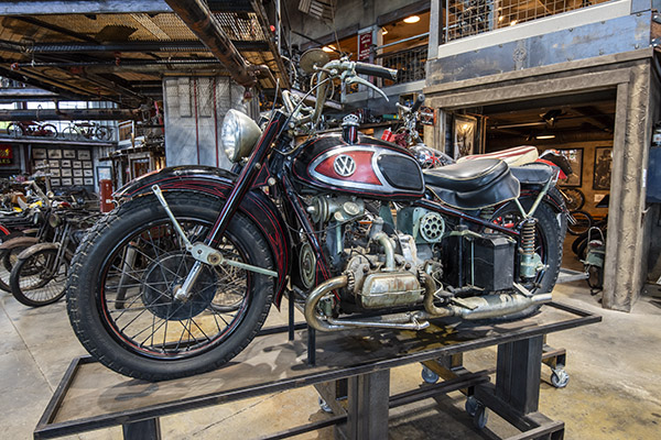
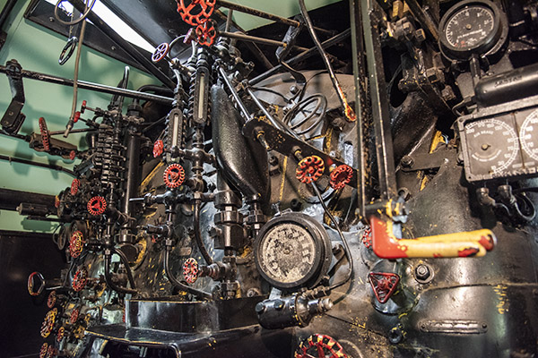
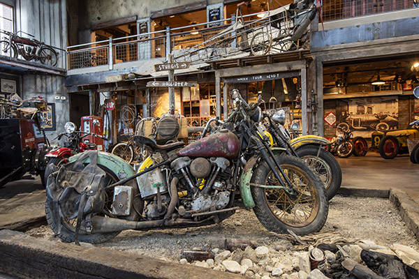
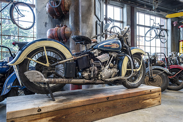
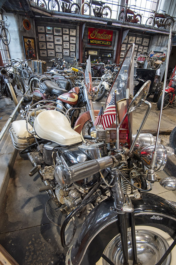
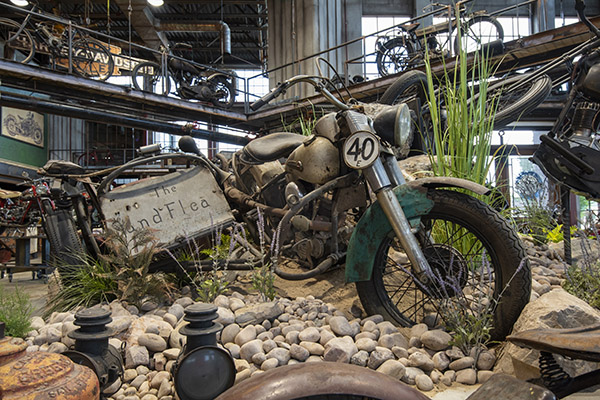
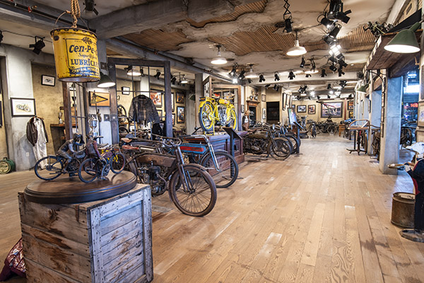
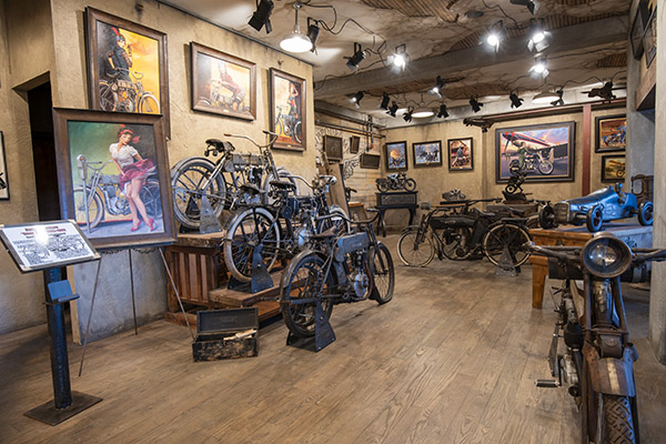
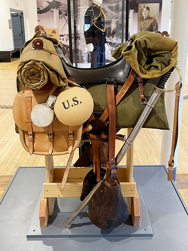
The view upon entering the Museum was visually arresting, starting with the famous Von Dutch VW-powered motorcycle (as seen in many print publications and in an episode of the American Pickers TV show). It stood proudly on a weathered steel pedestal. The Von Dutch motorcycle was surrounded by numerous Panheads, Knuckleheads, Indians, and other old motorcycles, machines that were built when guys like Roosevelt, Truman, Eisenhower, and Kennedy lived in the White House. None of the bikes were restored. I had entered barnfind Heaven. I’ve been in lots of museums that proudly display motorcycles that look better than the day they rolled off their assembly lines. Legends is different, and I’m here to tell you it is better.
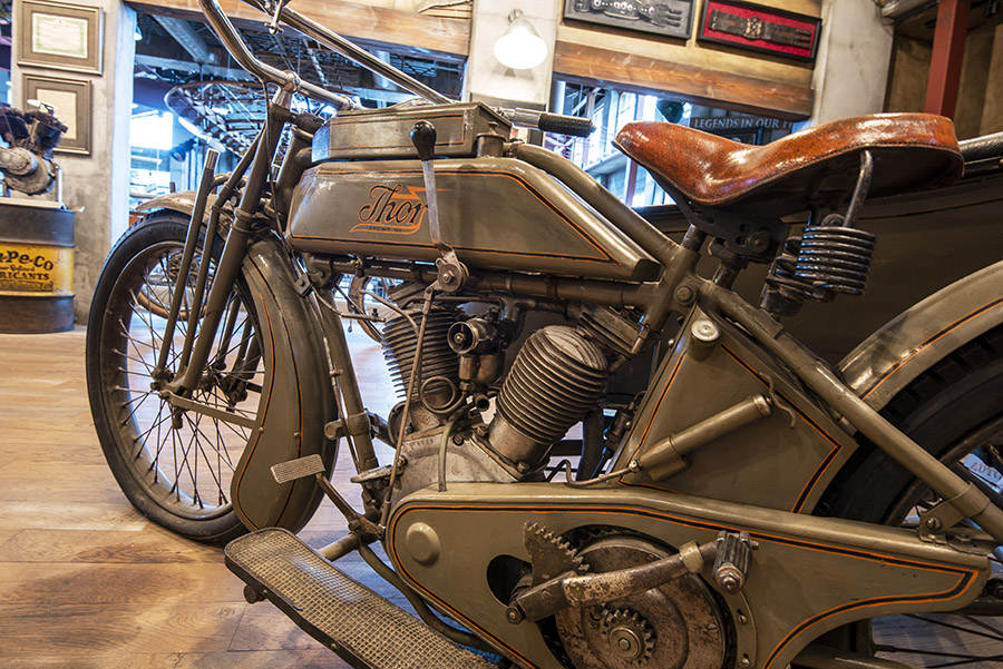
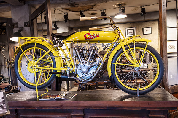
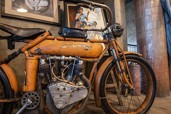
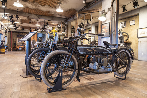
The Legends Museum second floor is comprised entirely of pre-1920 motorcycles. A Journs Cyclone, one of only 12 known to exist, dominates the display; the Museum’s owner paid a whopping (and record) $1.3 million for it at Mecum’s last year. There were many more exotic motorcycles. Thor. Henderson. Flying Merkel. I’ll let the photos do the talking here, folks.
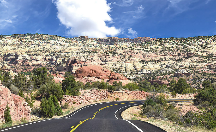
One of the best things about the Legends Motorcycle Museum is its north central Utah location. Utah is one of our most beautiful states, and it figures prominently in our collection of previous Motorcycle Classics Destinations pieces (which include Zion National Park, Bryce Canyon National Park, Cedar Breaks National Park, Utah Highways 12 and 24, Arches Canyon National Park, Golden Spike National Historic Park, and Flaming Gorge National Park). If you’re headed to Utah, Legends should be part of your itinerary. And if you’re not headed to Utah, you should start thinking about a visit. It’s spectacular.
Subscribe to ExNotes for free!
We need your support! Do what you can to help ExNotes stay in the black!

More Huber? Check out A Trip Into The Moment.

More Gresh and Berk? You bet! Check out A Cup O’ Joes!

Join our Facebook ExNotes page!


 We are a literary bunch, us ExNotes writers. Joe Gresh and I published a collection of our favorite stories not too long ago, and I’ve penned (or keyboarded) a few myself. Here’s a link to the Gresh and yours truly book,

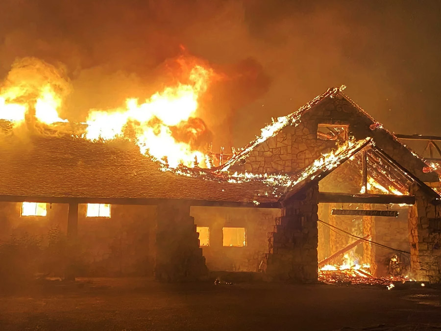
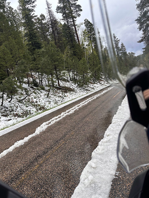
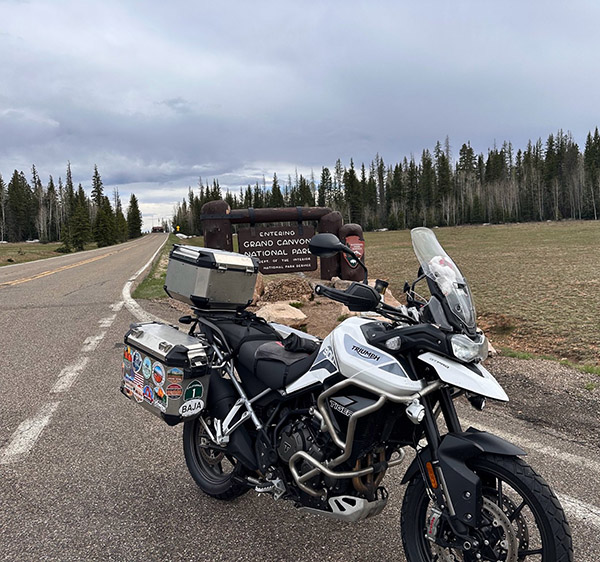
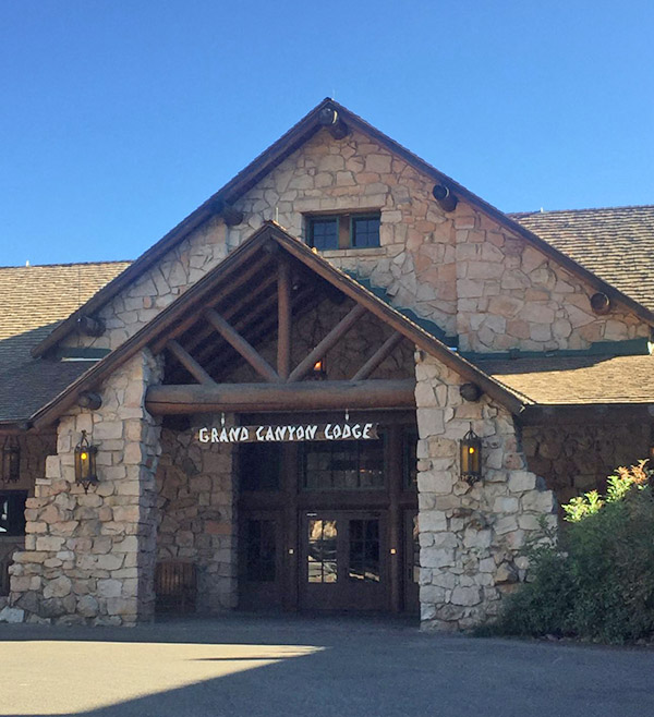 I remember reaching the lodge after completing the rim-to-rim hike, a long, steady climb from the Colorado River to the quiet heights of the North Rim. My legs were leaden, my pack dusted with red earth, and each step through the final miles of the North Kaibab Trail carried the weight of the canyon behind me. The landscape narrowed into cool shadows and silent stands of fir and aspen. As I crested the rim and glimpsed the lodge through a break in the trees, a quiet stillness settled in. I walked into the stone-and-timber building, ordered a hot meal, and sat near the window overlooking the vast expanse I’d just crossed. It wasn’t dramatic or loud, just a deeply satisfying end to a long journey.