The Top Five Southern Colorado Motorcycle Roads

By Mike Huber

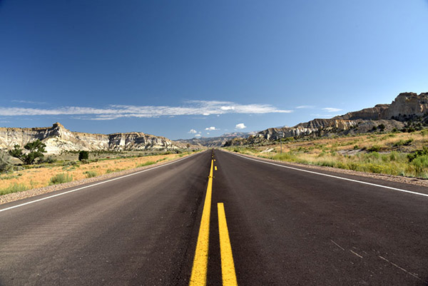
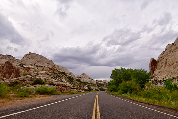
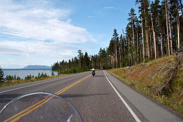
As an avid motorcyclist it’s easy to appreciate the beauty in each state and for many riders discovering amazing roads that many would overlook can become second nature to us.  Some might even say it’s an art form.  Throughout this vast and beautiful country called the United States of America we are fortunate enough to have a plethora of both paved and dirt roads that are meant to be sought out like the Ark of the Covenant.  These roads are meant to be experienced intimately the only way they can be, on two wheels. Experiencing them on a motorcycle can become a thirst that is never quenched, and although each state has its own unique characteristics, ultimately some will stand out more than others. One state that has that effect for me is Colorado.

Colorado is one of those states that as soon as you ride past the “Welcome to Colorful Colorado” sign the roads seem to present themselves to you like a feast on a golden platter with an endless amount of wine.   The rides we will review can each be completed in one or two days and are best ridden between late April and early October.  To help with prioritization since there are so many incredible rides we have developed a very complex mathematical rating system of 1 to 5 wheelies (5 being the highest).  The rating uses the following criteria:

    • Road conditions
    • Diversity of riding options
    • Activities along the route
    • Abilities to disperse camp/hotel access
    • Scenery

Route 550:  The Million Dollar Highway

Rated 5 Wheelies

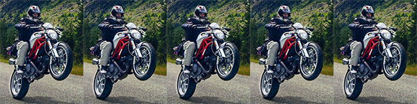
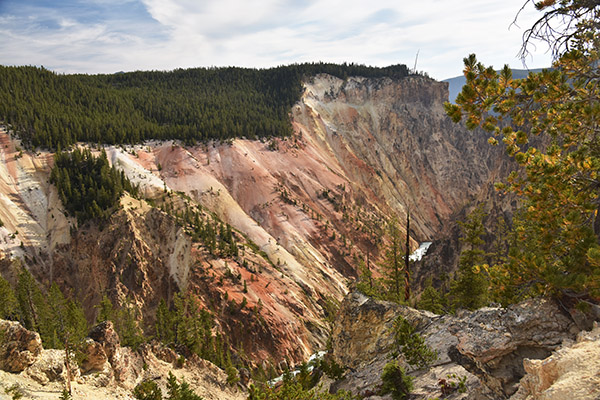
Road Description.  This loop may be one of the greatest roads in all of North America. The road is paved and in immaculate condition.  It combines some of the tightest switchbacks one can expect to experience on a motorcycle. The full route per the map is ~355 miles and can be done in 1 day, but highly recommend taking at least 2-4 to fully experience and immerse yourself in this beautiful part of the country.  There are endless forest roads off 550 to get your fill of dirt riding littered with an infinite amount of beautiful dispersed campsites. Also some wonderful old mining towns rich with history, hiking, restaurants, hotels, and hot springs.

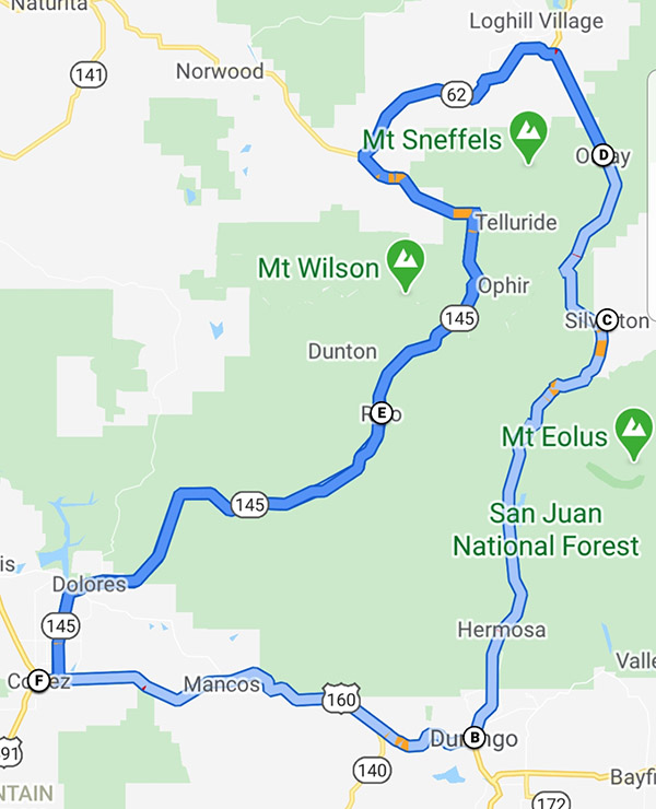
Points of Interest.  There’s no shortage of amazing places to stop along this road.  Below is a small list of the places you should not miss along this route.

    • Silverton is a great little mining town with wonderful people.  It’s a perfect place to load up on supplies if you are camping.  You can warm up after getting some miles in at the Brown Bear Café.
    • Ouray is a beautiful mountain town with several hikes to waterfalls, hot springs, and some wonderful restaurants. My favorite is the Ouray Brewery.
    • Rico is a really tiny town which consists of a great hotel and bar called the Enterprise Bar and Grill, with wonderful people, great food and cold beer.

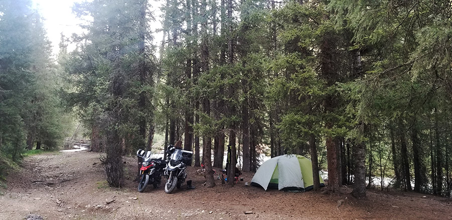
Where to Stay/Camp.  There is an immense amount of national forest land that can be used to camp on along this loop.  Really any dirt road you ride down will guide you to an epic campsite next to a creek. This makes for a relaxing post ride time to wind down in a hammock, while having a refreshing beverage. The towns of Silverton and Ouray have several hotels that are right in the heart of the town and a short walk to tourist activities and restaurants.

Off-Roading.  There is an endless amount of dirt roads to find here, this goes from flat well-groomed forest roads to find a campsite to the technical challenging mountain passes like Engineer or Imogene Pass (which I have not done due to the size of my GS1200 and conservative riding style).

Out of so many outstanding rides in the state of Colorado, the Million Dollar Highway should be on the top of any list.  This road and area really earn that 5 Wheelie rating due to exceeding each standard for riders of all ability levels. There are so many sights to see along this route that you will never tire of absorbing the beauty that surrounds you in this part of the state. If you are fortunate enough to have the time, doing the loop in reverse can be a great way to add a few more days to your adventure.

Mesa Verde National Park

Rated 5 Wheelies

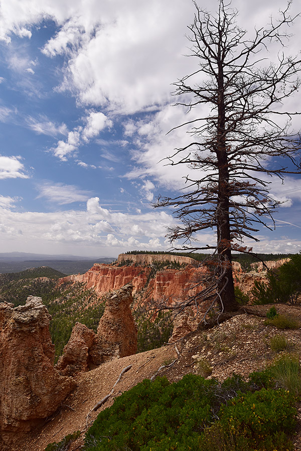
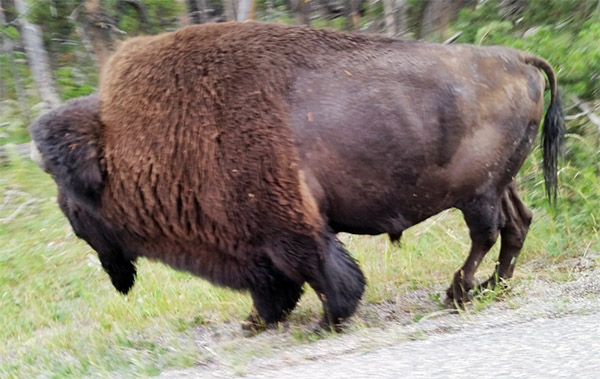
Road Description.  As soon as you enter Mesa Verde National Park the road begins screaming up in elevation with some incredible views overlooking the valley below you will almost have a sense of vertigo overcome you.  What is wonderful about this feeling as it goes on and on as you travel through the park.  Although the distance from the park entrance to the furthest point is only 28 miles, those miles are filled with numerous overlooks and pullouts that can make this seemingly short ride take 2-3 days.  This is especially true if you are taking in the hikes along the way.  The only piece of concern for this ride is the numerous road snakes in some areas of this ride. Otherwise its full enjoyment as you have a 360 view of the valleys below that outstretch clear into Utah, New Mexico, and Arizona.

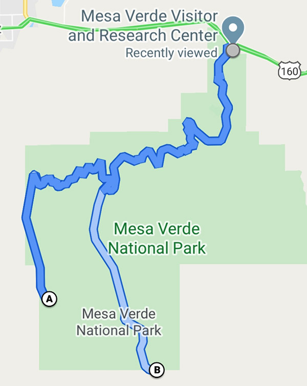
Points of Interest.  Since this is a National Park there are ample amounts of short hikes and tours to break up the day(s) you spend in this magical location. A few of the more popular ones are outlined below:

    • The Cliff Palace requires purchasing a tour ticket at Park Visitor Center, but even without one you can walk to the overlook to get a spectacular view of the houses the Hopi built into the cliffs which are all but hidden except from this vantage point.
    • The Balcony House also requires a tour ticket but is well worth it as you can walk through the ruins and really get a sense of the
    • The Knife’s Edge Hike is a great 2-mile hike with little elevation next to Morefield Campground that has incredible sunset views, which enable the rocks to really light up and glow.

Where to Stay/Camp.  Morefield Campground- This is the only campground in the park so making reservations ahead of time is recommended. It is one of the better National Park campgrounds I have stayed at and includes free showers, great Wi-Fi from most campsites (antennas are off the bathrooms), and a launderette, gas, and fully stocked store for all your camping and souvenir needs. There are also several wonderful hiking trails right next to the campground.

Off-Roading.  This is one of the drawbacks of a National Park, as there is no off-roading permitted within the park boundaries.  The beauty and activities from hiking and riding makes up for this shortcoming.

Route 65: Grand Mesa Scenic Byway

Rated 5 Wheelies

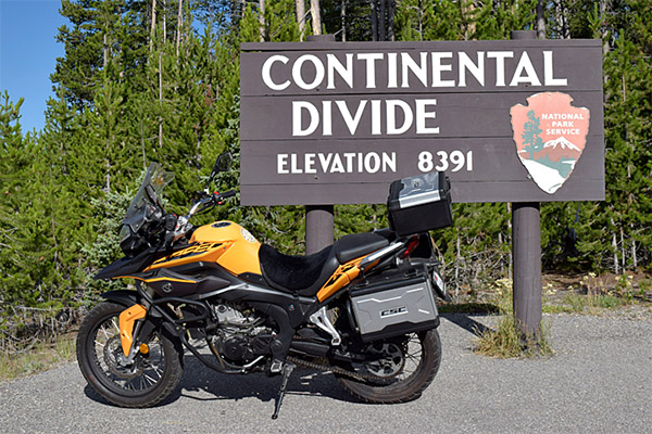
Road Description.  Yet another beautiful Colorado mountain road filled with switchbacks that rise in elevation and bring you to over 10,000 feet up and onto the World’s largest Mesa. There are several pullouts along this route to take in the views, but no gas stations from Cedaredge to Mesa (50 miles, but can be close to 100 miles if you are doing the off-road portion) plan accordingly.

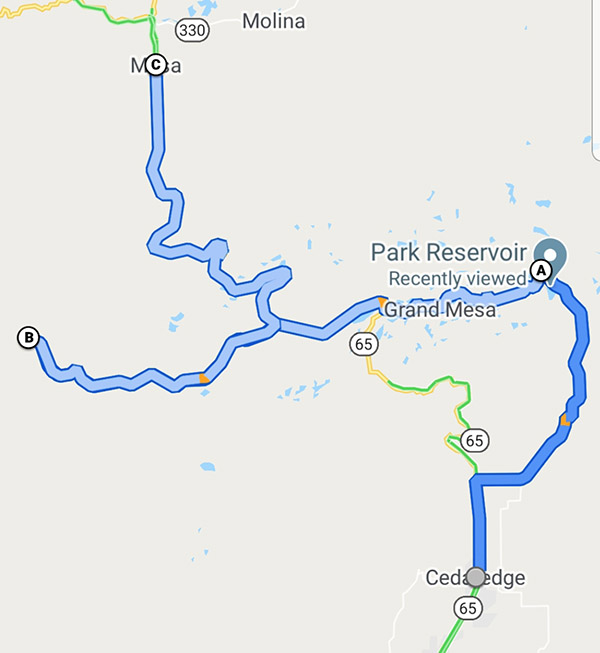
Points of Interest. The main point of interest the mesa itself and the amazing views, alpine lakes, dispersed camping, and off-roading.

Where to Stay/Camp. Dispersed camping is plentiful along Rte125 where you can get a lakeside campsite with little issue and make it your own paradise for the evening as you watch the sunset glistening off one of the many alpine lakes. There are also plenty of campgrounds along this way if you are looking for less primitive camping.  Hotels are scattered along this route in the towns of Delta, Mesa, or driving to up Grand Junction for a greater variety of lodging.

Off-Roading.  Route 125 Surface Creek Road is a great 15-mile loop.  This road has you experience the mesa while passing crystal clear alpine lakes with numerous dispersed camping areas.  There is also a 10-mile dirt road in great condition to visit the Lands’ End Observatory. The views off the mesa looking down on the plateau can allow you to see into Utah on a clear day with awe inspiring views.

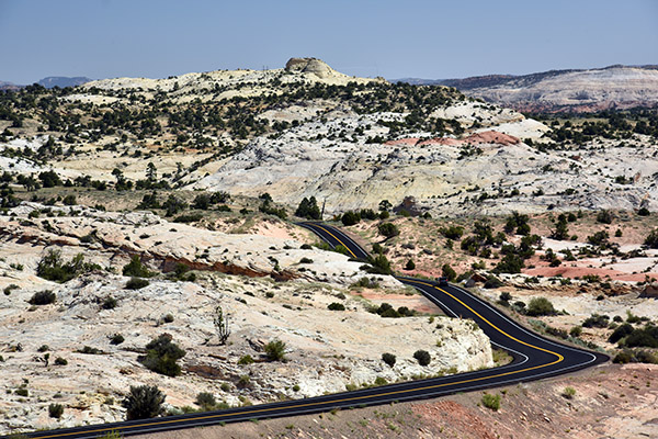
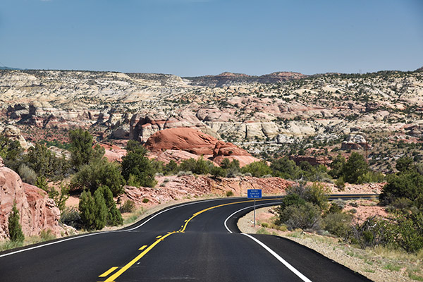
Route 141: Grand Junction to Naturita

Rated 4.5 Wheelies

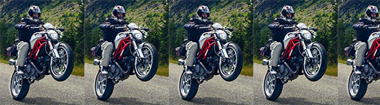
Road Description.  This is a low elevation beautifully paved road that is 105 miles long.  This road will have you leaning your ride until you feel the mist kissing your windshield from Dolores River as you pass amazing rust colored mesas that stretch into the sky and rival that of Monument Valley. The road has very little traffic which will allow you to enjoy some solitude as you embrace the scenery you ride through. The only reason this route is rated as 4.5 is the lack of amenities.

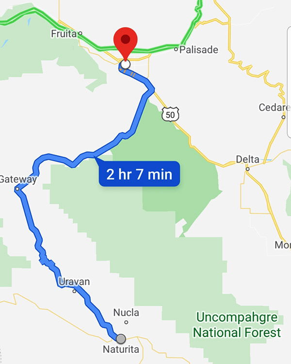
Points of Interest.  This road is in quite a desolate area, outside the tiny town of Gateway.  Gateway Canyons General Store is owned and run by the preacher of the church next door to it.  This is the only place to gas up between Grand Junction and Naturita so be sure to check your fuel levels.

Where to Stay/Camp.  Dispersed camping here is plentiful but mainly in one area just south of Grand Junction, Divide Road. This road is a steep switchback dirt road that connects to numerous other roads which are great fun exploring for campsites to settle down in.  There are numerous dispersed sites with beautiful views over the canyon in which you can see the Dolores River running far beneath you.

Off-Roading.  Divide Road also encompasses numerous off-roading opportunities that sprawl out across this mesa.  This is a perfect place to explore for that unique dispersed campsite while hitting some fun dirt to enhance your day.  There are however areas of slippery clay, so if it is raining it can become slick in portions of this road.

Routes 160 and 149: Pagosa Springs to Lake City

Rated 4 Wheelies

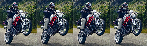
Road Description.  This route consists of 45 miles of a four-lane highway on Route 160 that will have you summit at over 10,000 feet.  The road will then drop you into South Fork, Colorado.  This is where you will turn left onto Route 149.  Route 149 will quickly whittle down to a tighter and quieter road for the next 75 miles, which are filled with mountain passes. South Fork is the only town between these areas so make sure you gas up and grab lunch before heading onto the second part of this amazing road.  The next portion will have you speeding across lower elevation prairies and then climbing high into the mountain tundra that will resemble something from another planet before descending into Lake City.

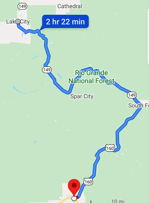
Points of Interest.  I specifically wanted this trip to begin (or end) in Pagosa Springs so you have an opportunity to experience the hot springs in Pagosa.

Where to Stay/Camp. Throughout the ride there is no shortage of camping in both dispersed and paid locations. In Pagosa there are numerous hotels. I prefer the hotel directly across the street from the spa as it is much more affordable then the spa and in a great location.  For Lake City, the Matterhorn is a beautiful Swiss style motel which will allow you a solid night’s sleep at a great price. It’s a perfect spot to recharge if you are going to take on some of the more challenging off-road portions in Colorado the following day.

Off-Roading.  Lake City is the starting point for some of the more serious off-roading mountain passes, such as a few of the most popular passes including Cinnamon and Engineer.  Both of these passes surpass 12,000 feet.  If you crave technical off-roading challenges with views that can’t be beat, these are the two passes I recommend.

Conclusions

Southern Colorado is a rider’s paradise, and a region that should not be missed for riders of all experience levels. Other avid motorcyclists have also recommended these roads to me, which reinforces my approval for these routes and motivated me to write this comprehensive layout to help others. I hope this breakout has been helpful and serves as a reason to visit Southern Colorado and have the riding experience of a lifetime.


Never miss an ExNotes blog:


Don’t forget: Visit our advertisers!


Moundsville, West Virginia

John Denver got it right:  Almost Heaven, West Virginia.   Hold that thought.  Let the music play in your mind as you read this blog.

I think I found the best place in America for motorcycling.  I could be wrong, but if you like twisties, if you like impressive views, if you like points of interest, and if you like good food, West Virginia (and in particular, the roads around Moundsville) is where you want to be.

A view from the top of the mound. That bridge spans the Ohio River, and that’s Ohio on the other side.

Moundsville is named after the huge mound that dominates the town (it’s what you see in the photo at the top of this blog).  It was only in the 1800s when the person who owned the land surmised that it was an ancient burial mound (there were several in the area).   The Native Americans who lived and then disappeared in this region were named (by us, not by themselves) as the Adena people, and it is now known that the mounds predate Christ. There’s an interesting museum next to the mound, and it is an easy place to spend an hour or two.  The mound and the museum are free, and if you’re feeling up to it, there’s a circular stone stairway that takes you to the top of the mound (I made the climb, so if I can do it you probably can, too).

Susie on the way to the top of the mound.
The Grave Creek Mound Archeological Complex Museum.  It’s a very nice museum.
A prehistoric mastodon in the museum.

Across the street from the mound is another treasure, and that’s the West Virginia State Penintentiary.  It was used for well over a hundred years, but it closed in 1996.  The West Virginia Supreme Court closed the place because it was inhumane.   The good news is that there’s a modestly priced, 90-minute, guided walking tour.  It’s a must-do sort of thing (in my opinion) and we thorougly enjoyed it.  This is a place with a horrifying history (it was consistently one of the most violent prisons in America), and our guide (Tina) made it come alive for us.

The West Virginia State Penitentiary. Take the tour; it’s well worth the price of admission.
Yep. Nine people.  Another 85 went via the gallows.  The West Virginia Penintentiary used to hold public executions and charge admission.  One condemned guy in one of these public executions had the trap spring open before the executioner slipped the noose around his neck.  He dropped 25 feet straight down, breaking numerous bones. Undeterred, the staff strapped him to a stretcher, hauled him back up the gallows steps, and hung him while he was still on the stretcher.  “Don’t worry ab0ut the pain,” they are reported to have told him.  “In five minutes, you won’t feel a thing.”
A typical cell. It’s 5 feet by 7 feet. It housed three inmates.
A cell in the isolation wing that housed a gang leader. He didn’t have to share his cell, but he spent 23 hours a day here.
One of the cell blocks.

One of the most intriguing aspects of our prison visit was the woman who works in the gift shop.  She lived in the prison for many years.  No, she wasn’t an inmate.  She was the warden’s wife.  We had a very nice (and interesting) conversation with her.

One last stop on this most interesting West Virginia day was the Palace of Gold.  If you’re old enough to remember the Hare Krishna crowd (the folks who used to hawk their books in airports), this West Virginia enclave is Command Central for them.  The 30-minute tour was inexpensive and there were lots of photo ops.   It’s not for everyone, but I enjoyed it.

The path from the gate to the palace.
The entrance. It’s hard to imagine this being founded in the 1960s in West Virginia, but there it is.
One of the hallways in the Palace of Gold.
Another photo op in the Palace of Gold.

What I enjoyed even more were the roads to and from the Palace of Gold.  Think magnificent twisties and stunning views, and you’ll have a feel for this part of West Virginia.  It truly is a stunning area.

US Highway 250 in West Virginia is incredible.
Twisties, twisties, and more twisties. If you designed a road specifically for motorcycles, it would look like this.

The best kept secret in Moundsville has to be Bob’s on 3rd Street.  It’s in downtown Moundsville and it’s not fancy, but wow, the food is both spectacular and reasonably priced.  We tried several different dishes, but the signature dish (named, of course, “the Mound”) is my favorite.  It’s a gigantic thick pancake topped with scrambled eggs, hash browns, bacon, cheese and then another thick pancake.  Put a little butter on top, pour on a little maple syrup, don’t tell the American Heart Association about it, and you can thank me later.  And you will thank me.  The open faced turkey sandwich and the open faced roast beef sandwich are great, too.  And the pies…all I can say is wow.  We tried a slice of the coconut creme and the blackberry pies, and they were awesome.

“The Mound” at Bob’s on Third Street in Moundsville. It was awesome.
Coconut creme and blackberry pie. There are many more on the menu. Bob’s is Moundsville’s best-kept secret.

Like what you see here on ExNotes?  Hey, do two things to thank us.   Sign up for a free subscription here…

…and keep clicking on those popup ads!

Bill’s Old Bike Barn…a first peek

Stop what you’re doing.  Get off the Internet (and for sure, get off Facebook and the other moronic “social media” time wasters).  Start planning a trip to Bloomsburg, Pennsylvania.  You need to see Bill’s Old Bike Barn. The riding is fabulous in rural Pennsylvania and with Bill’s as a destination, the ride is even better. You can thank me now or you can thank me later, but you will thank me.

Any motorcycle museum that includes in its directions “turn where you see the dinosaurs” should grab your attention.  In the case of Bill’s Old Bike Barn, your undivided attention is warranted.  To say I was blown away would be an understatement of immense proportions.  To cut to the chase, I’ve never seen anything like Bill’s, and I know for damn sure I’ve never met a man like Bill.  That’s Bill artistically framed by Milwaukee iron in the photo above, and yeah, I shot that picture.  I’m proud of it.  It hints at the dimensions of the man and what he’s created out there in Pennsylvania.

During our interview I asked Bill his last name and he told me:  Morris, just like the cigarettes.  I didn’t get it until later, and then I couldn’t stop laughing.  If you don’t get it immediately, you will.  Bill has that kind of slingshot wit.  I love the guy and his collection.  You will, too.

Above all else, Bill is two things: A collector, and a people person.  The extent if his collection…well, I can’t describe it.  You need to see it.  You’ll get just a hint here in the ExNotes series of blogs we’re doing.  When you visit the place, you’ll feel like you owe me.  When you meet Bill, you’ll know you’ve made a friend.  A most interesting friend.

Up above, that’s the building that houses Bill’s collection.  You can’t really see it from the highway.  You have to look for the dinosaurs (just like the directions say), turn, and then head uphill.  You’ll go by the bison, some other cool items, and more.  The building looks deceptively small from the outside.  Inside…you could spend weeks and not see all of what’s in there.

You can learn about Bill’s Old Bike Barn on his website, but we’re going to give you more here on ExNotes.  We’re going to do it over the span of several blogs over the next few weeks, and in an upcoming article in a major moto mag.  Ever watched and enjoyed American Pickers?  Trust me on this (and trust me on everything else, for that matter): Bill Morris puts American Pickers to shame.  You and I have never seen anything like what’s in Bill’s Old Bike Barn.

I’m excited about what I’ve seen and what I’m going to be sharing with you.  I’ll do my best to bring it to life in print and in the photos, but it won’t be enough.  You really need to visit Bill’s Old Bike Barn.


Never miss an ExNotes blog…sign up here for free:

Bryce, Grand Staircase-Escalante, and Capitol Reef

Utah, hands down, is the most beautiful state in the Union.  I’ve been to every state in the US except North Dakota, and unless there’s something hiding up there, Utah gets my vote.   There are places in Utah with scenery and riding that are as close as you can get to heaven without a one-way ticket.  There’s Zion National Park (to be covered in a future blog), there’s Bryce Canyon National Park, Grand Staircase-Escalante National Monument, and Capitol Reef National Park (which I’ll cover in this blog), there’s Cedar Breaks National Park (a topic for a future blog), there’s Kodachrome Basin State Park (another future blog), there’s Flaming Gorge National Park (that’s coming up in another blog), and there’s Arches National Park (to be yet another blog).  And then there’s the Dinosaur Highway.  I’ve been to all of them, and I’m telling you, if you like road trips it doesn’t get any better than Utah.

Panguitch on the western end of this trip, and Hanksville on the eastern end. It is a grand ride.

There’s a reason I’m touching on Bryce, Grand Staircase-Escalante, and Capitol Reef in one blog.  Two reasons, actually:  State Routes 12 and 24.  These two roads run through all three National Parks, and they are two of the best roads I’ve ever ridden.  If you want to plan this grand adventure, start in Panguitch, ride Utah SR 12 and 24, and spend the following night in Hanksville, Utah. I’ve got good places to have dinner in both towns, and I’ll share them with you in this blog.  It’s a full day’s ride to get from one to the other (maybe longer if you want to stop and see the sights).

The large featured photo at the top of this blog is in Bryce Canyon National Park. This is another photo in Bryce. Unlike Zion ((where you are in a basin looking up at the rock formations), in Bryce you are up top looking down into the colorful canyon. Bryce has stunning views.

This is the most beautiful stretch of the planet I’ve ever ridden. The colors and the riding are stunning. Think bright blue skies, vibrant and verdant pine trees, and multi-colored pastel rock formations. The formations include stunning pinnacles called hoodoos, plus arches, large rock mounds, exposed vermillion cliffs and monstrous domes and folds in the Earth’s surface. Although the region was once alive with dinosaurs, you most likely won’t see fossils. But you will see an artist’s palette of pleasing pastels: reds, pinks and browns due to iron in the sandstone, yellows and creams created by limonite, and purples presented by pyrolusite. Whatever the chemistry, the display through this stretch is dazzling.

The spot for dinner in Panguitch is the Cowboy’s Smoke House Cafe. You’ll probably have to wait to get in. Trust me: It’s worth it.

You can ride US 89 from Panguitch to pick up SR 12 at its western end. Head east and in just a few miles you’ll be at Bryce Canyon National Park. Bryce is one of America’s jewels, with hoodoos arranged in several natural amphitheaters. An early morning start will help capture dramatic photos; the sun will be low in the eastern sky and the resultant lighting makes the colors pop. Native American Paiutes thought these hoodoos were ancestors turned to stone. Take a long look at some of these formations and you’ll see why.

Stay on SR 12 after Bryce and you’ll skirt Grand Staircase-Escalante National Monument on tantalizing twisties. All of SR 12 is breathtaking; it is something out of a dream. It takes you through a series of red rock formations and then winds along a ridge with sheer drops on either side. Forget about guard rails and shoulders; you’ll feel as if you are riding the sky. Cook a corner too fast on this stretch and you’ll wish you were wearing a parachute. This area, more than any other I have ever ridden, is a near-religious experience.

The red rocks of Utah along SR 12.
It was tough to keep going on Utah SR 12…I wanted to stop after every corner for photos.
One of many scenes along Utah SR 12. You need to ride this road. It’s one of the best.

State Route 12 tees into SR 24, but you’ll be able to see Capitol Reef National Park long before you get to SR 24. Head east on SR 24 toward Hanksville and you’ll ride through much of the accessible portion of Capitol Reef. It’s perhaps the least known of Utah’s national parks, but its scenery is as stunning as any of the other parks.

Capitol Reef and Utah SR 24.

Only a portion of Capitol Reef is visible from SR 24, but it is outstanding. Hundreds of miles of unpaved roads into Capitol Reef offer similar scenic views. The park’s unique white sandstone domes (similar to the U.S. Capitol building) were formed by a warp in the Earth’s crust 65 million years ago. “Reef” refers to any barrier to travel, and when you see these formations, you’ll certainly understand the name.

Another scene along SR 24 heading east.
Gabriel, Juan Carlos, and Uncle Joe along SR 24 after rolling through Capitol Reef. We rode 5000 miles through the western United States on brand new 250cc CSC motorcycles. It was a great ride with great guys.

State Route 24 follows the Fremont River through Capitol Reef National Park, and as it twists and turns on its way to Hanksville, you’ll be thanking me for turning you on to these very special roads.  The Whispering Sands hotel is a good, clean place to spend the night, and Duke’s Slickrock Grill is a great place for dinner.  Try the trout; it’s wonderful.  And don’t miss the photo op standing next to Duke.


Want to discover more great moto destinations?   We’ve got you covered!

Yellowstone National Park

Man, it was cold.  It was the coldest we would be on our 18-day, 5000-mile ride around the western United States.  Yellowstone National Park was our destination and we wanted to arrive early.  Baja John was doing the navigating and the trip planning, and we were leaving early that morning out of Cody, Wyoming, at 5:00 a.m. to beat the tourist traffic in Yellowstone.  I had an electric vest; our Chinese and Colombian guests did not.  I knew they had to be hurting.  I had my vest dialed all the way up and I was.  Did I mention it was cold?

So, about that big photo above:  That’s Yellowstone Falls on the Yellowstone River.  There are something like 10 waterfalls in Yellowstone National Park.  I’ve only seen the one above.  That means I have at least nine reasons to return.

Back to the story.  I did mention it was cold riding into Yellowstone that morning, didn’t I?

Following Baja John into Yellowstone. That trip was 6 years ago, and I still get cold looking at this photo.
Another shot entering Yellowstone National Park from the east.  That’s Baja John in front of me…we were dressed for the cold, but I think our guests found it to be a little colder than the weather they are used to in southern China.

The trip was a wild one…18 days on the road with a dozen guys from China, two from Colombia, and all on free motorcycles provided by Zongshen via CSC Motorcycles.  CSC was the importer, I was the go-between spanning the CSC/Zongshen interface (and two continents), and while we were arranging the initial shipment Zongshen asked if I had any ideas to promote the bikes in the US.  Wow, did I ever!

In Zongshen’s main offices, with key Zongshen execs viewing photos from my rides in the US and Baja. Sue grabbed this photo and it’s one of my favorites. Without realizing it, I was selling those guys on giving us 15 motorcycles to ride around the US.  This looks like a staged photo.  It’s not.

That ride became the Western America Adventure Tour, and it was a hoot.   I mean, think about:  Every angry and ignorant asshole on the Internet was condemning Chinese bikes and here we were, with 15 of the things just arrived in America, setting off on a 5,000 mile ride from So Cal to Sturgis, west across the US to the Pacific Ocean, and then riding the Pacific coast back to So Cal.  On that epic ride we didn’t have a single breakdown and that was giving the Internet trolls meltdowns.  It was a grand adventure.

But I digress.  Back to Yellowstone.  On our ride, we hit every National Park along the way, and Yellowstone was one of the best.   Prior to that ride, I’d never been to Yellowstone and I had always wanted to see it.  And for good reason…it is (in my opinion) the quintessential National Park.  Yellowstone is surreal, with sulfur-laden steams and ponds spewing forth, majestic views, waterfalls, bison, bears, deer, elk, wolves, geysers, and more.   It was a first for me.  I was a Yellowstone green bean.

When we entered Yellowstone, we arrived so early the gates were unmanned and we entered for free.  But it had been a long, cold ride in from Cody and we were nearly out of gas.  My fuel light was blinking as we entered the park and I didn’t know for sure if there would be gas in Yellowstone.  John felt confident there would be, and he was right.   I saw the Sinclair sign up ahead, but before we got there, we had a close encounter of the bison kind.  We were cruising along at about 30 mph, and all of a sudden I noticed this locomotive next to me.  I was too slow to realize what it was until I was alongside, but our chase vehicle driver John (we had two Johns and one Juan on this ride) grabbed this photo…I had passed within 10 feet of this monster!

Just as I went past my big buff buddy above, he  exhaled.   In the frigid Yellowstone air, fog came out of his nostrils.   It was like riding alongside a steam locomotive.

Here’s another cool shot in Yellowstone:  The Continental Divide.  We had crossed it several times on the ride to Yellowstone already, but I think this is the first time I stopped for a photo.

Sometimes the photos almost take themselves.

One of the many attractions in Yellowstone is Old Faithful.   Here’s a shot of the geyser in its full glory.

It was one of those motorcycle rides that was so much fun it made me feel a little guilty.  (That’s a Jewish thing; maybe some of our Catholic readers will understand it, too.)  I felt bad because Sue wasn’t enjoying the trip with me.  So I fixed that.  A few years later Sue and I hopped in the Subie, pointed the car north, and a few days later I rolled into Yellowstone National Park again (this time with my wife).  Naturally, I grabbed a few more photos.

Peering into the valley carved by the Yellowstone River.
Ah, the bison. This was really cool stuff.
Click. Click. Click.
A photo of Sue in the Subie photographing a bison.
Wow.

I’m not a geologist, but geology seems to me to be a pretty interesting subject and there sure are a bunch of geological things in Yellowstone.  Like the bubbling and burbling pits and pools you most definitely do not want to fall into.

You get the idea.  In doing a bit of Internet research on Yellowstone, I came across this Yellowstone map.  It is a good way to get the lay of the land up there in Wyoming, but visiting Yellowstone National Park would be even better.

You can learn a little bit more about Yellowstone as a destination (and how to get there) by reading an article I wrote for Motorcycle Classics magazine.  It’s a cool place and I’ve never met anyone who felt like visiting Yellowstone was anything other than a marvelous experience.  Trust me on this:  Yellowstone National Park belongs on your bucket list.


Never miss an ExhaustNotes blog:


Would you like to read more Motorcycle Classics Destinations articles?  Hey, just click here or better yet, buy your own copy of Destinations.


One more thing…if you’d like to learn more about the RX3 motorcycle and our 5,000-mile Western America Adventure Ride, you should do two things:  Buy yourself a copy of 5000 Miles at 8000 RPM, and watch Joe Gresh’s video: