What Fear Doesn’t Know

By Bobbie Surber

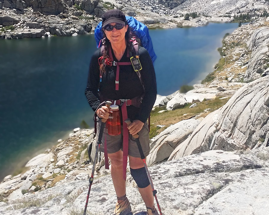
I started the John Muir Trail alone in August 2014 because I was afraid of solo wilderness travel and decided the only way to get through it was to go. Two hundred and eleven miles from Yosemite Valley to the summit of Mount Whitney, alone, in twenty-one days. I had walked several Camino de Santiago trails. I knew what my legs could do. What I didn’t know was whether I could trust myself out there with no one to defer to and no one to blame if it went wrong. About ten days in, somewhere in the Evolution Range, the trail stopped being hypothetical about it.

Evolution Valley, August 11, 2014

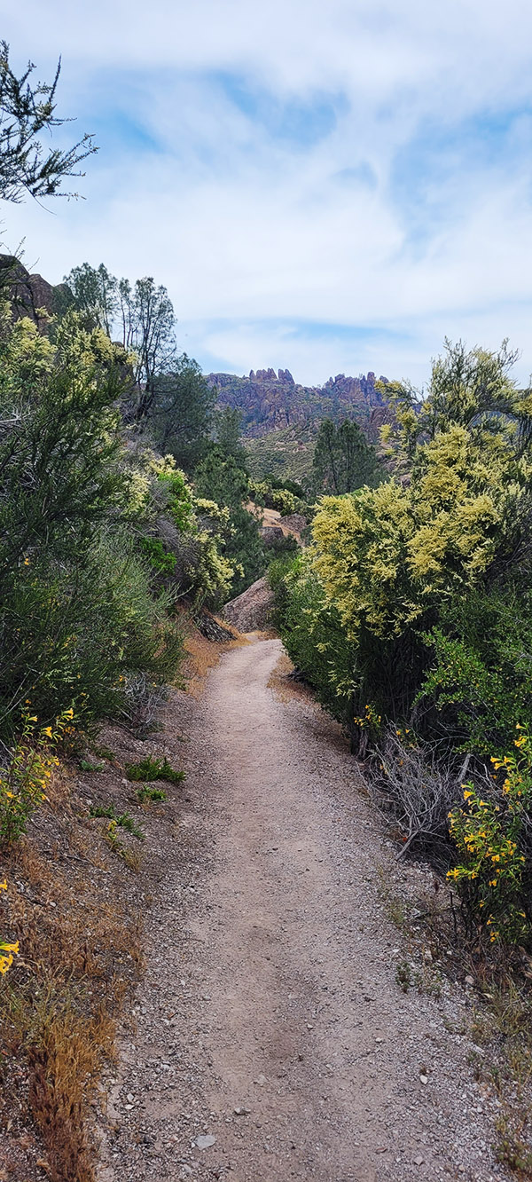
Evolution Valley has a reputation. Every hiker on the JMT knows the name before they get there, the way you know certain words in a foreign language before you have ever been to the country. Sacred. Iconic.

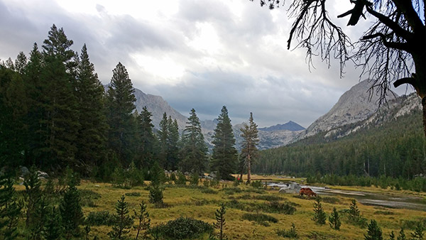
The valley floor opens at 9,500 feet. The green catches you off guard, Evolution Creek winding through golden meadow grass, the peaks rising above it all. Darwin, Mendel, and Huxley are named for the scientists who mapped the theory of evolution. The whole region carries their names. A pack mule grazed in the middle distance like it had nowhere to be. I wanted to stay for days.

What I remember is rocks tumbling along the shore and a sky boiling so close above me it felt like something you could reach up and touch.

On a trail this long, you keep running into the same people. Joan was a nurse, and we had fallen into step together enough times over the preceding days to know each other a little. Her hiking companion was difficult in the way that some men are difficult on the trail, controlling the pace, the decisions, the route. What I had pieced together over those chance miles was that before they left he had taken Joan’s wallet, her ID, and locked everything in his car. She had no money. No identification. No way out that wasn’t entirely on his terms.

The storm came the way they always do in the Sierra in August. Fast. Without apology. We turned back from the pass. The man looked around and declared a campsite near Wanda Lake.

Wanda Lake, 11,426 feet.

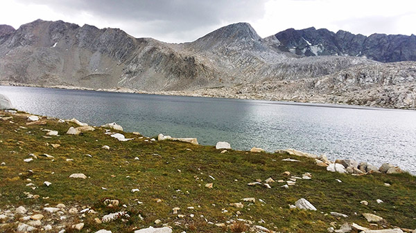
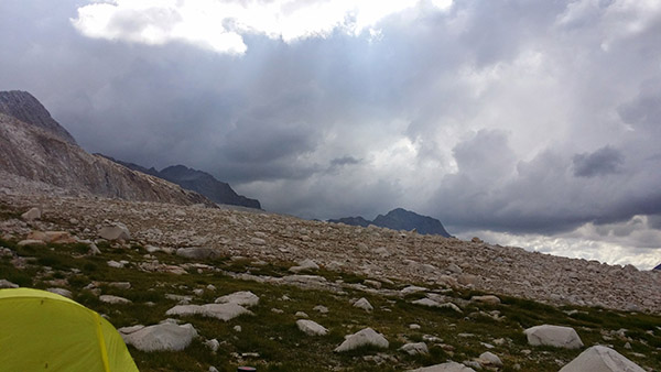
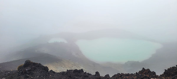
Wanda Lake sits at 11,426 feet, the largest lake at the base of the pass. Rocks scattered along the shore, the surrounding peaks nothing but scree and exposed granite, the water grey-green under the storm light. No trees anywhere in the frame. No shelter. No dip in the terrain between you and whatever the sky decides.

Southbound hikers passing through said it plainly: worst possible place to stop. Death zone for lightning. The man didn’t move. Joan looked at me.
I packed up my tent and left.

Joan stayed. I thought about her the whole way down, and if I’m honest, most of the way back up too.

The moonscape above the tree line.

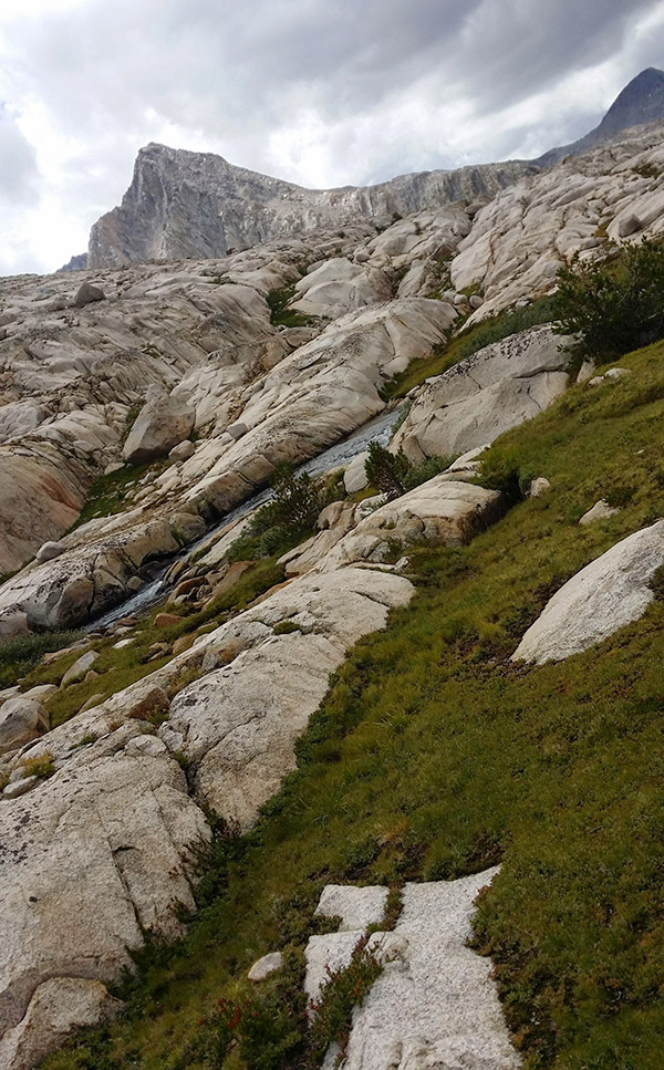
The trees had stopped somewhere far back down the trail and the world had changed. Granite slabs in every direction, pale as bone, thin fingers of grass finding whatever purchase they could in the cracks. Nowhere to step off and disappear. Nowhere to wait out the storm. Three or four miles of that back down to tree line alone, the lightning coming closer, the thunder hitting hard enough to feel it in your chest, past Sapphire Lake, past Evolution Lake, back through the point where granite finally gives way to trees.

Sometime in the night a young hiker asked for shelter. Her tent had flooded out. She came inside and we lay there listening to the lightning work through the dark, each strike closer than we wanted, praying it would move on without finding us.

His camp. The death zone.

By morning, the lightning had stopped. The sky hadn’t cleared, but the lightning had stopped, which felt like enough. Outside, the trail had become a gathering point. Everyone I had met on the JMT was there packing out. The mountain had called a meeting, and the vote was unanimous: hike out, trip over.

A man found me in the crowd, someone I had spoken to on the flight out to Yosemite at the very start of all this. A lifetime ago. His hiking partner had quit after three days. He had kept going alone. We agreed without much discussion to summit together and he went to break camp.

He came back without his pack.  Wife. Kids. He was hiking out. He said I should come too. Every person around us had made the same decision. The sky above the pass was still doing things skies should not do. He wasn’t wrong to ask.

I stood there in tears while everyone packed out around me. The lightning was gone but the sky was still dark. The pass was still up there. I was genuinely afraid. Not the manageable kind. The kind where your breathing goes shallow, your stomach turns, and adrenaline floods your body until your hands shake.

Every rational thought said to give up and call it quits. Instead my feet turned uphill.

It was the same thing that had kept me moving on the first Camino when everything hurt, the bed was warm, the next town far. Not courage. Just an inability to stop.

The same miles back. Through the trees, past Evolution Lake, past Sapphire Lake, back into the moonscape. The sky was boiling. In monsoon season you just move through it and hope.

A hiker came toward me on the trail heading the same direction I was. He had been pushed back the day before, same storm, same decision point. Now he was going back up too. I asked what he thought it was going to be like.

It’s going to be a shit storm, he said.

He kept walking.  So did I.

Muir Hut, 11,955 feet.

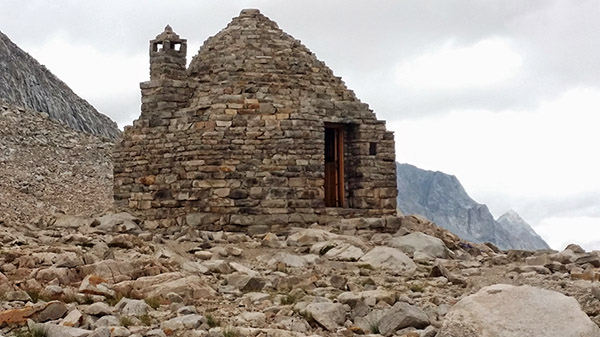
The Muir Hut sits at 11,955 feet at the top of the pass, a round stone shelter built in 1930, low against the mountain as though it grew there. The door was wood, dark and heavy, slightly open. I pushed through it.

That same hiker was inside. He had made it up first, sitting there with a camp stove and two cups.

He handed me one. Coffee.

The storm hammered the stone walls. The coffee was hot. Both my hands around the cup. Inside I was fine.

He said he was sorry for being such an ass. We laughed about that. Two people with no business being up there, sitting in a hut built to honor John Muir while the mountain made its point outside.

We walked out of the hut and the storm had passed.

Lightness and grace. After all of that, just lightness.

A few days later, Joan found me on the trail. We hatched a plan. I pulled the hundred-dollar bill tucked into my pack. Others gave what they could. We mapped her a route out. She didn’t hesitate. Some kinds of courage don’t need explaining.

Whitney was still days away. The tears at the summit were still ahead, the kind I hadn’t understood when other hikers described them. But coming down that pass in the running water, something had settled. I stopped and turned around.

The sky clears, August 12, 2014

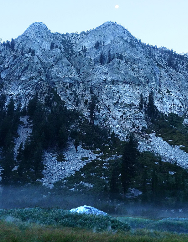
The sky had gone clean and blue, a full moon already up over the granite, the trees black against the last light. I took a picture. I knew I would want to remember what it looked like when the mountain finally let me go.

I was going to finish. And Evolution Valley was still out there, waiting for a return trip in better weather. It still is.


Nepal Annapurna Trek Part 1

By Mike Huber

You can catch up with earlier parts of Mike’s Nepal adventure here.


With the inability to reach Lukla Airport due to weather my guide and I were feeling defeated as we bounced along the bumpy road back to Katmandu.  We each had a couple of beers along the ride to kill the boredom and try to determine what next steps would be.  Upon arrival in Nepal I had the foresight to purchase a 90-day visa to be proactive should things go sideways, as they seem to always do.

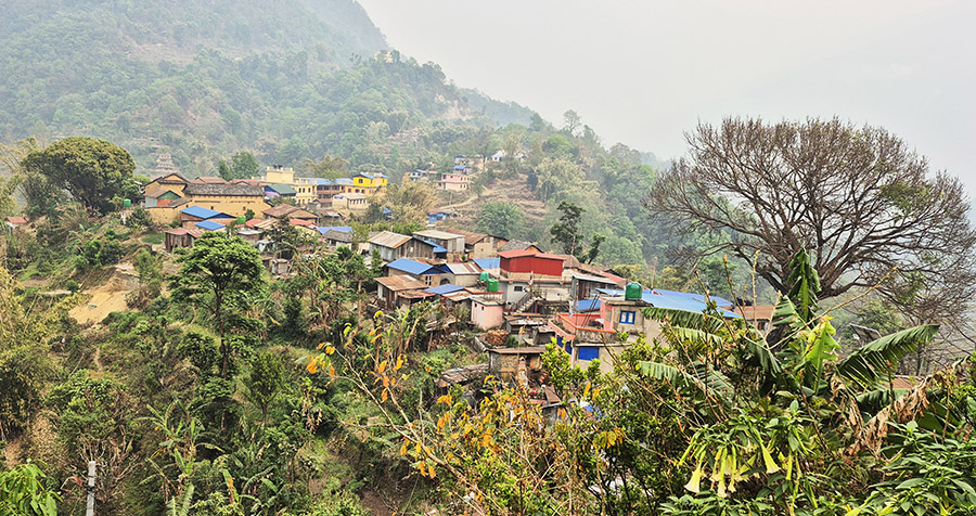
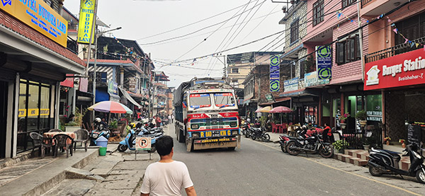
Upon returning to Katmandu my tour operator Kiran met me at the hotel with a new itinerary. One that would lift my spirits for sure.  There was another trek I was contemplating, The Annapurna Circuit. It was a 17-day trek which was more remote than the Everest one. This would now replace the Everest Base Camp Trek.  Kiran then added that upon completing the Annapurna Circuit I would helicopter from Katmandu to Lukla as rotary winged aircraft had much less restrictions in terms of visibility.  All in all this would fill up a month and a half and allow me to hopefully complete both objectives (Annapurna and Everest Base Camp).

The next day Guyen, my guide and I were on our way on another local bus that would take us to Tribeni Tol, which was the starting point of the trek at a low 738 meters in elevation.  The first few days would remain at those low elevation but long days, up to 27k.  There were a lot of fires in Nepal and the region we were trekking had the worse air quality on Earth (even worse than New Delhi, India).

Not being much of a hiker and even less of a trekker it didn’t take long before I realized being uncomfortable was part of this hobby.  Something was almost always hurting. My previous occupation of falling out of airplanes had me feeling constant pain in my back and constant knee issues. Being used to having pain here or there (or everywhere) I travel with a plethora of medicines.  Pretty much a full kit and as needed I reload in countries where most of these drugs are over the counter.

It didn’t take but half a day and my knees were beyond shot.  My hiking poles became crutches.  It was time to dig into my medicine kit and see if I had anything that could help. A challenge with my med kit is the pills are from literally all over the world so whenever I need something I have to hope there is a cell signal for me to cross reference it and translate it.  After tearing the kit apart I found something that I thought may help.  It was a powerful anti-inflammatory I picked up in Romania.  As I opened the pills they looked a bit odd.  They were longer and sorta waxy.  Back to the internet I went. As it turns out it’s a suppository. At this point I was in a ton of pain and contemplating turning back as I didn’t want to get into trouble further u the trek due to this injury.

I gave the pills a shot, and with my dinner of chicken momos completed it was time to go to sleep to see if these Romanian anti-inflammatory pills would be able to salvage my trek.


Join our Facebook ExNotes page!


Never miss an ExNotes blog:


Help us keep the lights on:


Don’t forget: Visit our advertisers!


Tongariro Crossing, Tongariro National Park, New Zealand

By Mike Huber

The Tongariro Crossing in New Zealand is touted as one of the world’s best day hikes. This obviously meant it was a hike I had to tackle.  The crossing is 19.4 kilometers (11.64 miles) across an active volcano, and it includes a LOT of stairs, both up and down.  Having not been hiking in several months, this was the first time I was actually questioning my physical ability. I don’t think it comes from age as much as hard landings from falling out of airplanes.  Either way, it’s the Number 1 hike on Earth so it really needed to be checked off my list.

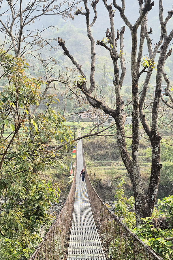
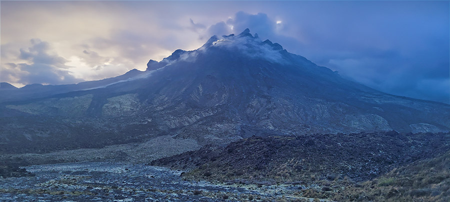
As with all mountains, the weather is constantly changing and this mountain would prove no different.  The previous day the hikes were cancelled due to heavy winds.  Upon waking up at 0400 it was a relief to learn that the shuttles would be running that day. My campsite was just outside the town of National Park and was right along the shuttle path for a 0545 pickup and a 30-minute drive to the trailhead.

The hike started with misty clouds which added to the already stunning mountain scenery, and the winds, well they were blowing hard. I had purposely loaded my day pack heavy with extra everything in the event I’d need it.  That was smart. By day’s end I had used almost everything I brought.  This was comforting since I thought I had over packed.

The first five kilometers weren’t bad except for the brutal winds, which were a constant battle. It got to the point that when the winds subsided I’d almost fall down due to leaning in so much.  Once that five kilometers were wrapping up, there were several posted signs that said “If you aren’t feeling well, now is a great time to turn back, there is no shame in that.”  I used those signs as motivation to continue.

Once reaching the summit, it was obvious the crown jewel of the hike would not be shining as brightly as it had been in the photos.  There were two bright neon emerald green lakes that in the sun just glowed; however, with the weather having turned so quickly it was nothing more than a dull blue barely visible through the cloud bank.  The winds were still howling from every direction.  There was hardly even time to snap a few photos before I decided it was time to descend into the next crater for some shelter and to take a break and eat a snack. The only portion that remained was the never-ending descent filled with many more steps.

Overall, it was a magnificent day with great views and conversation with fellow hikers from all over the world. My finish time, not that it matters, was just over 6 hours.  This seemed admirable as the estimated time for most was between 6 and 8 hours.  The remainder of the day was spent at my campsite swimming in my own personal grotto behind my tent, talking with others that hiked it (or would in the morning), consuming ibuprofen, and feeling semi accomplished now that this hike was now completed.


Read the Mike Huber New Zealand posts here:


Never miss an ExNotes blog:


Don’t forget: Visit our advertisers!


El Condor Comida

By Mike Huber

Pinnacles National Park is the 50th National Park I visited. I believe there are 63 National Parks total (National Park Service keeps adding them yearly, so…).  As with all the parks it is rare to be disappointed with a visit to any of them.  In fact, I have visited some of the parks numerous times just to be sure to fully embrace each part of them as many are quite large.

Pinnacles National Park is one of the lesser visited National Parks, which I find refreshing since there are fewer tourists than other National Parks, like Yellowstone and Yosemite where the crowds can be almost overwhelming and detract from the experience. For Pinnacles I had reserved two nights camping so once I arrived late in the day, I could knock out a shorter hike and complete a long hike on the spare day.  The longer hike I chose was to summit the highest peak in the park, Chalone Peak, which reaches 3,304 feet in elevation.  That isn’t that bad because there is only a 2,034-foot elevation gain from the base. This is a 9-mile trail that snakes through beautiful hills. Every turn provided an incredible panoramic view of the fields below and the mountains that stretched to the sky.

Once summitting the peak, it was time to rehydrate and fuel up with lunch for the hike back.  As I sat down, I heard what sounded like someone vomiting.  Looking to my left I saw I was sitting about 25 feet from a California condor.  It was tagged with No. 89.  The National Park Service tags these rare birds to track and follow them at a level not seen since Facebook started tracking me. Having researched No. 89, I learned this guy was born in captivity in Idaho in 2011. There are under 600 of these massive birds remaining in the world. To have the rare opportunity to see one was magical, but to be able to sit next to one for 30 minutes as I ate lunch was something spiritual, equivalent to petting the gray whales in Baja.

As I sat eating my lunch the condor and I constantly exchanged gazes.  Every so often it would spread its wings to show off its true size.  Not only did it not seem bothered by me, it seemed to enjoy my company (I mean, who doesn’t?).  After about 30 minutes I began wrapping up lunch and as I packed up, No. 89 silently turned away, spread its wings, and leapt off the rock like a hang glider sailing down about 100 feet and then turning upward it flew off into the distance.

This magical encounter reinvigorated me for the 4.5-mile hike to the base of the mountain. I had a solid buzz from the encounter for the remainder of the day.  Just like all the close encounters I have had in nature, that buzz never seems to fade and it has me looking forward to National Park Number 51.


Please click on the popup ads!


Never miss an ExNotes blog:

Camino de Santiago Part 1: A Walk Across Spain

By Bobbie Surber

The Camino de Santiago, also known as the Way of St. James, is a network of pilgrimage routes that lead to the shrine of the apostle Saint James the Great in the cathedral of Santiago de Compostela in Galicia, Spain. The Camino has been a popular destination for Christian pilgrims for more than a thousand years, and it is now visited by people of all faiths and backgrounds from around the world.

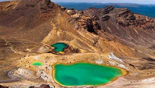
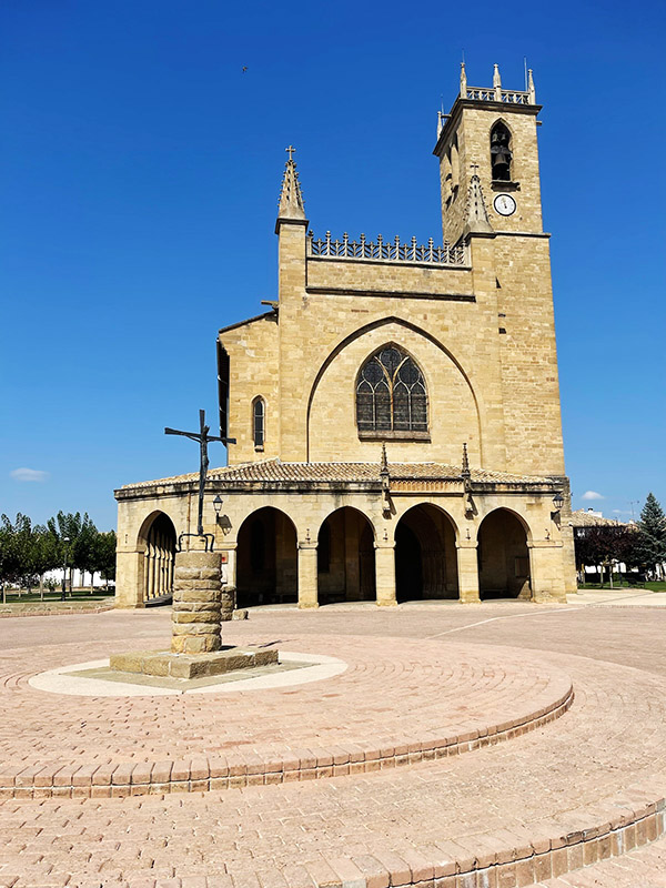
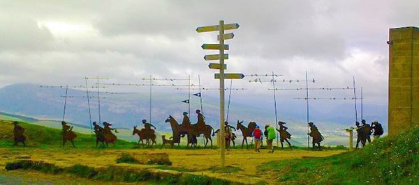
There are several routes of the Camino de Santiago, including the Camino Frances (French Way), which is the most popular, and the Camino Portugués (Portuguese Way), which starts in Lisbon or begins in Porto for a two-week shorter Camino. The Camino de Santiago is a long-distance walk or hike that typically takes 30-40 days to complete, depending on the route and the pace of the individual pilgrim.

Along the way, pilgrims stay in Albergues (pilgrim hostels) or other types of accommodation and follow the yellow arrows and shells which mark the way. The Camino de Santiago offers a unique opportunity to experience the beauty of the Spanish landscape and culture and to challenge oneself physically and spiritually.


Please click on the popup ads!


I walked seven different Camino Routes with my first Camino in 2012 and the last in September 2021. My last walk found me starting in Pamplona, Spain, a vibrant city never lacking a reason for a fiesta, a city known worldwide for the Running of the Bulls every July.  I ended my journey in Leon, Spain. With my added side trips, I walked over 300 miles, experiencing high desert plateaus, the Rioja wine region, the blissful Logrono’s tapas, the magnificent Burgos Cathedral, the Meseta’s emptiness, and the joy of Leon.

I was on a multi-month motorcycle/camping trip through Arizona, Utah, Colorado, Wyoming, and Montana. When riding, there are times when every part of your brain is laser-focused on the road ahead of you and who might try to run you over from the back or side, but every now and then, the ride is so peaceful that you have time to turn a portion of your brain to the gift of “I wonder.” This led me to reminisce over my six prior walks along different Camino routes in Spain, Portugal, and France. Once released, an avalanche of memories and images flowed to the point that I knew I would be booking my flight to Europe as soon as I stopped my ride for the day.

A quick Google Flights search gave me what I needed, and I soon had a ticket. This was another solo walk, my favorite way for most hikes. My arrival in Pamplona was early enough that I decided to start my Camino right from the Pamplona Airport, bypassing one of my favorite cities in Spain.

The morning had the hope of the fall weather yet to come as I headed slowly up the first of several foothills with the goal of a 10-mile walk for my first day. The gravel crunched satisfactorily underfoot as I quickly adjusted my backstraps to climb up to an iconic ridge that all pilgrims look forward to, the Alto del Perdón, a mountain pass in the province of Navarra in northern Spain, about 12 miles outside of Pamplona. I had returned to the Camino Frances trail after nine-year of absence, taking in beautiful views of the surrounding landscape and a chance to rest and recharge. The mountain pass is named after a sculpture of the Virgin Mary and the phrases “Señora del Camino” (Lady of the Way) and “Perdón” (Forgiveness), which are inscribed on the base of the sculpture. The windswept ridge and the massive wind turbines in the background contrast the sculptures that represent a pilgrimage from the Middle Ages. I took my first full breath after 18 hours of travel and an excellent 8-mile walk to this point. I thought about my intentions for this walk, what I hoped to gain and whom I would miss in the coming weeks of a long walk across most of Spain.

Reluctantly leaving the ridge late afternoon, I knew it would be challenging to reach my Albergue for the night. The steep loose gravel trail reminds me that my knees are not what they used to be, and motorcycle riding for the prior months did little to prepare me for the rigors of this walk. Soon the village of Uterga appeared with another climb up to her main street. My arrival timed perfectly to watch the evening stroll of the locals begin, kids running in the square, little old ladies with perfectly quaffed hair and well-put-together outfits ambling in deep conversations. Adults were sitting in outdoor cafes having a drink, visiting each other, and enjoying the last dregs of daylight. I wanted to plop my disheveled self within their mist and order my first long-awaited glass of Vino Tinto, but I pulled myself together and made the last of my walk to my Albergue in short order.

This first night’s stay found me in a dorm room in a private Albergue with its small restaurant and bar. After showing my pilgrims pass (issued to show you are walking the Camino) and paying 12 Euros for my place in the dorm room, I quickly dumped my backpack on my bed, looked in the mirror, confirmed I looked like a wreck, dashed for the bar, and ordered my first of many good Rioja wines. Settling in, I met my first group of fellow pilgrims. A portly German fellow in his mid-fifties that I would painfully learn would serenade us throughout the night with his epic snoring. Also, a group of Italian bicycle riders. They were loud, and all were talking at once with what would become the usual question:  Why is an American woman walking the Camino alone?  Well, that’s a question for another day! I order my second glass of wine and move into the restaurant for the start of the evening’s Pilgrim meal, an inexpensive three-course meal with portions that could feed a small family, and your choice of bottled water or a bottle of wine, Good God, man, why would you order the water?  I certainly did not.

I had equal feelings of contentment and joy seeping in as German, Italian, and Spanish conversations swirled around me—fellow pilgrims sharing their day’s success and physical hardships. Many of the pilgrims had started 60 miles back on the French side of the Pyrenees, had survived the celebrations of Pamplona, and were still in high spirits so early in their walk. I listened to their stories and their countless toasts made in several languages. I left the room while the wave of conversation and laughter reminded me of how lucky I was to be on this walk for a 7th time. This surely was the beginning of an epic adventure and the hope of what Spain had in store for me.


Never miss an ExNotes blog:

ExhaustNotes Travel:  The Bisti Badlands Of New Mexico

By Joe Gresh

In the northwest quadrant of New Mexico there’s a lonely, two lane highway numbered 371 that runs north from the small town of Thoreau on Interstate 40 to Farmington. About 30 miles south of Farmington, on the east side of Highway 371 is a place called the Bisti Badlands in the De-Na-Zin Wilderness. The Badlands are where you can find the ever-patient hoo-doo’s standing watch over mankind as we scurry around like red ants on our disturbed mound. Not ageless, the rock formations and strangely eroded pedestals found in the Bisti slowly change over time. Unless a stone topples to the ground you might spend a lifetime observing and never notice the backs of the old ones ceding to gravity’s incessant pull.

CT and I left Farmington around 9:00 a.m. and drove to the Bisti where we met Gilbert, who works as a guide for Navajo Tours USA, a Native American company that operates in Chaco Canyon and Shiprock as well as the Bisti Badlands. These guys are good and it’s not just me.  National Geographic thinks so too.


Help us keep publishing:  Please click on the popup ads!


Gilbert is Navajo and has like 16 different jobs, guiding tourists through the Bisti being one of them. Along with Gilbert, me, and CT was Sasha. Sasha spoke with a heavy accent; she sounded like she was from an eastern European country or maybe Texas. Her husband and young son dropped her off at the Bisti parking area and as soon as they were satisfied we weren’t ax murderers they fled the scene. Sasha said they were tired of hiking around New Mexico and were going back to Farmington to rest.

Bisti Badlands is one of those places that doesn’t look like much from the parking area. There was only a sun-faded, Bisti Badlands map under scratched Plexiglas in an information kiosk to identify that we had arrived at the correct spot. The map looked as old and bleak as the landscape it described. I looked across a wide, shallow expanse of hard packed, barren dirt and wondered where the heck we were going to hike. I mean, there’s nothing out there.   Do we just walk out into the center of the desolate valley? Gilbert laid out a northeasterly route that would hit some of the high points of the Badlands. We opened a red pipe gate, stepped high over a large diameter cross bar between the gateposts, and started hiking.

Gilbert and Sasha were way younger and fitter. At first they appeared to have an ambling pace yet I would have to break into a canter every few hundred yards to catch up with them. I tried matching Gilbert’s stride one for one but he still pulled steadily away. I decided he was using some secret Navajo walking method taught only to tribe members. Sasha I figured to be a hiking ringer, one of those chicks that walks 75 miles before breakfast and drinks raw egg smoothies.

After a couple miles of hiking we started to get into an area that resembled the promotional materials for the Bisti Badlands. Large stones sat atop thin spires of Tuff, relatively soft volcanic ash and debris that had solidified. But Tuff isn’t all that solid hence the ground underneath the stones eroded before the harder top rock. We walked past huge piles of what appeared to be broken terra cotta clay. Gilbert explained that the section we were in has a low-grade coal seam running just beneath the surface. In the shallow valley by the parking lot you could see the darker stripe of coal. When the coal catches fire it bakes the clay above changing its color to red. This joint is one big, open-air kiln.

At the Bisti Pyramid Gilbert stopped for a rest. CT and I sat down on a stone. Gilbert lulled us into a stupor with his gentle voice telling tales of the Badlands. Sasha ran around the crazy rocks snapping photos. She reminded me of a Jack Russell Terrier. Too soon we were on our way again.

Our surroundings became more surreal, like we were walking through a Salvador Dali painting. I realized that I had no idea where we were and was so turned around I couldn’t tell which way was back. Gilbert pulled us in for another rest break and told Sasha we were going to stay here until she got back and to not wander out of sight. Sasha went climbing around with her giant Canon DSLR getting shots of rocks from every conceivable angle. Sasha oozed vigor and health. I started to wish I had gone back to town with her husband and son. They were probably drinking in a smoky bar somewhere.

Gilbert told us stories about getting lost in the Badlands at night. I was thinking about the cold, clear New Mexico night and looked around.  The only wood to burn was petrified. I sure didn’t want to start that coal seam on fire and end up like those baked clay fragments. Gilbert pointed me to a cell phone tower off in the distance. See that? he said. That tower is on Highway 371. If you get lost head for the tower; at night it has a flashing light on top.

We went further into the rough terrain; the flat lands were far behind. Stone shapes became more dramatic and impossible. We were in the Bisti Badlands proper and no mistaking it.

My feet were killing me. I asked Gilbert how much further before we start heading back to the cars. He said that we are almost at the turn around point. It had been ten miles at least, maybe more.

In the afternoon we started to head back. We were kind of quiet, just stumbling along in a near-death state of mind. I judged our distance traveled to be 25 miles. At last the parking area came into view. We were still 30 miles away but at least I could see our car and the restrooms.

At a turn in the path approximately 40 miles from the car parking area Gilbert said that Sasha wanted to explore the southern parts of the Bisti Badlands. We said to go on without us and that we would be fine as we could see the cars only 50 miles away. Gilbert said he would walk back to the cars with us to make sure and Sasha would wait for him to return where they could continue exploring the Bisti area. We made it on sore feet but we made it to the car. Gilbert showed us again on the map the route we had taken. I asked him how far we had traveled all total. Gilbert said 5 1/2 miles. And that’s how it is in the Bisti Badlands. Distances can be deceiving. If you are in the Bisti area look up Navajo Tours. You’ll have a fun hike and won’t get lost and die like the dumb tourist you are. I recommend them highly but don’t try to keep pace with Sasha.


Never miss an ExNotes blog: