GRIN Times In Datil, New Mexico

By  Joe Gresh

Among the many crazy conspiracy theories masquerading as knowledge today are the Walmart tunnels. These tunnels supposedly crisscross the nation for the usual nefarious reasons: FEMA camps, New World Order population control and extraterrestrial alien smuggling (to steal your jobs and women). When you stop to think about it, this whole insane, Walmart-tunnel thing is no wackier for Datil than the nearby Very Large Array radio-astronomy telescope.

The VLA was used in a movie about the search for alien radio transmissions. Or was it just a movie? If that doesn’t fire up our odd American mix of gullible/skeptical idiocy nothing will. Like all good conspiracy theories there is a grain of truth to the Walmart-tunnel thing that feeds the plot. New Mexico is full of old mining tunnels so if you look hard enough you’ll find one. Just not the ones owned by Walmart. Those ones are top secret.

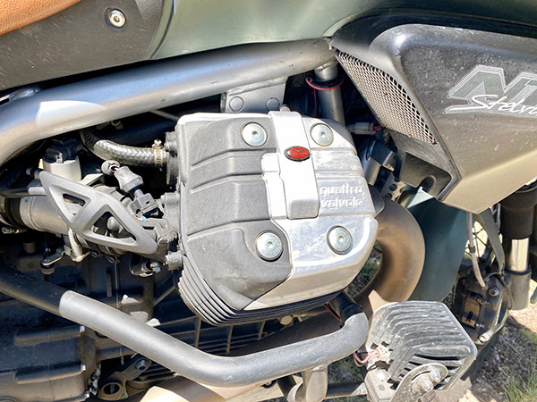
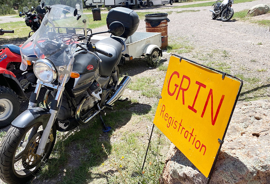
Naturally with all the weirdness going on near Datil, GRIN chose to hold its Guzzi motorcycle rally directly over a tunnel leading to Lake Como in Italy. I could hear the water rushing through the tunnels if I put my ear to a Quattro valvole rocker cover.

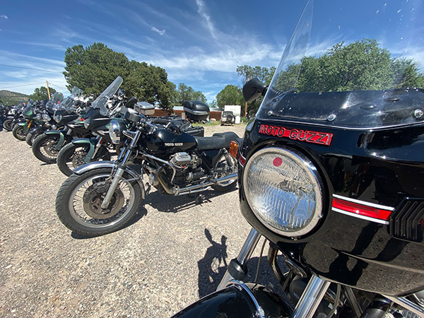
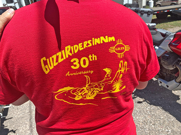
Finding Moto Guzzis in New Mexico is much harder than finding Walmart tunnels. I can’t recall seeing one on the road or parked up at a Starbucks. My buddy Robert rode his 850 Guzzi out to New Mexico one time but that doesn’t count. Guzzis aren’t super popular anywhere so a rally with 25-ish bikes is something to see. I forgot to add that GRIN stands for Guzzi Riders In New Mexico, the club that put on the show and rally.

Datil consists of an expensive gas station, a motel, a campground and a pretty good restaurant. I’m not sure you could call it a town, it’s more of a traveler’s rest. Behind the motel and gas station you’ll find the campground, and this is where the wrong-way, Italian V-Twins were situated.

The gang of Gizzard riders was an easygoing bunch. It took no time at all before I felt like one of the boys and damned if I didn’t start wanting one of these goofy motorcycles. An unusually high number of rally attendees told me that they had once owned a Kawasaki ZRX like the one I rode to the event. I did 410 miles round trip but there were riders from Texas and Colorado who had traveled much further.

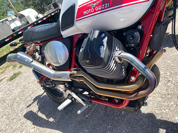
I’m a sucker for high pipes on a street bike so this Scrambler was my favorite of the bunch. Later in the day we went to the Datil restaurant and had a good lunch that totally blew my diet. I had the southwest turkey sandwich and it was smothered in Hatch green chili.

GRIN hosted several dinners for the 3-day rally and there was a Guzzi bike show. Attendees judged the bikes in a people’s choice sort of deal. It was kind of hard to see the entry numbers that were on tiny round stickers applied the Guzzi headlight glass. I didn’t get to vote because I wasn’t actually a member of GRIN. I feel this should invalidate the whole election process and make GRIN a dictatorship.

Late in the afternoon I had to head back to the ranch as I don’t like riding at night. My night vision is much improved since I had cataract surgery but an elk running across the road in front of your 70mph motorcycle takes a lot of seeing.

The seasons are slowly changing here in New Mexico, so it wasn’t unbearably hot on the ride home. Cool, dry air on top of the higher passes made me worry less as the sun set behind me. I pulled into the ranch in full darkness with the ZRX running on all four cylinders. It was like riding in a tunnel.


Chaco Canyon, New Mexico

By Joe Gresh 

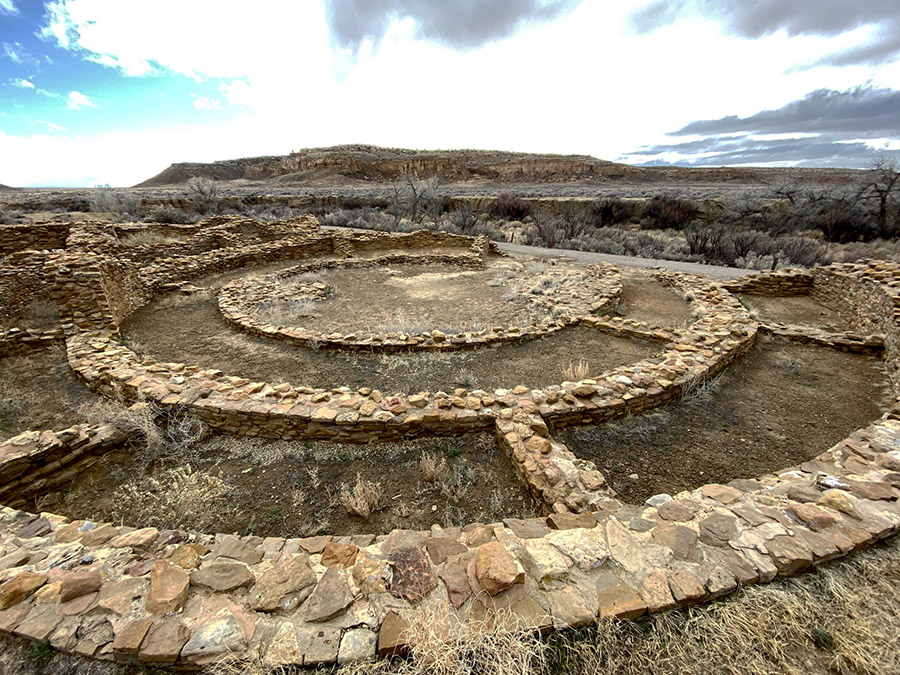
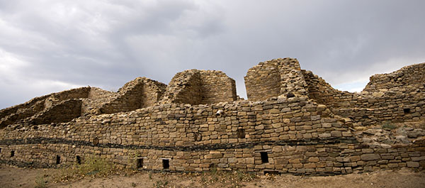
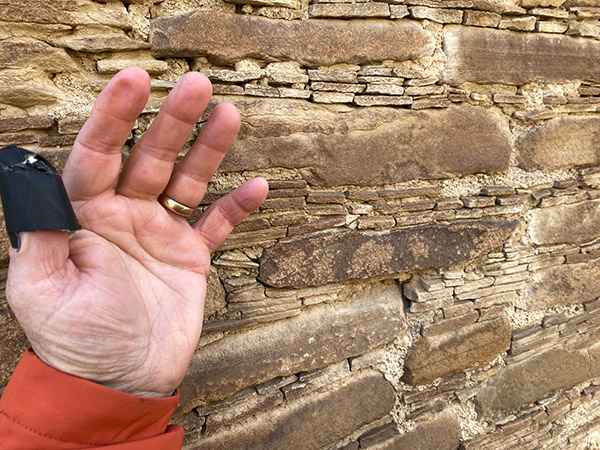
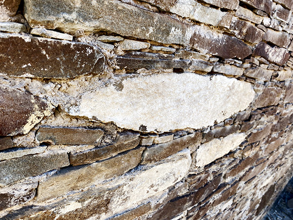
In 2019 we booked a campsite at Chaco Canyon in northern New Mexico. Chaco Canyon was a fairly large Native American city that served as the capital for the Chaco people a thousand years ago. Strung out along the canyon within walking distance of each other there are several large, condominium-style structures, some reaching 5 stories high and all of them with courtyards, living areas, kivas, and storage rooms. The condos were built with fantastically intricate stonework consisting of millions of large and small stones. Chaco society was well organized and their mathematics and architectural engineering were well advanced, as it would need to be in order to produce such big, complex buildings.
Also in 2019 the plague hit and Chaco Canyon was closed to visitors, so we never made it to the campground. The same thing happened in 2020, so we missed Chaco that year and instead spent our time arguing on the Internet about masks and vaccines with medically-trained basement dwellers. In 2021 we had a reserved campsite near the cliffs of the canyon and not long before we were due to arrive the cliff calved, covering our campsite with boulders. The campground was closed in order to clean up the rubble. The section where we were booked is still closed.

In 2022 we again called the ranger station at Chaco Canyon and reserved a site.  All looked well in 2022 but a day or two before we were to leave CT came down with a nasty cold and we decided camping would be no fun with one of us sick in bed. Reluctantly, we cancelled our reservations yet again. Our efforts to see Chaco Canyon seemed cursed. We decided to try again in 2023 and figured March would be a good time to go. We wanted to avoid the hot summer months. Building up to March everything was going swimmingly; this would be the year we finally made it to the historic Native American site.

And then the rain started. We watched the weather reports coming in from Chaco Canyon: rain, snow, hail. It rained at Chaco Canyon every day the week before we were to go. All roads leading to Chaco Canyon involve quite a few miles of dirt. The rougher, south entrance to the canyon was closed due to the muddy road being impassable. We didn’t care: we were going to Chaco even if we drowned in mud. Farmington was our staging area for the camping expedition and we drove in spotty rain all day to get there. Turning north out of Albuquerque on Highway 550 we stopped for gas. While I was filling the gas tank it started snowing. Then the wind picked up to a brisk gale. The last 50 miles to Farmington were in a drizzly rain mixed with sleet. We made it to our motel where it rained all night long. The normally well-maintained north entrance road to Chaco Canyon was starting to look a bit iffy.

The next day was overcast and rain threatened, but the morning was drama free with only a light dusting of snow on our way to the entrance to Chaco. If you’re going to visit Chaco Canyon you’ll no doubt read horror stories about how rough the road is leading to the canyon. Keep in mind the people fretting about the road are driving giant RVs held together with staples and chewing gum. You may lose a kitchen cabinet or an ill-considered propane tank. If you are driving a car or truck you’ll be fine. Unless it has rained five days straight before you arrived.

Turning off Highway 550, the first 8 miles to Chaco Canyon are paved and then the road turns into wide, graded dirt. This section was very muddy and CT put her Jeep in 4-wheel low and locked the front and rear differentials. She couldn’t go very fast because the Jeep wanted to spin into the ditch at the slightest sign of ham-fisted steering. Down hills were exciting; the Jeep kind of drifted to the bottom in a semi-controlled slide. The mud wasn’t deep, only a few inches, but it was like driving on ice covered with ball bearings and oil.

We saw two other vehicles on our 23-mile ride and one of them was stuck in a ditch. CT is a big believer in recovery gear so she has straps and chains onboard at all times. Unfortunately this means we have to stop and help people who get stuck in a mud bog. The guy was so glad to see us. We came to a gentle stop 30 feet past the deepest part of the mud hole. “You got a rope?” I asked Mr. Stucky.

“No I sure don’t,” he said. I gave a dejected look at the mud.

“Do you guys have anything we can use?” he asked.

“Yeah, we got something.” I stepped into the mud and pulled CT’s clean ARB tow strap out of its clean zipper case.

“I think if you can pull me back onto the road I’ll be ok. I was going too fast and spun out.”

I was only half listening to Stucky.  All I could think of was that this means we have to get CT’s ARB tow strap muddy with this sticky goo and then I’ll have to clean it later.

Walking was hard due to the mud sticking to our boots and the slipperiness, but we managed to connect our nice, clean, tow strap to Stucky’s SUV and pulled his rig backwards towards a less muddy area. Stucky’s mini SUV didn’t want to leave the ditch and it crabbed along spinning wheels and slinging mud for 100 feet before it popped out of the rut and onto what passed for the road. I started to wind up the tow strap when Stucky, sensing my disappointment, said, “Here, let me get that. No need for you to get any muddier.” I was muddy already, but I handed Stucky the strap. I wanted him to feel like he had a stake in not getting stuck again. As Stucky coiled the ARB tow strap mud oozed between each wrap. We were only a few miles to the campground from this point.

Once you make it to Chaco Canyon the roads are paved so we had no trouble finding the ranger station or our campsite. The place was nearly deserted. Stucky’s little teardrop trailer was the only other camper at Chaco that day. Fast moving clouds scudded from west to east bringing alternate periods of sunshine, snow, rain and hail. During a sunny spell we set our Campros tent up on the nice, raised tent platforms provided to each camping spot. The raised tent spots are built from pressure treated 8×8 beams laid out in a square totaling 14 feet by 14 feet. The squares were filled with nice, soft dirt and we were damn near glamping, you know? I guess if I were more observant, the tie down clevises screwed into the pressure treated lumber would have given me a hint about wind speeds in Chaco Canyon.

We watched the looping, 15-minute Chaco Canyon video at the ranger station’s little movie theater and then decided to set up and get our junk sorted out. It was windy and cold but we had plenty of warm clothing to wear. CT brought along 6 jackets, 7 hats, and 3 duffle bags full of thermal underwear. The tent was heaving and snapping; it took two people to hold it still long enough to assemble the thing. The temperature started dropping as soon as the sun went down. A campfire was out of the question in this wind so we made our bed, ate a little cold-cut snack for dinner, drank hot, Dancing Goats coffee and sat at opposite sides of the tent holding the corners down.

Moving all the heavy gear to the perimeter of the Campros tent seemed to keep it from blowing over. We were able to snuggle together in the sleeping bag and kept from freezing, which was the whole reason I wanted to go camping with CT in the first place. We saw 27 degrees that night and the wind never stopped blowing. The next day was slightly warmer and the sun was peeking out from the clouds, but it was even windier.

Due to the weather all the ranger presentations were cancelled. We signed up for a Chaco tour led by a Navajo business called Navajo Tours USA. We used these guys before at the Bisti Badlands and they are great fun. The tour started at 10 a.m. and we went to each condominium and wandered around while our guide told us about the different stone patterns and construction details of the buildings. Usually Chaco great houses have a basement level and many of the places we were walking had filled in with dust and sand over the preceding thousand years.

Above the basement there were three or four stories. Each level was accessed by a ladder from the level below. This system continued on until you reached the roof. The floors were made from large wood beams, called vigas in Spanish.  Over the beams were placed smaller sticks and an adobe floor. The vigas hauled to Chaco came from the mountains many miles away. I figure there must have been some sort of money or economy that would have allowed workers to drag those beams and still be able to sustain a living wage.

The walls of the condos were fairly thick. Starting at the bottom the walls were three feet thick or more. The walls tapered as they rose, becoming thinner floor-by-floor.  Top-floor walls might only be one foot thick. Originally, the inner walls were plastered smooth with some sort of lime coating. In a few spots you could still see the factory stucco. There were windows that let light into the rooms.  Inner rooms were dark but they had openings that aligned with outer windows that allowed outside light to penetrate several rooms deep. The outside windows had wooden shutters for winter use.

The winds, strong already, were picking up and at times you’d be blown off balance. Each gust brought a stinging blast of sand and my eyes were getting full of grit. The Chaco people situated their buildings according to astronomical events. Usually one long, straight wall aligned with the rising sun at the solstices. Sometimes the wall pointed towards a particular star. The building was a giant calendar.

There is a lot more to the Chaco culture, the long, straight roads they built, where their food came from, and why the city was abandoned after only a few hundred years, but it was late in the afternoon and getting colder. The wind was so strong I couldn’t hear our guide very well. Light hail was falling and wisps of snowflakes juked and stutter stepped in the air. As much as I enjoyed the lecture I was glad when it was over. I like it outside but there is such a thing as too much outdoors. We went back to the campsite to have a little hot tea.

Camp was a disaster. Our Campros tent looked like a downed weather balloon. Tent poles had broken, stakes were pulled out and the rain fly was detached and flapping in the breeze. Inside the tent everything was covered in dirt blown in through the screened roof.  We tried to get the tent propped back up but when I pulled on it things started ripping. We managed to get the rain fly back over the wreckage and placed large boulders on the corners to hold it in place. It was snowing again. There was nothing to be done with the wind blowing so we went to the ranger station and loitered. I bought a ceramic coffee cup with a Chao Canyon logo; it was good to be out of the wind.

By 7 p.m. the wind eased up a little and we went back to camp to try to salvage what we could. Our first chore was emptying the Jeep before it got dark. The idea being if we couldn’t fix the tent we could retreat to the Jeep and sleep in the back. Sure it would be cramped but at least we had a heater in the car. And the car wouldn’t blow over. Maybe.

We managed to get the tent propped back up with the short, broken poles. The short poles made every other dimension wrong. The main ridge pole had a huge S curve and there were wrinkles all over the place. It wasn’t a thing of beauty. Besides the broken poles, the upwind corners were ripped where the tent stake loops attach. We propped heavy stuff in those corners to hold the tent’s shape. Next we cleaned up all the sand as best we could and finally got organized enough to have another cold dinner and hot coffee. A campfire was out of the question because neither of us wanted to bother.  In retrospect, when we left that morning we should have lowered the tent and placed rocks on the rain fly to hold it down. I believe it would have survived without a problem. I have no gripe against the tent: it went through a hurricane.
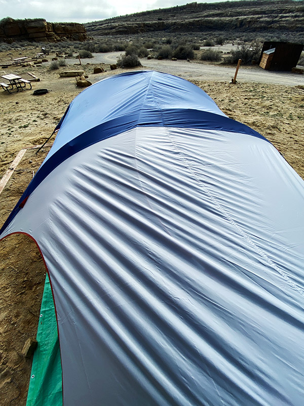
The jury-rigged tent stayed up all night long and by morning the sun was out and it was a relatively warm 40 degrees. Blue sky shined in through our open tent door and the wind was a gentle breeze. If our reservations were made just two days later we would have had a totally different feel for Chaco Canyon. It would have been nice Chaco Canyon instead of mean Chaco Canyon. The muddy road had dried up and was now passable by standard automobile. The campground started filling up as we packed our gear. Old Joe would have folded up the battered tent with the broken poles and torn corners, taken it home and stored it for 43 years thinking he was going to fix it one day. New Joe tossed it in the dumpster.
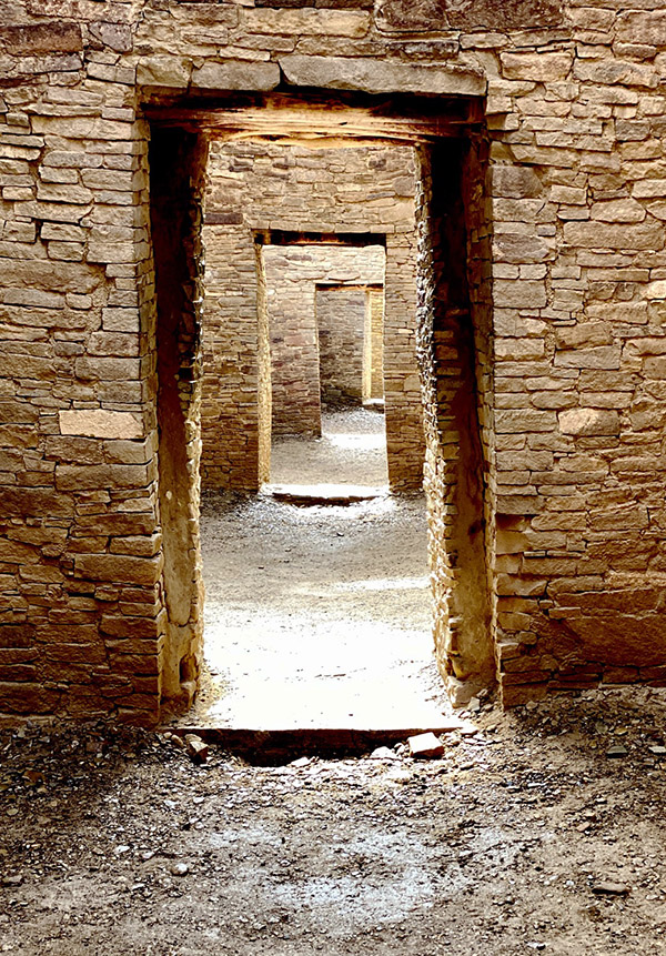
Those long-ago Chaco people had it much better in their thick stone buildings. Maybe the climate was different then, but I suspect not that much different. And it was an unusual weather pattern that saw all the other campers cancel their reservations leaving only Stucky, his dog and us in the entire joint.  The campgrounds were nice with clean bathrooms, flush toilets and heat, but no showers. We never did get to see all the buildings because it was so windy and cold. CT and I want to back to Chaco Canyon and explore more but maybe next time we’ll go when the weather is more clement.


Never miss an ExNotes blog:


You know what to do:  Please click on the popup ads!

ExNotes Stock Car Racing Review: Vado Park Speedway, New Mexico

Sometimes the story you set out to write doesn’t want to be written. Something is wrong, there’s no ju-ju, there’s no vibe, or in this particular case, there are no decent photos. I have an expensive Canon 5D that takes beautiful racing photos and I have a pretty good 300mm zoom lens with selectable, 2-axis stabilization. It’s not a professional lens by any means but it can do a fairly good job if you’re steady enough and don’t shoot at nighttime. The problem with the 5D and 300mm lens combo is that it weighs a ton and I don’t like carrying the thing around.

Anyway, it’s foolish pride on my part to try and capture the moment because as soon as I stop to think about a camera it’s not a moment any more. It becomes staged. It seems phony and something like grasping for the shot that will make the story. I don’t want to be a photojournalist and I never was. I learned the basic operation of a camera only because photos were a necessary evil in order to sell a story to magazines.

Oh, how I envy Cameron and Egan. Man, those guys have it made. They write their columns propped up on six pillows in an overstuffed bed between 1000-count Egyptian cotton sheets while green-skinned slave girls serve wine and grapes as they type each 600-word, 10,000-dollar column. And they do it without photos. Sometimes the magazine’s art director will tack on a few squiggly line drawings for the folks that need a picture. When I read their stuff I don’t miss the photos one bit.


Keep us going…please click on the popup ads!


Since I’ve pretty much given up on cranking out content for paper magazines, I find myself wanting to enjoy the story in real time. I want to live the story, absorb all the sounds, sights and smells, and then write about it later. Events may not be recorded exactly as they happened but they record what happened to me. At least I imagine it happened to me. Memories are funny things; each of us views the world looking out from different eyes.

Still, websites are a visual medium and photos do make the page look better. They also attract readers. For the Vado races I brought along the little Canon S100, a higher-end point and shoot camera not much bigger than a cell phone. I thought I could get a few photos good enough to use for this story but the shutter lag was hard to plan for. I’d press the release and a second later the camera would take the photo. In racing things move a long way in a second. Annoyingly, the auto focus kept locking on the barrier fence instead of the cars behind the fence. I have a bunch of really sharp shots of the fence

My first attempts were a mess. The S100 needed the shutter sped up and to do that it needed a higher ISO setting. And then the auto focus had to be disabled in the menu. All these settings required scrolling through the various menu pages or pushing buttons and turning dials, which I had forgotten how to do. Switching the S100 from regular stabilization to panning stabilization took twenty-three keystrokes to accomplish. For the same task on the Canon 5D you just flip a switch.

A man’s got to know his camera and the seductive lure of the cell phone has caused my camera skills to atrophy. While I was staring down into the S100’s tiny screen life was happening all around me. I turned off the camera, put it in my pocket and decided to watch the races.

The whole reason we were at the races in the first place was because of the Sylings. The Sylings are friends of ours who live in Alamogordo. They are forever going on fun outings then putting cheerful, Team Syling posts on Facebook. CT and I decided it would be a good thing to be more like Team Syling so we are making an effort to do fun things around New Mexico. The trip to Vado Speedway was CT’s birthday present/Team Syling adventure. I don’t want you to get the idea I’m not romantic; I also bought her a 12-gauge Mossberg pump shotgun.

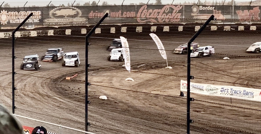
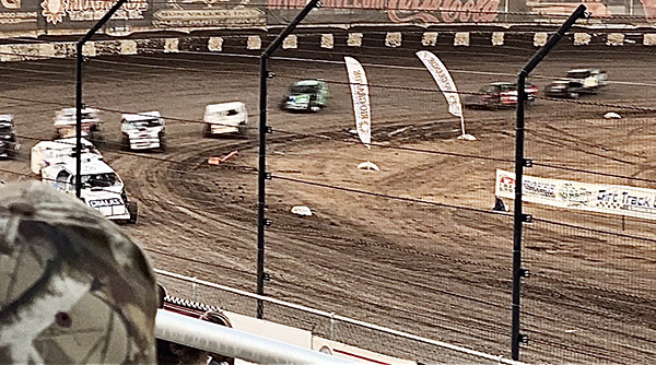
Vado Speedway is a fairly new track about 15 miles south of Las Cruces, New Mexico. You can see it from Interstate 10. The track looks small but they claim it’s 3/8th of a mile. Maybe the outside is 3/8 mile. It’s a dirt track, like God intended us to race on, and the corners are banked. The straights are short but the track is wide enough to allow plenty of passing. There are two lines at Vado: the high line and the low line. Both have their advantages but late in the evening the low line became very bumpy at the apex of the corner. Cars were bouncing up on two wheels in the rough. Most of the fast guys stayed up high where it was smooth, only dropping down to block a rival. As the evening wore on cars started to use the outside wall as a contact point like a slot car dragging the rails.

Stock car racing has changed a lot since the seemingly unlimited supply of Chevelles dried up. The night we went all the classes looked like Super Modified. There were no stock bodied cars. The lowest class cars are beat up sheet metal concoctions that look like something a child of three would draw when asked to draw a car. They resemble station wagons with large panels of metal aft to act as air dams. Think of the last outlaw sprint car race you went to with those giant billboard wings on top. It’s the same idea. The front wheels ran exposed on some of the cars. I don’t remember what they were named but in my day this class would be called the Sportsman class except for the homemade bodies.

The next step up from the flapping, crashing station wagon class was more station wagons. For all I could tell it was the same class, maybe “A” to the previous “B.” This class would have been called Late Models when I was going to stock car races back in the days when the planet Mars could still support life. These cars looked like the ratty-class cars but were built much better. The sheet metal was straighter and it didn’t flap around or fall off. The paint jobs and lettering were nicer and they crashed less. Besides being uglier than old style stock cars the Late Models’ engines sounded crisper and revved faster than the other, looser station wagons.

The top-tier division, known to me as Super Modifieds, were really nice cars. You could tell the owners had a ton of money in them, probably as much or more than a NASCAR stock car. They were fast and didn’t crash very often. The Super Modified cars didn’t look like station wagons but they still had acres of sheet metal on the side to assist with corners. All the wheels were covered by bodywork. NASCAR driver Kyle Larson was racing in the Super Modifieds with a Hendricks car and he did fairly well. He got a Main Event second place finish against drivers that spend their entire career in this specialized form of competition.

The racing was very close and heats were frequent. All the classes had several heat races to determine which cars made the main event and the grids were well populated. Driver/teams from Kansas, Wyoming, Illinois, California and other states attended. The stands were another story. When CT bought our tickets she was told they were sold out of general admission so she bought reserved seats. After everyone was seated the grandstands looked about 60% full. Maybe the cold, night air kept spectators away.

When the racing was over the announcers thanked the track owner for keeping stock car racing alive. Whenever you hear that sort of talk it’s not a good sign. South-Central New Mexico used to have a stock car track in Tularosa, another a few miles away near Alamogordo, one on Highway 9 west of Sunland Park near the border with Mexico, and I think Deming might still have a track and maybe El Paso.

Stock car tracks used to be everywhere. Where I grew up there was a track in Medly and one just across the Miami River in Hialeah. Those tracks are gone now. I wonder if dirt oval tracks are disappearing all over America. I believe part of the reason for grass roots oval racing’s decline is that none of the cars racing are related in any way to the cars found in the parking lot. That is if you can find a car in the parking lot.   Today everyone drives bloated SUVs or pickup trucks.

Then there’s the high bar of entry into the sport.  Even those ratty station wagons require a lot of work to build. Maybe the demise of cheap, rear-wheel drive sedans is part of the problem. The class structure never adapted to new realities in the marketplace. Look how NASCAR’s rigid rules have created a situation where you can buy a box stock Dodge, Chevy or Ford off the showroom floor with more horsepower than a NASCAR contender. I know the old time stock cars shared few common parts with the cars they resembled but at least they resembled them and had engines you could check off on the dealer’s option page.

Finally, the “Car of Tomorrow” eliminated the last tentacles connecting the cars on the track and the car you drove to the track. Now all the bodywork is the same and only paint creates the illusion of several brands. The situation is probably not as bad as I’m making it sound. I’ve gotten grumpy as I got old. I liked it when stock car racing was the most exciting thing happening on a Saturday night.

I’ll be back to Vado Park Speedway. Later in the year they are hosting USRA Modifieds, which look a lot like old style stock cars. Then there are the winged and un-winged Sprint cars along with Super Trucks. We all need to do our part to keep this uniquely American form of racing alive. Hopefully a new generation will get interested in stock cars and start racing cheap, two liter, front-wheel drive sedans around those well groomed dirt ovals. I know a couple unused tracks nearb.  Just add drivers.


Never miss an ExNotes blog:

ExhaustNotes Travel:  The Bisti Badlands Of New Mexico

By Joe Gresh

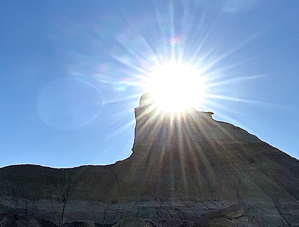
In the northwest quadrant of New Mexico there’s a lonely, two lane highway numbered 371 that runs north from the small town of Thoreau on Interstate 40 to Farmington. About 30 miles south of Farmington, on the east side of Highway 371 is a place called the Bisti Badlands in the De-Na-Zin Wilderness. The Badlands are where you can find the ever-patient hoo-doo’s standing watch over mankind as we scurry around like red ants on our disturbed mound. Not ageless, the rock formations and strangely eroded pedestals found in the Bisti slowly change over time. Unless a stone topples to the ground you might spend a lifetime observing and never notice the backs of the old ones ceding to gravity’s incessant pull.

CT and I left Farmington around 9:00 a.m. and drove to the Bisti where we met Gilbert, who works as a guide for Navajo Tours USA, a Native American company that operates in Chaco Canyon and Shiprock as well as the Bisti Badlands. These guys are good and it’s not just me.  National Geographic thinks so too.


Help us keep publishing:  Please click on the popup ads!

Gilbert is Navajo and has like 16 different jobs, guiding tourists through the Bisti being one of them. Along with Gilbert, me, and CT was Sasha. Sasha spoke with a heavy accent; she sounded like she was from an eastern European country or maybe Texas. Her husband and young son dropped her off at the Bisti parking area and as soon as they were satisfied we weren’t ax murderers they fled the scene. Sasha said they were tired of hiking around New Mexico and were going back to Farmington to rest.

Bisti Badlands is one of those places that doesn’t look like much from the parking area. There was only a sun-faded, Bisti Badlands map under scratched Plexiglas in an information kiosk to identify that we had arrived at the correct spot. The map looked as old and bleak as the landscape it described. I looked across a wide, shallow expanse of hard packed, barren dirt and wondered where the heck we were going to hike. I mean, there’s nothing out there.   Do we just walk out into the center of the desolate valley? Gilbert laid out a northeasterly route that would hit some of the high points of the Badlands. We opened a red pipe gate, stepped high over a large diameter cross bar between the gateposts, and started hiking.

Gilbert and Sasha were way younger and fitter. At first they appeared to have an ambling pace yet I would have to break into a canter every few hundred yards to catch up with them. I tried matching Gilbert’s stride one for one but he still pulled steadily away. I decided he was using some secret Navajo walking method taught only to tribe members. Sasha I figured to be a hiking ringer, one of those chicks that walks 75 miles before breakfast and drinks raw egg smoothies.

After a couple miles of hiking we started to get into an area that resembled the promotional materials for the Bisti Badlands. Large stones sat atop thin spires of Tuff, relatively soft volcanic ash and debris that had solidified. But Tuff isn’t all that solid hence the ground underneath the stones eroded before the harder top rock. We walked past huge piles of what appeared to be broken terra cotta clay. Gilbert explained that the section we were in has a low-grade coal seam running just beneath the surface. In the shallow valley by the parking lot you could see the darker stripe of coal. When the coal catches fire it bakes the clay above changing its color to red. This joint is one big, open-air kiln.

At the Bisti Pyramid Gilbert stopped for a rest. CT and I sat down on a stone. Gilbert lulled us into a stupor with his gentle voice telling tales of the Badlands. Sasha ran around the crazy rocks snapping photos. She reminded me of a Jack Russell Terrier. Too soon we were on our way again.

Our surroundings became more surreal, like we were walking through a Salvador Dali painting. I realized that I had no idea where we were and was so turned around I couldn’t tell which way was back. Gilbert pulled us in for another rest break and told Sasha we were going to stay here until she got back and to not wander out of sight. Sasha went climbing around with her giant Canon DSLR getting shots of rocks from every conceivable angle. Sasha oozed vigor and health. I started to wish I had gone back to town with her husband and son. They were probably drinking in a smoky bar somewhere.

Gilbert told us stories about getting lost in the Badlands at night. I was thinking about the cold, clear New Mexico night and looked around.  The only wood to burn was petrified. I sure didn’t want to start that coal seam on fire and end up like those baked clay fragments. Gilbert pointed me to a cell phone tower off in the distance. See that? he said. That tower is on Highway 371. If you get lost head for the tower; at night it has a flashing light on top.

We went further into the rough terrain; the flat lands were far behind. Stone shapes became more dramatic and impossible. We were in the Bisti Badlands proper and no mistaking it.

My feet were killing me. I asked Gilbert how much further before we start heading back to the cars. He said that we are almost at the turn around point. It had been ten miles at least, maybe more.

In the afternoon we started to head back. We were kind of quiet, just stumbling along in a near-death state of mind. I judged our distance traveled to be 25 miles. At last the parking area came into view. We were still 30 miles away but at least I could see our car and the restrooms.

At a turn in the path approximately 40 miles from the car parking area Gilbert said that Sasha wanted to explore the southern parts of the Bisti Badlands. We said to go on without us and that we would be fine as we could see the cars only 50 miles away. Gilbert said he would walk back to the cars with us to make sure and Sasha would wait for him to return where they could continue exploring the Bisti area. We made it on sore feet but we made it to the car. Gilbert showed us again on the map the route we had taken. I asked him how far we had traveled all total. Gilbert said 5 1/2 miles. And that’s how it is in the Bisti Badlands. Distances can be deceiving. If you are in the Bisti area look up Navajo Tours. You’ll have a fun hike and won’t get lost and die like the dumb tourist you are. I recommend them highly but don’t try to keep pace with Sasha.


Never miss an ExNotes blog:

A Sneak Preview…

Wowee, do we ever have some good stuff coming up right here on the ExNotes blog.  Guns, motorcycles, adventure touring in Transylvania, and the results of a content safari through Arizona all the way to Albuquerque.  Here’s an inkling of just a few of the topics coming your way.

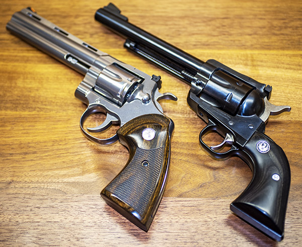
What’s the real difference between a $1500 Colt Python and a $650 Ruger Blackhawk?   Watch for our side-by-side, target-by-target comparo.  It’s coming up.

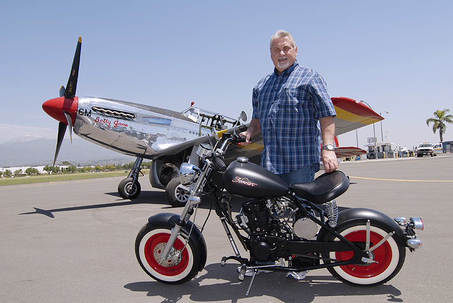
Into resurrections?   Hey, how about CSC’s replica of the original Mustang motorcycle!  You read our recent story about the Al Simmons Mustang motorcycle collection and the origins of the Mustang.   CSC’s Steve Seidner went a step further, and we’ll tell you all about it.

Ever have your well dry?  I mean literally, not figuratively.   Uncle Joe Gresh has, and he’ll tell you all about it.  Gresh is a guy who makes MacGuyver look like an amateur.   You’ll love this story.

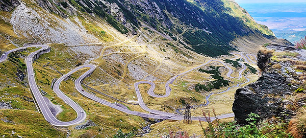
We’re going to bring in a new writer or two (or maybe more).  We have a blog loaded and ready to publish from good buddy Airborne Mike on a motorcycle ride through (get this!) Transylvania!  I kid you not.  Transylvania and the Transfagarasan Highway!

On that topic of new writers…Joe Gresh will tell you all about what you need to do to be considered for the ExNotes editorial staff.  Watch for a blog on this topic in the near future.

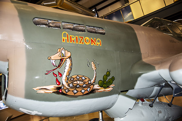
The Pima Air Museum in Tucson is another treasure.  Wow, that was a fun visit.  There’s so much there we couldn’t take it all in during a single visit, and it’s a place that screams for more than a single blog.  I need to return.  The photo ops were incredible.

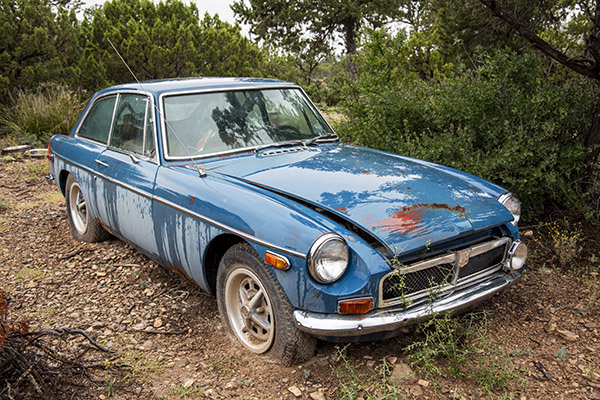
More good Joe Gresh stuff straight from Tinfiny Ranch, including the Gresh moto stable and the world famous Gresh project bank.  Motorcycles, the MGB-GT, and more!

How about the Franklin Automobile Museum in Tucson, Arizona?  Never heard of it?  We hadn’t, either, but (trust me on this) it’s Tucson’s best kept secret!

White Sands Missile Range?  Yep, that, too.  Everything from a Nazi V-2 to current US weaponry, and we’ll have the story right here.

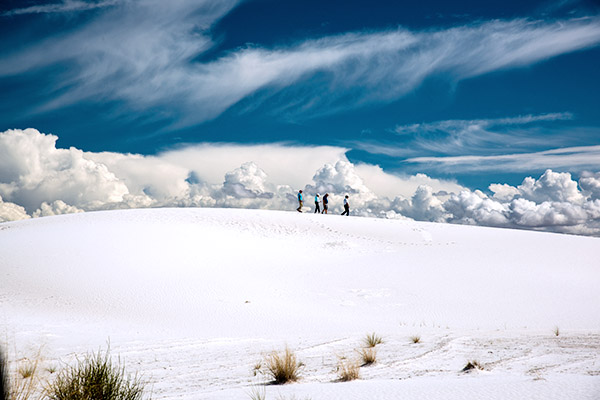
How about White Sands National Park?   Think Sahara Desert, and you’ll have a good idea about what these rolling snow white gypsum hills look like.  It was awesome!

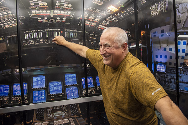
The New Mexico Museum of Space History, with a guided tour by none other than Joe Gresh?  That was a really fun visit with lots of cool exhibits.  It’s coming your way.

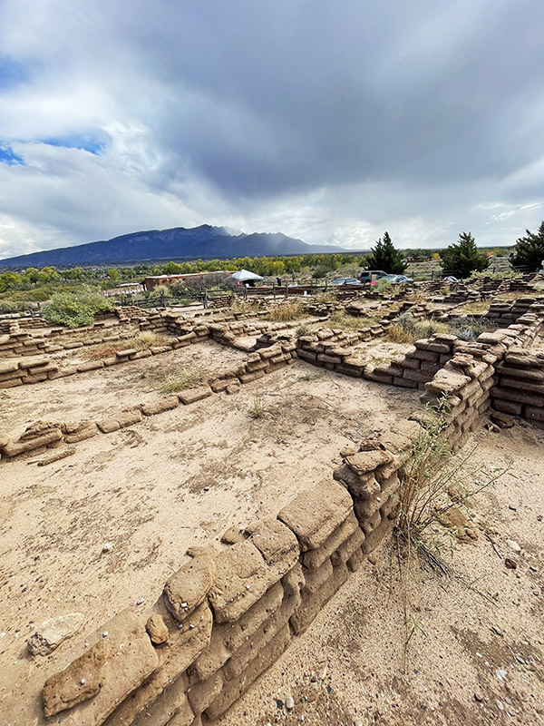
How about sacred Native American ruins in New Mexico?  We saw several and they were impressive, including the Kuaua Native American site along the Rio Grande River.

Albuquerque is quite a town, and Old Town Albuquerque is quite the place.  We had a lot of fun wandering around and taking photos.  It’s in the mix for a future blog.

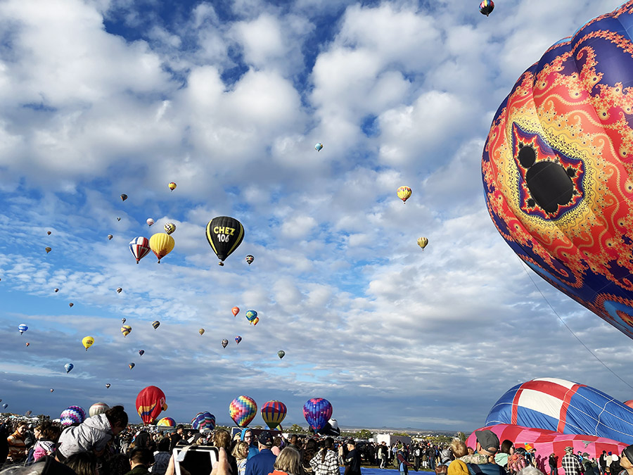
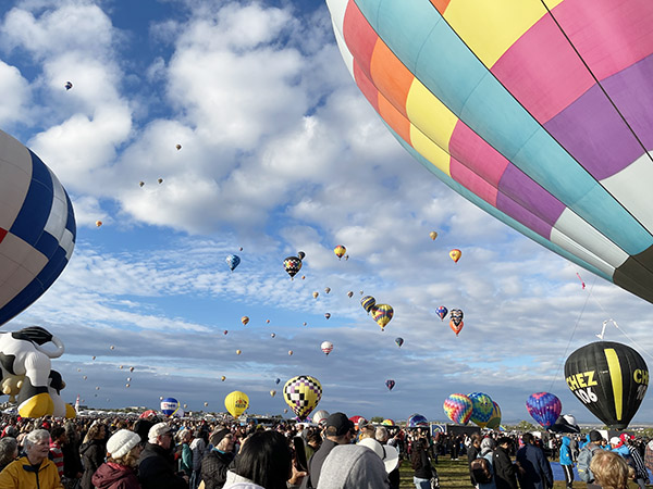
And the Albuquerque 50th Anniversary Balloon Fiesta…wow, was that ever spectacular.  The excitement and wonder of that event is one of the most impressive things I’ve ever experienced.

Stay tuned, folks.   It’s quite an adventure, and it’s onging!


Click on those popup ads…we get paid everytime you do!


Never miss an ExNotes blog:

Rain Delay

There are three paved routes across the Sacramento Mountains in southern New Mexico. To the north, highway 380 crosses from Hondo all the way to the small town of San Antonio on the Rio Grande River. Thirty miles south is the central road, Highway 70, running from Roswell to Tularosa. Highway 70 is 4-lane all the way and is the main east/west route over the mountains. Another thirty miles further south is Highway 82. Highway 82 twists and turns its way from oil rich Artesia to Cloudcroft at 9000-feet elevation and then runs downhill to the valley floor at Alamogordo. There is another route, unpaved, called 506. Yet another thirty miles south from 82, Route 506 takes you from Queen in the east to the border patrol checkpoint on Highway 54. Not really a highway, 506 is a fairly good dirt road but in the wet it can be tough going. 506 is the lowest-elevation passage as it crosses the southern tailings of the Sacramento Mountains, which flatten out towards El Paso, Texas.

I’m telling you this geographical information because of the tacos. I took the RD350 on a lunch run with the Carrizozo Mud Chuckers the other day. We did a great circle route that brought us to a taco stand in Ruidoso, on Highway 70. This particular taco place was one I had not been to yet.  It was rundown-looking and at first I thought it was closed. The front had an enclosed porch area that had 2X6 beams roofed with plywood. One end of the porch was open. The ceiling was low and I could touch the 2X6 beams if I jumped a little. Inside this patio were three wooden picnic tables thickly coated with a gummy white paint.

Dozens of coats of paint left the texture sort of soft, like skin, but more like dried skin. If you stood up fast enough you could just catch the fading impression of denim on the bench seat. To the far right was an entry door. Through this glass entry door I could see an indoor dining room with six, orange, Formica-topped booths but the door to this room was locked.

“Can I help you?” a small plexiglass window swung out into the patio. Inside was the one guy running the taco place. It was my turn to buy so Mike ordered nachos with cheese and a Mexican Coke in the tall, glass bottle except they were out of nacho cheese. I ordered a Pepsi and 3 beef tacos with rice and refried beans but had to order the items individually since there was no meal option. Eddie ordered a single tamale with rice and beans and a Sprite. The order was scribbled on one of those light green paper pads with a piece of carbon paper between the pages for a copy. Our taco man tallied up our stuff in his head and it came to 31 dollars, which shocked me a little. I gave the window guy 2 dollars as a tip. The guy in the window said, “Let me have your name, I’ll call you when it’s ready.”

It’s monsoon season in New Mexico and dark clouds were encircling the taco place. Any direction you looked had rain curtains slanting across the sky. I heard my name called, no mean feat with the thunder, and picked up the order. Eddie carried the drinks. My food came in a styrofoam, 3-compartment box. The main, triangle-shaped compartment held three disintegrating tacos. In the little square area to the upper left was a spoonful of rice, in the right compartment was a squirt of liquefied, refried beans. My tacos fell apart on contact. Mike’s nachos were like tiny burned triangles of cardboard. The nacho cheese would have really helped those chips more than I can say. Mike looked at the chips and said, “I’m not really hungry.” and he shoved the festive, red tub of ashes over to Eddie and me.

The guy in the window leaned out and asked us how the food was. I gave him a thumbs up hand signal. I don’t know why I did that. I guess I should have complained. I figured why spoil the taco guy’s day. If he hasn’t learned how to cook by now he never will make better food and telling him how truly awful the stuff was would change nothing on the ground. We finished up and decided we better make a run for home before it started raining on the taco place. I didn’t like our odds staying under that roof.

By sheer luck I had a rain jacket in the Yamaha’s tank bag. Eddie had a t-shirt and Mike had a semi-water-resistant jacket. To understand how unprepared we were you have to understand the optimism all motorcycle rides start with. We split up, Mike and Eddie turned north towards Highway 380 and I headed directly west on Highway 70. Within a mile it was pouring rain.

Great, horizontal bolts of lightning lit up the dark grey skies. The Yamaha ploughed through deep pools of water hydroplaning slightly and I dropped my speed to allow more time for water to squeeze out from under the tires. At 7600 feet elevation my wet jeans were starting to get cold. The raindrops were huge and felt like pea gravel hitting my hands.

Water trickled in from my ungloved wrists and pooled in the rain jacket elbows. My boots began to fill with water. Past the fire station, Highway 70 begins its descent into Tularosa. Each mile downward raised the air temperature a fraction of a degree. I entered the Mescalero Indian Reservation. Weather-wise, it was still raining but the skies were looking lighter further ahead and I was no longer shivering in my wet clothes.

Both lanes of traffic on Highway 70 came to a stand still. I could see flashing blue police lights reflecting off the wet pavement. It was still raining pretty hard and on a motorcycle you don’t want to be stuck in a line of stopped traffic. The head of the stoppage wasn’t far away so I lane-split between parked cars and the smell of brake linings until I found a gap in front of a late-model, white Chevy pickup. I turned right into the gap at walking speed. The truck driver got on his horn for 10 or 15 seconds to scold me. Here I was, soaking wet, trying to get off the road, while he was sitting snug and dry in his $70,000 pickup. Yet he begrudged me because I got 35 feet ahead of him. What kind of perpetually-miserable person does that? How much better would things need to be for him before he let go of the anger?

I parked the Yamaha at a cut that led up to a wide parking area. Water ran through an earthen ditch, pooled for a moment, and then crossed an asphalt swale before dropping off a tiny waterfall where the undermined asphalt had broken away in chunks, like calving icebergs. There was a guy standing in the rain smoking a cigarette, I asked him if there was an accident. “No, a mud slide has blocked the road.” He said. “The cops say it will be about 30 minutes before the road is cleared.” The man finished his cigarette and flicked it into the ditch where the current swept it down to the pool. The butt eddied several times then floated over the asphalt swale, plunging down the falls and drifted with the current until it was out of sight. The man walked back to his car and got inside out of the rain.

My boots were full of water and my feet needed to dry out a bit so I pulled off each boot and then poured out as much water as I could. Standing barefooted I rung out my socks, then pulled each sock back on followed by the side-specific boot that corresponded with the foot I was working on. Should I turn around and climb 9000 feet to Cloudcroft and home? It would take about an hour of cold, wet, riding. The rain clouds looked heavier in the direction of Cloudcroft and there is no guarantee that route won’t have a mudslide. The rain picked up strength and the blue skies ahead were closing in.

I could go north to Highway 380 and home but that’s back into the main part of the storm and two more hours of cold feet.  I‘m nearly home, maybe 40 miles to go. Another cop pulled up and spoke to the one blocking the highway. The first cop started his SUV Ford. It looked like we were getting ready to go. I started the Yamaha; it’s a cold-blooded engine and cools off fast when not running. Steam rose up from the warming engine, fogging my face shield. I could hear cars starting in the line of stopped traffic. The first cop drove down Highway 70 towards the mudslide and the second cop took up his position blocking the highway. And then he shut off his car. I let the Yamaha run a few more minutes then turned it off. A big cab-over box truck turned around and drove away in the opposite direction followed by a new Jeep Wrangler pickup truck. Then some more cars gave up and headed back. I walked over to the new cop and asked him what was happening. “They had the road cleared but another mudslide came across and buried the road.” Across the highway a yellow Case backhoe drove down the wrong side of the road.

“Any idea how much longer?” The new cop said maybe 30 minutes. Things were getting complicated and my calculations began to factor in the road not opening for quite a while. Going over Cloudcroft at night in the rain would not be fun so if this thing went really long I planned on going north to 380 to go south back home, a distance of 110 miles or so. If we could just get a mile or two down the highway I could get on reservation roads and work my way around the stoppage. The rain fell steadily and in my wet clothes I was starting to get a bit chilled so I took a walk to get my blood circulating.

The longer I waited the more I had invested in Highway 70 home. If I had made a decisive move back when we were first stopped I could have been home by now. I was well over an hour stopped and the blue sky ahead was gone, replace by dark clouds. I guess I could go back to Ruidoso and get a motel room for the night. I could dry out my clothes and try again in the morning. Another cop pulled up and spoke to the second cop who looked over to me and said “We’re getting ready to go.”  I ran back to the Yamaha and started the engine.

The police cars formed a rolling blockade and the miles long line of traffic followed behind slowly. The mudslide section was still pretty slippery and there were small branches and stones to dodge. Further on we came to another mudslide area but kept driving through the inch-deep goo. A few miles outside of the Indian reservation the road was just wet and the cop cars pulled off the highway. I was at the head of the line, or P1, and no way was I going to let all those cars pass me and kick up a wet fog of water. I spun the Yamaha up to 7000 RPM and the run into Tularosa was fast and violent but I got there first.

It was warm and dry in Tularosa. I backed off the throttle and puttered along at the speed limit. The honking guy in the white truck passed me and then got in front of me. He just had to, you know? I made it home several hours after the Carrizozo Mud Chuckers. They got hammered by the rain also but didn’t have to stop for blocked highways. In retrospect, if I had taken their route I would have been home much earlier but then if I did that I wouldn’t have had anything to write about.


Click on those popup ads!

The 2021 Rubber Chicken Ride

If you had asked me a week ago what the Rubber Chicken Ride is about I would have replied, “I have no clue, Bubba.” Held annually in Truth or Consequences, New Mexico the 2021 Rubber Chicken Ride resisted any defining characteristics and after three days participating I still have no clue what it was about.

There’s an entry fee, $50, that goes to the New Mexico Off Highway Vehicle Association, (NMOHVA). I guess it’s a like a fundraiser except a motorcycle ride breaks out while passing the collection plate.

I met up with the near legendary dirt-riding group, The Carrizozo Mud Chuckers at the Truth or Consequences Travel Lodge motel. The Travel Lodge is one of the few remaining old school types where the room doors open out directly onto the parking lot. I like this layout as you can hang out as a group tinkering with the bikes. It fosters community spirit and you can lock your bike to the uprights supporting the overhang. At the motel we met six other Rubber Chicken Riders none of who had any idea what was going on and all pushing 70 years old. That’s like 3 years older than the Chuckers.

This year’s Chicken was stripped to the bare bones due to Covid. No group dinners, no Show Us Your Scars competition, no organizing at all: just show up and ride. Part of the confusion was due to my not bothering to download the GPX files from the Rubber Chicken thread on ADVrider, which I knew nothing about until I was at the event. I probably couldn’t have figured out how to migrate the files to my GPS anyway. It annoys me that those old codgers can download files into their displays and I’m still using paper maps. I think of my GPS is kind of a last resort deal; I use it when I’m not sure how to get home.

That first day we tried to find the Rubber Chicken sign up area at Healing Waters Plaza, a place no one in Truth or Consequences seems to have heard of. Everyone we asked sent us to a different Healing Waters but they were hot springs, not the sign up staging area. The town was named Hot Springs in the past and has quite a few still around. Luckily, my Garmin knew about the palm-lined plaza and after riding past it several times we were able to find the pocket park along with a couple other Rubber Chicken Riders. Oddly, there was no water in sight.

The other riders we met at Healing Waters were as clueless as we were so we sat around and talked bikes for a while then the Chuckers and I decided to ride out to nearby Elephant Butte Dam to check out the scenery. After the dam tour we hit up the local Denny’s. You know how they say landing and take off are the most dangerous parts of flying, that’s how it is for me getting on or off the tall Husky 510. The Husky’s kickstand is so designed that once you’re on the bike you can’t tip it over far enough to retract the stand. This means I have to get on or off the bike with the kickstand up. Not a problem on a normal motorcycle, with the Husky it takes Baryshnikov-level flexibility to toss a leg over the high seat and rear luggage stores. I’m no Baryshnikov.

I got half way off the bike but my boot hung for a life-altering moment, still on one leg the bike started to topple over the far side. I pulled the bike back towards me but pulled a little too much. With my stubby, grounded-leg near the centerline of the wheel track the bike toppled over onto the near side taking me out in the process. In the Denny’s parking lot. In front of everyone.

Back at the Travel Lodge we grilled the other riders.  They resisted at first but stopped struggling as soon as they were evenly browned on both sides. The way it was supposed to work is you download route files and load them in your GPS before arriving, then at the plaza meet up with like-minded riders and off you go, a merry band of riders. It’s a great way to meet new riding buddies. There’s no NMOHVA sanctioned rides. This is the loosest possible group ride you can imagine. One of the riders had an old, Rubber Chicken event T-shirt. In a testimony to how damaged things have become since Covid all we got this year was a tiny NMOHVA sticker with a rubber chicken on it.

The second day there was a sign up table at the Healing Waters Plaza. Maybe 15 riders had gathered and we had a good gabfest with the boys and one girl. By now we pretty much had the event figured out so the Chuckers and I headed out to Chloride, an occupied-ghost town for one of the routes: the Chloride canyon loop. We didn’t have GPX files but the Chuckers had paper maps.

At the end of the road in Chloride the road turns hard left and becomes unpaved. It’s sort of rough and rocky being a dry streambed at the bottom of a steep canyon. After about a mile of this abuse we stopped to reassess our riding skills and time left in the day. For a route that 6 guys on dirt bikes had done just a day before there were no tire tracks except the ones we were making. I dreaded turning on the Garmin because I’ve never read the owner’s manual, it always leads to a bunch of button pushing and frustration instead of riding. The Garmin said the road went for 5.6 more miles then dead-ended.

We started doubting our direction. Maybe we are on the wrong route, those 70 year-old guys couldn’t have gone this way. None of us liked the idea of riding this rocky trail 5 miles and then turning around and riding it back. We chose an alternate route. Seeing as there were no official routes anyway we felt we could take liberties with the Rubber Chicken.

Our alternate route was a long, 60-mile stretch of fairly easy dirt bookended between 80 miles of pavement on either side. The route seemed to go on forever. We went over the continental divide twice, once on paved Highway 59, once on Dirt Road 150. The later it got the faster we went. Highway 152 was a marvelous twisty road that we could use as much of the side-tread of our knobbies as we dared. We arrived back at the Travel Lodge at 7 pm; 9 hours of riding over widely varying terrain made for excellent sleeping.

On the third day of the Rubber Chicken Ride, a Sunday, the other riders at the Travel Lodge had loaded up their bikes and gone home. The Mud Chuckers and I decided to leave the Rio Grande Valley and work our way one valley east to Tularosa Valley, our home turf. In retrospect, we didn’t get much for our $50 but it got us away from our usual dirt-riding spots and it supported the NMOHVA so it was money well spent. While I was telling this story to my wife, CT, it must have sounded like I was complaining. Maybe I did bitch a little. She said that volunteer organizations always need help and that maybe next year we should print a few maps, plan a Rubber Chicken route and set up a ride instead of waiting for others to do the hard work for us. That sounded an awful lot like a gauntlet being thrown down to me.


Subscribe to ExNotes!
Riding With The Carrizozo Mud Chuckers

Sixty-one miles north of my place in La Luz, New Mexico lies the town of Carrizozo. The seat of Lincoln County, Carrizozo’s streets are laid out at an angle to the intersection of Carrizozo’s two main highways, 380 and 54. There are colorful donkey statues stationed around, a junkyard church on the outskirts of town and the Carrizozo Mud Chuckers motorcycle club.

The Mud Chuckers MC, founded by my riding buddy, Mike, is primarily a dirt-based riding club. The area around Carrizozo has hundreds of graded farm roads and tight mountain trails. It’s an ideal spot for racking up miles on the dirt. I recently joined them on one of their frequent moto-camping rides. The Chuckers shun traditional campgrounds preferring instead to camp anywhere they can find a spot with no people around.

Like all the ‘Chuckers rides I’ve been on the pace was downright leisurely with frequent stops to look at old mine sites, hunt for geodes, gold deposits and old metal objects or just sit in the shade to discuss unimportant things. The ‘Chuckers are in no hurry to get anywhere and that suits me just fine.

On this day we rode west to Socorro, NM and took the Escondida Lake exit to the Back Country Byway. The Byway meanders generally east-west then south with the terrain ranging from desert scrub to medium-high trees. At the speed we operate it’s best to look for a campsite early because ‘Chuckers don’t like stress. We checked out several places but nothing looked appealing. There was either no shade or no firewood or a stinky dead cow rotting nearby so we pushed on.

Eddie dropped his KLR 650 in a sand wash and bent his clutch hand so that it didn’t want to work right. He was doing 45mph so the impact, while soft, still hurt. The ‘Chuckers are not spring chickens. In perfect tune we can hardly swing a leg over the motorcycle. Eddie called it a day. Since we never leave a man behind we short cut the Byway and followed him back to his house in Carrizozo where we had begun this adventure.

With Eddie’s DNF, that left me, Dan and Mike still on the lead lap. By now it was getting late so we abandoned our plan to camp on the Back Country Byway and decided the higher mountains behind White Oaks would be the best option. It was late and we still had a 30-mile ride to the forest.

We found a spot with plenty of firewood and soft ground. We managed to get camp set up just before dark, which is always a good idea. Once they find a place to roost the Carrizozo Mud Chuckers really come on the pipe. The fire was roaring, Mike brought along pork chops and a metal grill to cook with. I don’t know where he stores all that junk on his 390 KTM. Sizzling pork chops, boiling coffee, cookies, beef jerky, Wheat Thins: man, things were hopping at camp this evening. The altitude we were camping was around 7000 feet, it got pretty cold, probably in the 30’s but around the fire it was 75 degrees.

Campfire nights last longer than regular ones and I turned in at midnight. Mike and Dan sat up longer. Flickering lights and murmured shadow conversation played across the inside of my tent. I felt safe knowing the bear would go after them before me. The next morning The Mud Chucker’s were in no hurry to leave. We restarted the fire and had coffee with whatever scraps of food we had left over from last night’s feast. The Mud Chuckers always leave their campsites cleaner than they found them and the way they put out a campfire borders on obsessive.

When I got back home it felt like I had been away a month instead of only two days. Camping on a motorcycle seems to distort time and distance. Changing your observation point really does have a profound effect.

Mike and Eddie want to start a motorcycle tour business. Their plan is to buy a few TW200 Yamahas and run all inclusive, guided camping tours around New Mexico. It sounds like a pain in the butt to me. Why ruin a nice motorcycle ride with business?

I’ll let you know if the tour company idea works out. Maybe a full ExhaustNotes.us tour review or something. Get the ‘Chuckers to kick in a free tour as an ExhaustNotes subscriber gimmick?


Like what you read?  Sign up for a free subscription, leave a comment, and share the hell out of this blog!
Resurrections: 1974 MGB-GT Part 1

Here at Exhaustnotes.us resurrection projects are leaps of faith. They feel good and inevitable, and promising. You know instinctively it’s the right thing to do and that everything will work out ok in the end. The Kawasaki Z1 was like that. I had no doubt that motorcycle would once again tear great, jagged, 8000 RPM holes through the atmosphere. It just had to, you know?

This 1974 MBG-GT is not that kind of resurrection. Nothing about this car feels inevitable, least of all my ambition to see it through to the end. I’m going into this project fully expecting to fail. “Life’s too short,” my buddy Burns said. “Make a hot tub or a planter out of the thing.” That’s sound advice spoken from the heart. The man is trying to save me from myself.

Anyone in the saving-souls business knows that people tend to bushwhack their own meandering path towards destruction. There’s not a lot well meaning friends can do to stop your sanity from hiking off into the woods. It’s a negative human trait offset by our ability to make music and microwave corndogs. And I still don’t know how to play the guitar.

Here’s the thing: I never wanted an easy life. My dreams are not of leisure. I don’t seek comfort. Fun is no fun to me. Put me on a beach towel in Tahiti and I’ll go stark raving mad. Instead, I choose to make a mess of things. I don’t want to hear the MGB-GT run. I have to hear it run. It’s laid fallow for 5 years that I know of and probably 10 more besides. The little British car parked next to the needle bush has mocked me long enough. I’ll have my revenge.

If you’re expecting a short series on the MGB-GT stop reading now. The car has serious rat infestation issues. Most of the interior is chewed up. There must be 50 pounds of rat guano inside the cabin and engine room. I’m going to take this slowly and spend the absolute minimum amount of cash at each stage.

There will be no grinders shooting sparks, no photogenic noir-arc welding and no artificial deadlines to create artificial tension in the story. This job will be stress free and I reserve the right to walk away any time I choose. The MGB will always take a back seat (get it?) to other projects.

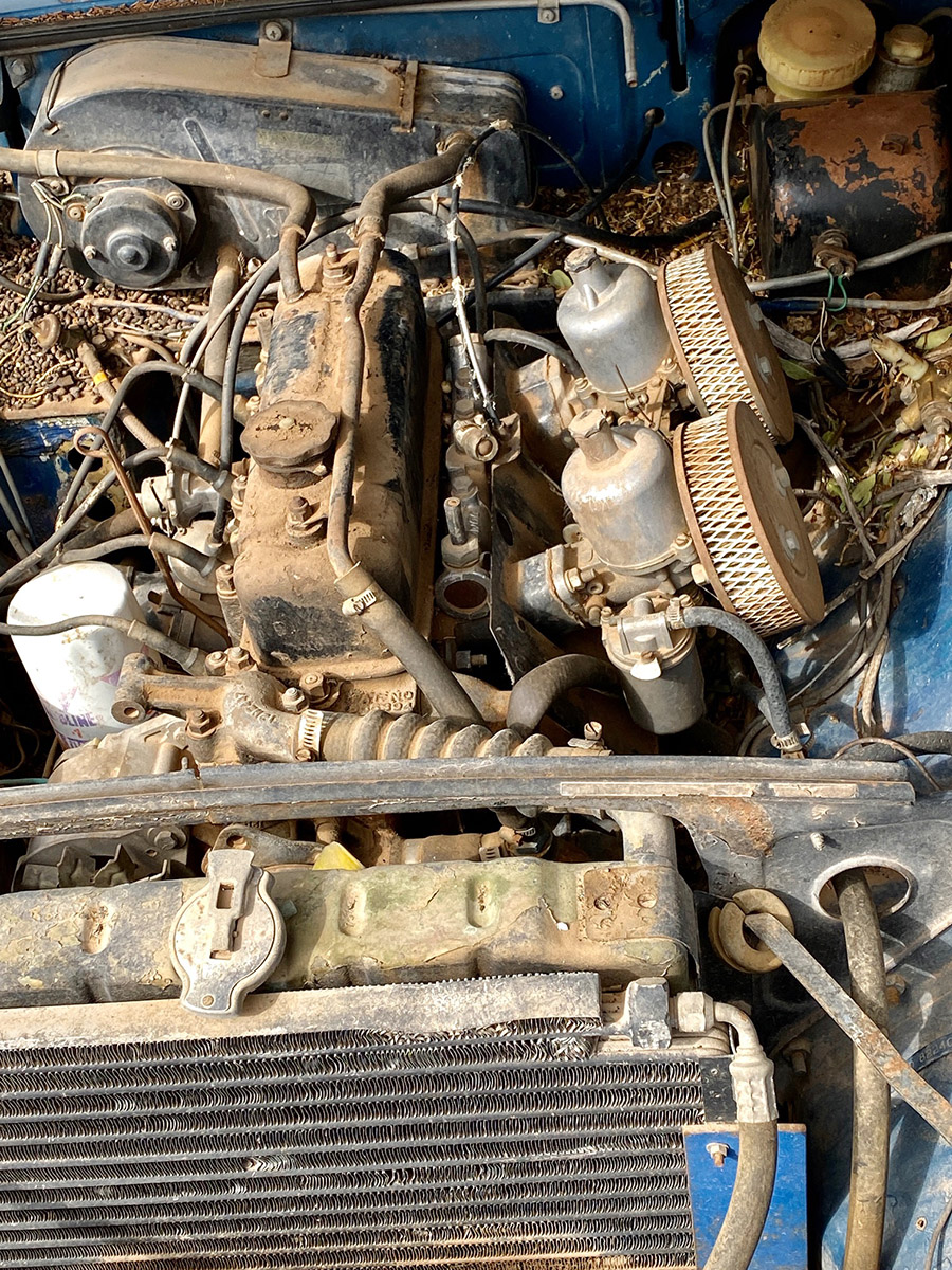
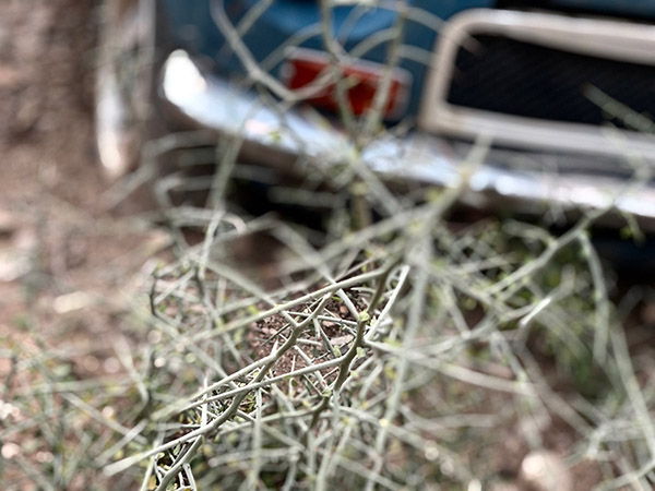
The first thing I plan to do is to get rid of this spiny plant. The thing has incredibly sharp 2-inch long needles that will flatten a tire or stick into your leg bone. After that cleaning out the rat-poo engine room so that I can see what I’m up against. Cleaning rat poo in New Mexico is not as simple as hooking up a shop vac and sucking up the stuff.

Here in New Mexico we get several cases of Hantavirus every year. The virus can lay dormant in rat droppings and infect people when disturbed, so no vacuuming. Instead you spray the mounds of poo with a strong solution of bleach to kill the virus (if it can be considered alive). Next you don gloves and an N-100 mask and shovel the wet bleach-glop into a suitable container.

This part of resurrection is no walk in the park. If you manage to stay alive through this step another shot of bleach on the remaining rat droppings should make it fairly safe to use the shop vac. Follow up the final vacuuming with a pressure washer and engine cleaner. And then you can begin. I’ll start by disconnecting all the chewed electrical circuits and…and…well, you’ll see in the next installment of Resurrections: MGB-GT Part 2.


Gresh’s resurrections reside here!

Aztec Ruins, New Mexico and Motorcycle Classics magazine

This was exciting…Susie and I were tooling through New Mexico on  our way to Mesa Verde in Colorado when we spotted a sign for Aztec Ruins National Monument.   We’d never been there.  In fact, we had never even heard of the place.  But it’s there, it’s real, and it’s a grand destination.  The result?   Well, hey, check this out!