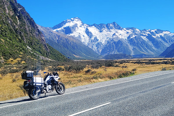
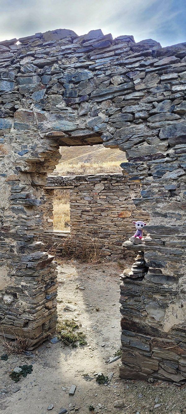
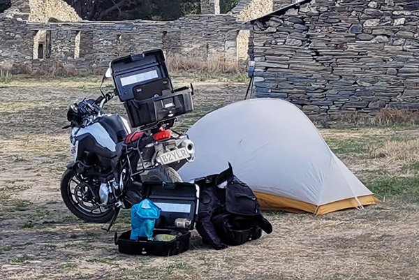
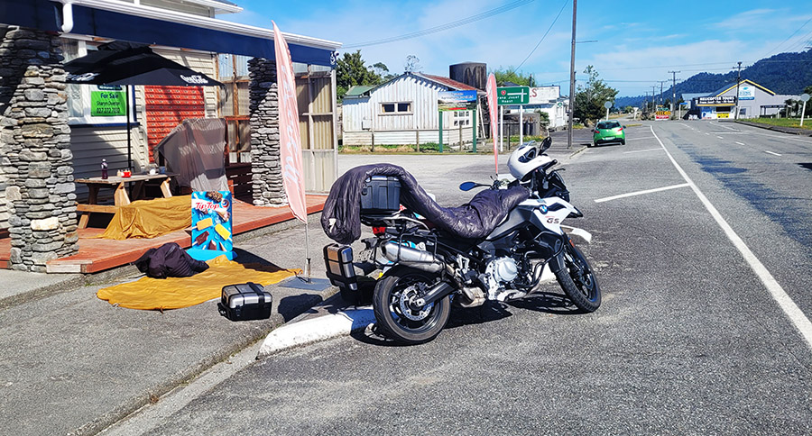
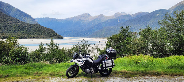
Zooming Through New Zealand: Part I

By Mike Huber

Having both traveling and motorcycling as my two greatest passions in life whenever I have an opportunity to combine them it is always quite magical.  Add on top of that camping, and it’s a trifecta for pure bliss.  Having found myself in New Zealand (and previously hearing tales of the incredibly technical roads and terrain here) was something that I didn’t want to miss, yet I almost did.

One of my strengths as a traveler, which seems counter intuitive, is my lack of planning.  I rarely plan more than a week in advance, and sometimes less than that.  In the past this has been a double-edged sword.  The agility of minimal planning allows me to instantly adjust with few consequences when opportunities arise, but it also has caused me to miss highlights that require more planning.  Still, this is the way I have traveled and for the most part it works.  To be fully transparent, the lack of planning could be due to laziness.  But to be perfectly honest if it hadn’t been at least semi-successful I would absolutely put in the work to lay out a more detailed plan.

This lack of planning almost became a major regret here in New Zealand.  By the time I arrived on the south island to reserve a motorcycle they were booked months in advance.  I was pretty distraught, but I understood the reasoning since it was peak tourism season (and I hadn’t planned).  It didn’t look like riding a motorcycle in New Zealand was in the cards for me.

There was a bright spot as an old friend of mine, Neal from the United States, happened to be on an Air Force duty assignment here. We hadn’t hung out in almost 20 years, so seeing him would be a great way to wash away the disappointment. Neal was in Christchurch and attached to an Air Force unit whose mission was to provide support for Antarctica.  Which I thought was really cool as they were part of the maintenance team for C-130s that delivered supplies to the frozen continent.  I love C-130s as I used to jump out of them when I served with the 82nd Airborne Division. The only difference (from my limited perspective) is the props had eight blades on the propeller instead of four, and these planes had skis attached to the wheels for ice landings. Of course, I thought all this was bad ass.

Leading up to our visit, Neal kept mentioning this Brazilian BBQ place that is an all you can eat meat on a stick fest. When we arrived along with three of his soldiers, the owner came out to greet my friend like he was the mayor of Christchurch.  Instantly I knew Neal frequents this place quite often.

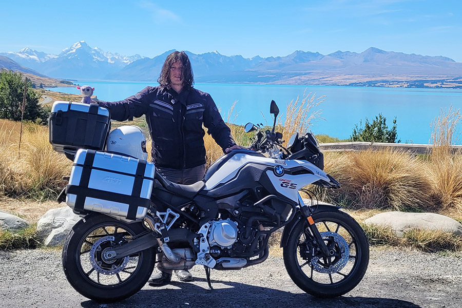
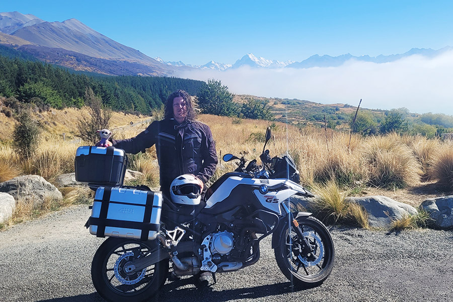
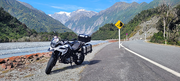
After we ordered Brazil’s National Drink, the Caipirinha, we waited for the feast to begin.  During this time I began chatting up the owner. He was originally from Arizona and had motorcycled quite a bit throughout the United States.  It didn’t take long for the conversation to turn to motorcycling New Zealand and how I couldn’t find a bike.  Within 5 minutes he had texted the owner of a local family-owned rental company, South Pacific Motorcycles.  They had a BMW GS750 available for the exact days I wanted. This was great to hear. I may be able to rebound from my lack of planning after all! If this wasn’t destiny, I don’t know what is.

I had 5 days to kill in Christchurch until I picked up the BMW.  That wasn’t too hard as it’s a fairly large city with some quirky architecture, botanical gardens, museums, and beaches to occupy my time until it was time to pick the bike up.  The downtime also allowed me to research different routes.  This wasn’t done by online forums or social media groups but by just looking at maps and putting a route together (as I would do in the United States).  Again, this could be laziness, but it’s what works for me.  Things were looking bright and the weather was great the day Kim, from South Pacific Motorcycles, picked me up in front of my hostel.  It was time to get this adventure underway.


Read the Mike Huber New Zealand posts here:


Never miss an ExNotes blog:


Don’t forget: Visit our advertisers!


Tongariro Crossing, Tongariro National Park, New Zealand

By Mike Huber

The Tongariro Crossing in New Zealand is touted as one of the world’s best day hikes. This obviously meant it was a hike I had to tackle.  The crossing is 19.4 kilometers (11.64 miles) across an active volcano, and it includes a LOT of stairs, both up and down.  Having not been hiking in several months, this was the first time I was actually questioning my physical ability. I don’t think it comes from age as much as hard landings from falling out of airplanes.  Either way, it’s the Number 1 hike on Earth so it really needed to be checked off my list.

As with all mountains, the weather is constantly changing and this mountain would prove no different.  The previous day the hikes were cancelled due to heavy winds.  Upon waking up at 0400 it was a relief to learn that the shuttles would be running that day. My campsite was just outside the town of National Park and was right along the shuttle path for a 0545 pickup and a 30-minute drive to the trailhead.

The hike started with misty clouds which added to the already stunning mountain scenery, and the winds, well they were blowing hard. I had purposely loaded my day pack heavy with extra everything in the event I’d need it.  That was smart. By day’s end I had used almost everything I brought.  This was comforting since I thought I had over packed.

The first five kilometers weren’t bad except for the brutal winds, which were a constant battle. It got to the point that when the winds subsided I’d almost fall down due to leaning in so much.  Once that five kilometers were wrapping up, there were several posted signs that said “If you aren’t feeling well, now is a great time to turn back, there is no shame in that.”  I used those signs as motivation to continue.

Once reaching the summit, it was obvious the crown jewel of the hike would not be shining as brightly as it had been in the photos.  There were two bright neon emerald green lakes that in the sun just glowed; however, with the weather having turned so quickly it was nothing more than a dull blue barely visible through the cloud bank.  The winds were still howling from every direction.  There was hardly even time to snap a few photos before I decided it was time to descend into the next crater for some shelter and to take a break and eat a snack. The only portion that remained was the never-ending descent filled with many more steps.

Overall, it was a magnificent day with great views and conversation with fellow hikers from all over the world. My finish time, not that it matters, was just over 6 hours.  This seemed admirable as the estimated time for most was between 6 and 8 hours.  The remainder of the day was spent at my campsite swimming in my own personal grotto behind my tent, talking with others that hiked it (or would in the morning), consuming ibuprofen, and feeling semi accomplished now that this hike was now completed.


Read the Mike Huber New Zealand posts here:


Never miss an ExNotes blog:


Don’t forget: Visit our advertisers!


Top 10 California Motorcycle Roads: Part 2

By Mike Huber

This is a continuation from my previous blog highlighting ten of the best roads in the beautiful state of California.

California 198 to Sequoia National Forest

Rated 5 WheeliesRoute Details.  Yes, another mind-blowing road that goes through another National Park. This route has beautiful mountain switchbacks with no towns and minimal distractions. This allows you to lose yourself while focusing on the tight corners as you speed next to some of the largest trees on the planet. This route highlights how small you as a rider next to these majestic trees in Sequoia National Park.

    • Start to Finish Points: Wood Lake to Pinehurst
    • Distance: 78 miles
    • Ride Time / Recommended Time: 3 to 6 hours
    • Recommended Time of Year: May to October
    • Main Point Of Interest(s): General Sherman Tree
    • Cautions / Dangers: Wildlife in early morning and evenings
    • Important Contact Numbers: CHP (Visalia) 559-734-6767

Road Description.  Although this route can be completed in a day, I would recommend you take two days. The reason for taking this slower is to allow yourself to stop and enjoy the sightseeing along this national park. The road is in excellent condition as you climb the switchbacks to crest the highest point in the park. There are no gas stations along this route so it is imperative that you fill up in either Three Rivers or Hume Lake (75 miles between the two) or outside the northern part of the park near Squaw Valley (90 miles from Three Rivers).

Points of Interest.  Since this is a National Park there is plenty to do outside of riding including hiking, sightseeing, and camping. This is one of my favorite National Parks since it is so stunning but everything is a very short hike to get to. Some of the largest trees in the World reside in this park. The General Sherman Tree is the world’s largest tree and is along this route. There are many other gigantic trees that are awe inspiring and shouldn’t be missed.  These are the points of interest I recommend:

Where to Stay/Camp.  Camping and hotels are limited to what is available in the National Park. Reservations should be made ahead of time as the park can often be booked full and will leave you no other options for 50+ miles for a place to stay.  Here’s where to check:

Fort Bragg to Bodega Bay on Highway 1

Rated 4 Wheelies

Route Details.  This route can be combined with the Fort Bragg to Garberville route, but I wanted to ensure they were written on separately as I feel the riding and terrain changes from the previous one to this route. This is Northern California at its finest. Pristine ocean views that include lighthouses and beaches for over 100 miles.

    • Start to Finish Points: Fort Bragg to Bodega Bay
    • Distance: 107 miles
    • Ride Time / Recommended Time: 3-6 hours
    • Recommended Time of Year: May to Oct
    • Main Point Of Interest(s): Numerous Beaches and Lighthouses
    • Cautions / Dangers: Possible heavy fog in the morning
    • Important Contact Number:  CHP (Ukiah) 707-467-4420

Road Description.  Beautiful sweeping corners that hug the cliffs consume this ride. You can feel your lungs cleanse as you breathe in the mist of the Pacific Ocean while blasting along one of the most well-known, yet less traveled roads in our country. The road is in great condition and there are plenty of small Oceanside towns that have locations to fuel up and allow you to stop in for meals or a beverage. It is important to ensure you soak up some sun while taking a breather and meet other riders at one of the many stops along this epic part of Highway 1.

Points of Interest.  This stretch of Highway 1 has some of the most beautiful and unpopulated beaches in the country along it. There are several lighthouses that are worth stopping by to visit. Mendocino Headlands State Park is a perfect place to stop and get a short hike in to regain focus for the upcoming curves you will be leaning heavily into. There are also several small beach communities like Mendocino, Fort Ross, and Gualala you will ride through, any of which make for a great stop for lunch or a stayover if you have the time.  Here are my favorite spots:

Where to Stay/Camp.  This stretch of road is one of the easier places to locate campgrounds and hotels due to the lack of crowds along it. As always making reservations ahead of time is recommended to ensure you have a safe place to rest for the evening. I have always had a pleasant experience staying along this route.  Any of these places are good:

Northern Tahoe Loop

Rated 4.5 Wheelies

Route Details.  113 miles of diverse riding from open field to challenging switchbacks as you climb the cliffs along beautiful Lake Tahoe and take in some of the most intense roads and vistas in California. The road is in excellent condition with much of it newly paved. There are plenty of turnouts for taking photos, which is fortunate because the curves are very sharp and come up quickly so the ability to pull over and take in the views is an added bonus along this trip. The route is not a letdown. You and your motorcycle will be smiling all day.

    • Start to Finish Points: Kings Beach with Reno Junction in the north as your turnaround back to Kings Beach
    • Distance: 113 miles
    • Ride Time / Recommended Time: 4 to 6 hours
    • Recommended Time of Year: May to September
    • Main Point Of Interest: Lake Tahoe, Reno
    • Cautions / Dangers: Quickly changing weather conditions, especially in fall
    • Important Contact Numbers:  CHP (Truckee) 530-563-9200

Road Description.  This is one of the more picturesque and challenging rides in California. This route provides such a range in diversity, both in the scenery and the road types. You start in Kings Beach where there are rolling meadows and begin to quickly climb to over 9,000 ft. where you will be skirting the edges of cliff sides with some serious switchbacks thrown in for added intensity. This road is not for beginner riders as the technical cornering along with the beautiful views can be too dangerous for a novice to safely navigate, however, for seasoned riders on a clear day the photos from this ride will soon be the background on your laptop screen.

Points of Interest.  This route has plenty of tourism along Lake Tahoe and in Reno as you loop through the stunning Tahoe National Forest. There are plenty of pullouts along this route to catch your breath and absorb the beauty that is fully surrounding you. As you traverse this loop you will not have to worry about any long stretches without gas or places to stop for food.  Here are a few favorites:

    • Gar Woods Grille & Pier is the perfect place to start or end your day with great food, beautiful views of the lake, and live music on the weekends
    • Brewforia is perfect lunch location with excellent craft brews and delicious burritos
    • The Peavine Taphouse in Tahoe at the top of the loop it is worth pulling in to get some heavily loaded pizza to fuel up for the return trip

Where to Stay/Camp.  With Tahoe National Forest surrounding you there are plenty of opportunities for dispersed camping along this ride. There is also an abundance of hotels, both high end and budget as well as state and private campgrounds. In short there is no need to worry about finding a place to lay your head and recover or to prepare for an incredible day of riding here.

Death Valley Highway 190

Rated 4 Wheelies

Route Details.  This road is quite unique from any other road in this state. It is 135 miles of just raw desert. Ensure you carry extra water to drink although there are gas stations every 35 miles or so. However, with this area having some of the hottest weather on the planet keeping an extra gallon of water (at least) on you is a wise move. The road is as desolate as you can find on a motorcycle, and the topography is like something from another planet. Even though the roads are straighter as compared to other rides I have listed, it’s the region and scenery that really make this road jaw dropping. Be very aware of the weather prior to traveling through this area.

    • Start to Finish Points: Lone Pine to Death Valley Junction
    • Distance: 135 miles
    • Ride Time/Recommended Time: 4 to 6 hours
    • Recommended Time of Year: September to early May
    • Main Point Of Interest: Death Valley National Park
    • Cautions/Dangers: Extreme heat conditions, possible sand in road
    • Important Contact Numbers:  CHP (Bishop) 760-872-5150

Road Description.  If you’ve ever dreamed of driving a motorcycle on Mars this is what it would be like. This road is one that you will never forget due to the dramatic landscape and post-apocalyptic feeling as you roll through the desolate desert of this National Park. The temperatures are extremely hot so I will mention this again to confirm the weather prior to embarking on this route. Early morning is a perfect time to go if you are traveling east to west to watch the landscape change colors in front of you while you are riding.

Points of Interest.  The main attraction of this part of the country is Death Valley National Park. This area is home to the lowest point in the southern 48 with an elevation of 280 feet below sea level. As you stand in the depths of that point and turn northward you can see Mt. Whitney in the distance. Mt. Whitney is the highest point in the lower 48 rising up at over 14,000 feet. During springtime the desert erupts with beautiful fields of wildflowers that stretch across the desert. This makes February and March one of the best times to visit this area. This time also provides relief from the extreme heat of this National Park.  There’s more info on Death Valley National Park here.

Where to Stay/Camp.  This road has only a few places to stop along the way so it is important to ensure your water and fuel levels are topped off at each stop. Even though there are so few places to eat there is plenty of camping along the way during cooler months.  Here are the spots I recommend:

    • The Panamint Springs Hotel is the only place in Panamint Springs to get food, water, and a hotel room
    • Just prior to entering the National Park the Death Valley Hotel is the perfect mid-way point to either grab lunch, camp or a hotel room
    • The Oasis at Death Valley resort has a great steakhouse and saloon that is perfect for a beverage to wind out your day; on the eastern side of the park this resort will be a welcome break from the heat of the day

San Juan Capistrano to Lake Elsinore on Route 74

Rated 4 Wheelies

Route Details.  This is a perfect ride for a Sunday afternoon to wind down from the weekend. Fun switchbacks up through the Ronald W. Caspers Wilderness. The road has some beautiful pullouts for a panoramic view of the lake right before you descend down into the town of Lake Elsinore. This ride is popular with local riders so be aware of that as you travel through it and be mindful of speed traps.

    • Start to Finish Points: San Juan Capistrano to Lake Elsinore
    • Distance: 52 miles
    • Ride Time / Recommended Time: 2 to 4 hours
    • Recommended Time of Year: Year round
    • Main Point Of Interest(s): Lake Elsinore
    • Cautions / Dangers: Speed Traps
    • Important Contact Numbers:  CHP (San Juan Capistrano) 949-487-4000

Road Description.  Beautifully maintained roads where you can really practice cornering on your motorcycle. This road is more of a social route that will allow you to stop and chat with fellow riders and build new friendships than a long distance run. It’s close in proximity to LA which makes it a perfect ride on any day where you have a few spare hours and are in need of wind therapy.

Points of Interest.  Once you leave San Juan Capistrano there is nothing until Lake Elsinore, except for probably one of the coolest motorcycle bars I have ever visited, Hell’s Kitchen Motorsports Bar and Grill. This is a place you have to stop at along this road to meet other riders and get a beverage and a burger. There are also several hikes with waterfalls that are worth stopping by for a break and to stretch out.

    • The Ortega Waterfalls is a lovely place to rest and take a quick swim, located at 33382 to 32806 Ortega Highway in Lake Elsinore, California
    • Hell’s Kitchen Motorsports Bar and Grill is a great stopping point to meet other riders and car enthusiasts
    • Kristy’s Country Store is the only place along this route to get snacks or water

Where to Stay/Camp.  Surprisingly for such a short stint of road there are several wonderful camping opportunities either along the beach or in the hills along Route 74. All the campgrounds along this road are very clean and well maintained. These can allow for a weekend getaway that isn’t too far of a ride to get some air and enjoy a nice fire glowing off your motorcycle as you unwind from a week at work.

    • Doheny State Beach is a great location for beach camping
    • The Orange County Park area is a perfect campground with short hikes you can start right from your campsite; closer to Lake Elsinore, this campground also has some short beautiful hikes that are closer to the waterfalls

Conclusions

As you can see there is no shortage of beautiful roads in California. These routes listed along with the bars, restaurants, and tourist points are some of my favorites in the state. The experiences you embrace along these roads are sure to create some of the fondest memories that will stay with you for a lifetime. If you found this article useful or would like to share your favorite roads and experiences in California please feel free to share so we can work together to expand our knowledge on this unforgettable state.


Never miss an ExNotes blog:


Don’t forget: Visit our advertisers!


Huber World Tour Stop 1: Auckland, New Zealand

By Mike Huber

Having chosen New Zealand as the first stop on the “Huber World Tour” was probably the easiest of the decisions I have made.  Especially since the runner up was India and buying a Royal Enfield and roaming through that country for five to six months.  Pipe dreams, but somehow I knew that would be too much to do solo for my first adventure (it surely isn’t out of the question for the future though).  My sister had visited New Zealand and Australia last summer for the Women’s World Cup Soccer Match and couldn’t say enough good things about the countries, so I decided why not dip my toes in the travel waters instead of going off the deep end with a lead-weighted belt.  So in October I bought a backpack, booked airfare, and passed a couple months with family and friends prior to leaving.

I left JFK on January 8th with a lot of anxiety and second guessing my decision on the long flight to Auckland.  The flight was tolerable, not great, but I managed. Upon landing I was amazed at the efficiency of the airport. It was all digital entry and the walk off the plane took longer than passing through immigration and customs. Normally when I land in a foreign country I take off like a rocket and usually make several mistakes in my haste.  I have no timeframe on my travels and I forced myself to sit, have a coffee, and fully gain my bearings before paging an Uber to bring me to a hotel I had pre-booked for two days in the event I had bad jet lag.

Arriving at my hotel around 11:00 a.m. I knew it was way too early to check in and for some reason I had a lot of energy. I found a local island on a map and saw ferries frequented it. What a great way to spend my first day. The island was like a little Martha’s Vineyard with shops, restaurants and bars.  It also had a short hike up to the highest point on the island, Mt. Victoria. The hike got my legs moving again after my long flight.  Once I began feeling tired I ferried back to Auckland. Upon disembarking the ferry I was starting to feel a bit tired so I thought taking one of those Lime Scooters would be a great idea.  Well, I now know how I am going to die.  It will be on a Lime Scooter.  Not only was I starting to fade fast but the traffic drives on opposite the side of the road.  Fortunately for me people are super nice here and I didn’t hear one F-Bomb as I clumsily navigated my way back to the hotel on the scooter.  I was asleep within an hour.  What a cool first day in New Zealand.

The following day I was still in a bit of a fog but felt I could do a 2-mile walk to the War Museum and learn to navigate the bus system.  The War Museum was spectacular.  I guess I never realized they were even involved in World War II.  They even had a paratrooper regiment.  After spending a couple hours it was time to grab a coffee for a much-needed boost. The thing I learned in college (maybe the only thing) is that coffee will physically wake you up but mentally it rarely does anything to get your brain flowing.  Nonetheless, I felt refreshed and coherent enough to purchase a bus pass online.  It was time to aim towards my next objective, a beautiful city overlook called Mount Eden.

Again, everyone here is super nice and welcoming. Upon boarding the local bus my pass didn’t work and I showed the pass on my phone to the driver.  He laughed and told me to sit down and not to worry about it.  I was scrambling to find out why it didn’t work and began talking to other passengers.  This is when I learned I had bought a bus pass for Portland, Oregon.  The bus passes had similar names.  Okay, I will figure this out later and just focus on getting to Mount Eden for some photos.  That didn’t happen.  I was on the wrong bus and by this point it was a 2-hour loop to return to a bus stop near my hotel.  I was pretty upset with myself for most the ride but in hindsight I had a free bus tour of Auckland and a story.

Clearly another solid night of sleep was required.  However, before I could sleep I had to decide where I was going and would be staying the next night. I had heard of an island called Waiheke that was a 45-minute ferry ride away and thought that may be a good spot for a few days to relax as I continued to slowly lift the vail of jet lag. After booking an AirBnB for two nights and confirming the ferry schedule, it was time to sleep and prepare for the following day of travel to Waiheke Island.


Read the Mike Huber New Zealand posts here:


Never miss an ExNotes blog:


Don’t forget: Visit our advertisers!


Top 10 California Motorcycle Roads: Part 1

By Mike Huber

California is beautiful from every aspect, but once you climb on a motorcycle and get the full experience of this gorgeous state you’ll realize it is difficult to find a place with more riding diversity. From the northern redwoods to the people-watching along Venice beach to the eastern deserts and right up to the Sierras. California is a destination where you’ll want to spend time.  And when I say time, I mean having the ability to savor each region and each road.

Garberville to Fort Bragg

Rated 5 Wheelies

Route Details. This is a beautiful road with twisties that rival the famous Tail of the Dragon in North Carolina, with much more diversity due to the forest and ocean views.

    • Start and Finish Points: Garberville to Ft. Bragg
    • Distance: 68 miles
    • Ride Time / Recommended Time: 3-4 hours
    • Recommended Time of Year: May-Oct
    • Main Points of Interest(s): The stretch from Leggett to Rockport
    • Cautions / Dangers: Minimal but possible sand/rocks on road in mountain twisties
    • Important Contact Numbers  CHP (Ukiah) 707- 467-4420

Road Description. I chose this route as my #1 in California due to the technical street riding, lack of traffic, and scenery. This route also has plenty of classic Americana stops along the way that even for this short ride will add to the enrichment of this route. It is an out of this world experience and you will feel at times as if you are in Star Wars zooming through Endor on a speeder. Once you adapt to that environment you are thrust out of the forest and into views of the vast openness of the mighty Pacific Ocean. It is hard to achieve a greater riding experience from every aspect over such a short distance.

Points of Interest. Garberville is a wonderful place to start as it is a quaint little hidden California town with wonderful people. The people are down to earth and easy to talk with as you consume a cold beverage or lunch while comparing tales from the road. There aren’t a lot of restaurants or stores in Garberville but the two I recommend are:

    • The Blue Room (747 Redwood Drive in Garberville, a great place for a drink/lunch/dinner)
    • The Eel Café (801 Redwood Drive, which offers breakfast and lunch sandwiches)

Another must see spot is the Drive Thru Tree Park for an unforgettable experience and great photo opportunities.  Make sure you drive your moto through the Redwood tree.

Fort Bragg is larger compared to Garberville and offers more choices for nightlife and entertainment.   Two of my favorites are:

    • The Tip Top Lounge, a great place to stop after riding all day for a beer and a solid burge
    • The Piaci Pub & Pizzaria for great pizzas and an environment conducive to unwinding

Where to Stay/Camp. Both Garberville and Fort Bragg offer numerous hotels and camping spots, and even though this is a short ride I highly recommend making this trip an overnighter to fully absorb the culture of this part of the state and its beauty.  These are my favorite spots:

Santa Monica to Oxnard on the Pacific Coast Highway

Rated 5 Wheelies

Route Details. This is the quintessential California beach road with exhilarating sweeping corners that introduce a new view of the Pacific Ocean as you lean through each turn.

    • Start and Finish Points: Santa Monica to Oxnard
    • Distance: 50 miles
    • Ride Time/Recommended Time: 3 to 4 hours
    • Recommended Time of Year: April to November
    • Main Points Of Interest: Beaches along the route
    • Cautions / Dangers: Minimal, but possible sand near beaches
    • Important Contact Number: CHP (Woodland Hills) 818-888-0980

Road Description. As far as a California dream road, this is the one. Riding it early morning can be the best time due to low traffic and the ability to taste the salt from the Pacific Ocean as you wind northbound. There are plenty of beaches and overlooks to stop at. This really allows yourself to fully absorb the beauty of this part of California.

Points of Interest. Santa Monica is a great starting (or ending) point and you can walk out to the pier or rent bicycles to ride the boardwalk down to Venice Beach which will allow for some outstanding people watching and opportunities to engage in tourist attractions along the way. As you travel north from Santa Monica there are no shortage of quaint restaurants and shops along PCH1 to visit and relax. This is a road that feels as though it’s designed for a leisurely ride in order to fully experience the sights and sounds while on two wheels. A classic place to get some seafood is Neptune’s Net right along the Pacific Coast Highway for great seafood and wonderful people.  If time allows, a worthwhile day can be spent visiting Channel Islands National Park.

Where to Stay/Camp. Camping is limited along this route but Point Mugu State Park is a great place for beach camping. Hotels are plentiful but expensive in both Santa Monica and Oxnard.

Highway 120 and Tioga Pass

Rated 5 Wheelies

Route Details. This is one of the best roads in California.  It runs through Yosemite National Park and over intense switchbacks to Tioga Pass, where you will feel as though you are on top of the world (at almost 10,000 feet elevation, that isn’t too far from the truth). There are minimal fuel stops along this way so make sure you are fueled up.

    • Start and Finish Points: Groveland to Lee Vining
    • Distance: 92 miles
    • Ride Time / Recommended Time: 4 to 6 hours
    • Recommended Time of Year: May-September
    • Main Points Of Interest: Yosemite National Park and Tioga Pass (elevation 9,943 feet)
    • Cautions/Dangers: Wildlife throughout the passes, loose rocks and dirt on some mountain passes
    • Important Contact Number: CHP (Bridgeport) 760-932-7995

Road Description. Some incredible scenery as you pass through Yosemite National Park and even more breathtaking as you lean into some of the tightest switchbacks you can ever hope to encounter with serious drop offs so be sure to not get too caught up in the scenery and maintain focus on the road.

Points of Interest. Although this area of California is not as populated as some of the others there are plenty of places to stop and eat. With Yosemite National Park as the centerpiece of this ride there is a plethora of beauty and experiences to be had.  My favorites are:

Where to Stay/Camp. There are numerous inns, hotels, and quaint bed and breakfasts along this route. All the ones I experienced have been wonderful experiences. Here are two of my favorites on each side of the route, and the camping opportunities within Yosemite.

    • Lakeview Lodge in Lee Vining is a clean safe place to stay with modest rates and parking for your motorcycles
    • Yosemite National Park for camping, where reservations are strongly recommended
    • The Sonora Inn in Groveland is another winner both from a price standpoint and for the quality and cleanliness of the rooms

Cotton Springs Road to Joshua Tree

Rated 4.5 Wheelies

Route Details. A short but deeply satisfying route that winds through Joshua Tree National Park. No services along this way so be sure you fill your tank either east on I-10 at the Chevron Station or in the town of Joshua Tree (depending on which way you are traveling).  Ensure you have water and are hydrated due to excessive heat during hotter times of the year.

    • Start and Finish Points: Exit 173 off I-10 to Joshua Tree
    • Distance: 94 miles
    • Ride Time/Recommended Time: 4 to 6 hours
    • Recommended Time of Year: September to November, February to May
    • Main Point Of Interest(s): Joshua Tree National Park
    • Cautions/Dangers: Loose rocks/dirt on some corners
    • Important Contact Number: CHP (29 Palms) 760-366-3707

Road Description. Beautiful desert and mountain views. In spring there are fields of wildflowers that really show how much life is in the fragile ecosystem of Joshua Tree. The roads are in excellent condition and encompass fun sweeping corners then will open up with straightaways that provide majestic vistas of the region.

Points of Interest. This is a desolate road, which is great for riders looking to just check out of the crowds and embrace riding.  As previously stated there are no gas stations in the park so ensure you fill up prior to entering it.

    • Chevron off Exit 173 along Interstate 10 (62450 Chiriaco Road, Chiriaco Summit, California 92201)
    • General Patton Museum is next to the gas station and worth a visit
    • In included the added mileage here through Joshua Tree National Park to allow you to fully explore the park (including the ride out and back to Keys View
    • For a great diner to fuel up before or after your ride try the Country Kitchen restaurant

Where to Stay/Camp. With Joshua Tree National Park being so desolate, camping there is a magical experience. On a clear night you can see the stars and planets like nowhere else. The campgrounds tend to fill up during peak seasons so be sure to reserve a campsite prior to your trip. As far as hotels go, both the town of Twenty Nine Palms and Joshua Tree have numerous hotels that are perfect for unwinding after the ride.

Mulholland Highway

Rated 4 Wheelies

Route Details. This is a 50-mile route that is beyond filled with some serious mountain switchbacks. This is an incredibly intense road that to me rivals the Tail of the Dragon in NC. The switchbacks just don’t end as you climb through the Santa Monica Mountains and then spit out onto Highway 1 and views of the Pacific Ocean.  It is a motorcyclist’s dream ride.

    • Start and Finish Points: Alizondo Drive Park to El Matador Beach
    • Distance: 50 miles
    • Ride Time / Recommended Time: 2 to 4 hours
    • Recommended Time of Year: Year round
    • Main Point Of Interest(s): The Rock Shop
    • Cautions / Dangers: Speed Traps
    • Important Contact Number: CHP (Woodland Hills) 818-888-0980

Road Description. For being so near to Los Angeles this road is a real getaway without having to travel far. The quality of the road is perfection and something that people from all over the LA area flock to. For this reason be cautious with your speed as there are several places they set up speed traps, however, quite often fellow riders will park ahead of these speed traps and provide you a warning. If you are looking at getting rid of the chicken strips on your tires this is definitely the road where you can accomplish that.

Points of Interest. This road has minimal places to stop along the way, but with all these switchbacks why would you want to stop. There is one famous attraction that is a must do as you traverse these mountain roads, and it is The Rock Store. It is a popular place for riders of all types to stop and get a sandwich and a drink. Jay Leno is often seen here talking shop with the riders and being social with others riding this fantastic road.

Where to Stay/Camp. With this ride being so close to the city there are minimal camping options. Hotels are numerous on both sides of this ride however. There are plenty of canyon roads off the main highway that are worth exploring, so even though this is a shorter ride you can absolutely make a full day out of this area. This will allow you time to fully embrace the roads and fellow riders along the way.  My favorite place to camp is the Decker Canyon Camp.


Never miss an ExNotes blog:


Don’t forget: Visit our advertisers!


The Top Five Southern Colorado Motorcycle Roads

By Mike Huber

As an avid motorcyclist it’s easy to appreciate the beauty in each state and for many riders discovering amazing roads that many would overlook can become second nature to us.  Some might even say it’s an art form.  Throughout this vast and beautiful country called the United States of America we are fortunate enough to have a plethora of both paved and dirt roads that are meant to be sought out like the Ark of the Covenant.  These roads are meant to be experienced intimately the only way they can be, on two wheels. Experiencing them on a motorcycle can become a thirst that is never quenched, and although each state has its own unique characteristics, ultimately some will stand out more than others. One state that has that effect for me is Colorado.

Colorado is one of those states that as soon as you ride past the “Welcome to Colorful Colorado” sign the roads seem to present themselves to you like a feast on a golden platter with an endless amount of wine.   The rides we will review can each be completed in one or two days and are best ridden between late April and early October.  To help with prioritization since there are so many incredible rides we have developed a very complex mathematical rating system of 1 to 5 wheelies (5 being the highest).  The rating uses the following criteria:

    • Road conditions
    • Diversity of riding options
    • Activities along the route
    • Abilities to disperse camp/hotel access
    • Scenery

Route 550:  The Million Dollar Highway

Rated 5 Wheelies

Road Description.  This loop may be one of the greatest roads in all of North America. The road is paved and in immaculate condition.  It combines some of the tightest switchbacks one can expect to experience on a motorcycle. The full route per the map is ~355 miles and can be done in 1 day, but highly recommend taking at least 2-4 to fully experience and immerse yourself in this beautiful part of the country.  There are endless forest roads off 550 to get your fill of dirt riding littered with an infinite amount of beautiful dispersed campsites. Also some wonderful old mining towns rich with history, hiking, restaurants, hotels, and hot springs.

Points of Interest.  There’s no shortage of amazing places to stop along this road.  Below is a small list of the places you should not miss along this route.

    • Silverton is a great little mining town with wonderful people.  It’s a perfect place to load up on supplies if you are camping.  You can warm up after getting some miles in at the Brown Bear Café.
    • Ouray is a beautiful mountain town with several hikes to waterfalls, hot springs, and some wonderful restaurants. My favorite is the Ouray Brewery.
    • Rico is a really tiny town which consists of a great hotel and bar called the Enterprise Bar and Grill, with wonderful people, great food and cold beer.

Where to Stay/Camp.  There is an immense amount of national forest land that can be used to camp on along this loop.  Really any dirt road you ride down will guide you to an epic campsite next to a creek. This makes for a relaxing post ride time to wind down in a hammock, while having a refreshing beverage. The towns of Silverton and Ouray have several hotels that are right in the heart of the town and a short walk to tourist activities and restaurants.

Off-Roading.  There is an endless amount of dirt roads to find here, this goes from flat well-groomed forest roads to find a campsite to the technical challenging mountain passes like Engineer or Imogene Pass (which I have not done due to the size of my GS1200 and conservative riding style).

Out of so many outstanding rides in the state of Colorado, the Million Dollar Highway should be on the top of any list.  This road and area really earn that 5 Wheelie rating due to exceeding each standard for riders of all ability levels. There are so many sights to see along this route that you will never tire of absorbing the beauty that surrounds you in this part of the state. If you are fortunate enough to have the time, doing the loop in reverse can be a great way to add a few more days to your adventure.

Mesa Verde National Park

Rated 5 Wheelies

Road Description.  As soon as you enter Mesa Verde National Park the road begins screaming up in elevation with some incredible views overlooking the valley below you will almost have a sense of vertigo overcome you.  What is wonderful about this feeling as it goes on and on as you travel through the park.  Although the distance from the park entrance to the furthest point is only 28 miles, those miles are filled with numerous overlooks and pullouts that can make this seemingly short ride take 2-3 days.  This is especially true if you are taking in the hikes along the way.  The only piece of concern for this ride is the numerous road snakes in some areas of this ride. Otherwise its full enjoyment as you have a 360 view of the valleys below that outstretch clear into Utah, New Mexico, and Arizona.

Points of Interest.  Since this is a National Park there are ample amounts of short hikes and tours to break up the day(s) you spend in this magical location. A few of the more popular ones are outlined below:

    • The Cliff Palace requires purchasing a tour ticket at Park Visitor Center, but even without one you can walk to the overlook to get a spectacular view of the houses the Hopi built into the cliffs which are all but hidden except from this vantage point.
    • The Balcony House also requires a tour ticket but is well worth it as you can walk through the ruins and really get a sense of the
    • The Knife’s Edge Hike is a great 2-mile hike with little elevation next to Morefield Campground that has incredible sunset views, which enable the rocks to really light up and glow.

Where to Stay/Camp.  Morefield Campground- This is the only campground in the park so making reservations ahead of time is recommended. It is one of the better National Park campgrounds I have stayed at and includes free showers, great Wi-Fi from most campsites (antennas are off the bathrooms), and a launderette, gas, and fully stocked store for all your camping and souvenir needs. There are also several wonderful hiking trails right next to the campground.

Off-Roading.  This is one of the drawbacks of a National Park, as there is no off-roading permitted within the park boundaries.  The beauty and activities from hiking and riding makes up for this shortcoming.

Route 65: Grand Mesa Scenic Byway

Rated 5 Wheelies

Road Description.  Yet another beautiful Colorado mountain road filled with switchbacks that rise in elevation and bring you to over 10,000 feet up and onto the World’s largest Mesa. There are several pullouts along this route to take in the views, but no gas stations from Cedaredge to Mesa (50 miles, but can be close to 100 miles if you are doing the off-road portion) plan accordingly.

Points of Interest. The main point of interest the mesa itself and the amazing views, alpine lakes, dispersed camping, and off-roading.

Where to Stay/Camp. Dispersed camping is plentiful along Rte125 where you can get a lakeside campsite with little issue and make it your own paradise for the evening as you watch the sunset glistening off one of the many alpine lakes. There are also plenty of campgrounds along this way if you are looking for less primitive camping.  Hotels are scattered along this route in the towns of Delta, Mesa, or driving to up Grand Junction for a greater variety of lodging.

Off-Roading.  Route 125 Surface Creek Road is a great 15-mile loop.  This road has you experience the mesa while passing crystal clear alpine lakes with numerous dispersed camping areas.  There is also a 10-mile dirt road in great condition to visit the Lands’ End Observatory. The views off the mesa looking down on the plateau can allow you to see into Utah on a clear day with awe inspiring views.

Route 141: Grand Junction to Naturita

Rated 4.5 Wheelies

Road Description.  This is a low elevation beautifully paved road that is 105 miles long.  This road will have you leaning your ride until you feel the mist kissing your windshield from Dolores River as you pass amazing rust colored mesas that stretch into the sky and rival that of Monument Valley. The road has very little traffic which will allow you to enjoy some solitude as you embrace the scenery you ride through. The only reason this route is rated as 4.5 is the lack of amenities.

Points of Interest.  This road is in quite a desolate area, outside the tiny town of Gateway.  Gateway Canyons General Store is owned and run by the preacher of the church next door to it.  This is the only place to gas up between Grand Junction and Naturita so be sure to check your fuel levels.

Where to Stay/Camp.  Dispersed camping here is plentiful but mainly in one area just south of Grand Junction, Divide Road. This road is a steep switchback dirt road that connects to numerous other roads which are great fun exploring for campsites to settle down in.  There are numerous dispersed sites with beautiful views over the canyon in which you can see the Dolores River running far beneath you.

Off-Roading.  Divide Road also encompasses numerous off-roading opportunities that sprawl out across this mesa.  This is a perfect place to explore for that unique dispersed campsite while hitting some fun dirt to enhance your day.  There are however areas of slippery clay, so if it is raining it can become slick in portions of this road.

Routes 160 and 149: Pagosa Springs to Lake City

Rated 4 Wheelies

Road Description.  This route consists of 45 miles of a four-lane highway on Route 160 that will have you summit at over 10,000 feet.  The road will then drop you into South Fork, Colorado.  This is where you will turn left onto Route 149.  Route 149 will quickly whittle down to a tighter and quieter road for the next 75 miles, which are filled with mountain passes. South Fork is the only town between these areas so make sure you gas up and grab lunch before heading onto the second part of this amazing road.  The next portion will have you speeding across lower elevation prairies and then climbing high into the mountain tundra that will resemble something from another planet before descending into Lake City.

Points of Interest.  I specifically wanted this trip to begin (or end) in Pagosa Springs so you have an opportunity to experience the hot springs in Pagosa.

Where to Stay/Camp. Throughout the ride there is no shortage of camping in both dispersed and paid locations. In Pagosa there are numerous hotels. I prefer the hotel directly across the street from the spa as it is much more affordable then the spa and in a great location.  For Lake City, the Matterhorn is a beautiful Swiss style motel which will allow you a solid night’s sleep at a great price. It’s a perfect spot to recharge if you are going to take on some of the more challenging off-road portions in Colorado the following day.

Off-Roading.  Lake City is the starting point for some of the more serious off-roading mountain passes, such as a few of the most popular passes including Cinnamon and Engineer.  Both of these passes surpass 12,000 feet.  If you crave technical off-roading challenges with views that can’t be beat, these are the two passes I recommend.

Conclusions

Southern Colorado is a rider’s paradise, and a region that should not be missed for riders of all experience levels. Other avid motorcyclists have also recommended these roads to me, which reinforces my approval for these routes and motivated me to write this comprehensive layout to help others. I hope this breakout has been helpful and serves as a reason to visit Southern Colorado and have the riding experience of a lifetime.


Never miss an ExNotes blog:


Don’t forget: Visit our advertisers!


The Legendary Fung Wah Bus

By Mike Huber

Ok, so throughout my life I have tended to do a LOT of dumb stuff.  Almost daily anyone around me is questioning how I am still alive. This is no exaggeration, but there is one activity I partook in that is by far the most reckless.  That is riding on the Fung Wah Bus.  Recently I was in a bar in Boston (yes, imagine that) and I was telling the story of the Fung Wah bus, which entertained the entire bar for close to an hour. My stories of this legendary form of transit must have been quite epic  as when cashing out I was told my entire tab had been paid.  So I thought a write up on my experiences around this hazardous mode of transportation would make for a fun read.

The Fung Wah Bus isn’t in service anymore for reasons described below.  It was a $10 bus ride from South Station in Boston to Chinatown in New York City. I was 27 years old, living just north of Boston.  A close friend was in New York City.  The bus always arrived on time, there was no hassle with airports, and it was just easy.

I was alerted to the dangers of this bus when I arrived to work on Monday.  My manager asked what I had done that weekend.  I replied I had gone to Manhattan to hang out with a friend.  He asked how the flight was.  “Flight?” I asked.  “I didn’t fly. I took the Fung Wah Bus.”  He doubled over laughing and said he paid me enough to do better, which was followed by several explicit adjectives.  I still heard him ranting about it an hour or so later.  I was a bit taken aback.

It didn’t take long for me to realize the history of this bus and the numerous safety violations and failed inspections that made taking this bus not only risky, but in hindsight, downright dangerous.  Massachusetts had even shut the service down a few times over the years.  These busses were flipping over, catching on fire, and wheels were falling off.  Outside that, though, the busses ran on time, no matter the amount of traffic or weather conditions.  They had this trip down to an art.  It was so honed that once when I was stuck in traffic on the Cross Bronx Expressway, a few cars in front of me I spotted a Fung Wah bus.  Here’s my chance!  I followed it off the expressway as it zigged and zagged through the narrow surface streets until it returned to the now less-congested expressway. I felt like a running back following a lineman as a blocker until I could see the end zone. What a rush!

With it being a 4-hour ride, the driver would always stop at a Roy Rodgers Restaurant for a few minutes to allow you to stretch, grab a bite to eat, and pray to the God of your choice for a safe remainder of the trip. To this day having driven that stretch hundreds of times in my car I never saw that restaurant unless I was on the Fung Wah.  Wherever the bus exited the highway, we all went into Narnia.

At the end of the day the Fung Wah never disappointed and although the bus was decommissioned like Old Ironsides, it provided some great stories and an economical way to get to New York City.  As I sat in a Boston bar finishing my Sam Adams, I was thankful to the mysterious patron who got my tab.  I am fortunate that this experience (riding the Legendary Fung Wah Bus) crossed my path.


Never miss an ExNotes blog:


Don’t forget: Visit our advertisers!


My New Home

By Mike Huber

Traveling and living mostly off my BMW GS1250 for the past six years has really taught me how to live in a minimalistic way, but travel with enough to be comfortable.  It is a rarity that I need anything more than what I have.  My organizational skills are honed to the point that I know where everything I own is at all times. Everything has a specific place and keeping items consistent with their location is key to organization.  I can get out of my tent at 2:00 a.m. and know not only which pannier any given item is located, but the exact location within that pannier.  It’s an art form that I take pride in. So you can imagine if things are flipped upside down and I am pushed into a new packing routine how it would take time to readjust my mindset to a new format.

This is exactly the place I have found myself in now.  Beginning January 10th I am converting from a motorcyclist to a backpacker as I begin a trip to Oceania for an unknown period of time.  Auckland, New Zealand will be my starting point and a 50 Litre Osprey Backpack will become my new home.  Relearning organizational skills as a backpacker will include a learning curve, albeit a fast one.  With a little bit of discipline my organization as a backpacker will become just as honed as my previous life was on the motorcycle.

Here’s my packing list:

Although this seems minimalistic it will be summer in the southern hemisphere so going light on clothing was an easy decision to make.  I am sure if I am missing anything it will be easier to pick it up along the way rather than carry the weight and bulk of unneeded items.  Being new to backpacking I am fully open to criticism and suggestions on anything I am missing or have over packed.  Let me know your feedback and items that you cannot live without that should be added to this list.


Read the Mike Huber New Zealand posts here:


Never miss an ExNotes blog:


Join our ExhaustNotes Facebook group!


Don’t forget: Visit our advertisers!


My First Motorcycle Arrest

By Mike Huber

Instead of one of my usual blogs on motorcycles, I felt it was time to highlight some of my motorcycling shortcomings. Many of us when starting this magnificent hobby have had a few blunders along the way and, well, some of us have had more significant blunders than others.  Being who I am, it seems when I do anything it is extreme.  Over my 28 years of motorcycling, it is pretty obvious that riding is no different.

I was a young U.S. Army Specialist serving in the 82nd Airborne Division.  One of my best friends was about to go through a rough divorce at the same time that I felt the call to obtain my first motorcycle.  He let me practice on his bike and use it for the test if I purchased it from him.  Facing an imminent divorce allowed for an extremely generous discount (he needed divorce and beer money), and being flat broke, this was what led me to make the purchase.  The bike was a bright yellow Honda Magna 750 that had more than enough power (probably too much) for a first motorcycle.

The deal was pretty much done.  I passed my written test and was ready to take my driver’s exam.  I’m not sure if I was nervous or inexperienced (or both), but as soon as I started the test maneuvering around cones, I knew I was making a ton of mistakes.  The Honda Magna was heavy and not the best choice for a new rider taking the motorcycle license test.  Amazingly, though, I passed the exam.  I later learned my friend had been chatting up the evaluator while I was testing to distract him.  Regarding a successful test output, my friend had as much skin in the game as I did.   After passing the test, I paid him $3500 in cash that I obtained by somehow qualifying for a personal loan.  I became the proud owner of a 1995 Honda Magna 750!

It didn’t take me long to realize I was invincible on the Magna, even though I had no riding skills.  I was a 22-year-old unstoppable 82nd Airborne Paratrooper with a fast motorcycle.  What could go wrong?

Pretty much everything could go wrong.  Almost every evening when leaving Ft. Bragg there would be lights flashing in my rearview mirrors.  It couldn’t be for me as I was way too far ahead of them.  This, of course, was because I was going over 100 miles per hour.  Everything was distant in my rearview mirrors at that speed.  From what others had told me, the MPs were not allowed to leave post and had to call any pursuits into the local Fayetteville police.  By the time that happened and an officer would be dispatched, I was long gone and most likely home on my couch watching TV and having a beer.

This cat and mouse game went on for months.  Not daily, but usually one or two times every week.  I didn’t care as it was nothing but entertainment for me.  These near run-ins with the law helped my ego, but did not improve my riding skills one bit.  Until one day when the birds came home to roost.

Sitting at a light on Ft Bragg, I decided to teach myself how to split lanes.  Not noticing an MP (a Military Police officer) nearby, and noticing even less the car driver next to signaling the MP.  Instantly the lights flipped on and I heard the “whoop whoop” of a siren.  This happened at the moment the light turned green.  All traffic stopped to allow the MP to move forward but he couldn’t as everyone had frozen (except for me, of course). Clicking down into first gear and blasting off like a Shillelagh missile, I was out of there.  Knowing the MP would be able to catch up quickly (I was in the heart of Ft. Bragg), there was no running to the safety of the post border.  After a quick couple turns, I realized it was probably best to pull over.

It was no surprise that the MP was not too happy.  As he was listing my charges, I asked him if I could go inside my battalion headquarters to let my team know I would be late returning from lunch.  The MP agreed, and I entered the headquarters building and proudly announced “Hey, Sarge, I am gonna need a little longer lunch today.”

My sergeant asked why, and the MP promptly and quite loudly said, “His ass is coming with me to the station!”  As I rode to the MP processing station and received my charges, it hit me: It was my wedding anniversary.  Since my CQ (Charge of Quarters) shift was 24 hours, I hadn’t called my wife.   While the arresting officer was rambling to everyone in the station about my reckless driving, I thought this would be a good time to call her.  I asked and was granted permission to make a phone call.  I called my wife and wished her a happy anniversary.  She was quite pleased that I somehow found the time to call during my busy day.  The call was going great until my wife asked where I was.

“Ummm, jail,” I said.  “I am in jail.”

My wife was instantly very mad at me.  Prior to that she had been happy.  I’ll never understand women.

Once released from jail, I was not punished, other than receiving a written letter stating that I had embarrassed the battalion and the 82nd Airborne Division:

The letter was quite stern.  I could not ride a motorcycle on Ft. Bragg until I successfully completed a motorcycle training class.  The safety class was sorely needed, as my riding skills were horrendous (to say the least).  The one hope I had was that upon completing the training class my new riding skills would be used for good and not evil.  Sadly, there would be a Part 2, a Part 3, and even possibly a Part 4 to my maturing as a motorcyclist. For the time being, however, I was allowed back on post and I didn’t receive any military judicial punishment, and that was something to be thankful for.


Never miss an ExNotes blog:


Don’t forget: Visit our advertisers!


A Drought While Surrounded By Water

By Mike Huber

This year I decided to expand my hobbies while traveling across the United States by motorcycle.  I enjoyed camping and riding but felt with the long summer days I needed something to do once I arrived in camp (other than drink beer around a beautiful campfire, which will still happen no matter how many hobbies I take up).  Fishing seemed to be a perfect way to spend early evenings once my campsite was set up. I was going to become a successful motorcycle fisherman.

OK, well the successful part ended rather quickly.  I started off just crushing it and catching fish almost every time I went camping.  I was fishing lakes around Arizona and thought that once I was in California it would only improve.  It didn’t.  In fact, I didn’t catch a single fish from July to the end of August.  In my own defense, I was fishing rivers where most were fly fishing and not using lures or worms.  But still, to be skunked day after day for a few months was demoralizing, especially one day when fishing in Lassen National Park.  There was a couple next to me, literally right next to me, using the exact same power bait and reeling in bass after bass.  As soon as he landed a fish his wife would clean and cook them on the spot. Meanwhile, I wasn’t even getting a bite.  I may have cried that night in my tent a little (or a lot).  I kept a positive outlook, as I was just starting my trip and had so many states to visit that my luck would surely turn around.

My luck did not turn around.  It got to where the fish were mocking me jumping all around my lures.  Even when I changed from power bait to spinners to gummy worms every 30 minutes or so, it just wasn’t happening.  This is where my friend said to me “That’s why they call it fishing, not catching.”  Ugh.  I clearly need better friends.

As my travels (and my fishing drought) continued, I camped and fished in 14 states without a bite (AZ, CA, OR, WA, ID, MN, PA, NY, VT, NH, ME, NJ, VA and MD).  Talk about a drought. This was awful.  I think what made it worse was my BMW GS1200 was so loaded down that I had the pole visible on the bike held by ROK Straps which invited people to come up and talk with me about my fishing success and comment “oh, you will definitely catch something here…I’ve never been skunked there.”  Well, I didn’t and  I was skunked.  Repeatedly.

On November 1st my BMW was stolen.  The steering column was cracked open like a lobster and it was pushed into an alley where the thieves pried open my panniers and took only a few items.  One of them happened to be my trusty $40 Walmart collapsible fishing pole. This was the ultimate insult to wrap up an unsuccessful fishing year.

Not being one to give up, the first thing I bought after the BMW was recovered was another fishing pole.  Over the winter months my plans are to start watching YouTube videos and reading how to improve my chances on the waters I travel along next spring throughout this great country.  2024 is my year to catch fish!


Never miss an ExNotes blog:


Don’t forget: Visit our advertisers!