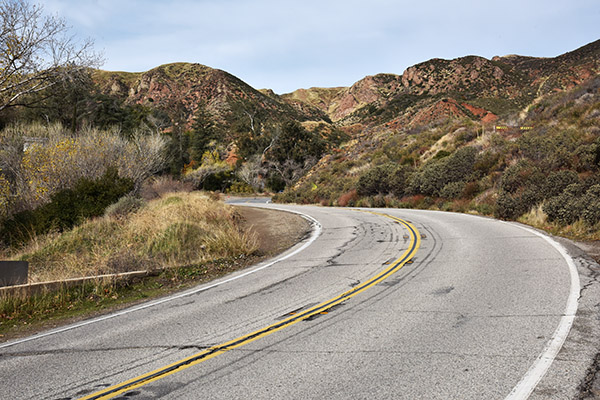
Susie and I were up in the Santa Clarita area last week and we thought we would attempt to find the St. Francis Dam site. A quick Google search brought us to a map, we took a right off I-5 at the 126, and we soon found ourselves on San Francisquito Canyon Road. Wow, after a bit of the burbs it grew rural real fast. I know great roads, and folks, this is one. San Francisquito Canyon Road is an awesome set of twisties, one I plan to return to soon on my motorcycle.
We were only traveled a few miles when we came upon a large art deco building (an LA Department of Water and Power plant). We had arrived.
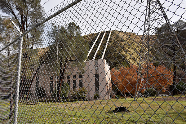
The DWP building was magnificent, and when we parked, we found this plaque:
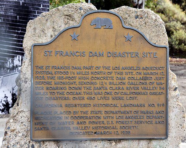
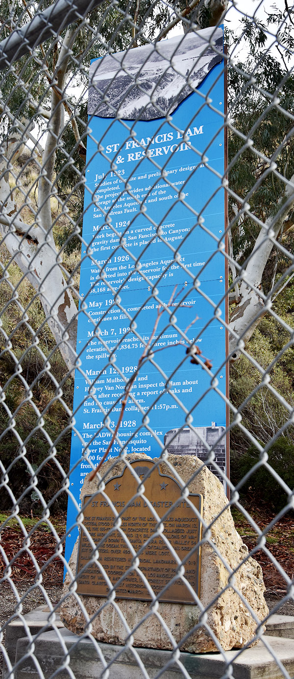
As the plaque said, we were a mile and a half from where the actual dam had stood, so we continued north on San Francisquito Canyon Road. The building (the one in the photo above) is a replacement…the original power plant was swept away when the dam collapsed. I would think so; when the dam collapsed it released a 10-story tall 12 1/2 billion gallons of water.
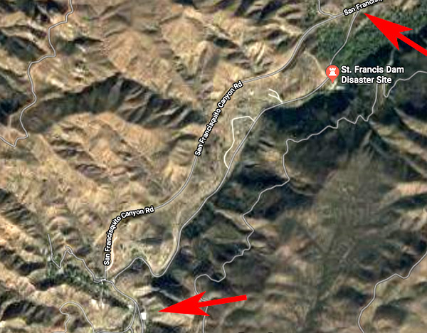
We didn’t see the actual dam; the Internet told us it was a 5-minute hike east of the road (you can’t drive to it), and according to what we read, there’s not much of the dam left. We drove north a little further and saw the dirt road leading to the site, but there was a gate and it was closed. Maybe next time.
I was very intrigued by San Francisquito Canyon Road, and I wanted to know where it went. I found this satellite photo map on Google:
From the map, I could see that continuing north on San Francisquito Canyon Road would brings us to Elizabeth Lake Road, and from there it’s Lake Hughes Road south to get back to Interstate 5 near Castaic. The little bit we did on San Francisquito Canyon Road showed it to be a great road. I had ridden Elizabeth Lake Road on previous motorcycle rides (without realizing how close I was to the St. Francis Dam disaster site). On the map, Lake Hughes Road appears to be even twistier than San Francisquito Canyon Road, and it looks like it would be a great ride.
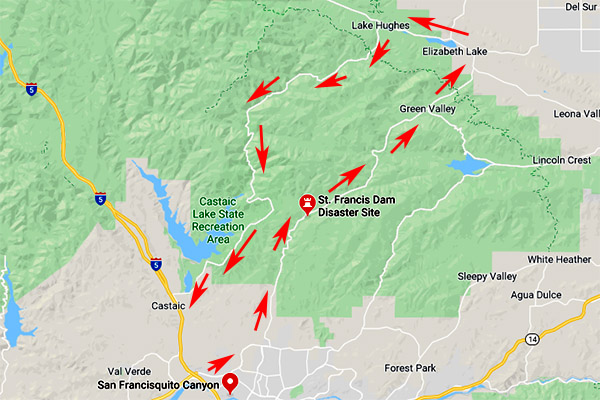
I’m going to return to this area on my motorcycle and do the ride you see above. It’s going to be great, and you’ll read about it right here.
Stay tuned!
How about doing the run the two Motor Officers did the night of the disaster? That would be interesting and a great read.
That kind of thinking is why you rose to the top in your profession, Mike. That is a superior idea.
Watch for falling rocks on Lake Hughes Road. Did that ride a few years ago. Had some base ball size rocks around some of the turns.
Will do, John. Thanks for the heads up.
Your planned ride sounds great. How about finishing it off with a trip to Jocko’s while your in that neck of the woods.
Jocko’s is about 200 miles north of there, maybe a little less. That would turn a day trip into an overnighter. Wait a minute…that’s not a bad idea…
Why is it that retired police officers have all the best ideas?
On Lake Hughes Rd stop for food at The Rock Inn. Good food and good people working there. A favorite of the South Coast BMW Riders Club every January.
I’ve been there and I agree, Bill. Thanks for posting.