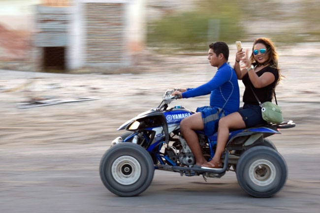
This is a nice leisurely run down to San Felipe on the Sea of Cortez, mostly staying off the freeways. It’s ideal for a smaller bike. I’ve done it many times, most recently on the CSC TT250 (a bike with a 229cc Honda CG clone engine) and it’s a laid back, fun ride. About half of it is through the lower portion of southern California, and the other half is through the upper portion of northern Baja, touching two oceans and taking in the best scenery of both areas. Here’s what the Baja portion of this ride looks like on a map…

The idea is to spend a day meandering through southern California to get to Tecate. My favorite route heads east on Rt. 66 through San Bernardino and beyond into Yucaipa, diverting north for just a bit through the mountains into beautiful Oak Glen, crossing I-10 (without getting on it) to the 243 up to Idyllwild, and then picking up 79 to head south through Julian and on to Tecate. This part of California is an amazing country ride, and it’s likely you’ll see bobcat, wild turkey, deer, and coyote. Good times, to be sure. There are two Tecates, actually…one on the US side of the border, and the far more interesting Tecate on the Mexico side.
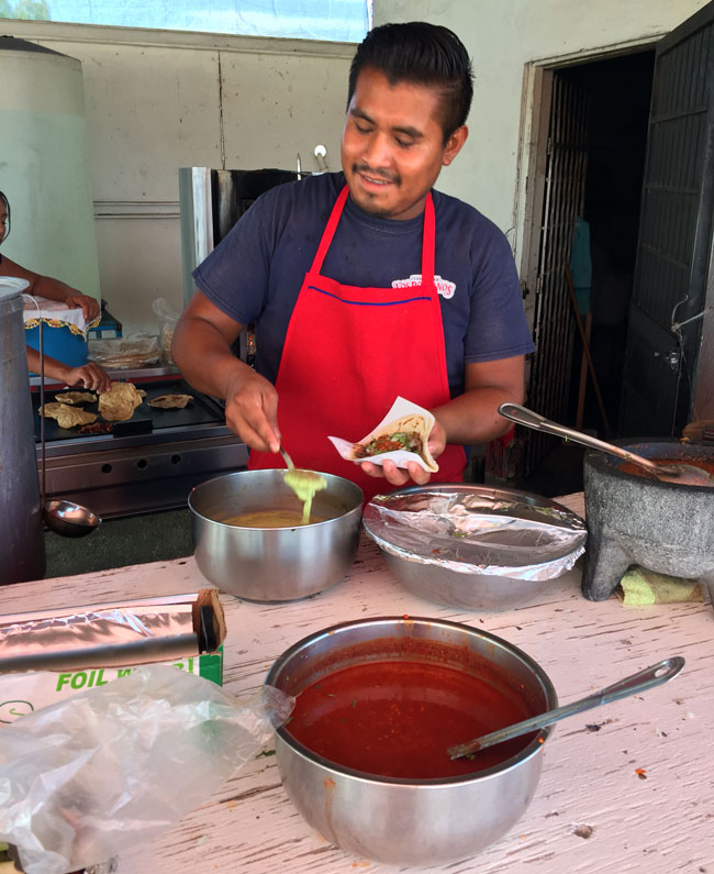
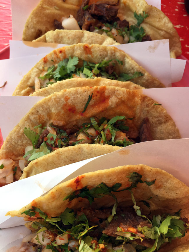
Tecate is a fun town. If you call ahead, you can arrange for a tour of the Tecate brewery. Tecate’s town square is cool, and if you stay at the El Dorado Hotel, it’s within walking distance. There’s a great Chinese restaurant across the street from the El Dorado, although you probably didn’t venture into Mexico to eat Chinese food. That’s no problem, as there are a couple of outstanding taco stands (also an easy walk from the El Dorado, and any of the Mexican restaurants on the town square are great. Trust me on this; I’ve tried them all.
On Day 2, pick up Mexico Highway 2 out of Tecate and head east toward Mexicali. The Rumarosa Grade is the best part of this road. The scenery is breathtaking and it’s a spot where you will want to stop for photos.

Highway 2 runs directly into Mexicali, but you don’t want to do that. Mexicali is a large industrial town (some might argue that Mexicali has its charms, but I’m not of them). Take the bypass that veers off to the right before you enter Mexicali (it’s well marked), and you’ll cut a quarter circle around Mexicali. The bypass will put you on Mexico Highway 5, which heads due south toward San Felipe (and that’s our destination for the second evening of this 4-day road trip).
Mexico Highway 5 is a cool road. For the first 15 miles or so south of Mexicali, it’s built up. I haven’t tried all of the taco stands along this stretch, but the ones I have visited have all been great, and the timing will be right for a lunch stop. As you continue south along 5, the surrounding land changes dramatically. You will enter a volcanic field that borders the northwest corner of the Sea of Cortez. The scenery is stark, with bleached white and beige desert accented by dark burgundy and black rock formations. You’ll smell the sulfur (this is a geologically active area, and it’s another great spot for dramatic photos).

You will soon see the Sea of Cortez as Highway 5 parallels the shoreline. Highway 3 cuts off on your right; but don’t take it (it’s the road we’ll travel the next morning). For now, continue south on 5 and you’ll run right into San Felipe.
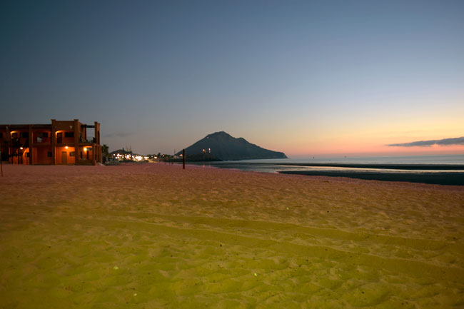
There’s a Pemex as you enter town, and I always like to top off there. Bear left to downtown, and you’ll enter the Malecon area. It’s a tourist area, but it’s nice. The Rice and Beans restaurant is the dominant eatery in this area, but any of the others are good (my favorite is Chuy’s). There are several hotels along this stretch; I like to stay at the El Cortez on the southern edge of town. The El Cortez has a fine restaurant, and they do a great job for both dinner and breakfast.
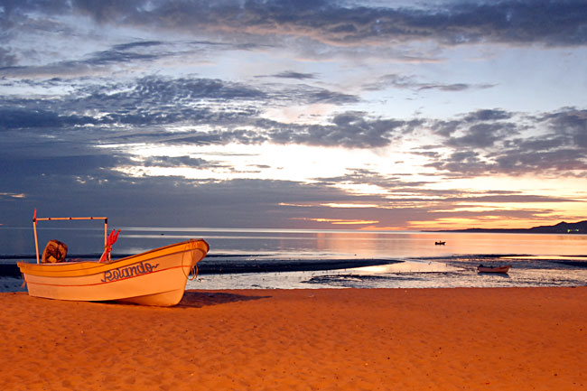
The photo ops in San Felipe are what make this a great destination. I like to grab evening shots, and then get up early the next morning for sunrise photos looking out across the Sea of Cortez. The tidal variation in the Sea of Cortez northern regions is extreme, and in the evening, you’ll see miles of exposed ocean floor. As you look out over the Sea of Cortez in the morning you’ll be facing due east, and the dawns are dramatic.

The next day brings us to Day 3 of this Baja adventure. After a great breakfast at the El Cortez restaurante, head north on Highway 5 again for maybe 20 miles, and then pick up Highway 3 east (the one we passed coming the prior afternoon heading down toward San Felipe). Highway 3 is another great road. It cuts through the coastal deserts and then climbs into northern Baja’s mountains. Watch for the rock art in this area. A favorite is a set of boulders painted to look like a whale skeleton, or maybe a giant lizard. It’s cool.
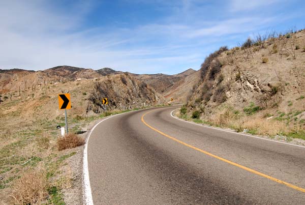

There’s a Pemex on Highway 3 in Valle Trinidad and it’s a good idea to top off here. Stay on Highway 3 and you’ll ride completely across the Baja peninsula. You’ll see the Pacific Ocean as you enter Ensenada on Baja’s west coast. It’s a gritty ride into town and you’ll get to see what a Mexican city looks like. Stay on Highway 3 and you’ll soon find yourself in the Zona Turistica. Highway 3 joins Mexico Highway 1 (the Transpeninsular Highway) for a few miles, and then it veers off to the right in El Sauzal. That’s on Ensenada’s northern edge (you’ll be headed northeast once you make the turn).
This is the Ruta del Vino, another great road. We’re headed back to Tecate for our third evening in Baja, and we’re passing through northern Baja’s wine country. This is an awesome stretch. Lunch has to be at Naranjo’s (it’s on the left as you head toward Tecate). There are many wineries through this magnificent stretch; my favorite is the L.A. Cetto vineyard. They have a great tasting room, but keep two things in mind: Don’t overdo it (remember, you’re on a motorcycle ride), and you can only bring one bottle back across the US border.
That night, the stay is in Tecate again, and you can try a different restaurant than the one you visited two nights ago. Like I said before, they’re all great. On the morning of Day 4, I always take my breakfast at the little restaurant right next to the El Dorado, and I’ll fill up again at the Pemex diagonally across the street. The lines at the garita (the border crossing) are usually hideously long, but hey, that’s not a problem for us. There’s a break in the concrete K-barriers just before the entry point, and nobody ever seems to mind when motorcycles use it to jump the line.
Day 4? It’s a rerun of Day 1 if you wish (and that’s what I always do, as the scenery is magnificent) or you can take any of several other options through So Cal as you head home.
Ah, that shot of the tacos makes me hungry. I can virtually smell them sitting here looking at the photo…