Firecrackers and Fall Colors

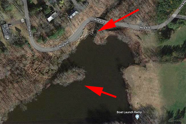
When I was a kid growing up in New Jersey (a very rural New Jersey in those days), it was a local challenge to take off your shoes and socks and walk across the dam at the Old Mill.  The Old Mill is one of those cool places that attracts kids (even old ones, like me).  Remote, interesting, a hint of times past, and plenty of ways to get in trouble.  There had been a water-powered mill there decades ago (a common approach to factory power in our early history); now, only the dam and the lake it formed remains.  We called the area the Old Mill.

The upper arrow points to the Old Mill dam. The lower arrow points to an island (the scene of the goose attack, as will be explained below).  The lake formed by the dam stretches upstream for a good distance.
The Old Mill dam. We used to wade across the top when we were kids. I wouldn’t attempt it today.

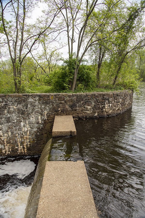
Those were fun times. The Old Mill was a little over a mile from my house and the big adventure when we were kids was to ride our Schwinns there (I wish I still had that bike). Walking across the top in your bare feet was the double dare. The water was about 4 inches deep as it rushed over the top, the dam was coated with algae, and it was slick. And 4 inches of rushing water carried a lot of power.  Taking that challenge marked you as a kid of substance (it was sort of a kid’s Combat Infantryman’s Badge).  Pauly, Zeb, Verny, my cousin Bobby, me…those were grand times, riding our bikes and pretending they were motorcycles, coasting down Riva Avenue to the Old Mill, and looking for new ways to get into trouble. My Schwinn had chrome fenders and I used to imagine it was a BSA 650 Lightning. Fun times. It’s hard to believe it was 60 years ago.

So, I need to go tangential for a second to give some context to this Old Mill story.  When we were kids, my Dad had one cardinal rule I probably heard the day I was born and at least weekly thereafter.   It was simple:  Never mess with firecrackers.  Dad lost two fingers when he was a kid fooling around with firecrackers cutting them up to pour the contents into a pipe to make a bigger firecracker.   You know the nutty things kids do.  If kids did that today they would be called terrorists.  In those days it was just kids doing what kids do.  But the results were not good…there was a spontaneous ignition and when it was over, my Dad had two fewer fingers.   Hence, the constant Dad drumbeat:   Don’t mess with firecrackers.

Well, you might guess where this story is going.  I couldn’t wait to mess with firecrackers.   My cousin Bobby was 6 years younger than me back then (he still is) and we were thick as thieves when we were kids.  One day Bobby, my friend Verny, and I rode our bikes to the Old Mill.  Verny had a bunch of firecrackers in his saddlebag.  Wow.  The forbidden fruit.  He even bought matches.  Boy oh boy, we were having fun…lighting the things and throwing them out over the water.   Bam!  Bang!  Pow!  It was like being in a Batman TV show.  Awesome fun.  I was playing with firecrackers.  It was better than running with scissors.

Boys will be boys, and Bobby was the youngest.  It wasn’t too long before Verny and I were lighting the things and throwing them at Bobby.  We were all laughing and having a good time.  Even Bobby.  He thought it was fun, too.  Right up until the time one of the firecrackers landed in his collar behind his neck.  To this day, I can still see it in slow motion…the little inch-and-a-half Black Cat tumbling through the air, its fuse sparkling, and then lodging in Bobby’s collar.  And then…BOOM!

All laughter stopped at that point.  Bobby froze, not making a sound after the detonation.  The firecracker literally blew all the hair off the back of his head, which suddenly looked like an orangutan’s butt…bright red and bald.  Bobby came through it okay.  Me, not so much. I knew what would happen when my Dad saw this. It was a death sentence.  Verny knew, too.  Everybody knew about my Dad and firecrackers.  Wow, were we ever in trouble.

Being Jersey boys, we came up with a plan.   Maybe if we gave Bobby a haircut, it wouldn’t look so bad.  Yeah, that’s the ticket.   A quick trim and no one would notice.   Ah, if only stupidity were money…I’d be the richest man in the world.  We rode our bikes over to Verny’s house, found a couple of scissors, and went to work.   After a few minutes, we realized what a sorry state we were in.  Instead of just looking like a kid who had all the hair blown off the back of his head, Bobby now looked like…well, a kid who had all the hair blown off the back of his head and a really bad haircut.  We were cooked.

All three of us rode to Bobby’s house, where my Uncle Herman (my Dad’s brother) took everything in with a single look.  Herman had been there when Dad lost his fingers (which, when I think about it, would have been about 90 years ago now).  Uncle Herman knew what the outcome would be if my father ever found out what we had done…I wouldn’t have made it to adulthood, and you wouldn’t be reading this blog.  So he did me a whale of a favor…he and Bobby stayed away from our house until Bobby’s hair grew back.  Uncle Herman, you’ve been gone for more than half a century now, but trust me on this…I’m still grateful!

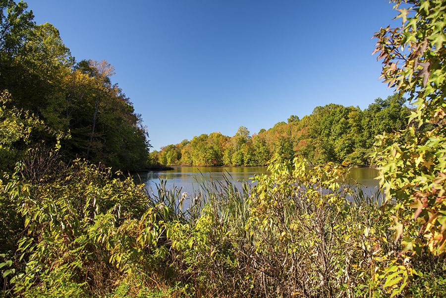
Susie and I were in New Jersey a couple of weeks ago and we did what we always do when we’re back there:  We visited the Old Mill.  The leaves were turning colors and it was spectacular.  Visiting the place always brings back memories…especially the ones above.

The Old Mill lake, as recently captured by my Nikon.

The Old Mill was built by the Davidson family (a nearby road is called Davidson’s Mill Road).  I have no idea what they milled and I couldn’t find anything about it on the Internet.  There was a another mill a few miles downstream that processed snuff (a major industry in this area a hundred years ago), so maybe it was a snuff.  Whatever.  The mill is long gone, but the dam remains and the area is a county park today.

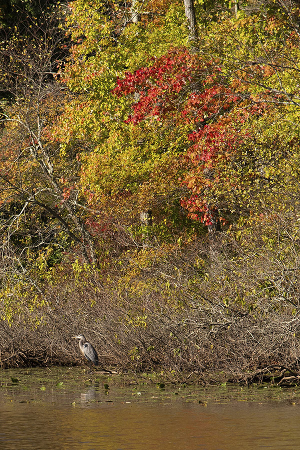
As I was snapping photos, I noticed a blue-gray speck in front of the little island near the dam (there’s an Uncle Herman story about that island, too, and I’ll get to it in a second).  I zoomed in, and it was a blue heron.  I’d seen them here before.  I wished I could have gotten closer, but my 120mm lens and Nikon’s vibration reduction technology did the trick for me.

A blue heron looking for lunch at the Old Mill.

Once when I was a kid, I rowed my little aluminum boat here all the way from my house.  The creek behind my place (Lawrence Brook) flowed to the Old Mill and beyond.   Uncle Herman, Bobby, my cousin Marsha, and I were having a good time as I rowed toward that island when we suddenly heard a god-awful hissing.  A goose was flying straight at us, low over the water, with what appeared to be a 10-foot wingspan (it probably wasn’t that big, but the overall effect was one of sheer terror and if that goose was trying to intimidate us, it succeeded).   The goose had a nest on that island, and we were where the goose didn’t want us.

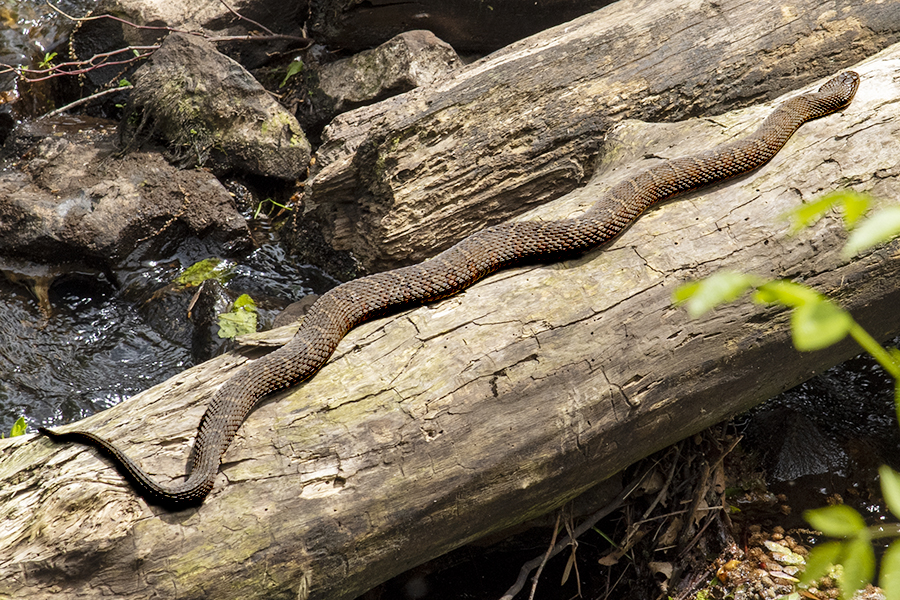
When I visited the Old Mill earlier this year, the water snakes were out in full force and I photographed a large one below the dam.  You can read more about that in the blog I did a few months ago.  There are a lot of cool critters in these waters, including frogs, several species of turtles, pickerel, sunfish, and snakes.  Good times for kids.  It was a good place to grow up.

A very large water snake sunning itself in New Jersey.

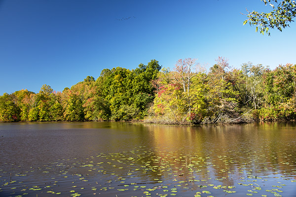
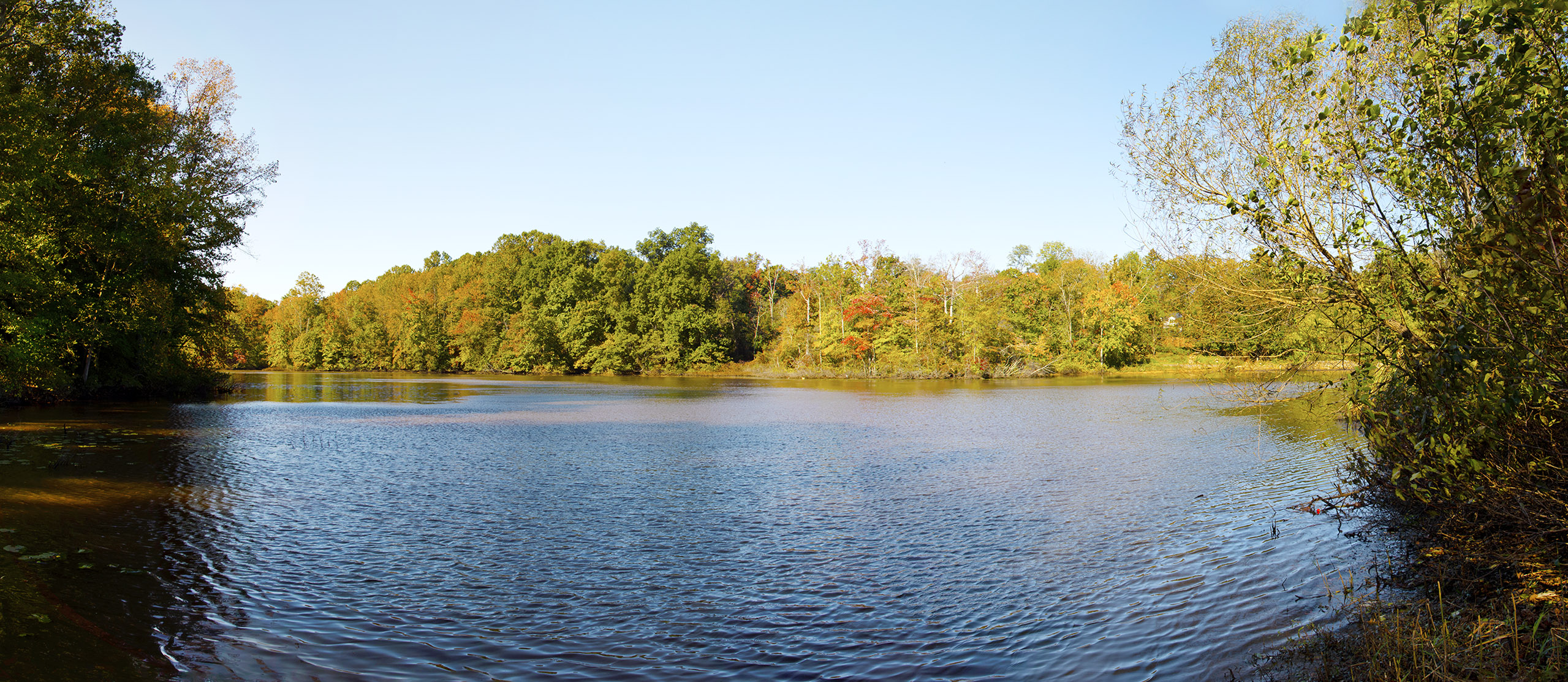
On this most recent visit, we were in New Jersey just as the leaves were turning colors.    This last photo is one I stitched together in PhotoShop.  A click will enlarge it, and then click on it again to see it full size.


Subscribe here for free!

The 2021 Rubber Chicken Ride

If you had asked me a week ago what the Rubber Chicken Ride is about I would have replied, “I have no clue, Bubba.” Held annually in Truth or Consequences, New Mexico the 2021 Rubber Chicken Ride resisted any defining characteristics and after three days participating I still have no clue what it was about.

There’s an entry fee, $50, that goes to the New Mexico Off Highway Vehicle Association, (NMOHVA). I guess it’s a like a fundraiser except a motorcycle ride breaks out while passing the collection plate.

I met up with the near legendary dirt-riding group, The Carrizozo Mud Chuckers at the Truth or Consequences Travel Lodge motel. The Travel Lodge is one of the few remaining old school types where the room doors open out directly onto the parking lot. I like this layout as you can hang out as a group tinkering with the bikes. It fosters community spirit and you can lock your bike to the uprights supporting the overhang. At the motel we met six other Rubber Chicken Riders none of who had any idea what was going on and all pushing 70 years old. That’s like 3 years older than the Chuckers.

This year’s Chicken was stripped to the bare bones due to Covid. No group dinners, no Show Us Your Scars competition, no organizing at all: just show up and ride. Part of the confusion was due to my not bothering to download the GPX files from the Rubber Chicken thread on ADVrider, which I knew nothing about until I was at the event. I probably couldn’t have figured out how to migrate the files to my GPS anyway. It annoys me that those old codgers can download files into their displays and I’m still using paper maps. I think of my GPS is kind of a last resort deal; I use it when I’m not sure how to get home.

That first day we tried to find the Rubber Chicken sign up area at Healing Waters Plaza, a place no one in Truth or Consequences seems to have heard of. Everyone we asked sent us to a different Healing Waters but they were hot springs, not the sign up staging area. The town was named Hot Springs in the past and has quite a few still around. Luckily, my Garmin knew about the palm-lined plaza and after riding past it several times we were able to find the pocket park along with a couple other Rubber Chicken Riders. Oddly, there was no water in sight.

The other riders we met at Healing Waters were as clueless as we were so we sat around and talked bikes for a while then the Chuckers and I decided to ride out to nearby Elephant Butte Dam to check out the scenery. After the dam tour we hit up the local Denny’s. You know how they say landing and take off are the most dangerous parts of flying, that’s how it is for me getting on or off the tall Husky 510. The Husky’s kickstand is so designed that once you’re on the bike you can’t tip it over far enough to retract the stand. This means I have to get on or off the bike with the kickstand up. Not a problem on a normal motorcycle, with the Husky it takes Baryshnikov-level flexibility to toss a leg over the high seat and rear luggage stores. I’m no Baryshnikov.

I got half way off the bike but my boot hung for a life-altering moment, still on one leg the bike started to topple over the far side. I pulled the bike back towards me but pulled a little too much. With my stubby, grounded-leg near the centerline of the wheel track the bike toppled over onto the near side taking me out in the process. In the Denny’s parking lot. In front of everyone.

Back at the Travel Lodge we grilled the other riders.  They resisted at first but stopped struggling as soon as they were evenly browned on both sides. The way it was supposed to work is you download route files and load them in your GPS before arriving, then at the plaza meet up with like-minded riders and off you go, a merry band of riders. It’s a great way to meet new riding buddies. There’s no NMOHVA sanctioned rides. This is the loosest possible group ride you can imagine. One of the riders had an old, Rubber Chicken event T-shirt. In a testimony to how damaged things have become since Covid all we got this year was a tiny NMOHVA sticker with a rubber chicken on it.

The second day there was a sign up table at the Healing Waters Plaza. Maybe 15 riders had gathered and we had a good gabfest with the boys and one girl. By now we pretty much had the event figured out so the Chuckers and I headed out to Chloride, an occupied-ghost town for one of the routes: the Chloride canyon loop. We didn’t have GPX files but the Chuckers had paper maps.

At the end of the road in Chloride the road turns hard left and becomes unpaved. It’s sort of rough and rocky being a dry streambed at the bottom of a steep canyon. After about a mile of this abuse we stopped to reassess our riding skills and time left in the day. For a route that 6 guys on dirt bikes had done just a day before there were no tire tracks except the ones we were making. I dreaded turning on the Garmin because I’ve never read the owner’s manual, it always leads to a bunch of button pushing and frustration instead of riding. The Garmin said the road went for 5.6 more miles then dead-ended.

We started doubting our direction. Maybe we are on the wrong route, those 70 year-old guys couldn’t have gone this way. None of us liked the idea of riding this rocky trail 5 miles and then turning around and riding it back. We chose an alternate route. Seeing as there were no official routes anyway we felt we could take liberties with the Rubber Chicken.

Our alternate route was a long, 60-mile stretch of fairly easy dirt bookended between 80 miles of pavement on either side. The route seemed to go on forever. We went over the continental divide twice, once on paved Highway 59, once on Dirt Road 150. The later it got the faster we went. Highway 152 was a marvelous twisty road that we could use as much of the side-tread of our knobbies as we dared. We arrived back at the Travel Lodge at 7 pm; 9 hours of riding over widely varying terrain made for excellent sleeping.

On the third day of the Rubber Chicken Ride, a Sunday, the other riders at the Travel Lodge had loaded up their bikes and gone home. The Mud Chuckers and I decided to leave the Rio Grande Valley and work our way one valley east to Tularosa Valley, our home turf. In retrospect, we didn’t get much for our $50 but it got us away from our usual dirt-riding spots and it supported the NMOHVA so it was money well spent. While I was telling this story to my wife, CT, it must have sounded like I was complaining. Maybe I did bitch a little. She said that volunteer organizations always need help and that maybe next year we should print a few maps, plan a Rubber Chicken route and set up a ride instead of waiting for others to do the hard work for us. That sounded an awful lot like a gauntlet being thrown down to me.


Subscribe to ExNotes!

InnBuffalo and Niagara Falls

Niagara Falls, New York:  It’s been a bucket list destination all my life and I’d never made it there (until last week, that is).  Susie and I flew back east, picked up my sister Eileen, and headed west again.  Niagara Falls is the largest waterfall in the United States, with more than 6 million cubic feet of water going over the edge every minute.  But I’ll get to Niagara Falls in a minute.  First, I’d like to tell you about the B&B in nearby Buffalo.  The InnBuffalo is where we stayed and we thoroughly enjoyed it.

The InnBuffalo off Elmwood.

Originally built in 1898 by Herbert Hewitt (a wealthy industrialist), the InnBuffalo is impressive.  Good buddy Joe Lettieri and his wife Ellen bought the place a few years ago and converted it to a B&B.  Joe and Ellen kept things as original as possible, with awesome original interior decor and a comfort level that is off the charts.  Take a look at these photos:

The InnBuffalo’s front porch. We sat here every night and enjoyed hot tea.
The library on the first floor.
The music room in the InnBuffalo.
The first floor hallway. The InnBuffalo has several fireplaces.
Looking out at the front porch from the parlor.
Stained glass windows in the stairwell.

Niagara Falls is a short 17 miles from the InnBuffalo.   As we approached the area, my sister pointed out the rising mist in the distance.  She correctly identified it as coming from the Falls, but I thought it was just steam escaping from a factory.   Nope, my sister had it right.  The mist is visible for quite a distance.  It was a hint of what was ahead.

You can view the Falls from either the New York or the Canadian side.  Folks say the view is more spectacular from Canada, but with the Covid restrictions in place we didn’t want to screw around with medical tests and crossing an international border.  Our visit was on the US side and it was great.

Niagara Falls. That’s Canada on the right.

We took the Maid of the Mist boat tour to the bottom of the falls, and with 6 million gallons per minute cascading down (the highest flow rate of any falls in North America), we experienced the obligatory soaking.  Even the tour boats are interesting…they are electric and fully recharge in 7 minutes between each tour.  If you make it up here, the boat tour is something you ought to do.

We were on one of tour boats and it was a cool experience.
The Maid of the Mist. All electric, all the time.

The Niagara Falls State Park area is interesting, too.  There’s no admission fee, although there is a fee for the boat tour to the bottom of the Falls.  Within the Park, you can get very close to the Niagara River water rushing by (you can see how close in the big photo at the top of this blog).  That part was a little unnerving, you know, seeing all that energy rushing by.  You wouldn’t want to fall in…it’s not likely you could get out before going over.

Di Camilla’s Bakery is a good spot to stop for lunch (my sister knew about it and she was right…it’s wonderful).  Di Camilla’s is located in the town of Niagara Falls just a couple of minutes from the Falls.  Try the broccoli pizza (it was exquisite).

Even though we visited in mid-October, the weather was comfortably in the mid-70s.  Joe Lettieri explained that temperatures are milder in the Buffalo area than they are further south, which suprised me.  I wouldn’t plan a motorcycle ride through the region in the winter, but Buffalo wasn’t the icebox I anticipated.

The roads in and around upstate New York are impressive.  There are several roads in the Buffalo and Niagara Falls areas worthy of exploration.  On the Canadian side, there’s the Niagara Parkway (also known as River Road), which parallels the Niagara River both before and after the Falls.  On the US side, there’s the West River Parkway.  And then there’s upstate New York and its plentiful two lane roads.  You could take the interstates into Buffalo and then Niagara Falls, but you’d be missing the best parts of New York and the northeastern United States.  Folks think of New York as New York City and its massive traffic.   Get out of the city, though, and New York is amazingly bucolic, rustic, and all the other favorable adjectives that apply to this area.  The great challenge is arriving late enough in the year to take in the changing autumn leaves and their reds, oranges, yellows, and browns, but not so late that you run into winter snow and ice.

One more thing…while you’re in Buffalo, don’t make fun of the Buffalo Bills.  I told an old joke about how the Bills got their name (“Boy I like to lose”) and I somehow managed to escape with all my teeth.  But it was close.  These folks take their football seriously.


More reviews on interesting parks?  They are right here!

Badlands National Park

Located in southwestern South Dakota, Badlands National Park is one of life’s bucket list destinations.   We visited it in 2008 when we were doing South Dakota’s Black Hills and, by accident, the Sturgis Rally.  I’m not big on Sturgis, but we were in the area to see Mt. Rushmore and we caught the tail end of the rally.  Okay, Sturgis: Check.  If anybody asks, I can say I’ve been.  But there are far more interesting things to see and do in this part of the world, and Badlands National Park is one of them.

Yours truly and Mrs. Yours Truly in Badlands National Park.  We were Triumph people in those days, as you probably can tell.

Badlands National Park is about 100 miles east of Sturgis, and it’s one of a half dozen cool things to see if you ever make Sturgis.  There’s Rapid City (a cool town with one of the best gun stores I’ve ever visited), Custer State Park (magnificent roads and scenery), Mt. Rushmore (amazing; words can’t do it justice), Devils Tower 100 miles to the west in Wyoming (think Close Encounters), Badlands (today’s topic), and the Minuteman Missile National Historic Site (I’ll touch on that, too).  South Dakota is a great place to visit.

So, back to Badlands.  This place is magic, but that’s not just my opinion.  It’s a view I share with my hero Theodore (as in Theodore Roosevelt).  Roosevelt came here in 1883 to hunt buffalo (we call them buffalo; the correct term is bison), and then again to remake himself when dealt a double whammy a year or two later (his wife and mother died on the same day).   He came as a dandy (a skinny, Harvard-educated, New York politician) and left as a rancher, a true Westerner, a future Rough Rider and President of the United States.

50 bison were transferred to Badlands National Park from Theodore Roosevelt National Park in 1963; today, the Badlands bison population is north of 1,000 animals.

To call the Badlands terrain dramatic is a massive understatement; you really need to stand before the landscape and take in the erosion-formed pinnacles and colors to get the full effect.

Badlands National Park in one word: Wow!
Stunning panoramas are the norm in Badlands National Park.

Highway 240, the Badlands Loop, through Badlands National Park.

The region’s history is a story of persistence, paleontology, politics, and (from a Native American perspective), duplicity.  Paleo-Indians hunted the area 11,000 years ago, followed by the Arikara people, and then the Great Sioux Nation. The Oglala Lakota (one of seven Sioux tribes) named the area “mako sica” (it translates to “bad lands”).  Homesteading by white settlers began in the 1850s, continued during the Civil War, and then picked up dramatically before and after the turn of the century. In an 1868 treaty, the US government promised the Sioux the area would be theirs forever, but you can guess how that went (we broke the treaty a short 21 years later).  Calvin Coolidge designated the area Badlands National Monument in 1929, it was formally established as such in 1939 by Franklin Roosevelt, and then redesignated a National Park in 1978.

The Lakota Native American people were the first to find fossils in the area and they correctly ascertained the area was formerly an ancient sea.  The Badlands are one of the richest fossil fields in the world with specimens reaching 33 million years into the past (there are 84 known extinct species; 77 of them are from this area).  Here’s another tidbit worth knowing if you plan a visit to the region: The South Dakota School of Mines in nearby Rapid City has an outstanding museum displaying some of these prehistoric finds.

A School of Mines dinosaur in Rapid City.
A fossil on display in South Dakota’s School of Mines.

Like much of South Dakota, the Badlands are rich with bison, badger, bighorn sheep, bird species galore, prairie dogs, bobcat, coyote, fox, elk, mule deer, white-tailed deer, pronghorn, rattlesnake, and porcupine. We saw many, including a princely, portly porcupine proudly padding along as if he owned the place (in retrospect, I suppose he did).

There’s all kinds of critters out there. We didn’t see any snakes, but we probably walked right by a few.

Parts of Dances with Wolves and Thunderheart were filmed here.

Here’s another cool little secret about the area:  The Minuteman Missile National Historic Site is positioned right at the northeast edge of the Park.  The U.S. Government took a former operational intercontinental nuclear missile site and turned it into a national historic site.   You can’t just show up and get in, though.  You have to make reservations and they only take a few people at a time, but wow, is it ever cool.  You go down to the control module, which is this tiny, thick wall, metal, electronics-crammed structure way underground.  The command capsule is mounted on giant springs, you know, to protect the occupants from an incoming bad guy nuclear intercontinental missile.  After you’ve seen that, the park rangers (all former USAF senior NCOs who actually served on Minuteman sites) take you outside to peer into a silo and view a Minuteman missile (presumably, one that’s been disarmed).  It’s shades of the Cold War, Dr. Strangelove, and Mutually Assured Destruction all rolled into a tourist attaction.   Trust me on this:  It’s cool and unless you stood guard against Ivan during the Cold War, it’s unlike anything you’ve ever seen.

A Park Ranger and former USAF ICBM NCO at the Minuteman National Historic Site. This is cool, folks.
A thermonuclear threat…the real deal. Peering down into the silo was a bit unnerving. What is really unnerving is that there are similar missiles on the other side of the world still pointed at us.
My artsy-fartsy Dr. Doomsday photo.

So there you have it…Badlands National Park, the Minuteman National Historic Site, and more.  South Dakota is one of my all time favorite places to visit.  If you are headed that way, don’t just wallow in the weirdness that is Sturgis.  There’s much more to see and do in South Dakota, and these two spots should be high on anyone’s list.


I took these photos back in 2008 with my Nikon D200 camera and a first-generation Nikon 24-120 lens.  As I view them today, they are not up to the richness and quality I would get from my current D810 Nikon and its VR 24-120 lens.  I may have to return to get better photos.


More National Park stories?   They’re right here!


Never miss an ExNotes story!

Phavorite Photos: Wenchuan Man

It was the fourth or fifth day Joe and I had been on the road in China, and we were headed up to the Tibetan Plateau.  I think I can safely say that Gresh and I were the only two Americans in Wenchuan that day based on the fact that we were taken to the city’s police department to fill out forms and let them know we were there (it was the only place in China we had to do that).

Wenchuan is a lively town, and the next morning we were enjoying what had already become a routine breakfast of hardboiled eggs and Chinese fry bread on the sidewalk when a bus stopped in front of us.  The fellow you see above stepped off and looked at us quizzically (we didn’t quite look like Wenchuanians).  I asked if I could take a photo by holding up my Nikon.  He nodded his head, I shot the photo you see above, and he was gone.  The entire encounter lasted maybe two seconds, but that photo is one of my China ride favorites.  His expression could be used in a book on body language.


Three earlier favorite photos, one in Bangkok, one in Death Valley, and one in Guangzhou.  Click on them to get to their story.

Good Morning, Vietnam!

It was one of those crazy motorcycle adventure moments when a chance encounter leads to a lasting friendship.  I was leading a group of maybe 10 guys on CSC RX3 motorcycles in Baja and we stopped to buy bottled gas from the capitalists along the Transpeninsular Highway in Cataviña.  It was a crowded scene with two or three Bajaenos pouring gas from plastic water jugs into our motorcycles with bikes and bodies tightly crowded around.  That’s when I noticed a tailpack on one of the bikes that looked different from the rest of our RX3s, and suddenly the difference hit me: It was bigger than the others and it had jump wings on the back.

Jump wings?  That’s odd, I thought.  I didn’t think any of the guys I was riding with was a fellow former paratrooper.  That’s when I met Mike Huber.  He hadn’t been riding with us; he just happened to get mixed into our group at the Catavina fuel stop.

Mike is a cool guy with a cool lifestyle.  Most recently, that included a moto trip across Vietnam with his girlfriend, Bobbie.  Mike published a story in ADVMoto, a magazine that has previouly published work by yours truly and Joe Gresh. Mike’s Vietnam adventure is here.   I enjoyed reading it and I think you will, too.


One of these days, I keep thinking to myself.  Vietnam must be one hell of a motorcycle destination.  Good buddies Buffalo and his cousin Tim also rode Vietnam, and you can read that story here.   It’s weird…I met both of those guys on a CSC Baja ride, too!


The best bikes for Baja?  It’s all right here!


Riding Baja?  Make sure you insure with BajaBound, our preferred insurance company!


Never miss an ExNotes adventure…sign up here for free!

Devils Tower: Close Encounters of the Motorcycle Kind

Most of us have seen the 1977 movie, Close Encounters of the Third Kind.  It’s what we think of when we see Devils Tower (which I’ll get to in just a bit).  Before I do, consider this question:  Are there close encounters of the first, second, fourth, and fifth kind?   The short answer is:  Yes.

The concept of classifying suspected alien encounters came from a guy named Allen Hynek.  Hynek defined the first three categories, and then two more were added.  Here at ExhaustNotes, we try to formulate the questions you might have before you even know you have them, so we did.   Here’s the answer to what has been keeping you up at night.

    • Close Encounters of the First Kind: These are viewings of unidentified flying objects less than 500 feet away.  They are relatively rare, like seeing a GS 1200 actually in the dirt.
    • Close Encounters of the Second Kind: These involve unidentified flying objects with some sort of associated physical effect, like interference with your vehicle’s ignition or radio, animals reacting to a sensed alien presence, or an alien craft leaving impressions on the ground. They are things for which there simply is no earthly explanation.  I think $1500 freight and setup charges on new motorcycles fall into this category.
    • Close Encounters of the Third Kind: This is the one we all know about. It’s when you climb to the top of Devil’s Tower for an alien rock concert and laser show. Seriously, though, the people who write these descriptions say a close encounter of the third kind involves things like seeing a living being inside an unidentified flying object. In the motorcycling world, I guess it would be like waving at a Starbuck’s-bound GS rider and having him return the wave.
    • Close Encounters of the Fourth Kind: This is when the aliens abduct you.  I imagine it would be a lot like a free weekend at a posh resort, but you have to listen to the time-share pitch.
    • Close Encounters of the Fifth Kind: These involve direct communications between humans and aliens. These actually happen to me a lot, and they usually start with unsolicited cell phone calls for solar power, paying off student loans, extending car warranties, or contributing to a Hillary Clinton campaign. These people have to be from outer space.  No Earthling would ever expect me to go for any of the above.

So there you have it.  On to the topic of this blog, and that’s Devils Tower, Wyoming.  It’s awesome, and if you haven’t made the trek it needs to be on your list.

I first visited Devils Tower when we toured South Dakota’s Black Hills and Mount Rushmore in nearby South Dakota.  Devils Tower was a short 90 miles to the west, I’d seen the movie, and I had to see the place in person.  It was worth the trip.  Instantly recognizable, the dark tower climbs 867 feet above its surroundings.  Eerie is not too strong an adjective.  The thing just looks other-worldly, and attributing the divine, the supernatural, or an extraterrestrial vibe to Devils Tower is a natural reaction.  No fewer than six Native American peoples, Steven Spielberg, and U.S. President Theodore Roosevelt have done exactly that.  I get it, and when you see Devils Tower in person, you will, too.

I also visited Devils Tower when we rode the RX3s through western America with a crew from China and Colombia (that’s what the video above is from).  It’s in a good part of the country…Mt. Rushmore, the Black Hills, the Badlands, and more are in this area and the riding is awesome.  If you ever do Sturgis, Devils Tower needs to be one of your stops, but it’s best to see this part of the world when the Sturgis Rally is not underway (there is such a thing as too many motorcycles, and the tattoos, open pipes, and body odor that goes with Sturgis gets old quickly).

One of the things that makes Devils Tower so dramatic is its distinctiveness; it just doesn’t look like it should be there.  Even the experts can’t agree on how it came to be. The rock docs agree that it was formed by magma (molten rock) forcing itself up between other rocks; what they argue about is how this occurred. One camp holds that the formation was pushed upward by molten rock below, another that Devils Tower once was a larger structure worn down by erosion, and yet another feels the tower is the throat of an ancient volcano.  To get geologic for a moment, it is a laccolithic butte (a wonderful term that could be applied to a few people I know) comprised of phonolite porphyry (dark-colored rock).  Devils Tower is comprised of sharply-defined trapezoidal columns with four, five and sometimes seven sides. They look like they were machined, and in a sense, I guess they were.

The Lakota, Cheyenne, Crow, Arapaho, Shoshone and Kiowa Native Americans all treat Devils Tower and its surrounding regions as sacred ground.  Theodore Roosevelt designated it the first U.S. national monument in 1906.  Native American names for the monolith include mato tipila (bear lodge), the bear’s tipi, the bear’s home, the tree rock, and the great gray horn.  An 1875 U.S. Army expedition misinterpreted one of the Native American names as Bad Gods Tower, and that became Devils Tower.

The Tower is visible from great distances — there’s no missing it or mistaking it for anything else — and the ride in provides varying perspectives.  Once inside the National Park, you can walk to the base, you can take a hike around Devils Tower, or you can climb to the top.  I’ve been there several times, and I think it’s one of our great destinations.


More Destinations are here.


Don’t miss anything.  Sign up here for free!

The Columbia River Gorge

I’ve visited a few places in my time and I have a few favorites.  The Columbia River Gorge is at the top of the list.   Sue and I flew to Portland a few years ago for a quick 48-hour circumnavigation of the Columbia River Gorge.  I wish I could tell you we rode a motorcycle, but it was four wheels this time.  I have motorcycled through the Columbia River Gorge several times so I guess I’ve got my bona fides if I needed to prove something.  But I don’t and there are times when a  car is my preferred mode of travel.  You know, if it gets cold, you turn on the heater.  If it gets hot, you turn on the AC.  If it rains, you hit the windshield wipers.  Yeah, I know, I’m not being manly.  It is what it is, my brothers.

So anyway, we grabbed a Hyundai Veloster at the Portland rental lot.  It appealed to us, it promised to sip fuel gingerly (a promise it met), and it was comfortable for our weekend getaway.

The smart (and scenic) money on the Columbia’s Oregon side is Highway 30 (also known as the Oregon Scenic Byway), an historic (read:  two-lane, non-freeway) route that parallels the Columbia River. Twisty and green with stunning views of the falls and more quiet, and offering lots of things to stop and photograph…it’s a road that checks all the boxes.  There’s Multnomah Falls, the Vista House, moss-covered concrete guardrails, and much more.

Continuing east along Highway 30, still south of the Columbia River, is a ticket into a flower-covered stretch of scenery through the Rowena Crest area.  Rowena Crest kind of sounds like a suburban housing tract, but it is anything but.  This is good country up here in the Pacific Northwest.

This is a premier wildflower area, and they were out in force during our visit.

Here’s a shot a shot of the Columbia River in the Rowena Crest area.

We crossed the Columbia River (after riding east for most of that morning) at Biggs.  Once we were in Washington, we turned left on Highway 14, the road in Washington that parallels the Columbia on the Washington side.  It’s another two-lane road, although it’s busier than Highway 30 on the Oregon side.

Traveling west on 14, we were pointed directly at Mt. Hood (a snow-covered inactive volcano in Oregon).

The views and the roads are impressive on both sides of the Columbia River.

After driving for a while on the Washingon side, we came to the Bridge of the Gods.  It was our ticket back into Oregon.  I first rode across this bridge after riding the 2005 Three Flags Classic Rally.  Good buddy Marty and I had been up to Canada and we were returning to southern California through Washington and Oregon.  I love everything about the Bridge, not the least of which is the road surface.  It’s grated iron, and if you look down while riding a motorcycle, it’s as if you’re flying.  You can’t see the road surface at all…all you see is the Columbia River water way below.  It’s really cool.

Here’s the view from the Washington side.

Here’s what it looks like as you drive across.

And one more photo, this time from the Oregon side…

During our weekend in the Columbia River area, we stayed in Hood River, a nice little town on the Oregon side.   Our hotel was on the river, near a favored spot for kiteboarding and standup paddling.

A circumnavigation of the Columbia River Gorge, using the Bridge of the Gods and the bridge at Biggs at the western and eastern anchor points, makes for an ideal two-day adventure ride.  Hood River is the place to stay.


Hey, want to get notified when we post a new blog?  Sign up here:


Take a look at the Motorcycle Classics story on the Columbia River Gorge, and more of our published works are here.

Phavorite Photos: Orlando and Velma

We started this Phavorite Photo series a short while ago at Python Pete’s suggestion, and while going through a few of my favorites recently the photo you see above popped out.  That’s my good buddies Orlando and Velma on their CSC RX3 headed up to Dante’s View, a natural overook that provides what has to be the best view of Death Valley (the view is shown in the photo below).  We were on the Destinations Deal tour, and Orlando and Velma bought their RX3 motorcycle specifically to go with us on this ride.  The Destinations Deal was a grand ride, and Orlando and Velma are great traveling companions.

I grabbed that photo of Orlando and Velma with my little Nikon D3300, its kit 18-55mm lens, and a polarizer. The D3300 was a superb traveling SLR.  The photo needed a little tweaking in PhotoShop to bring it up (they almost all always do).  A bit of cropping, a correction in levels, another correction in curves, eliminating an unsightly sign that was in the background, and just a little bit of vibrance and saturation enhancement.  Here’s what the original looked like:

I was particularly impressed with Orlando’s RX3 motorcycle. This was the second time I led a CSC tour with folks riding two up on an RX3. Orlando had no difficulty hanging with the rest of us (we were all riding solo), and surprisingly, his bike returned the same fuel economy.  There’s a lot to be said for small bikes.  I’ve said some of it before.

I have more than a few favorite photos.  You’ll see more here on the ExhaustNotes blog.


Something we’ll do in each one of these Phavorite Photos blogs is show our prior favorites.  Just click on the photo to get to each earlier blog.  There’s only one so far; there will be more.


Never miss an ExNotes blog….sign up here for free:

Favorite Baja Hotels: Guerrero Negro’s Don Gus

That photo above could also be in our Phavorite Photos series.  It’s the motorcycles on one of our Baja rides (all CSC RX3s) parked outside our rooms at the Don Gus Hotel in Guerrero Negro.  That photo has always been one of my favorites.

Not fancy, not expensive, and comfortable:  That’s how I would describe the Don Gus Hotel in Guerrero Negro (incidentally, that’s also a pretty good good description of the RX3).  The Don Gus is on the main drag on the left as you come into town, and it’s nearly directly across the street from the more well-known Malarimmo’s.   The Don Gus has a nice bar and the food is great.

Malarimmo’s usually fills up quickly when the California gray whales are in nearby Scammon’s Lagoon (that would be from January through March).  There are at least a half-dozen hotels in Guerrero Negro, and the Don Gus is the one I’d go for if Malarimmo’s is booked up.  The Don Gus is less expensive than Malarimmo’s and the restaurant maybe isn’t as fancy, but it’s a good place to stay and you won’t be disappointed.  If you want a whale watching tour and Malarrimo’s is full, let the folks at the Don Gus know the night before and they’ll hook you up with another tour company.  They’ve done so for me many times, and I’ve found that once you are out on the water who you tour with doesn’t make a difference.  They are all great.

Looking at these photos….man, I have got to get my knees in the breeze and point my Enfield south.  I am missing Baja big time.  Gresh, you up for Tony’s fish tacos?


When you ride in Baja, make sure you insure with our favorite:  BajaBound!


Want more Baja?  Here you go!


You know the drill.  Hey, it’s free…sign up here: