The Boogie Woogie Bugle Boys of CSC

“Time’s fun when you’re having flies,” as the frogs like to say.

Susie and I were headed north in the Subie and we stopped at the In-N-Out in Gilroy.  I had an Animal Style burger.  We had just had a nice telephone conversation with Steve Seidner, CEO of CSC Motorcycles.  The two events had me thinking about the California Scooter Steve donated to the In-N-Out foundation.  I realized that had been 11 years ago.  Time speeds up as we age, I think.  It feels like it was yesterday.

Steve donated a custom built bike to the In-N-Out charity auction every year during the California Scooter days, each one painted with a custom theme, with all proceeds going to the In-N-Out Foundation.  That year, the good folks at In-N-Out asked us to base the color theme on Melanie Troxel’s In-N-Out funny car.

Melanie Troxel’s In-N-Out Funny Car.

The 2011 In-N-Out California Scooter was simply magnificent. Chrome Lucky 13 wheels, custom paint, a painted frame, a custom seat…ah, the list went on and on.  I watched Lupe and Tony put the In-N-Out bike together and it was a hoot.

That year’s In-N-Out dinner and auction was awesome.   I met one of the principals in the In-N-Out founding family who took me in tow and explained what the auction was all about, the prizes, and bit of the family’s background.  She is a most charming woman…bright, attractive, and articulate.  The CSC bike was the major item to be auctioned that year, she explained, and it brought a good chunk of money into the In-N-Out charitable foundation.  I met and chatted with Melanie Troxel, the In-N-Out funny car driver, who is bright, articulate, and attractive (are you sensing a theme?).  I asked her what it was like to pilot a funny car, and with a wink, she told me it was over before you realized it.

That was quite a night.  Those were good times.  And those were interesting little motorcycles.  We rode them all the way to Cabo San Lucas and back.  Yep, we rode to Cabo and back on 150cc motorbikes (you can read that story here).  And it all happened more than a decade ago.  It seems like it was yesterday.  Or did I mention that already?


Never miss an ExNotes blog!


More epic rides are here!


Hit those popup ads!

Zion National Park

Zion. The name implies something of biblical proportions, something religious or heavenly.  It’s easy to understand that’s what the Mormon settlers thought when they entered this area in the mid-1800s. One of the crown jewels of the National Park system, Zion may be as close to heaven as you can get without a one-way ticket.

Late in the day, entering Zion National Park from the east on Utah SR 9.

I’ve visited Zion many times, and I’d go back again in a heartbeat.  Living in So Cal, Zion is only a day’s ride away.  I’ve been there in cars and many times on motorcycles ranging from 250cc Chinese imports to Big Twin Harleys.  My strong feelings for Zion are personal: It was the destination of my first big motorcycle trip. My riding buddy and departed friend Dick Scott suggested Zion back when we were going through our Harley phase (a phase most of us passed through), and it was beyond beautiful as we rolled into the park on Utah State Route 9.  Zion exceeded anything I could have imagined; I remember feeling like I was riding into a Western painting.  It has this effect on everyone with whom I’ve ever visited the Park.  That big photo above?   That’s Mr. Tso, a very likeable visitor from the Peoples Republic of China who rode with us on the CSC Motorcycles/Zongshen 5000 Mile Western America Adventure ride (a publicity effort that sold more than a few RX3 motorcycles worldwide).

Riding into Zion National Park, peering over the windshield. It’s almost a religious experience.

Nestled where the Mojave, the Great Basin and the Colorado Plateau meet, Zion requires adjectival adeptness to even approach an accurate description. Pastel pink mountains, verdant vegetation, electric blue skies and emerald pools combine with abundant wildlife to create a surreal collage of seemingly endless picture postcard scenes. As national parks go, it’s small, but the scenery is absolutely over the top. I’ve been to a lot of places on this planet, and I can state with certainty that Zion’s beauty is unsurpassed.  The wildlife add to the experience.  On one of the CSC rides (the Destinations Deal ride), we hit what I thought was traffic and had to stop in one of Zion’s tunnels.  I was frustrated until I lane split to the front of the line and found that the delay was caused by a group of bighorn sheep majestically and casually crossing the highway in front of us.  They were magnificent, and no, I did not get a photo.

Stopped by a bighorn sheep herd, with my fellow Zongers in the rearview mirror.
Taking in the splendor that is Zion, this group of riders is stopping to takes photos.
Tony, who is finding Zion to be a bit different than the Peoples Republic of China.

The folks who know about such things think the first humans inhabited Zion a cool 12,000 years ago, hunting local game including woolly mammoths, camels and giant sloths. As these critters were hunted to extinction, the locals turned to farming and evolved into an agrarian culture known as the Virgin Anasazi. The Paiutes moved in when the Anasazi migrated south, and then the Mormons settled alongside the Paiutes in the mid-1800s (that’s when the area received its biblical moniker). Archeologists are still finding evidence of these earlier civilizations.  These earlier folks were moving into Zion around the same time that the indigenous peoples were creating the cave paintings in Baja.

A wide-angle photo of SR 9 winding through Zion National Park.
One of the tunnels through Zion’s mountains along Utah SR 9.

The Great Depression brought great change in the 1930s, and Franklin Roosevelt’s Civilian Conservation Corps built roads and added upgrades to make the park more accessible. The Virgin River cut deeply through sandstone to create magnificent channels and impressive geologic formations, and the CCC work made these areas easier to reach. For most people, a visit to Zion is to see the sights from the valley floor, but you can also take a half-day excursion up the western edge of the park on Kolob Reservoir Road.  From there, you can look down into Zion for a completely different and equally magnificent perspective of the area.

Good buddy Rob, Willie, and more on a ride through Zion National Park.

Let’s talk about the ride — more superlatives are in order here. From any direction, you’ll know you are approaching a magical area. Antelope. Deer. Brilliant blue skies. Magnificent forests. Stunning mountains; it’s all here. From Southern California, you’ll experience tantalizing two-wheeled treats as Interstate 15 cuts through the canyons carved by the Virgin River. Riding in from Arizona’s Grand Canyon region southeast of Zion, the roads are similarly magnificent. And if you’re riding in from Bryce Canyon National Park to the northeast, well, you get the idea. This is one destination that has to be on the bucket list.

An easy ride from southern California…just take I-15 north and exit at Utah SR 9.

Zion National Park is an easy one-day freeway ride from southern California. Grab Interstate 10 East, then I-15 North through Nevada into Utah, to Utah Route 9 East (as you see in the above map).  From the south, pick up State Route 89 North in Flagstaff and watch for the signs where Route 89 crosses 9 West before Mt. Carmel, Utah. From the northeast, it’s I-70 West and grab the exit for Route 89 South.

Looking up from the floor of Zion National Park. In Zion, you are mostly in the canyons looking up.

As mentioned above, unlike Bryce Canyon or the Grand Canyon (two National Parks in which you look down into the rock formations), at
Zion you are in the canyon looking up.  For a different Zion perspective, take the Kolob Reservoir Road from the north to see things looking down into Zion. Check weather conditions first, as the road climbs to over 8,000 feet and may be impassible during the winter months.  Kolob Terrace Road begins in Virgin, Utah, about 13 miles west of Springdale. Look for the sign to the Kolob Reservoir.

If you’re looking for a good place to eat, Casa de Amigos Restaurant in Springdale, just before you enter Zion from the south, is a good spot (the shredded chicken burritos are my favorite).  It may be a victim of the pandemic, as Google indicated it was closed temporarily.  If you enter Zion from the east, Mt. Carmel is the last town before you reach the Park and there are several restaurants and hotels there.


Never miss an ExNotes blog!


If you would like to learn more about our 5000-mile christening ride through the American West on Chinese 250cc motorcycles, pick up a copy of 5000 Miles At 8000 RPM.

Bryce, Grand Staircase-Escalante, and Capitol Reef

Utah, hands down, is the most beautiful state in the Union.  I’ve been to every state in the US except North Dakota, and unless there’s something hiding up there, Utah gets my vote.   There are places in Utah with scenery and riding that are as close as you can get to heaven without a one-way ticket.  There’s Zion National Park (to be covered in a future blog), there’s Bryce Canyon National Park, Grand Staircase-Escalante National Monument, and Capitol Reef National Park (which I’ll cover in this blog), there’s Cedar Breaks National Park (a topic for a future blog), there’s Kodachrome Basin State Park (another future blog), there’s Flaming Gorge National Park (that’s coming up in another blog), and there’s Arches National Park (to be yet another blog).  And then there’s the Dinosaur Highway.  I’ve been to all of them, and I’m telling you, if you like road trips it doesn’t get any better than Utah.

Panguitch on the western end of this trip, and Hanksville on the eastern end. It is a grand ride.

There’s a reason I’m touching on Bryce, Grand Staircase-Escalante, and Capitol Reef in one blog.  Two reasons, actually:  State Routes 12 and 24.  These two roads run through all three National Parks, and they are two of the best roads I’ve ever ridden.  If you want to plan this grand adventure, start in Panguitch, ride Utah SR 12 and 24, and spend the following night in Hanksville, Utah. I’ve got good places to have dinner in both towns, and I’ll share them with you in this blog.  It’s a full day’s ride to get from one to the other (maybe longer if you want to stop and see the sights).

The large featured photo at the top of this blog is in Bryce Canyon National Park. This is another photo in Bryce. Unlike Zion ((where you are in a basin looking up at the rock formations), in Bryce you are up top looking down into the colorful canyon. Bryce has stunning views.

This is the most beautiful stretch of the planet I’ve ever ridden. The colors and the riding are stunning. Think bright blue skies, vibrant and verdant pine trees, and multi-colored pastel rock formations. The formations include stunning pinnacles called hoodoos, plus arches, large rock mounds, exposed vermillion cliffs and monstrous domes and folds in the Earth’s surface. Although the region was once alive with dinosaurs, you most likely won’t see fossils. But you will see an artist’s palette of pleasing pastels: reds, pinks and browns due to iron in the sandstone, yellows and creams created by limonite, and purples presented by pyrolusite. Whatever the chemistry, the display through this stretch is dazzling.

The spot for dinner in Panguitch is the Cowboy’s Smoke House Cafe. You’ll probably have to wait to get in. Trust me: It’s worth it.

You can ride US 89 from Panguitch to pick up SR 12 at its western end. Head east and in just a few miles you’ll be at Bryce Canyon National Park. Bryce is one of America’s jewels, with hoodoos arranged in several natural amphitheaters. An early morning start will help capture dramatic photos; the sun will be low in the eastern sky and the resultant lighting makes the colors pop. Native American Paiutes thought these hoodoos were ancestors turned to stone. Take a long look at some of these formations and you’ll see why.

Stay on SR 12 after Bryce and you’ll skirt Grand Staircase-Escalante National Monument on tantalizing twisties. All of SR 12 is breathtaking; it is something out of a dream. It takes you through a series of red rock formations and then winds along a ridge with sheer drops on either side. Forget about guard rails and shoulders; you’ll feel as if you are riding the sky. Cook a corner too fast on this stretch and you’ll wish you were wearing a parachute. This area, more than any other I have ever ridden, is a near-religious experience.

The red rocks of Utah along SR 12.
It was tough to keep going on Utah SR 12…I wanted to stop after every corner for photos.
One of many scenes along Utah SR 12. You need to ride this road. It’s one of the best.

State Route 12 tees into SR 24, but you’ll be able to see Capitol Reef National Park long before you get to SR 24. Head east on SR 24 toward Hanksville and you’ll ride through much of the accessible portion of Capitol Reef. It’s perhaps the least known of Utah’s national parks, but its scenery is as stunning as any of the other parks.

Capitol Reef and Utah SR 24.

Only a portion of Capitol Reef is visible from SR 24, but it is outstanding. Hundreds of miles of unpaved roads into Capitol Reef offer similar scenic views. The park’s unique white sandstone domes (similar to the U.S. Capitol building) were formed by a warp in the Earth’s crust 65 million years ago. “Reef” refers to any barrier to travel, and when you see these formations, you’ll certainly understand the name.

Another scene along SR 24 heading east.
Gabriel, Juan Carlos, and Uncle Joe along SR 24 after rolling through Capitol Reef. We rode 5000 miles through the western United States on brand new 250cc CSC motorcycles. It was a great ride with great guys.

State Route 24 follows the Fremont River through Capitol Reef National Park, and as it twists and turns on its way to Hanksville, you’ll be thanking me for turning you on to these very special roads.  The Whispering Sands hotel is a good, clean place to spend the night, and Duke’s Slickrock Grill is a great place for dinner.  Try the trout; it’s wonderful.  And don’t miss the photo op standing next to Duke.


Want to discover more great moto destinations?   We’ve got you covered!

Grand Canyon National Park

Arizona’s Grand Canyon National Park is another bucket list destination.  As As was the case described in our recent blog on Devils Tower, a movie inspired my first visit.  A contemporay review of the 1991 Grand Canyon movie said it was about “random events affecting a diverse group of people exploring the race- and class-imposed chasms which separate members of the same community.”  That’s an artsy-fartsy tinsel-town mouthful.  Grand Canyon was pretty good and it had some big name actors in it.  But we’re not here to talk about the movie.

On to Grand Canyon National Park. The name sounds majestic, and the Grand Canyon surely is.  I’ve been to the Grand Canyon many times (it’s only a day’s ride from home) and I would not pass on an opportunity to see it again.  It’s a great ride in a car or on a motorcycle. I’ve done full-family car trips and I’ve done a number of motorcycle trips. Interestingly, some of the best rides were on the 250cc CSC RX3 motorcycles with guys from China, Colombia, and the US (you can read more about the RX3 trip in 5000 Miles At 8000 RPM).

A Grand Canyon photo from the 5000-mile Western America Adventure Ride.

There are two places to see the Grand Canyon National Park, the North Rim and the South Rim. The South Rim is by far the most heavily visited area and offers the best views, but the North Rim is a better ride, especially the last 50 miles or so along Arizona Route 67 (also known as the North Rim Parkway). Getting to the South Rim involves riding through a spectacular desert to get to Grand Canyon National Park, at which point you enter a beautiful pine forest. And when you visit the South Rim, you can continue on in the direction you were traveling when you leave — you don’t have to backtrack. The North Rim is different: There’s one way in, and one way out. It takes longer to get to the North Rim along heavily-forested Route 67 (and that road shuts down when it snows), but wow, what a ride!

My first Grand Canyon visit brought me and a riding buddy to the North Rim on a couple of Harleys nearly 30 years ago. It rained all the way in, we were thoroughly soaked and chilled, and I still remember how much fun I had. The Grand Canyon Lodge is the pot of gold at the end of the rainbow. It’s a magnificent place to stay or you can just have lunch there.  The view is awesome, but I think the views from the South Rim are even better (and there are more vantage points).

Ah, the South Rim. That’s where I took the big photo at the top of this blog and it shows none other than world-famous concrete consultant and moto-journalist Joe Gresh.  It almost looks fake, like I had a cutout of Gresh and pasted it into the photo, but it’s not.  He’s just a very photogenic guy.

You can approach the South Rim from either the east or the west via state Route 64 running along the canyon’s southern edge. On my last trip, we came in from the eastern end, paid our fees to enter the park, and a helpful Ranger explained that there were a series of viewpoints along the way. We hit every one and each was beyond stunning. It’s hard to believe what you see when viewing this magnificent region, and it’s easy to understand why the early Spanish explorers concluded it was impossible to reach the Colorado River a mile below. You can see all the way to the North Rim (10 miles away as the hawk flies, but a full day on a motorcycle).  On a clear day you can see 100 miles.

The Tower at the eastern edge of the South Rim.

There’s an ancient tower of sorts on the easternmost viewing spot along the South Rim and we had an interesting experience there on the CSC Destinations Deal tour.  Our good buddy Orlando left his gloves on this new RX3 while we were taking in the view, and when we returned, we caught a thief red-handed trying to steal them.   Or rather, I should say red-beaked.  It was a big old crow (a bird, not the whiskey) and he was trying to make off with one of Orlando’s gloves.  We all started screaming at that big old blackbird, and it dropped the glove and flew away.  That was a good thing.  It was super cold that morning and Orlando would have had a tough time continuing the ride without both gloves.

Good buddy Rob giving a Grand Canyon elk a drink on the CSC Destinations Deal ride.  Don’t try this at home, kids.

The earliest known Grand Canyon habitation occurred during the Paleo-Indian period nearly 12,000 years ago, but the emphasis here is on “known.” Archeologists are still discovering ancient stuff down there. Geologically, the Grand Canyon started about 20 million years ago.  The Colorado River, flooding, ice, wind and seismic shifts worked their magic to create the 277-mile-long, 15-mile-wide, and mile-deep Grand Canyon.

Fine dining in Williams’ Red Raven restaurant, right on Old Route 66.  That’s me and good buddy Paul after a wild boar hunt.

Hey, here’s one more thought:  If you’re doing the South Rim, it’s something that you can take in in a day.  Most folks stay in Grand Canyon Junction just outside the entrance to the South Rim, but that’s a real touristy area and if you don’t like McDonald’s or pizza, your dining choices are limited.  My advice is to stay in Williams, about one hour south.  It’s just off I-40.  Williams is a bit touristy, too, but the hotels and restaurants are a cut above what’s in Grand Canyon Junction.  It’s a nice ride north to the South Rim early the next morning.   Trust me on this; you can thank me later.


Never miss an ExNotes blog.  Sign up here:


More epic motorcycle adventures are waiting for you here!

CSC’s New 400 Twins!

Boy oh boy, the 400cc market segment is hot.  It was the RX4, then we learned the Janus 450cc Halcyon is coming, and now, CSC just announced two stunning 400cc twins!  Check this out!

I’ve seen both bikes in person at CSC, and I can tell you the bikes look even better up close and personal than they do in the photos.  CSC has quite an extensive line of motorcycles, electric motorcycles, and ebikes, and now these new 400cc twins will broaden their appeal even further.  Check them out at the CSC Motorcycles website!


The KLR 650 is back!

An new exciting thing is that Kawasaki brought back the KLR 650.  A review of the Kawi info makes it look like the big change is fuel injection, along with a few other things (like digital instrumentation, accessory and USB outlets, higher alternator output, optional integrated locking luggage, and optional ABS).  Per the Kawasaki announcement:

The all-new KLR®650 dual-sport motorcycle is built to empower your passion to escape and explore. Featuring a 652cc engine, new fuel injection system, all-digital instrumentation, disc brakes, and optional ABS, the KLR650 is ready and eager to make new memories. Dual-sport capability allows the journey to go on- and off-road with all three available models, including two special edition models that are equipped with factory-installed Kawasaki Genuine Accessories. With the KLR650, KLR650 Traveler, and KLR650 Adventure motorcycles, your next great expedition awaits.

This is good; Kawasaki is finally catching up to CSC’s RX3 and RX4 series of adventure motorcycles.  Don’t get me wrong; I owned a KLR 650 (first gen) and it was a stellar motorcycle.  One of my good buddies is still riding it.  They were fabulous motorcycles; I hope the new one is as good.  By the way, if you’d like to read our comparison of the KLR 650 to the CSC RX4, you can do so here.

My 2006 KLR 650 in Baja.

Pricing, per Kawasaki, is $6699 for the base model and $7,999 for the fully-loaded model, with a Kawasaki-listed destination charge of $410.   There’s no mention of the setup fee.  But they do mention in the small print that the dealer sets the actual destination charge and your price may vary.  You think?  Mark my words…dealers will throw on a $1500 freight and setup fee on this bike.  When you enter the green room, be forewarned: Having worked in the motorcycle industry, I can tell you that actual freight (what the dealer really pays) is well under $400, and setup on a KLR 650 takes under an hour.  And as point of reference, when I bought my ’06 KLR 650 new, it was $5200 out the door.  Let the good times roll.

Day 7: Volcan Nevado del Ruiz

On my 8th day in Colombia and 7th day on the road, we left the town of Honda and rode to the top of Volcan Nevado del Ruiz, which took us up to about 14,000 feet.   It was the highest I’d ever ridden and I was surprised at how well the RS3 (the carbureted version of the RX3) was doing.  But I’m getting ahead of myself…let’s get into the blog I wrote for CSC Motorcycles at the end of that fine day.


Posted on December 21, 2015

A delightful hotel, sweltering heat, more mountain twisties, freezing cold, fog that cut visibility down to 30 feet, dirt roads, riding at 13,576 feet, hot sulfur baths, and a burbling volcano that killed 23,000 people in 1985…all in a day’s ride for us.

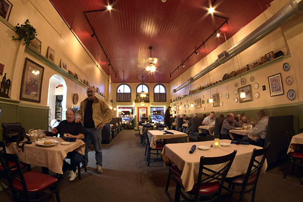
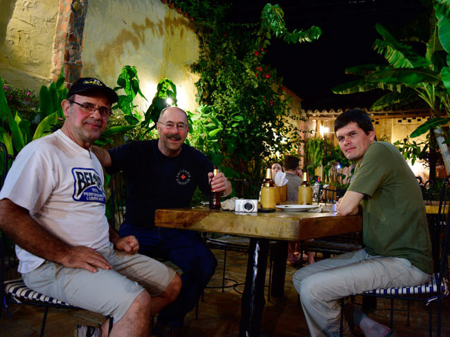
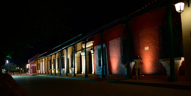
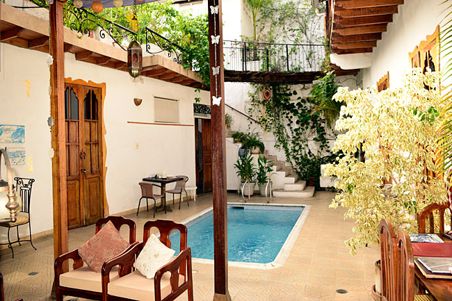
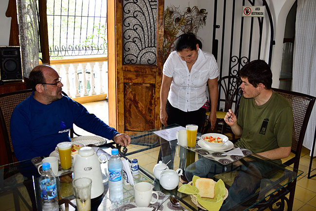
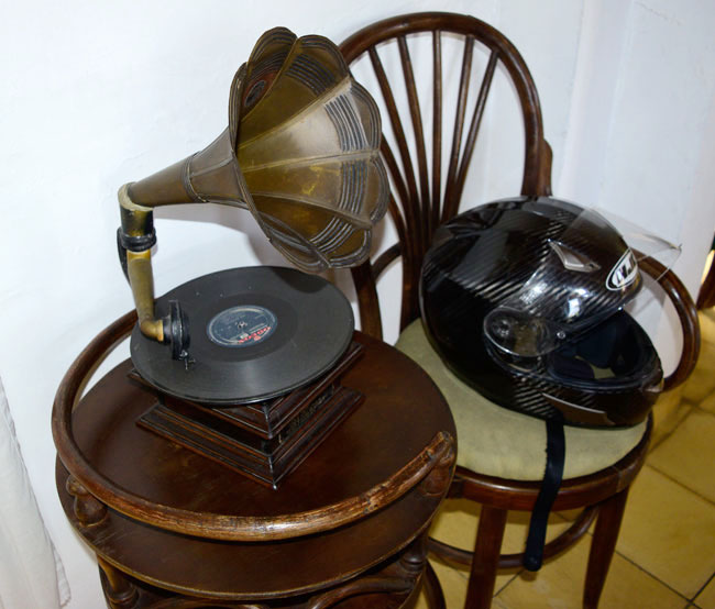
The hotel first…it was the Epoque, a great little boutique hotel in Honda that was one of the coolest places (in one of the hottest cities) I’ve ever parked a motorcycle. It was arranged in a square around a small pool (which we enjoyed immensely the previous night). Here are a few shots of the courtyard, Juan and Carlos having breakfast, and an antique record player in the dining room…

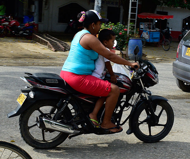
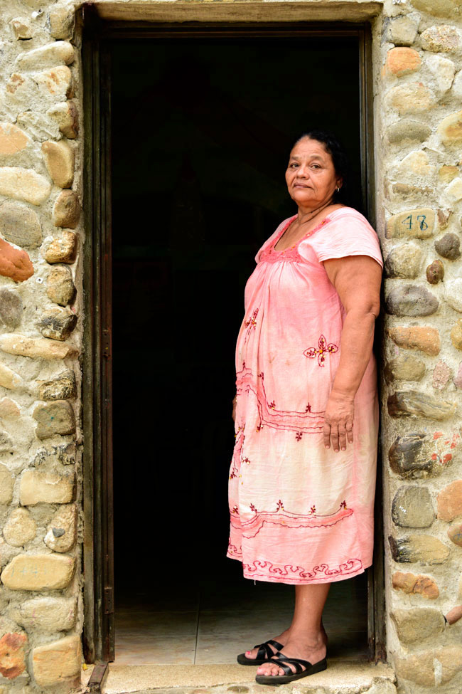
From there, it was another trials ride following the boys from Medellin as we twisted, turned, climbed, and descended cobbleboulder streets in Honda. Juan took us to the first bridge to ever span the Magdalena River, where I grabbed this shot of a Colombian woman taking in the humid morning air of Honda…

Here’s the bridge. It has planks across the bottom as the road surface. It’s real Indiana Jones stuff….

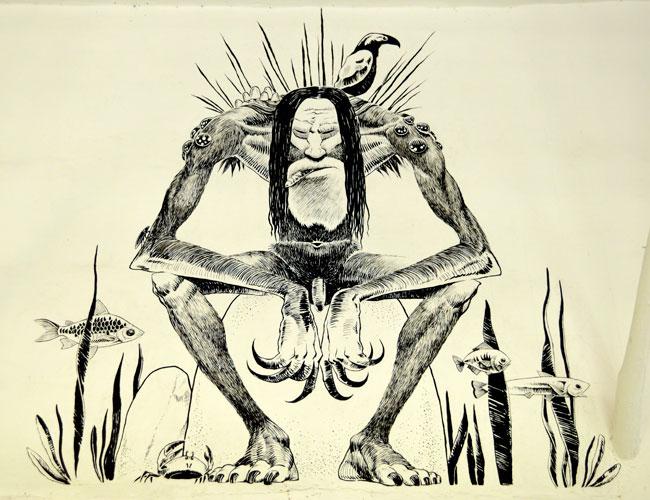
We saw the Magdalena River museum, and stopped in to check it out. Folks, it was hot. I was soaking wet by now, drenched in sweat.

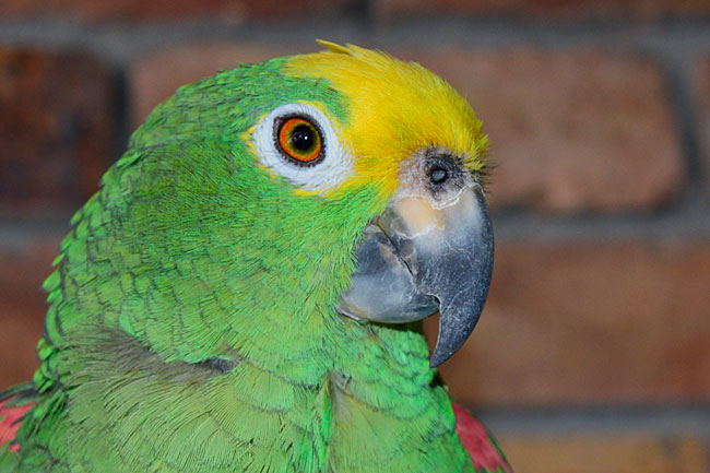
The museum was interesting and it had some bizarre art. This guy reminds me of a boss I had a couple of decades ago…

The Colombians used steamships on the Magdalena, just like we did on the Mississippi River.

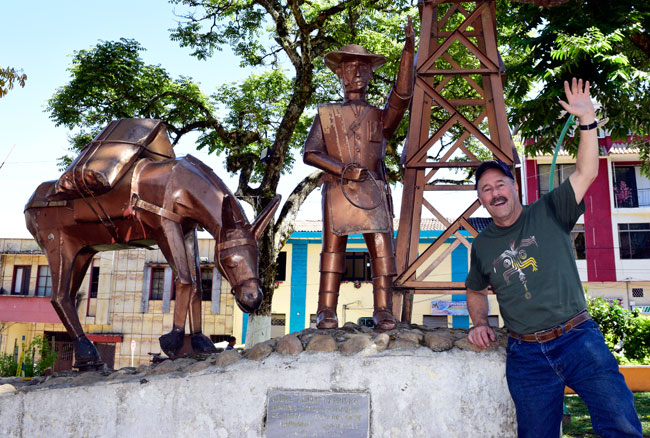
We left Honda and started to climb. The temperatures dropped mercifully. We stopped in Fresno. Yep, Colombia has a Fresno, too.

That’s me in the town square. I’m the guy on the right.

Two young ladies in a small store in Fresno.

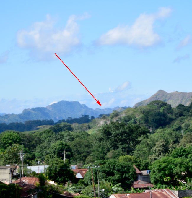
As we were sipping energy drinks, Juan pointed out our destination for that evening, the Volcan Nevado del Ruiz. It was showing a little steam, and I stuck an arrow in this picture so you could see it.

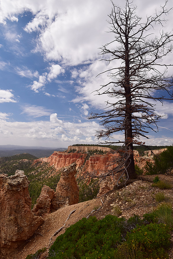
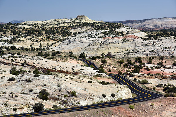
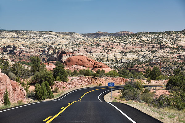
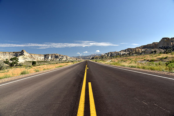
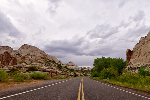
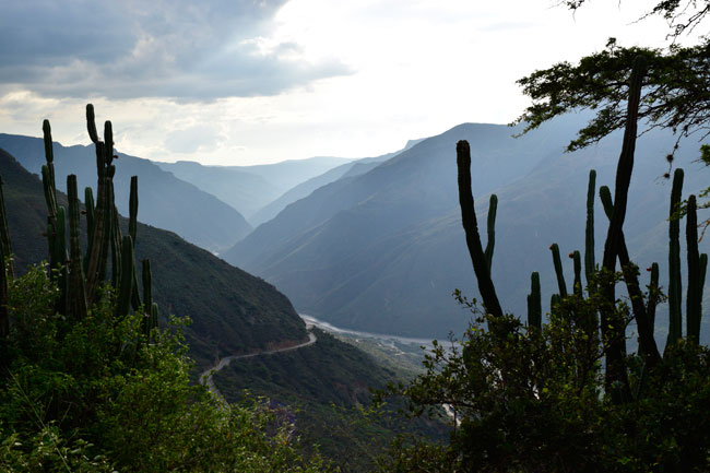
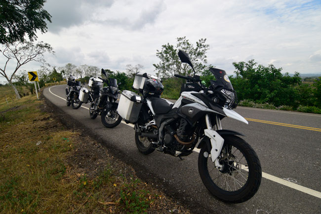
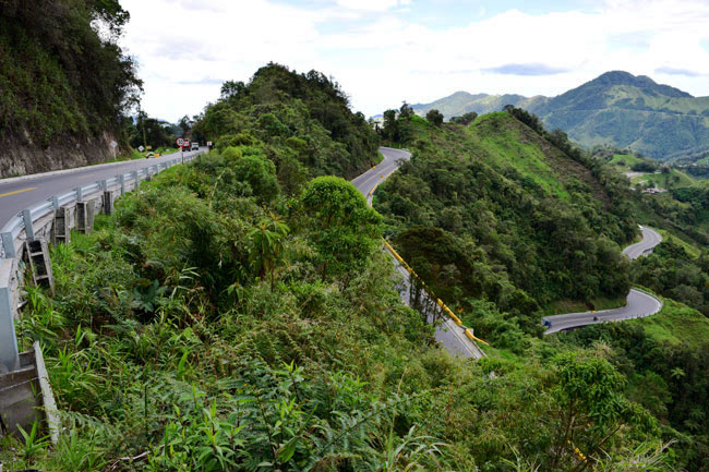
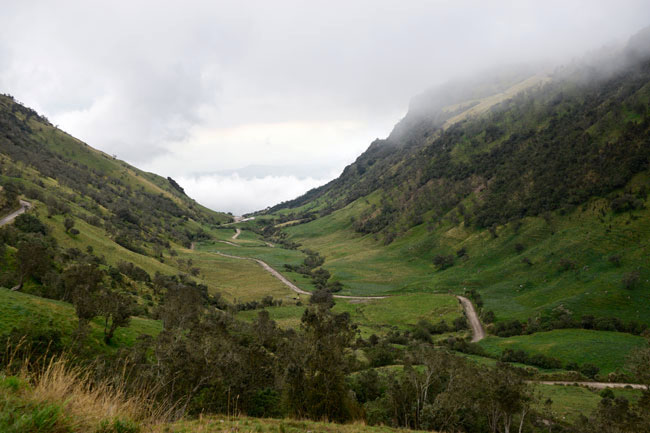
We continued our climb. The roads were magnificent.

The photo below shows my front tire, with chicken strips that are about as small as I’ve ever been able to make them. I was getting better at keeping up with the Colombian motorcycle community.

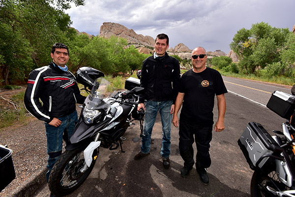
Our riding positions are Juan, me, and Carlos. Juan is amazing. I’m struggling to keep up in the twisties, and I know he’s dialed it back for me. He’ll ride through the corners (and the roads are all corners, folks) standing on the pegs. At one point, we were taking a set of curves at speeds way above those at which I would normally ride, with the bikes leaned over at an unimaginable angle, when I looked ahead and saw Juan. He was standing on the pegs, similarly leaned over, and while all this was going on, he was reaching back to check the latch on one of his saddlebags as if it was the most normal thing in the world to do. The guy is an incredible rider.

As we continued to climb, we entered the clouds. Literally. We left the pavement and got on a dirt road headed up to the volcano.

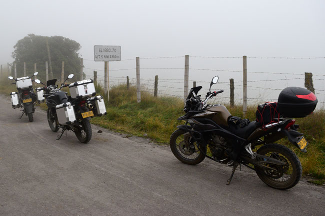
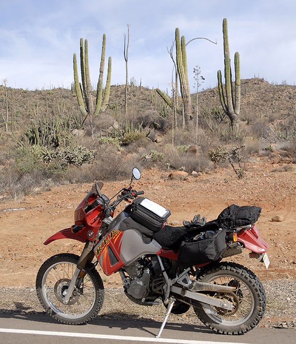
4,138 meters! That’s 13,576 feet, and it’s as high as you can go on a motorcycle anywhere in Colombia. Juan told me he once did this ride on a Yamaha DT100, carrying a passenger on the back!

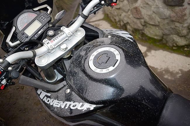
That’s not dirt on my RX3, folks. It’s volcanic ash. This was not your typical motorcycle ride.

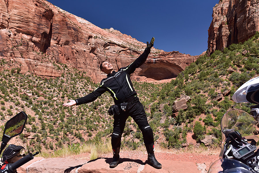
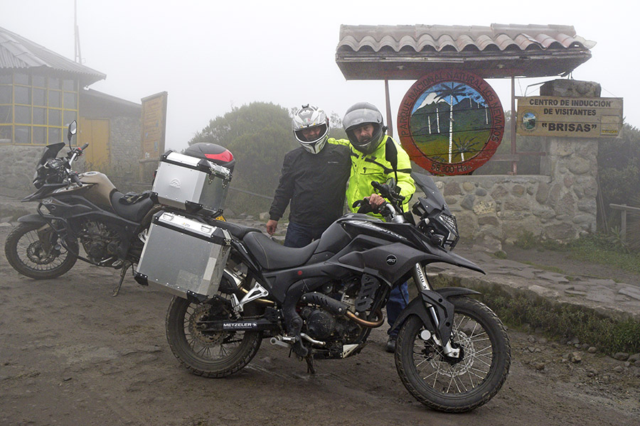
Yours truly, posing with Carlos, on the top of the world, on top of a volcano with indigestion. Wow. This volcano is the very same one that blew in 1985 and wiped out an entire community. It was like Pompeii, as the guys explained it to me. 23,000 people lost their lives in that event. And here we were, riding in conditions where I could barely see Juan’s tail light in front of me, on dirt roads, in bitter cold. Wow.

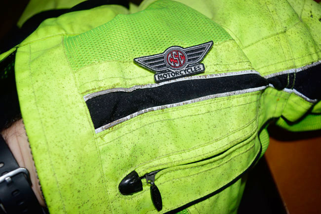
Here are a couple of shots showing my helmet and my jacket, dusted with Volcan Nevado del Ruiz ash.

We left the volcano, rode another 20 kilometers on this dirt road, and found our hotel in the middle of nowhere.

The hotel had hot springs, and they were awesome. I had a good soak, we had dinner, and that was the end of Day 7 on this epic journey.

Today is our last day. We’re finishing our great circumnavigation and headed back to Medellin. Much of our ride today will be on dirt. I’ll take a few shots and post about it tomorrow.

Later, my friends.


You can read the earlier blogs from this great trip, and a few other moto adventures, here on our Epic Rides page!


Please click on the popup ads!


Never miss an ExNotes blog:

A TT250 Ride

I woke up last Friday with but one thought:  I have got to get out on my motorcycle today.

Well, I did, and I had a glorious ride up through the Cajon Pass in southern California.  That’s the pass that cuts between the San Gabriel Mountains and the San Bernardino Mountains.  Most folks would just take Interstate 15 from So Cal to the High Desert through the Cajon, but to me riding a motorcycle on the freeway is a bit of a crime against nature.  There are surface streets that get you through most of the Cajon Pass, and if you know where to look, there are dirt roads that do the same.  Those roads are way more fun, but it’s like I said…you have to know where to look.

Me?  I know where to look.

On old Route 66 through the Cajon Pass. Yep, it’s still there, and it was a perfect photo op with my black CSC TT250 on a cloudy June morning.

Big freight trains slog through the Cajon Pass on a regular basis, and there’s a dirt road that runs along the tracks for several miles.  It was a perfect road for the TT250.  I was out there on my own, having a good old time when I stopped to grab a photo, and that’s when I heard it.  The rails, that is.  They started singing.  They do that when there’s a train downrange.  You can actually hear the metallic buzz the rails emit miles before the train comes into view.  Time to switch the cell phone camera to the video mode.  I didn’t see anything for a couple of minutes, and then way down the hill in the distance I could just make out a headlight.  Then that one orange orb became three blurry headlights, the signature of the first of several freight locomotives.  They were working hard.  It takes a lot of power to pull a train up a mountain pass.  The lights grew in size, the indistinct three orange dots came into focus, and there it was:

The train was a monster.  I finished the video, I took several stills, and then I mounted up and rode at a sedate pace in the opposite direction for a good five minutes before I saw the end of that train.  I’ll bet it was three miles long.  Maybe more.  There were four locomotives pulling and there was a fifth on the tail end. It’s hard to imagine the weight and the energy of a freight train like the one I saw that morning.  And it was doing it all going uphill, charging through the Cajon Pass from the Pomona Valley up to the High Desert. It was impressive.

That train just kept coming, and coming, and coming.

I had a hell of a ride that morning.  A bit of freeway (but not too much), a fair amount of dirt, a stream crossing that was deeper than I thought it would be (and damn, there was no one to video me standing on the pegs with water splashing all over my boots and jeans), a train, Old Route 66, and nice, cool weather.  It was grand.

It was about 5 years ago that I was sitting in Zongshen’s marketing offices in Chongqing discussing this, that, and the other thing on the RX3 for CSC Motorcycles.  All the while, I kept stealing peeks at a 150cc dual sport bike the Zongshen wizards had mounted on a display pedestal in their conference area.  Finally, I asked…what’s the deal on that motorcycle?  Can it be had with a 250cc engine?

My good friend Chongqing Fan smiled.  I could read that guy like a book, and what I was reading was this:  He knew, and he knew I knew:  The guys at Zongshen, China’s largest motorcycle manufacturer, they can do anything.  A few quick digital pics back to CSC, a recommendation, a quick decision from a CEO who’s not afraid to make decisions (that would be Azusa Steve), and the CSC TT250 was born.  I own one of the very first to arrive in America, and it’s been a hoot.  We’ve even done Baja on the TT250s (talk about brand loyalty…half the guys on that ride also own an RX3).  CSC can barely keep TT250 motorcycles in stock; they sell as soon as they arrive.  Most of the time, they’re sold before the ship gets here.

I selected black for my TT250 (one of three or four colors available in 2016) because I thought it would photograph well, and I was right. It does a lot more than just sit there and look pretty, though.  The TT250 is a great motorcycle. It’s simple, torquey, easy to maintain, great handling, reliable, comfortable, and inexpensive. Plus, I know the factory and the people who make and import this motorcycle.  Good buddy Gerry and I wrote the shop manual for this motorcycle, and I know the bike’s innards.  You might say I know it inside and out.  I think the fact that I know most everyone involved in creating and importing this motorcycle makes it even more of a hoot to ride.

TT250s on the production line in Chongqing.  Mine was in there somewhere.
Your mileage may vary.

The TT250 is about as simple as a motorcycle gets, and it has what has to be one of the most ubiquitous and reliable motorcycle engines on the planet.  You see these motors in various versions (ranging from 125cc to 250cc) everywhere.  They’re bulletproof.  They’re designed to be rode hard and put away wet, and that’s what folks in South America, Central America, Asia, and the Middle East do.  It’s no accident that my good buddies at Janus Motorcycles chose the same engine to power their amazing 250cc motorcycles. I’m going to ride my TT250 until the wheels fall off.  Then I’ll buy replacement parts for probably something like $9 and repeat the process.

The TT250 is a light bike.  It’s easy to ride and easy to keep vertical (they tell me it’s easy to pick up if you drop it, but I’ve never dropped mine).  The TT250 weighs 309 pounds wet and in an age of overweight, bloated, and expensive monster motorcycles, riding it is fun.  It’s not an ego statement.  It’s a motorcycle.  It’s what a motorcycle should be.  I feel like a kid every time I get on it (and in six months, I’ll be 70 years old).  I started riding motorcycles on a Honda Super 90 (a 90cc single) when Lyndon Johnson was in the White House.  Riding a simple single makes me a hooligan again, braapping the mean streets of rural New Jersey before I was old enough to have a license and loving every second of it.

I have the 49T rear sprocket on my TT250 (one down from the stock 50T), and that’s about perfect for me.  My bike tops out at about 66 mph indicated, and after my hundred mile ride through the Cajon Pass that morning I topped off and checked my fuel economy.  62.5 mpg.  Just a little better than I usually get.   Your mileage, as they say, may vary.

I have the Wolfman bags on my TT.  They’re light, they don’t get in the way, they’ve held up well, and they’re handy if I want to carry stuff.  That’s usually a few tools (just in case, but I’ve never needed them on the road), a bottle of Aleve, a change of underwear, and I’m good for a couple of weeks in Baja.

Speaking of Baja, good buddy Baja John is another guy with the same affliction as me: He owns both an RX3 and a TT250.  And a .44 Magnum or two, but that’s a story for another blog.  Baja John keeps his TT250 at a beachfront home in Baja, and as soon as this Covid 19 business is in the rearview mirror, I’m headed down there.  I want to photograph one or two of the more remote missions, John knows the trails, and the TT250 is the motorcycle to get us there.

More good times are on the horizon, folks.  Stay tuned.


Epic rides reside here!

Day 4: Barichara!

Continuing the Colombia adventure, this was my post for the CSC blog on the 18th of December in 2016.  We were having a hell of a time and very nearly everywhere we went good buddies Juan and Carlos explained to me that we could not have ridden these roads just a few years ago due to the narcos and FARC instability in Colombia.  It was an amazing trip and I was thoroughly enjoying myself.


More riding, another Andean crossing, a bit of rain, and we arrived in Barichara!

Barichara is an artist’s town, and it’s one of the most exclusive places in all of Colombia. It was another glorious day of mountain riding. I did not take too many photos on the ride to Barichara, mostly because of the rain, our late arrival, and I was enjoying our dinner too much that evening in Barichara to break out the Nikon. But I did get a few photos.

My lunch at a restaurant along the Chicamocha River…

One of my “from the saddle” shots of a hydroelectric dam on the Chicamocha River…

A couple of shots chasing Juan Carlos through a massive tunnel in the Andes Mountains…

A fine feathered friend at a fuel stop…

And finally, a shot after the rain ended of the Chicamocha valley…

I’m enjoying the AKT Moto RX3. It’s different in a few minor ways than the CSC bike, and they are both fantastic motorcycles. I’ll do a blog after I return home describing the differences.

I’m calling it a night, folks. More to follow…as always, stay tuned!


I’ll post a few more photos and another video or two from Barichara in the next installment of our Colombian trip travelogue.  I wrote this blog before we went out that night, and I grabbed a lot more with my Nikon on our night out in Barichara.  It was an impressive town.   I’ve got to get back there one of these days.

More of the Colombia adventure and other epic rides are here!

Day 2: Mompos!

The Colombia adventure continues.   For those of you just joining us, this is a series of blogs I wrote four years ago for CSC Motorcycles when I was rode an AKT Moto RS3 (the carbureted Colombian version of the RX3) through the Andes Mountains.  Day 2 of that ride was absolutely awesome, ending with a visit to an enchanted town after a ferry ride down the Magdalena River.


Our second day on the road in Colombia started in Coveñas, and the humidity was oppressive. It was going to get worse as the day went on. We’re in the tropics, not too far from the equator, and hot and humid is the normal way of things here. On the plus side, you don’t care if it rains because you’re already drenched. It actually helps because it’s cooling.

Anyway, back to the morning in Coveñas. We ate in the hotel, and while we were waiting for breakfast, this dude was selling some kind of yams or roots, and Juan Carlos pointed out the scale he was using. It’s about as crude a scale as I’ve ever seen, but it’s sound technically, and it sure makes for an interesting photo.

Here’s a typical Colombian breakfast: Scrambled eggs with tomatoes and onions, bread, and a corn or flour tortilla with cheese (that’s called arrepo). The Colombians are big on cheeses, with different regions producing unique cheeses. It’s quite good.

The guys pointed out this car as we packed the bikes. This probably didn’t end well for the passenger, who most likely was not wearing a seat belt. The riding in Colombia is glorious, but it is stressful. Juan and Carlos said when they ride anywhere else (other than Colombia), it makes them sleepy because there’s only scenery. In Colombia, there’s scenery, but you have to watch out for everyone else. It’s intense. In a country full of twisties, people pass on blind corners routinely. I guess the theory is you pray a lot. People think nothing of passing if the oncoming traffic has room to move over, or if the oncoming traffic is a motorcycle. It’s weird, but you kind of get used to it. But it is intense (just like the heat and the humidity).

When we got on the road after breakfast, we only went maybe a mile when Carlos had a flat tire. Watching the guy repair it was interesting, and so was hanging out watching the world go by in Colombia.

And here are some of those watching the world go by in Colombia photos.

Here’s a photo of our RX3s somewhere on the road, headed to the ferry that would take us to Mompos, a remote town 45 minutes down the Magdalena River.

This church was across the street and just down the road from the ferry loading spot.

I only grabbed a few photos while we were boarding the ferry. The heat and humidity were getting to me at this point. It was about 4:00 in the in the afternoon, and it was sweltering.

Once we were underway, it got a little cooler on the river. You probably saw my video of that ride.

We arrived in Mompos and it was impressive. It’s the oldest town in Colombia, and to say it is off the beaten path would be an understatement. We had dinner in a restaurant run by an Austrian, where I had the best pizza I’ve ever had in my life.

After dinner, we chatted with the owner for a bit, and then we walked along the river front…I grabbed a bunch of photos there.

Folks, that’s about it for now. I’m a day behind in keeping you up to date on this trip, but Internet connectivity is dicey in these remote locations. As always, more to follow, if not today, then in a day or two (or three). Stay tuned.


If you’d like to see our earlier blogs in Colombia, please click here.