Three Steps to Ease into Moto Camping

By Mike Huber

I know many people on this page camp and ride, but some have yet to dive into mixing these two great passions.  My objective in this article is to help you bridge riding and camping, alleviate any concerns on this topic, and build a foundation of knowledge for those new to motorcycle camping. In doing so you will discover a deeper level of motorcycling that many riders experience.


Help us bring more to you…please click on the popup ads!


Start with Less

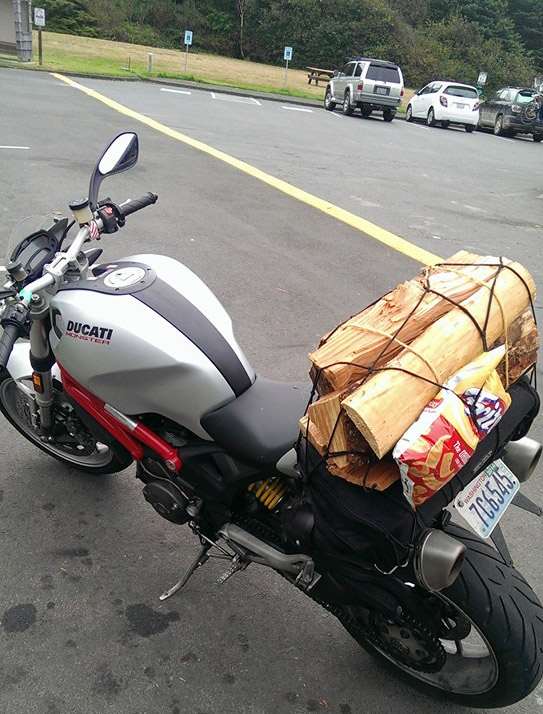
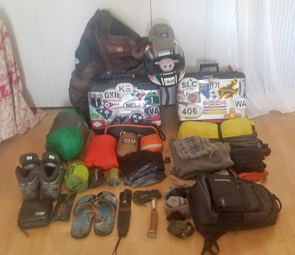
With all the social media posts of riders from around the world sharing their epic adventures and providing reviews of the gear they use can cause anxiety.  Intimidation from the expense and amount of equipment people use for moto camping can become overwhelming when starting this hobby.  I’m not saying any of these riders are wrong in the gear (or the amount) they use, but my philosophy while motorcycle camping is less gear is much more efficient and cheaper. My first time moto camping I had nothing other than a one-person Kelty tent (which I still use), a sleeping bag, and a small personal hygiene kit.  I planned to give moto camping a shot and figured I could survive one night out on Washington’s Olympic peninsula even if I was a bit uncomfortable.

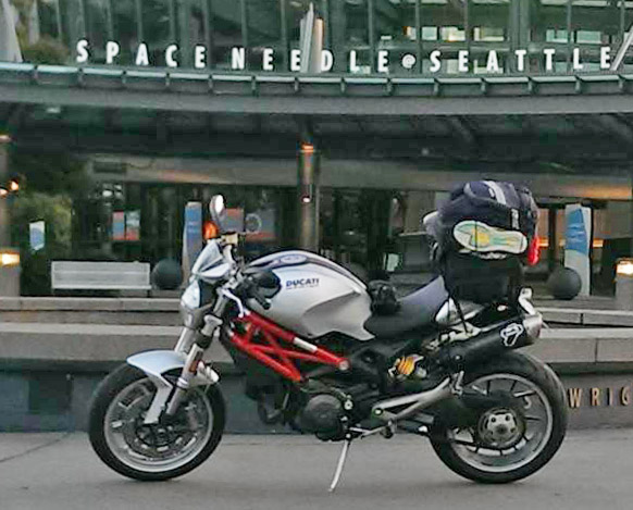
I wasn’t uncomfortable at all.  In fact, other than adding a 6-pack of beer and a crushed Subway sandwich my gear didn’t grow or change for the next 8 more years (even after “maturing” from a Ducati Monster M1100 to a BMW GS1200).  Would I have been more comfortable with a sleeping pad, cooking set up, and maybe even a chair?  Yes, but that came years later after learning from others (I am a bit set in my ways even if they force me to be uncomfortable). Starting from such a minimalist perspective and adding gear slowly allowed me to tailor my equipment perfectly.  You will find everyone has a “better” way of doing things; you might want to learn what works best for you and expand slowly.

Start in a Familiar Location

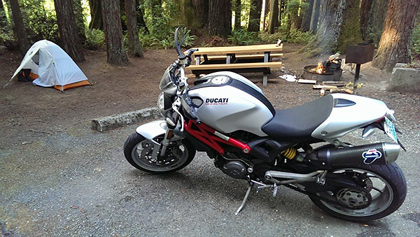
Roaring through the dense rainforest of the Olympic Peninsula on my Ducati Monster I was excited to be camping with my motorcycle for the first time.  In hindsight this choice was probably a further and more isolated location than I should have started with, but it worked for the most part. I had ridden the road several times, I was comfortable with the distance, and I was aware of the ever-changing weather conditions.  Being new to this I didn’t pack rain gear and of course it rained heavily that night (I was forced into my tent by the weather by 7:00 p.m.).  You must pack raingear if you want to ensure it never rains on your moto camping trip.   But even with the weather not cooperating it was a fun first night and it was enough to get me hooked on the lifestyle.

Looking back, a more comfortable way to experience my first moto camping adventure would have been a more controlled environment.  Even for those well-seasoned campers, testing new gear in your home or backyard to learn how to set up, adjust, and break down the equipment makes for a less stressful time in a real-world environment. Purchasing lots of expensive gear, not testing it, and going on a multi-state tour can be a painful way to learn the gear isn’t right for you or the climate.  Another way to learn your equipment and build experience is at a state park close to your home or a KOA.  Even if you have to retreat to the KOA store or end up back inside your house, don’t be discouraged.   That’s what this step is for.  Take notes on what worked and what didn’t, and build off that until you are comfortable with the next step, which can be dispersed camping or a longer distance ride.  It is better to learn in this semi-controlled environment than to have a horrific night with improper gear in poor weather and become completely deterred from ever moto camping again.

Learn From Experience

Having completed a successful test runs with your gear it is now time to begin learning how to increase your confidence in harsher and more remote environments. This point in your experience level is also the perfect time to make gear adjustments based on your notes.  With a few nights camping under your belt you can seek advice and learn from others, including their set up tricks and in what type of climate they moto camp.  In doing so you will fine tune your camping outfit so that it is perfect for you, your motorcycle, and the climate.

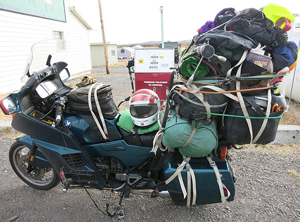
During this phase it is important to remain open minded.  Everyone has a method that works best for them.  For some it is a half shelter at a roadside pullout, for others it can be as elaborate as a 6-man tent with copious gear that requires 2 hours to pack.  Normally when I travel and moto camp it isn’t for just one night.   I’m on the road for two to three months at a time with Airbnbs or hotels as resting points or for working.  Even though I am comfortable with my moto camping equipment it’s always fun to chat up other motorcyclists. In most cases, even if their set up is completely different there is usually one or two takeaways I learn from conversing with them.

Conclusions

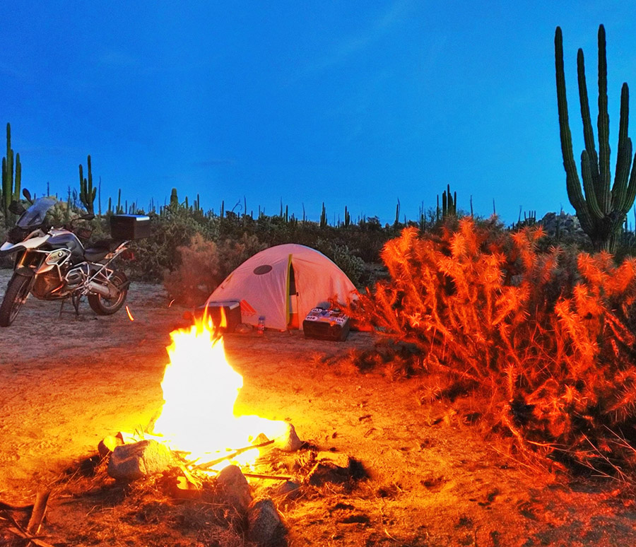
Moto camping is an easy and inexpensive way to escape the rat race with less effort than many would think.  These experiences and the people I meet along the journey are some of the most best I have had.  Being so removed from everything as you sit relaxing in the glow of a warm campfire reflecting off your moto is a fulfilling feeling that few venture to achieve.


Never miss an ExNotes blog:

Paddleboarding Horseshoe Bend

By Mike Huber

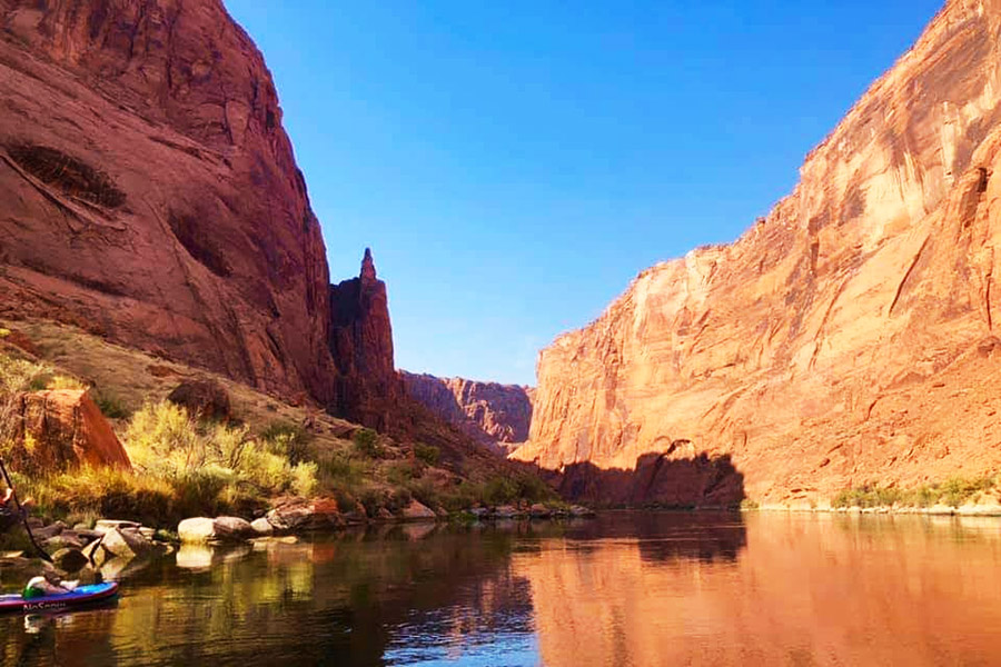
Since my last story was on paddleboarding I thought sticking with the topic would be a great opportunity to share a unique and exciting experience. Camping off a paddleboard at the base of Horseshoe Bend in Page, Arizona.  This was to be a 2-day, 15-mile trip down the Colorado River from Glenn Canyon Dam to Lee’s Ferry and would include one night of camping off our paddleboards. As an avid motorcycle camper, I thought camping off a paddleboard would be right up my alley as the amount of gear from a moto to a paddleboard was relatively the same.  This adventure would bring us to one of the most hostile environments in the United States, all while living it from a new perspective, being on top of the frigid waters of the Colorado River.
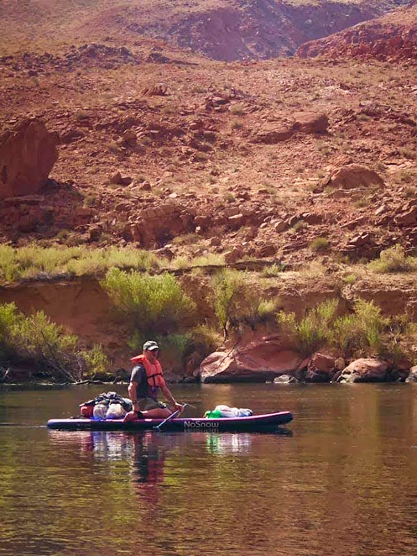
The adventure began with camping near Page, Arizona, and a day of light paddleboarding on Lake Powell to gain more familiarity and confidence on the board.  This was more for myself, as the two friends I was traveling with were both very experienced paddlers.  My paddling to this date was limited to a couple of 8-mile runs on the Salt River near Phoenix and a horrible windy day off the Colorado River where we launched from Hoover Dam.  The Salt River had portions of minor rapids, but the environment was much tamer than we would experience along the Colorado River.
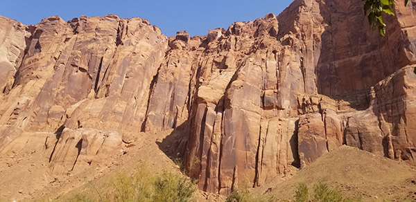
The Colorado River water is extremely cold even during the spring.  Contrasting the freezing water was the ambient air temperatures, which reached the high 90s (with no place to find shade or relief from the sun above the golden canyon walls that surrounded us).  Adding to the natural environmental threats there can be winds that blow up the river so strongly that you cannot paddle against them, even when going down river.  A year prior we were supposed to do a camping trip and ended up having to do an 18-mile paddle in heavy winds; on that trip, we were not able to camp as the winds were forecast to be worse the next day.  I didn’t want to put myself through that again.  That night we made our way to Horseshoe Bend in our car to watch the sunset and look down over the edge to see where we would camp the next evening.


Please click on the popups…it’s how we keep the lights on!


The day we were set to launch the winds were calm.  At 8:00 a.m. we loaded our watercraft onto a powerboat at Lee’s Ferry that would deliver us to the base of Glen Dam.  It was a cold ride in the boat to our drop off location as the sun was still hidden behind the massive walls that went straight up nearly a thousand feet.  Every bend we went around I was in constant awe.  It was as if every element that you can face in nature was in full view for us to admire, respect, and fear.  Once dropped off we unloaded the paddleboards, our gear, and took a few minutes to gain our composure before starting our 15-mile journey down river.

Pushing our boards off the shoreline, it was still cold and between the 40-degree water and 50-degree air none of us wanted to stand up on the boards.  Making a small error that could cause us to capsize during this delicate time would result in hypothermia with little hope of warming up until the sun crested above the canyon walls more than two hours later.  The winds were absent and with an occasional dam release we just coasted down the river effortlessly.  Having no headwinds was so much more pleasant than our previous time on this fully exposed river when we spent the day battling a constant headwind.

When the sun finally glimpsed above the canyon walls they instantly lit up. Just a beautiful golden prison we were trapped in with neon aqua waters so clear you can see fish swimming 20 feet below your board.  We had dispersed the weight of our gear between the three boards and then balanced them out as best we could.  We even had a bundle of firewood secured with Rok Straps for what we hoped would be a magical night under the stars. Along the way we stopped occasionally for a snack, a beer, or a short hike.  There are some hidden petroglyphs along the river where you can disembark from your board and hike in to view them.  This made for a perfect slow-paced and enjoyable day that we all fully embraced.
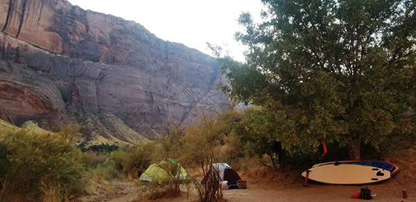
It was still early, yet due to the lack of headwinds and numerous dam releases we were already arriving at our camp at Mile 9.  Mile 9 camp is at the turn of Horseshoe Bend.  What made this really cool wasn’t the view (it all looked really the same with giant canyon walls on both sides of you).  What made this special was that when you looked up the thousand-foot walls you could see hundreds of tourists looking down at you and waving.  I felt like we were in a zoo exhibit. We set up camp and spent a relaxing afternoon swimming, chatting with other boaters (mostly kayakers and fellow paddlers), and just enjoying the fact we weren’t battling winds.  This was quite a rewarding day.
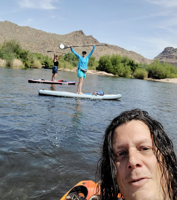
After a perfect day of mild paddling, relaxing and gazing off into this beautiful yet intimidating environment, the day slowly turned into evening.  It wasn’t long before we started a campfire.  Sitting around a campfire with new friends, cold beers from our Ice Mule Cooler, and exchanging stories is always the high point in my day.  I wandered off to use the bathroom when I noticed flashing from above.  At first, I thought it was the stars beginning to peer from above the cliffs, but it wasn’t.  The flashes I saw were the tourists above using their phones and flashlights to signal “hello” down to us.  As I zipped my pants up, I already had the “It was the cold water that caused shrinkage” or the “You’re 1,000 feet away…of course it looks smaller” thoughts.  For some reason my new friends around the campfire didn’t understand my humor and the stories continued until the flashes from the tourists above faded about the same time we did.
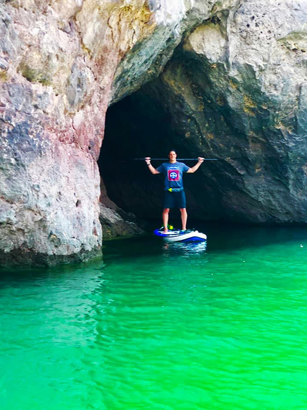
Having slept great that night at the base of one of the most iconic photo spots in the United States it was now time to pack up.  Winds always seemed to gain intensity as the day wears on, so we wanted an early start to avoid this threat, but there were no winds on this day, either. It was almost as if the river was rewarding us for having passed its initiation from that previous windy trip that didn’t allow camping.  The river was so calm we were able to even lay down on our paddleboards and allow the current and dam releases to carry us the remaining 6 miles downriver without any effort. This is how paddleboarding should be, but I knew this was an anomaly on the Colorado River. In my experience tailwinds are like unicorns.  They really don’t exist, yet somehow this trip we were surrounded by a herd of unicorns.

It wasn’t long before we could see Lee’s Ferry ahead of us on the right.  We made it to shore and began the process of packing our gear up to return to Lake Powell for one more night of camping before returning to southern Arizona.  Since paddleboarding Horseshoe Bend, anytime I see pictures of this location I zoom in and can often see paddleboards, kayaks, and tents at the beach when everyone else just is looking at the full view of the photo.  I absolutely prefer my new perspective of this part of Glenn Canyon National Recreation Area, that being through the eyes of a paddleboarder.


Never miss an ExNotes blog:

The White Sands Missile Range

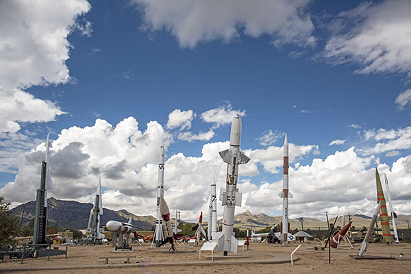
I first visited White Sands Missile Range in the mid-1970s when I was in the Army stationed at Fort Bliss, Texas.  I visited two places that day 50 years ago:  The White Sands Missile Range, and White Sands National Park.  I did the same most recently (i.e., hitting both spots on the same day) with Joe Gresh and Susie.  We recently posted about White Sands National Park.  Today, the focus is on the WSMR Missile Park, a display of military equipment just inside the White Sands Missile Range main gate.

WSMR is a place with history.   It doesn’t go back that far…it was created in July 1945, right at the end of World War II, when we grabbed all those Nazis for our space program (the Russians were doing the same). A lot of them were sent to White Sands, along with a hundred German V2 rockets.  We cut our space program teeth on them, launching two thirds of our V2 stash and studying the rest before we started building and testing American versions.  Our first atomic bomb was tested on the northern edge of White Sands Missile Range.  When I was based at nearby Fort Bliss to the south, we heard stories about missiles launched from White Sands that went a bit wide of their mark and landed in Mexico (as in Old Mexico, not New Mexico).  Like I said, there’s a lot of history here.

It used to be that you could just drive onto White Sands Missile Range and visit the missile park.  In those days, they had a German V2 on display along with perhaps a dozen or so other US missiles.  But that was then, and thanks to Osama Bin Laden, this is now.  Now, you have to park outside the main gate, show ID to the minders, fill out a form saying you’re not evil, and get permission to walk onto the base.  From the main gate, it’s maybe a couple hundred yards to get to the missile park.  The indoor stuff (including that old V2) was locked up when we visited, so all we could see was the stuff on display outside.  But that was good enough, at least until the skies opened up and the rains came down.

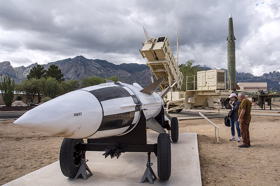
The photo ops were fantastic…military missiles, gun systems, and aircraft against the bright blue New Mexico sky, with a bit of cloud cover to soften the shadows.  We had a blast.  Figuratively speaking, of course.

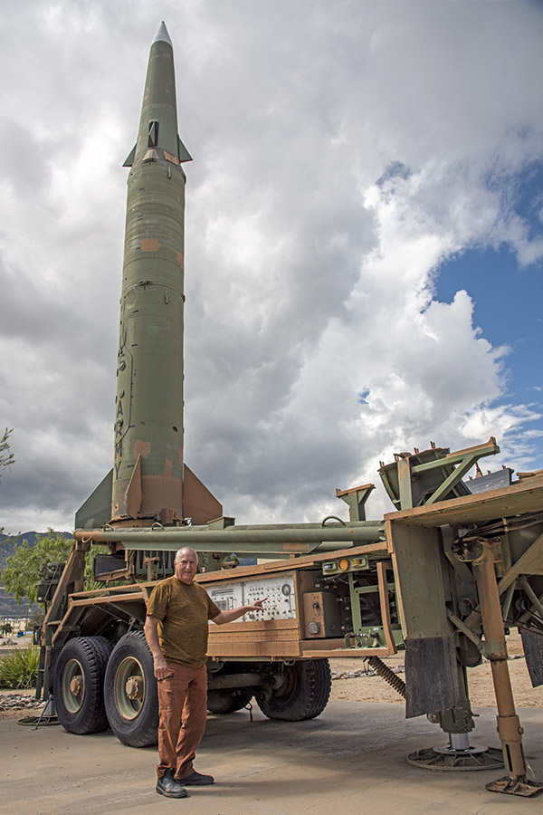
Joe Gresh, asking what would happen if he pushed that button.
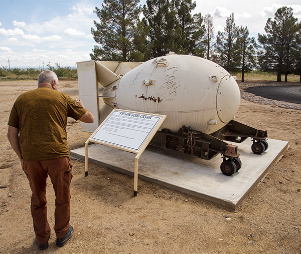
The Fat Man (I am referring to the atomic bomb).  Gresh has been dieting, and doing pretty well at it.
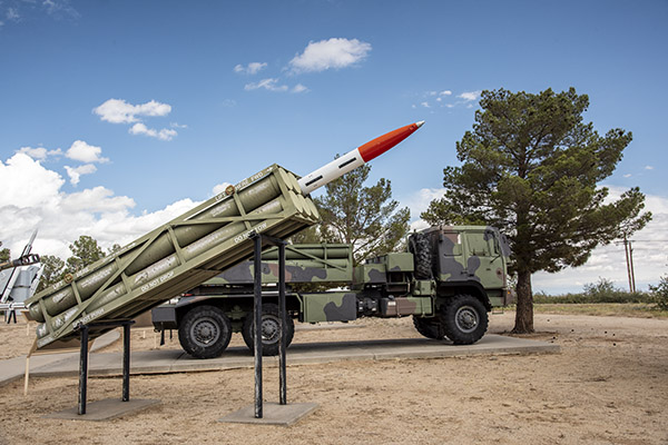
The mulitple launch rocket system, or MLRS.
There are all kinds of cool missiles on display here. It’s free, too.  We used to build plastic models of these things when I was a kid.
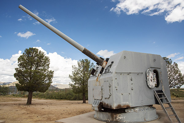
A US Navy 5-inch gun. Gresh climbed inside the turret when it started to rain.
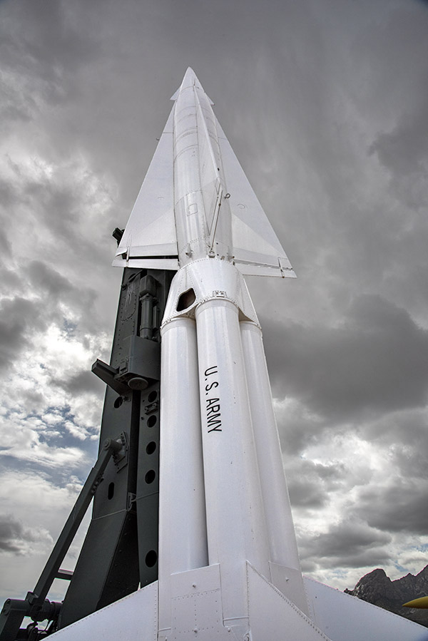
A Nike Hercules anti-aircraft missile, successor to the Nike Ajax. The Nike Hercules could carry a nuke. Although designed as an anti-aircraft weapon, the nuclear-armed Hercules could be used against ground as well as airborne targets. Don’t ask me how I know.
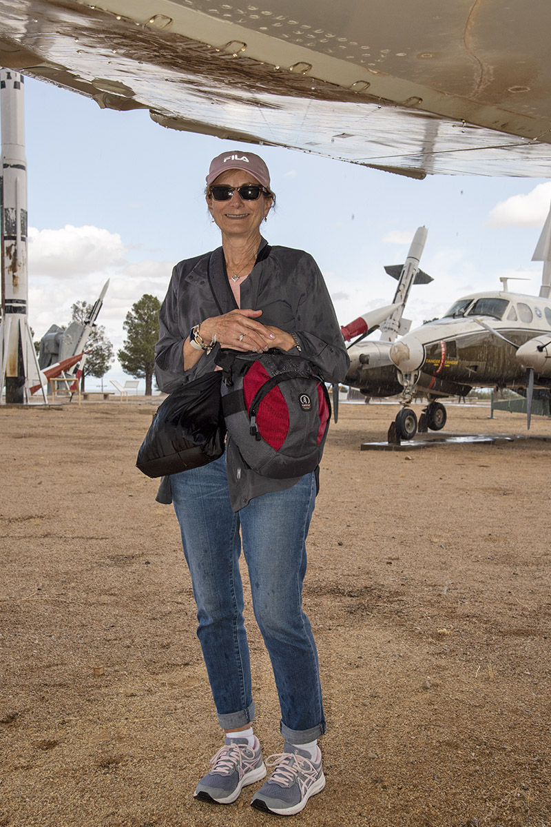
When it started to rain, Susie and I jumped beneath the wing of an F-4 Phantom.

We only stayed about an hour at the White Sands Missile Range, our visit shortened by the rain and the fact that the indoor displays were closed.  But that’s okay.  We’ll hit this place again on the next visit to New Mexico.


Keep us going!  Here’s why you should click on those popup ads!


Become a paid ExNotes writer!


Never miss an ExNotes blog:

White Sands National Park

Gresh has New Mexico pretty well scoped out.   I was worried that after visiting with him at Tinfiny Ranch there wouldn’t be much left to do in the area, but boy, did I have that wrong.

“White Sands,” Joe said.  “We can do the missile museum and the National Park.  It’s really not sand, you know…it’s gypsum.”  I didn’t know that, but I do now.  I first visited White Sands 50 years ago, and on that visit, we took in the missile museum and the National Park on the same day, too.  It’s doable; they are not far apart.  White Sands National Park is about 15 miles south of Alamagordo on US Highway 70, and the missile museum is a few miles south of that.

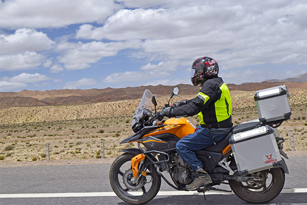
I shot this photo of Joe Gresh on an RX3 in 2016 as we rode through the Gobi Desert. We were both rolling along at 70 mph; I was about 10 feet to his left on another RX3. The Gobi looks a lot like the Mojave.

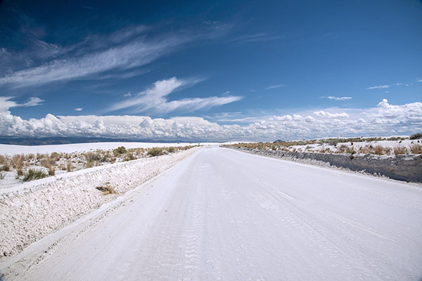
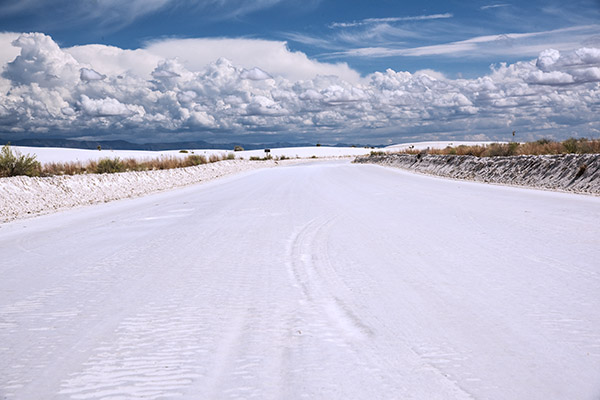
White Sands National Park looks about like what I would imagine the Sahara Desert to be, although having never been in the Sahara Desert, I could be wrong.  I always thought the Gobi Desert would look like the Sahara, too, but when Gresh and I rode through the Gobi a few years ago on our ride across China, it looked like the Mojave here in California.  But not White Sands.  Nope, it looks like, well, white sand, even though (as Gresh said) it’s really gypsum.

The photo ops really are amazing in White Sands National Park. You can get by with a cell phone, but to me it would be a crime against nature to visit any US National Park without a good camera and a circular polarizer. I use a Nikon and it usually wears a 24-120 lens.
The sky, the clouds, the white sands…it’s all very impressive.
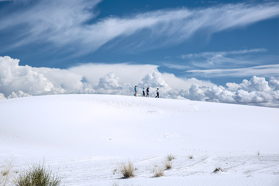
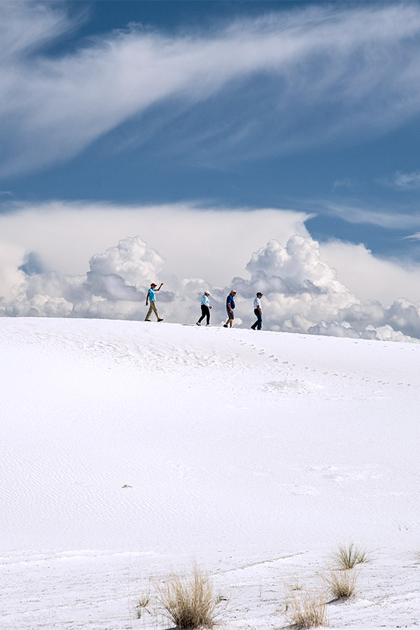
Folks walking the dunes in White Sands National Park. Many people bring sleds (of the circular pan variety) to slide down the dunes. You can rent them in White Sands National Park, too.

The ticket in is $25 per vehicle, but I have the lifetime senior citizen pass.  I was looking forward to using that pass, but when we went the entrance gate was unmanned (or unwomanned, or perhaps unpersoned, or whatever passes for politically correct these days) and we just rolled in.  It’s funny, I guess.  That’s what happened when Gresh and I led the CSC Motorcycles Western America Adventure Ride when we entered Yellowstone National  Park.  Gresh must be the national park admission fee good luck charm.

Gresh was really showing us a good time in the Alamogordo area, and we hit both the White Sands Missile Range Museum and the White Sands National Park on the same day.  From there, he took us to his favorite Italian restaurant in Alamogordo, but the day didn’t end there.  Our next stop was the New Mexico Space Museum.   Both WSMR and the New Mexico Space Museum are coming up in future blogs.  Stay tuned.


Like what you see here on ExNotes?  Hey, do two things to thank us.   Sign up for a free subscription here…

…and keep clicking on those popup ads!

Saguaros and Subarus

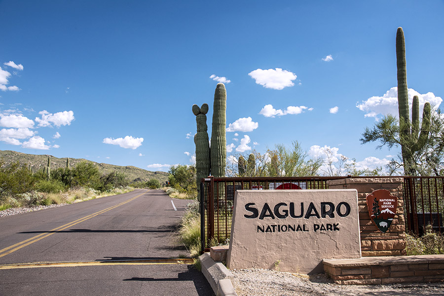
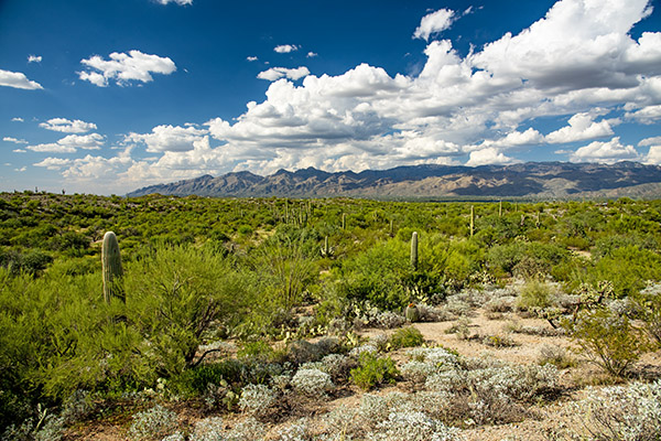
Susie and I were recently in Arizona and we found ourselves near the entrance to Saguaro National Park.  There are two sections of Saguaro National Park; we were near the one with an 8-mile driving loop through it.  It was an easy one-hour ride with frequent stops for photos.

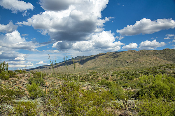
Arizona is a vibrant state. Bright blues, and green hills and valleys from the Tanque Verde’s waters.
Another case of Mother Nature moving the vibrance and saturation sliders to the right.
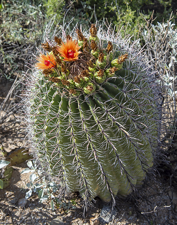
A barrel cactus, with two blooming flowers.
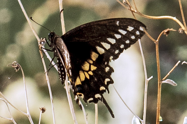
There were a lot of butterflies flitting about. This one landed for a few seconds. I didn’t really have the right lens for this sort of photo.
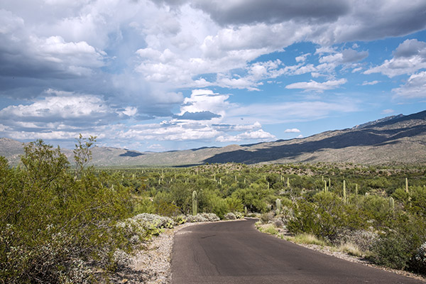
The 8-mile loop through Saguaro National Park is a one way road, with markings for tortoise crossings, rabbit crossings, javelina crossings, and more. All we saw was a lone rabbit. It was hot out there.
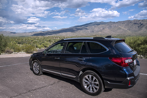
The Starship Subaru. It’s perfect for these kinds of road trips.
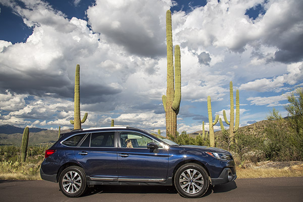
The Outback framed by the Park’s namesake cactus.

On these kinds of trips, I love traveling in my Subaru Outback.  If it gets hot, I turn on the air conditioning.  If it gets cold, I turn on the heater.  If it rains, I turn on the windshield wipers.  If I want music or news, I turn on the radio.  If I don’t know how to get someplace, I turn on the nav system.  I can carry as much stuff as I want, even more if I fold down the rear seats.  Don’t get me wrong; I like riding my motorcycle and I’ve done some big motorcycle trips.  But there’s something to be said about traveling with your wife in a comfortable car.  This is the third Subaru I’ve owned, and my next car will be another Subaru.

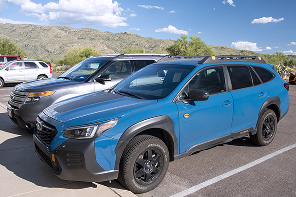
We stopped in the small visitor center before we left Saguaro National Park, and to my surprise, a new Subaru Wilderness Outback was in the parking lot.   It’s a version with different trim, more ground clearance, restyled bumpers (front and rear) for better approach angles, and lower gearing.  I like the idea of everything except the lower gearing and the trim.  Somehow, the Wilderness styling makes it look cheap (in my opinion) and the lower gearing lowers fuel economy.

I’ve owned three Subies now, starting with a 2006 WRX, a 2013 CrossTrek, and my current Outback.  They have all been great automobiles.

So, about this most recent trip:  We meandered through Arizona and New Mexico, and our travels included stops at the Tinfiny Ranch, the Albuquerque Balloon Fiesta, and more.  Stay tuned; there are more blogs coming your way from this adventure.  We had a blast.


Never miss an ExNotes blog:


Help us keep the lights on:   Please click on those popup ads!

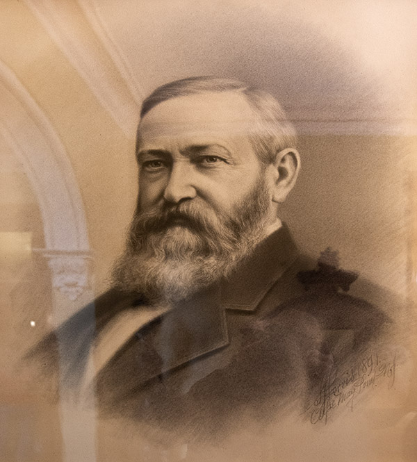
The Benjamin Harrison Presidential Site

As ExNotes blogs followers know, we visited Indiana this year.  The trip combined three missions:  We visited with good buddy Jeff and his wife Sally (who moved to Indianapolis shortly after we finished college in New Jersey), we visited and interviewed the key people at Janus Motorcycles in Goshen, Indiana, for a Motorcycle Classics article, and we hit as many points of interest as we could while we were in Indiana.  We hit home runs in all three areas, I think.  We enjoyed our time with Jeff and Sally, we had a great visit with Janus, and wow, did we ever see a lot in Indiana.  One of the coolest places we visited was the Benjamin Harrison Presidential Site in Indianapolis.

I didn’t really know anything about Benjamin Harrison when we visited the site, but I’ve learned quite a bit during and after our visit.   Here a few of his accomplishments:

      • Graduated Miami University at Oxford, Ohio in 1851.
      • Elected Indianapolis City Attorney in 1857.
      • Elected Supreme Court Reporter in 1860.
      • Breveted Brigadier Civil War General in 1865.
      • Appointed by President Grant to defend U.S. Government in Milligan case in 1871.
      • Argued five cases before the U.S. Supreme Court (the most of any lawyer-President).
      • Elected U.S. Senator from 1881-1887.
      • Elected U.S. President from 1889-1893.
      • Set aside 13 million acres of public domain land for national forest reserves.
      • Initiated the Pan American Conference in 1889, later resulting in the Pan American Union.
      • Established the United States Coast Guard Academy.
      • Expanded the Navy from three steel war ships to 22 ships by 1893.
      • Added six states to the Union during his Presidency (this was the most of any President).
      • Firmly enforced the 15th Amendment to secure voting rights.
      • Instituted the practice of displaying the American Flag over public buildings and schools.

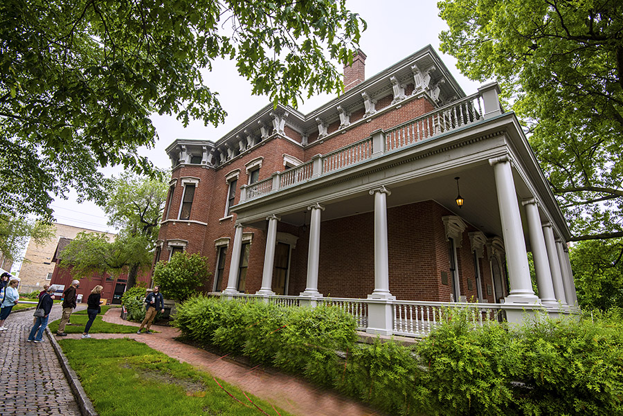
The Benjamin Harrison Presidential Site is in Benjamin Harrison’s actual home.  Harrison built it on the outskirts of Indianapolis, but the city has expanded and it’s now in what I would consider the downtown area.  The guided tour made for an interesting visit.

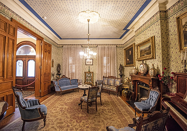
This room is a parlor just to the left of the front door.  The tour guide explained to us that it was restored to its original condition, including the creation of custom wallpaper to match that which was originally in the house.

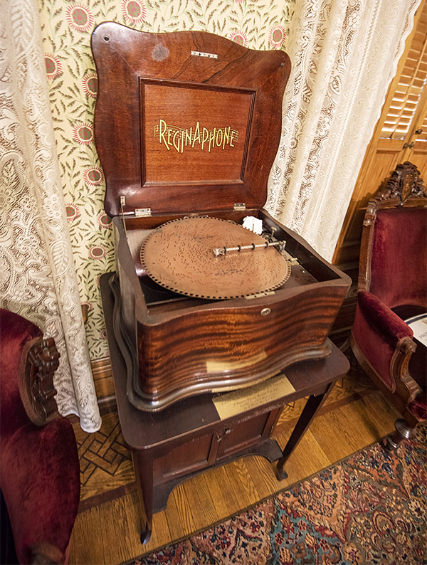
The Reginaphone was an early record player.  It uses a disk with protrusions to create the music.  This one works and we listened to it.

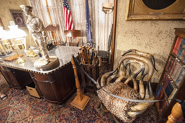
This is Benjamin Harrison’s home office. The horn chair is cool.

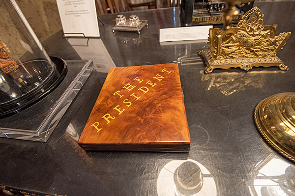
These are items on top of Benjamin Harrison’s desk.

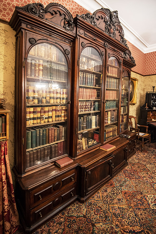
A very cool bookshelf dominated one of the walls in Harrison’s office.

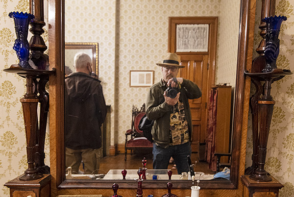
I can’t resist this shot whenever I see a mirror.

The tour continued with a trek through the dining room, the kitchen, some of the upstairs bedrooms, and a workout room.

I was surprised to see this when we left the Harrison Presidential Site.  Steve is everywhere, I guess.

The tour takes about an hour and a half, and it costs $14 (there are modest discounts for military personnel and a big discount for children).  You need to book your tickets in advance.

If you are in Indianapolis, I’ve got a good lunch suggestion.  One of the best kept secrets in that fine city is Shapiro’s Delicatessen.  It’s only 4 1/2 miles from the Harrison home and the food is stellar.  Both spots are worth a visit.


Never miss an ExNotes blog:


Keep our admission fee kitty healthy.  Hit those popup ads!

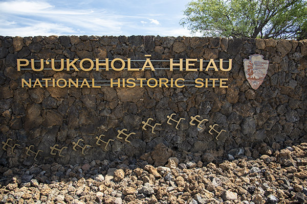
Pu’ukohola Heiau National Historic Site

I was in Hawaii when I wrote this blog, and we were on the Big Island (the actual island of Hawaii).  It’s much less densely populated than Oahu and quite a bit less touristy.  My daughter found a cool spot where the unification of the Hawaiian Islands originated, and that’s the Pu’ukohola Heiau National Historic Site.

King Kamehameha, the guy who was in charge of the island of Hawaii (which is one of eight Hawaiian islands) consulted with a Hawaiian priest about how to unify all eight islands.   The priest was called a kahuna, and because King Kamehameha was the guy was asking the questions, I suppose the priest would have been the Big Kahuna.  The Big Kahuna advised  King Kamehameha to build a temple and sacrifice an ally there.

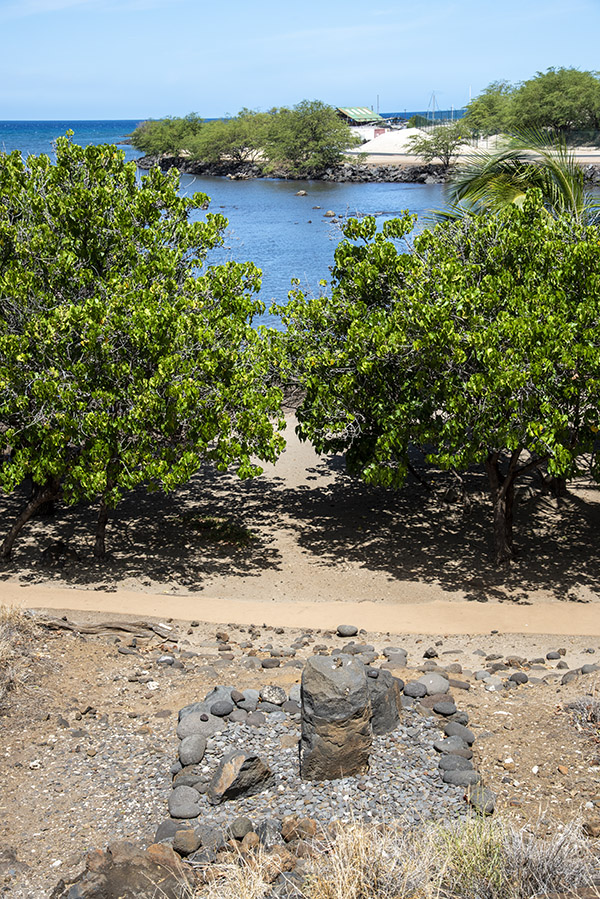
The Pu’ukohola Heiau temple is what you see in the photo at the top of this blog.  It kind of looks like a whale, and you can see whales occasionally when you are in Hawaii.  The temple was built in just one year with stones mined 27 miles away (and this occurred on an island where there were no horses or mules).  King Kamehameha picked an ally for the sacrificial offering; it was his cousin Keōua, except they weren’t really allies.  As the story was told to us, Keōua realized it was his destiny to be sacrified, so even though he knew the invitation was for a party that would not end well, he went.  There are other aspects to the story that are more disturbing.  Cousin Keōua mutilated himself before he arrived (he thought that would make him an imperfect sacrifice), but it didn’t work.  Yep, King Kamehameha killed the guy.  But evidently the Big Kahuna had been right.  King Kamehameha succeeded in unifying the Hawaiian Islands.

Pu’ukohola Heiau is where all this happened, at the edge of the Pacific, and the area and the temple King Kamehameha built are now a National Historic Site.

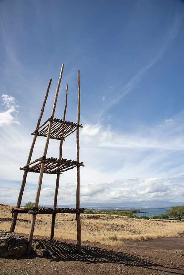
The Pu’ukohola Heiau temple is what you see in the large photo at the top of this blog.  It is impressive.    There’s a sort of a tower in front of it, and that’s what you see below.

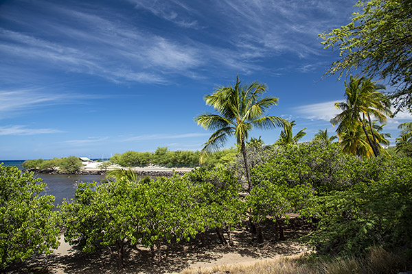
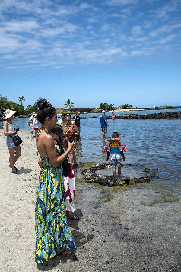
This Pacific Ocean inlet is at the base of the temple.  There are contemporary signs warning that the waters are shark infested, and they advise people not to swim or even wade there.  The sharks will attack, the signs warn.

In the old days, or so the story goes, the Hawaiians used to make human sacrifices in this bay.  The rock you see below is where the chief would sit to watch the sharks attack whoever was being sacrificed.

Surprisingly, there’s a public beach less than a quarter mile away along the same shoreline.  Needless to say, I stayed out of the water.

Another thing we saw there (and all over the Big Island) were mongooses.  Mongooses are an invasive species in Hawaii (they came from India), and they have become an apex predator as they have no natural enemies on the Big Island.  We didn’t know they were mongooses initially.  We thought they were rats, but the tails were way too big and thick for rats.  They behaved liked squirrels and they are about the same size.  The mongooses scurried about and would come right up to you (they were not afraid to beg for food).  I gave a mongoose something to eat, even though youi’re not supposed to.  I didn’t want to disappoint an animal unafraid to go head-to-head with a cobra.  I suppose you could introduce cobras to Hawaii to counter the mongoose invasion, but that would create other problems.


Never miss an ExNotes blog!


Don’t forget to help a couple of friends in need…hit those pop up ads!

Sea Turtles and Kaloko-Honokōhau National Historical Park

Wow:  Hawaii is just full of suprises.  The adventure on this fine Hawaiian morning was another National Historical Park, lava fields, a rugged downhill (and then uphill) hike over a jagged lava path, sea turtles, and a rotting meat flower (no kidding!).  A rotting meat flower?  You bet.  Read on and you’ll see.

We asked the Park Ranger at the entrance if we would be able to see the sea turtles, and he told us it all depended on what they were doing. “They might be sleeping, they might be out to sea, or they might be eating…you never know until you’re down there.”

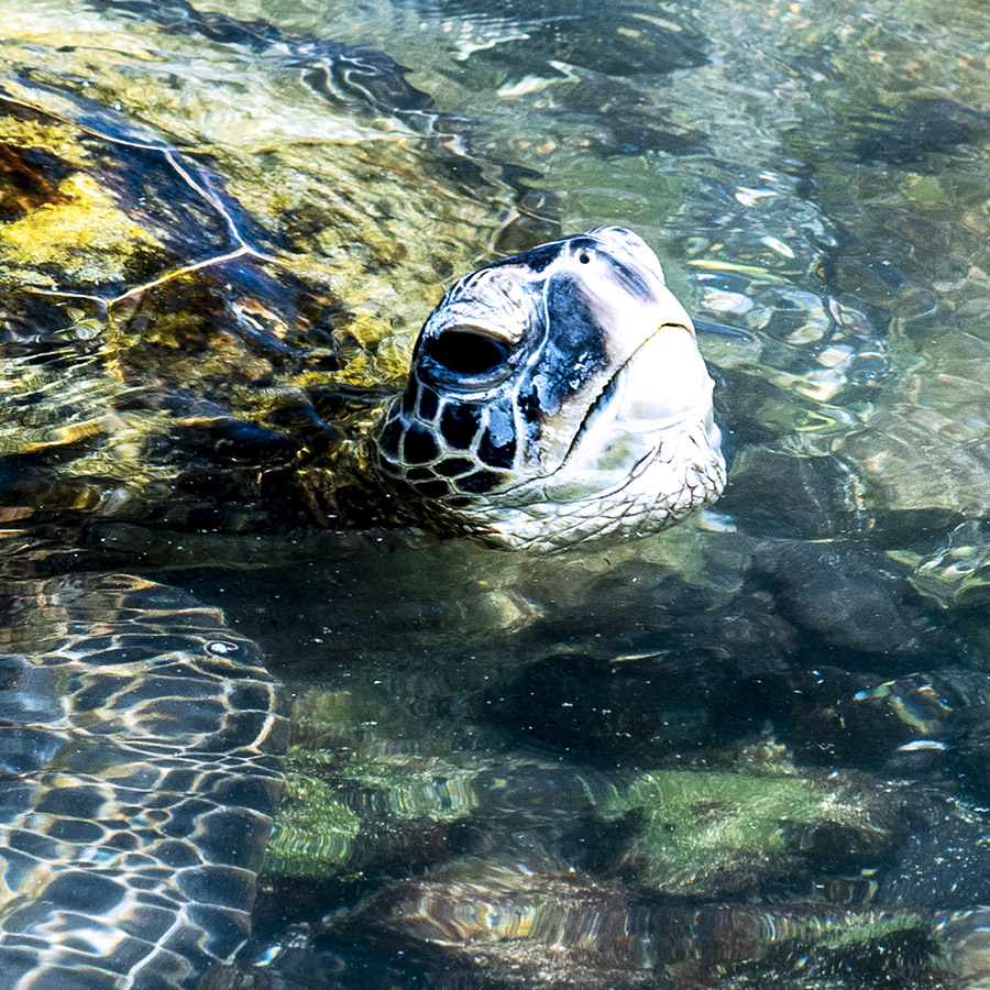
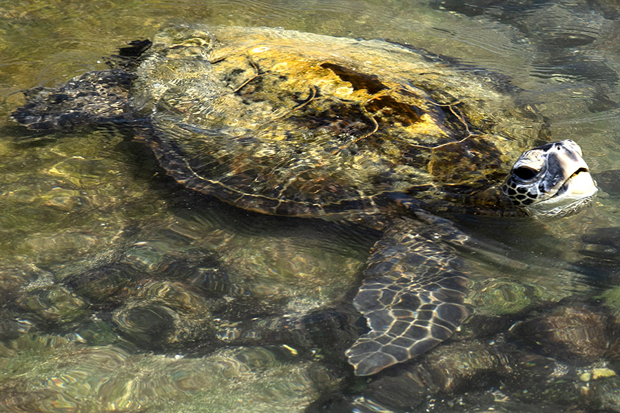
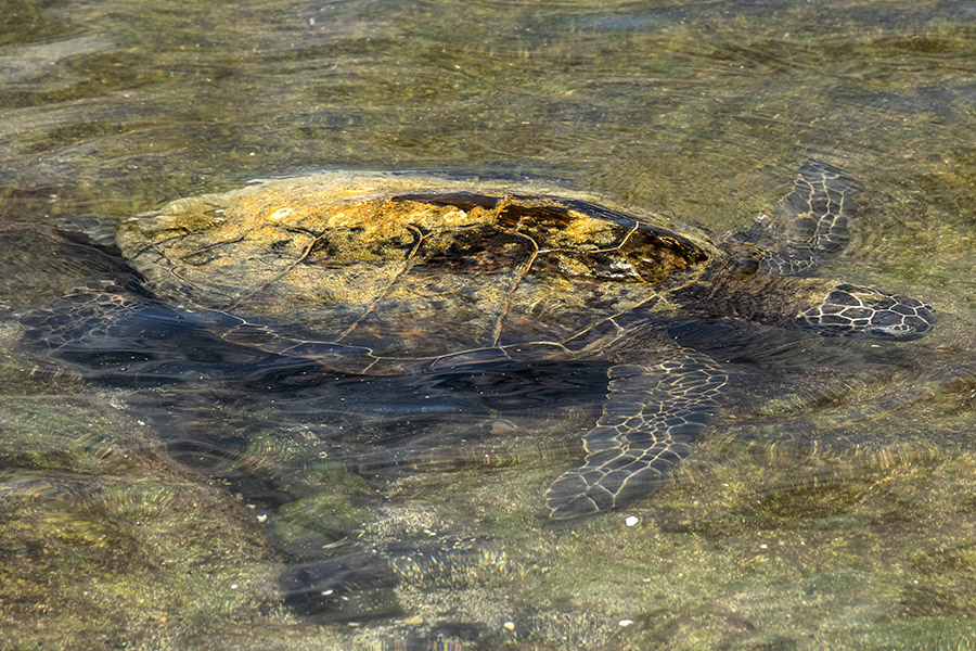
Down there meant taking the 1.3-mile hike to the Pacific’s edge, which we proceeded to do.  We were lucky; the turtles were out in force munching on the algae that grows on the rocks.  They were huge…their shells were maybe three feet long.   It was really something to see.  There were seven or eight turtles in the shallows when we arrived.

On the return hike Sue noticed an unusually attractive and large flower in a ravine next to the lava path.  I had the 24-120 lens on my Nikon and I didn’t want to attempt climbing down the jagged lava to get closer, so I zoomed in and grabbed this shot.

What struck me as unusual about the flower was its size, the fact that it seemed to be growing out of a cactus plant, and the flower’s markings and vibrance.  I wasn’t sure how to start researching a flower from a photo, but while I was looking at the photo Google popped up a Wikipedia link.   The Wikipedia page had a photo, too, and no doubt about it, it was my flower. Here’s what it said:

Stapelia is a genus of low-growing, spineless, stem succulent plants, predominantly from South Africa with a few from other parts of Africa. Several Asian and Latin American species were formerly included but they have all now been transferred to other genera. The flowers of certain species, most notably Stapelia gigantea, can reach 41 cm (16 inches) in diameter when fully open. Most Stapelia flowers are visibly hairy and generate the odor of rotten flesh when they bloom.   The hairy, oddly textured and coloured appearance of many Stapelia flowers has been claimed to resemble that of rotting meat, and this, coupled with their odour, has earned the most commonly grown members of the genus Stapelia the common name of carrion flowers. A notable exception is the sweetly scented Stapelia flavopurpurea. Such odours serve to attract various specialist pollinators including, in the case of carrion-scented blooms, blow flies of the dipteran family Calliphoridae. They frequently lay eggs around the coronae of Stapelia flowers, convinced by the plants’ deception.

I had heard of such flowers and I always wanted to see one.  For me this was a first.  I know what you are thinking, and no, I didn’t get close enough to take a whiff.  Maybe next time.

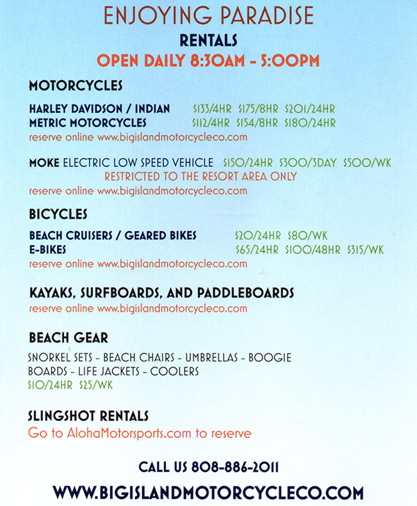
Here’s the same flyer I showed in a previous post from Hawii.  We weren’t on motorcycles on this trip, but rentals are available and I thought the pricing was reasonable.


Never miss an ExNotes blog:


Want to help?  Hit those popup ads, please!

Hawaii Volcanoes National Park

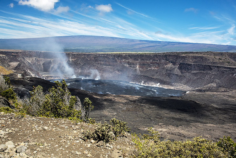
The Big Island, Hawaii, was formed by volcanoes, like the other Hawaiian islands and nearly all others in the Pacific.  Five volcanoes formed the Big Island, and one is still active.  That’s the Kīlauea volcano.  It’s the one you see above.  It’s the one we visited recently.

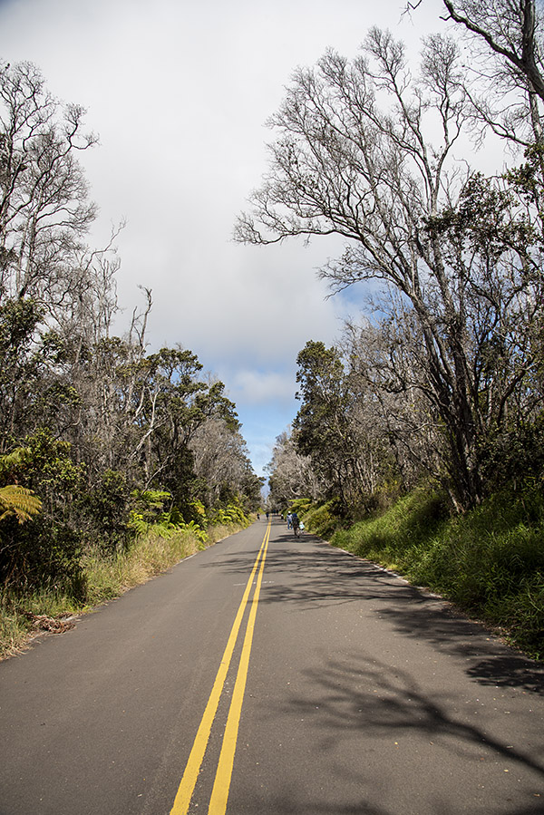
The walk from the park entrance to the Kileaua crater.

It’s a bit of a hike to get to the Kīlauea volcano crater once you enter the Hawaii Volcanoes National Park (the photo above shows the way in), but the hike is worth it.  Hawaii Volcanoes National Park is one of the few National Parks in Hawaii that charges admission.  I have the brass pass (the senior citizen National Parks lifetime pass), which has to be one of the best deals ever.
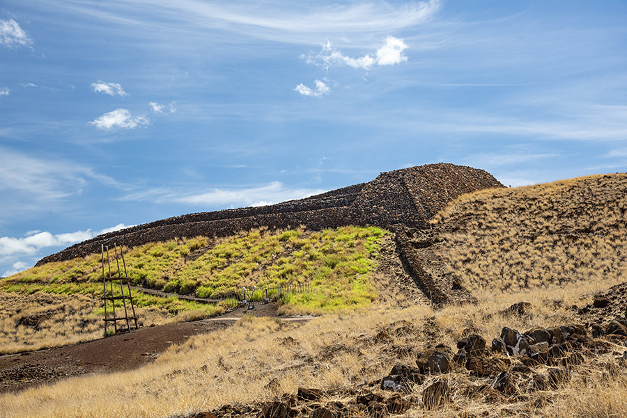
The big photo at the top of this blog is the crater, and it was impressive.  Hissing steam, a bit of lava flow, and a hint of what this planet is all about.  It was only in the last 50 years that the US Navy completely mapped the Pacific floor.  The Navy survey found many underwater mountains formed by volcanoes, all in a straight line.  A theory emerged that these were formed by the same magma eruption (i.e., a volcano) that created the Hawaiian Islands (which are the end of that straight line).  The eruption is a fixed point; the islands and underwater mountains  that extend in a thousand-mile-long straight line occurred as a result of tectonic plate shift over this point.  Fascinating stuff.

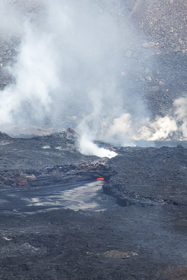
Lava in the Kīlauea crater.
The red glow you see in the photo above is lava in the Kīlauea crater.  I was a good half mile or more away from it, but thanks to the 24-120 Nikon lens and a bit of PhotoShop cropping, it looks like I’m right there. Trust me; I wasn’t.
We stayed just outside the Park on Volcano Road in a bed and breakfast tucked away deep in a tropical bamboo forest.  It was pretty cool and very remote.   Think banana trees, palms, humidity, colorful birds, and everything you might expect to see in an equatorial jungle.  We had a herd of wild pigs briefly wander into our yard one afternoon (and I, without a rifle or a camera, could only stare).  Surprisingly, the nights were deafening thanks to the Coqui frogs.  The Coqui frogs are an invasive species from Puerto Rico.  A few evidently hitched rides on plants coming from Puerto Rico to Hawaii.  The Coqui have no natural enemies in Hawaii, and they reproduced to levels previously unheard of (folks who know about this stuff estimate the Hawaiian Coqui population density at roughly 2,000 frogs per acre, and with no natural enemies, the levels are still climbing).  Well, maybe “unheard of” is probably a poor choice of words.  Believe me, at night, all you can hear are the Coqui.  Their “croak” is a 100-decibel “Co Kee” and when you multiply that by 2,000 per acre…well, you get the idea.  How a  tiny frog the size of half your thumb generates that kind of noise is beyond me.  It’s deafening and goes from dusk to dawn.  The good news is that the Coqui are only in the jungle areas; we didn’t have that problem on the other side of the island.

To state the obvious, you can’t ride your motorcycle to Hawaii.  But you can rent a motorcycle there.  The going rate is about $200 for a day, and if you rent for several days, the rate drops a bit.  The roads through Hawaii are scenic, and in a week on the Big Island you can pretty much take in most of what there is to see.  I checked out the motorcycle rentals in Hawaii’s Waikaloa Village.  Big Island Motorcycle Company had Harley big twins, Sportsters, and Suzuki V-Stroms, along with Polaris three-wheelers and other vehicles.  Gas prices in Hawaii were high, but surprisingly, they were below what gas costs in California these days.


Never miss an ExNotes blog!


Hit those popup ads!

Manzanar National Historic Site

This is a blog I posted a few years ago for CSC Motorcycles.  It was a one-day road trip headed north on the Three Flags Highway. That’s US Highway 395 in the photo below, which runs from the border with Mexico all the way up to Canada. My destination was the Manzanar National Historic Site, and I went there to do a story for Motorcycle Classics magazine.

Highway 395 is magnificent, but I wanted to scoot up there quickly and do a bit of exploring in and around Manzanar, which is 210 miles north for me.

Any road trip through this region wouldn’t be complete without a peek at the Cottonwood charcoal kilns (and a peek from within the kilns).

The Cottonwood charcoal kilns are about 10 miles south of Manzanar and about a mile to the east of Highway 395. It’s soft sand getting there.  It was no problem on my KLR 650.

When World War II broke out, Franklin Roosevelt had Americans of Japanese descent from the three western states on the Pacific interred in what were basically concentration camps. It was a national disgrace, it’s hard to believe such things occurred in this country, and if I had to choose a single word to describe my visit, it would be “disturbing.”

The camp was just to the right of the guard tower you see above. Even though it was 104 degrees down on the Mojave floor when I shot this photo, you can still see snow in the eastern Sierras.

There were 10,000 Japanese-American prisoners kept at Manzanar. This is the inside of one of their barracks.

One of the Japanese-American internees was a kid named Bob Uragami. When I worked for Aerojet (in another life a few decades ago), Bob worked with me in the cluster bomb business. He was a test engineer.

There was a list inside the museum at Manzanar, and I found Bob’s name…he was rounded up with the rest of his family when he was a boy.

Here’s a view looking out the door of one of the barracks toward the Sierras.

This is the Manzanar cemetery. It’s about a mile away from the barracks on a dirt road, but the road inside the prison grounds is hard pack.  It’s not a problem on a motorcycle.

And the exit…the camp was guarded by US Army MPs.

I had my Nikon with me, and I made a bunch of stops to take photos as I rode through the desert on the home. Check out this unusual house, guarded by a rusty T-rex.

You see a lot of unusual things out in the Mojave, not the least of which was a collection of iron art.

One final shot, folks…a selfie.

The ride to Manzanar and the National Historic Site was a good one.  You’ll want to check the weather before you leave.  Highway 395 has temperatures well over 100 degrees during the summer, and it can be a very, very cold ride during the winter.


Never miss an ExNotes blog…sign up here for a free subscription:


More motorcycle rides are here!