My Solo Motorcycle Journey from Sedona to Canada: Part I

By Bobbie Surber

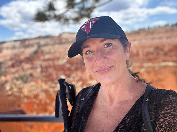
As a passionate female solo rider, I often find myself facing a barrage of incredulous looks and questions from both strangers and friends. They ask the usual list of queries: “Is it safe?” “Where will you stay?” “What if your bike drops?” It’s become almost customary to respond by sharing my blog or articles that capture the essence of the joy I find in solo travel, whether by foot or by bike. This brings me to my latest and most epic solo adventure – a motorcycle journey from my home in the enchanting town of Sedona, Arizona, all the way up to the stunning landscapes of Canada. Covering over 6,700 miles of magical terrain, this journey was a test of my spirit and a celebration of my love for long distance motorcycle travel.

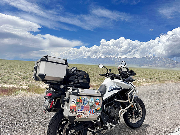
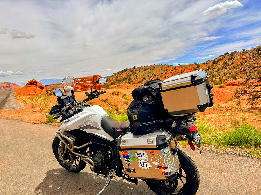
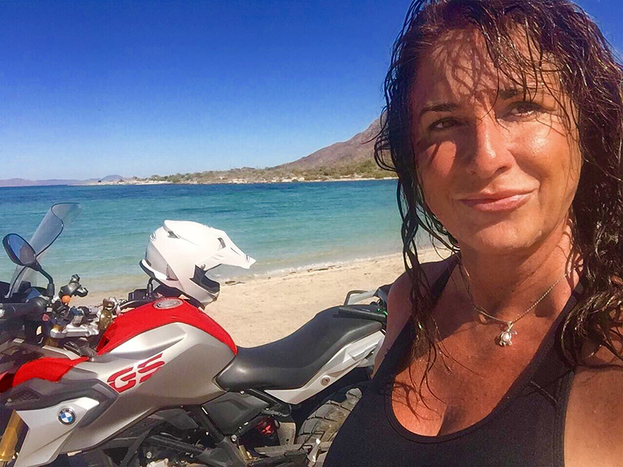
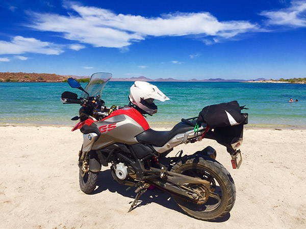
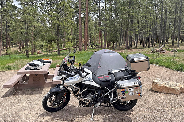
It all began last fall when the idea of a ride to Canada took hold of me. I knew that this was the journey I was meant to embark upon. I was determined to take my time, to savor the journey, and to visit as many National Parks as possible along the way. My plan was simple yet liberating: I would make up my route no more than a week in advance, pack light, and camp as much as possible off my trusty motorcycle, a three-cylinder Triumph Tiger 900 GT Pro, lovingly named Tippi.

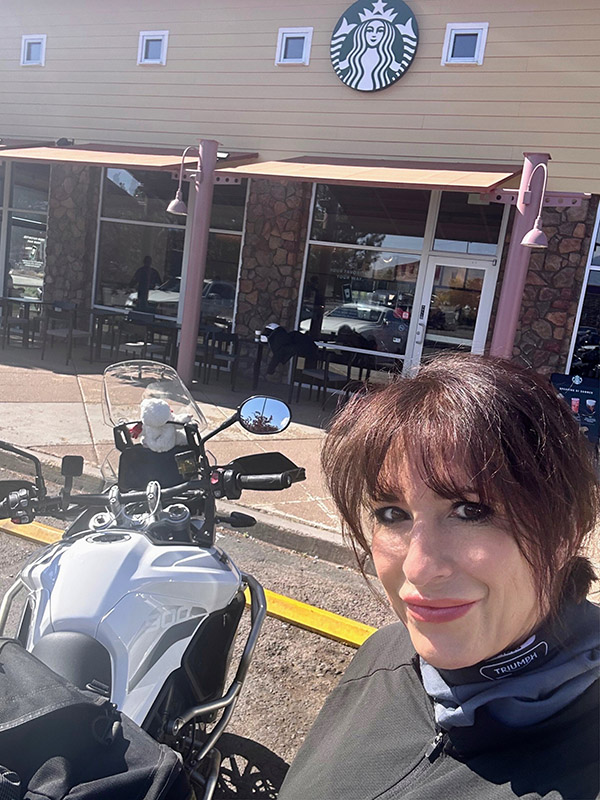
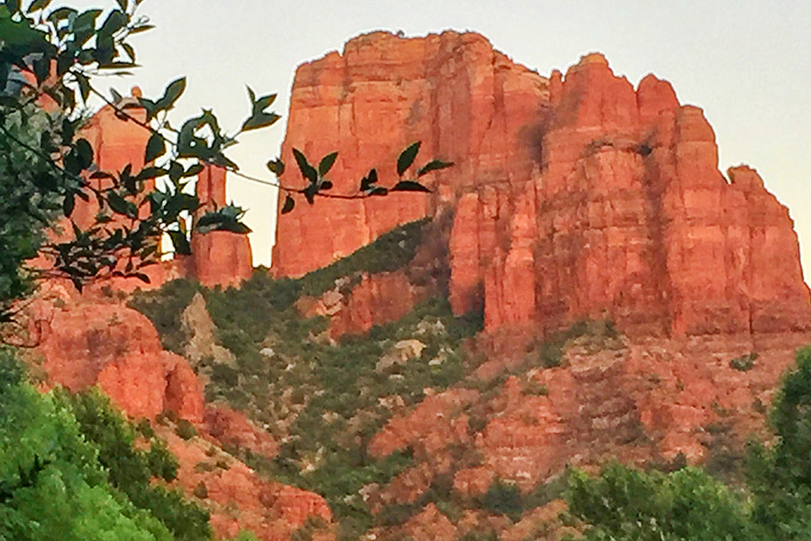
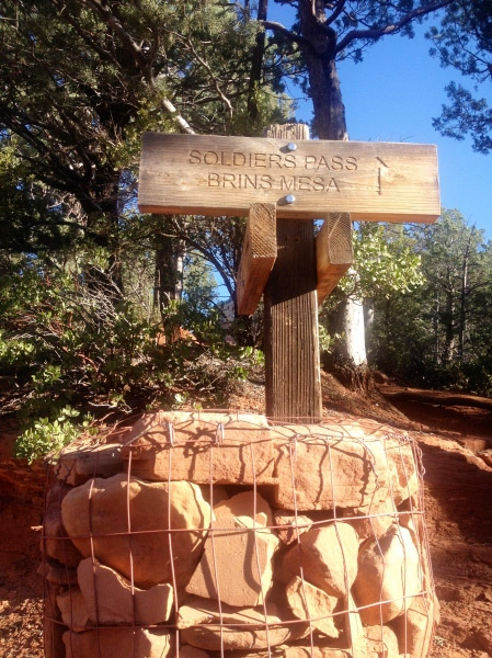
On the crisp morning of June 2nd, with the sun just beginning to warm the high desert of Sedona, I geared up for my adventure little did I know then that I would be gone for 11 plus weeks. The air carried an unusual coolness, a welcome departure from the scorching desert temperatures. My first stop was an obligatory one – Flagstaff, Arizona, just a short 30-mile ride from Sedona. The journey up Oak Creek Canyon was a visual feast, with Red Rock views and sinuous twists and turns that are a motorcyclist’s dream. I found myself at a Starbucks in Flagstaff, sipping on a well-deserved Americano, wondering what the day had in store for me as I charted my course towards North Grand Canyon National Park.

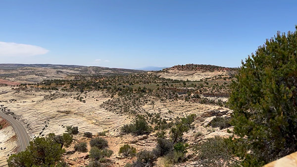
Leaving the comfort of Flagstaff behind, I embarked on Highway 89-A, leaving the tall pines of the city in my rearview mirror. The road led me to Lees Ferry, a spot where I could steal a quick moment with the majestic Colorado River. Riding through this part of Arizona on 89A felt like transitioning to another world. The landscape shifted from rugged mountains to a breathtaking desert expanse. Sandy plains, cacti, and the awe-inspiring sight of the Colorado River slicing through towering cliffs and canyons greeted me. Every time I ride through this area, I feel like I’m letting go of the worries of the world and immersing myself in the raw beauty of nature.

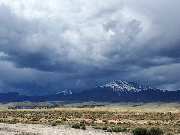
Arriving at Lee’s Ferry, I gazed in wonder at the grandeur of the Colorado River. Red Rock bluffs reached skyward, casting their reflections onto the water’s surface. A few photos captured the essence of the moment, and then I was back on the road, with Tippi carrying me across the vastness of the desert landscape with mountains looming in the distance with turbulent looking skies, laden with the threat of rain seemingly daring me to press onward.

Press on I did, and by the time I arrived at Jacob Lake, I was soaked to the bone. The reward, though, was immediate and satisfying. The general store at Jacob Lake had the antidote to my damp spirits – a hot cup of coffee and the most heavenly homemade cookies I’ve ever tasted in Arizona. While I warmed up and indulged my taste buds, I chatted with fellow riders who regaled me with tales of epic early June snowstorms they’d encountered that day while riding back from the Grand Canyon. It’s moments like these, swapping stories with fellow riders, that make a solo journey so enriching.

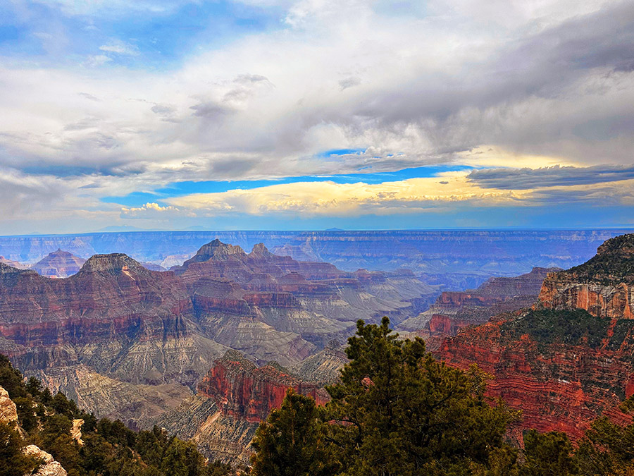
A swift pit stop at Jacob Lake was followed by the task of setting up my tent, which proved to be a bit of a challenge in the rain. But that’s the essence of adventure riding, isn’t it? You adapt, you overcome, and you keep moving forward. With my campsite established, I wasted no time and headed to North Grand Canyon. Fortunately, I was spared the snow, but a wicked hailstorm tested my resolve as I carefully made my way further up the rim.

By the time I reached the park, the weather gods seemed to have taken pity on me. Dry weather prevailed, and I was treated to the most dramatic skies one could hope for when visiting the North Grand Canyon. As I stood there, gazing out into the vast expanse of this natural wonder, I couldn’t help but feel humbled by the forces of nature and the grandeur of the world we live in. It was a moment of pure serenity amidst the chaos of my journey.

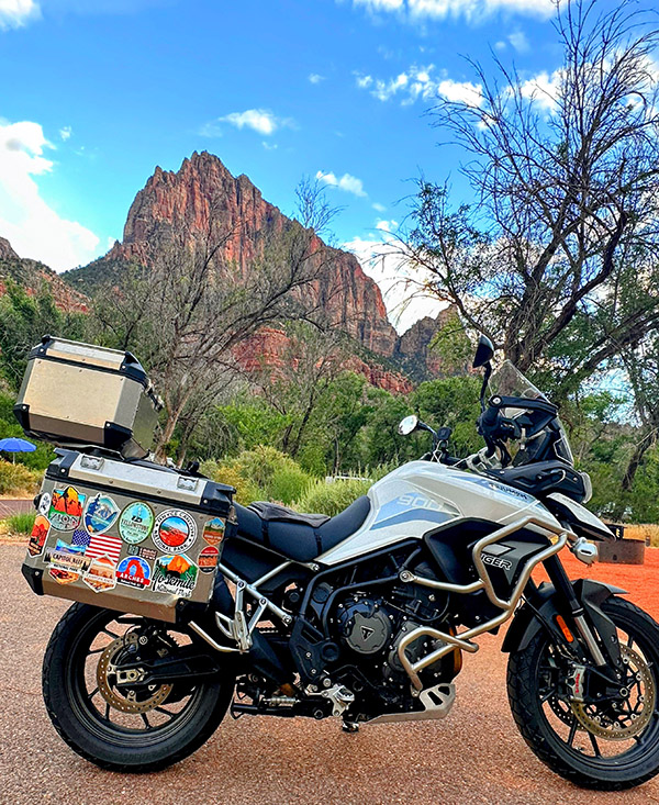
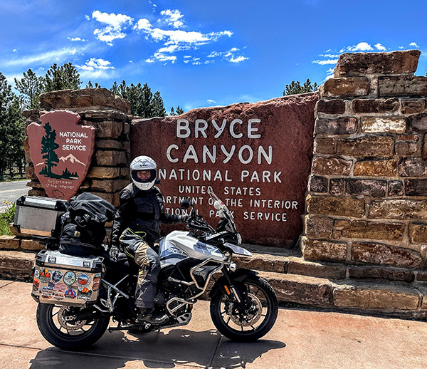
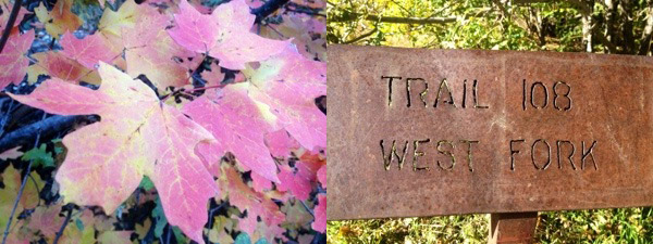
The following morning, I bid farewell to North Grand Canyon, heading down into Kanab for a quick gas and coffee break before completing the remainder of my ride on Highway 89A, with Zion National Park as my next destination. With two days and one night to immerse myself in the beauty of Zion, I was eager to experience the park in all its glory.

Entering Zion National Park on a motorcycle is a unique adventure. The winding roads and the freedom to embrace the open road add an extra layer of exhilaration to the journey. Plus, if you time it right, like I did, arriving early can help you avoid the epic traffic jams that can plague this popular destination.

Setting up camp as quickly as possible, I wasted no time in hopping onto a shuttle ride to the park’s lodge. From there, I embarked on a day of hiking, exploring several of Zion’s shorter trails. I couldn’t resist attempting to secure a permit for Angel’s Landing, a trail known for its breathtaking, albeit nerve-wracking, vistas. Alas, the permit eluded me, but that didn’t dampen my spirits. Zion offered me an array of other trails and sights to explore, and I reveled in every step I took.

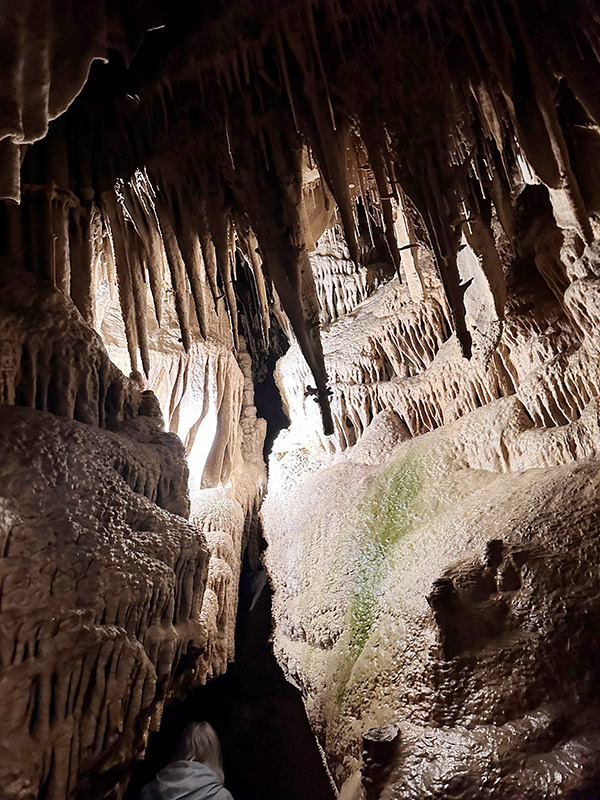
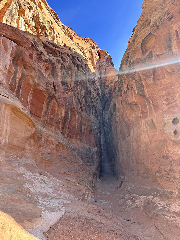
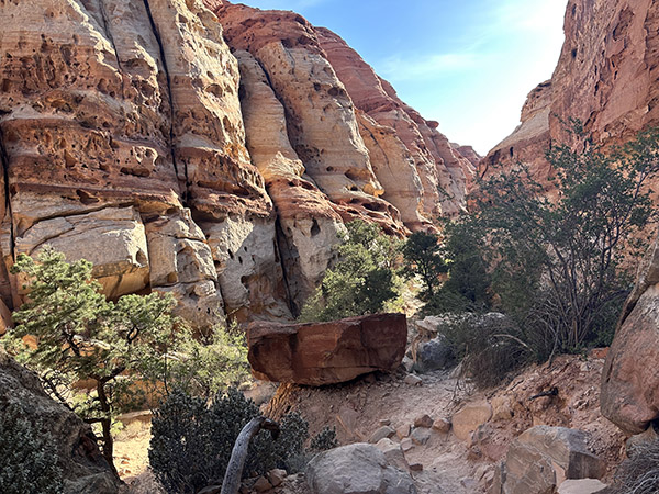
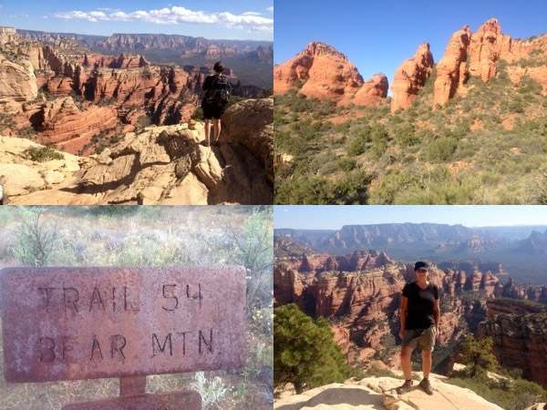
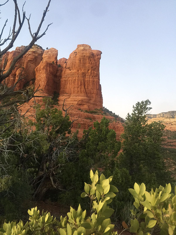
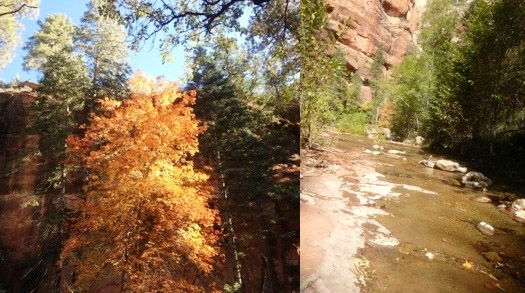
Zion’s rugged beauty is a testament to the power of nature’s sculpting hand. Towering sandstone cliffs, cascading waterfalls, and the vibrant colors of the Virgin River create a landscape that feels otherworldly. With my camera in hand, I captured every nuance of this remarkable place. Hiking a portion of the Narrows, with water rushing around me, was a highlight I’ll carry with me forever. Zion National Park, with its mesmerizing mix of desert and oasis, and once again confirming why I love this park so much.

As I lay in my tent that night, listening to the sounds of the wilderness around me, I couldn’t help but reflect on the incredible journey I’d embarked upon. From the stunning landscapes of my hometown of Sedona to the awe-inspiring grandeur of the Grand Canyon and the mesmerizing beauty of Zion, my solo motorcycle ride to Canada had already been a whirlwind of experiences. And this was just the beginning.

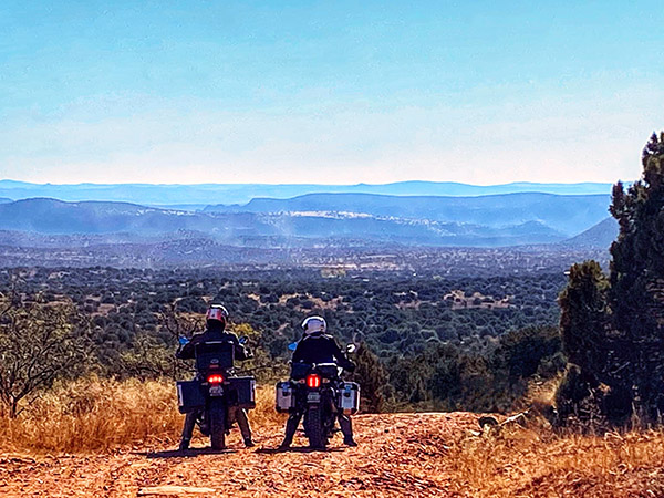
My journey would continue northward, taking me through more National Parks, enchanting towns, and breathtaking vistas, mountains, desolate beaches, and new friends I’d yet to meet. Each twist and turn of the road held the promise of new adventures and the opportunity to connect with the world in a way that only solo travel can offer. The open road called me, and I was more than ready to answer its invitation.


In the world of solo travel, there’s a unique freedom and self-discovery. It is a chance to test your limits, embrace the unknown, and find solace in the beauty of the world. My motorcycle journey from Sedona to Canada was not just a ride; it was a pilgrimage of the soul, an exploration of the heart, and a celebration of the indomitable spirit of the open road. As I drifted into sleep under the starry Utah sky, I couldn’t wait to see where the road would lead me next on this remarkable adventure.

My fellow adventurers, I invite you to stay tuned for the next captivating chapter of this solo ride from Sedona to Canada. The open road stretches before us, brimming with the promise of extraordinary experiences and inspiring tales yet to be written. With each twist of the throttle I embrace the unknown, and I can’t wait to share the unfolding journey of a lifetime with you.


Never miss an ExNotes blog:


The Wayback Machine: A Walk Across Spain (Part 1)

By Bobbie Surber

The Camino de Santiago, also known as the Way of St. James, is a network of pilgrimage routes that lead to the shrine of the apostle Saint James the Great in the cathedral of Santiago de Compostela in Galicia, Spain. The Camino has been a popular destination for Christian pilgrims for more than a thousand years, and it is now visited by people of all faiths and backgrounds from around the world.

There are several routes of the Camino de Santiago, including the Camino Frances (French Way), which is the most popular, and the Camino Portugués (Portuguese Way), which starts in Lisbon or begins in Porto for a two-week shorter Camino. The Camino de Santiago is a long-distance walk or hike that typically takes 30-40 days to complete, depending on the route and the pace of the individual pilgrim.

Along the way, pilgrims stay in Albergues (pilgrim hostels) or other types of accommodation and follow the yellow arrows and shells which mark the way. The Camino de Santiago offers a unique opportunity to experience the beauty of the Spanish landscape and culture and to challenge oneself physically and spiritually.


Please click on the popup ads!


I walked seven different Camino Routes with my first Camino in 2012 and the last in September 2021. My last walk found me starting in Pamplona, Spain, a vibrant city never lacking a reason for a fiesta, a city known worldwide for the Running of the Bulls every July.  I ended my journey in Leon, Spain. With my added side trips, I walked over 300 miles, experiencing high desert plateaus, the Rioja wine region, the blissful Logrono’s tapas, the magnificent Burgos Cathedral, the Meseta’s emptiness, and the joy of Leon.

I was on a multi-month motorcycle/camping trip through Arizona, Utah, Colorado, Wyoming, and Montana. When riding, there are times when every part of your brain is laser-focused on the road ahead of you and who might try to run you over from the back or side, but every now and then, the ride is so peaceful that you have time to turn a portion of your brain to the gift of “I wonder.” This led me to reminisce over my six prior walks along different Camino routes in Spain, Portugal, and France. Once released, an avalanche of memories and images flowed to the point that I knew I would be booking my flight to Europe as soon as I stopped my ride for the day.

A quick Google Flights search gave me what I needed, and I soon had a ticket. This was another solo walk, my favorite way for most hikes. My arrival in Pamplona was early enough that I decided to start my Camino right from the Pamplona Airport, bypassing one of my favorite cities in Spain.

The morning had the hope of the fall weather yet to come as I headed slowly up the first of several foothills with the goal of a 10-mile walk for my first day. The gravel crunched satisfactorily underfoot as I quickly adjusted my backstraps to climb up to an iconic ridge that all pilgrims look forward to, the Alto del Perdón, a mountain pass in the province of Navarra in northern Spain, about 12 miles outside of Pamplona. I had returned to the Camino Frances trail after nine-year of absence, taking in beautiful views of the surrounding landscape and a chance to rest and recharge. The mountain pass is named after a sculpture of the Virgin Mary and the phrases “Señora del Camino” (Lady of the Way) and “Perdón” (Forgiveness), which are inscribed on the base of the sculpture. The windswept ridge and the massive wind turbines in the background contrast the sculptures that represent a pilgrimage from the Middle Ages. I took my first full breath after 18 hours of travel and an excellent 8-mile walk to this point. I thought about my intentions for this walk, what I hoped to gain and whom I would miss in the coming weeks of a long walk across most of Spain.

Reluctantly leaving the ridge late afternoon, I knew it would be challenging to reach my Albergue for the night. The steep loose gravel trail reminds me that my knees are not what they used to be, and motorcycle riding for the prior months did little to prepare me for the rigors of this walk. Soon the village of Uterga appeared with another climb up to her main street. My arrival timed perfectly to watch the evening stroll of the locals begin, kids running in the square, little old ladies with perfectly quaffed hair and well-put-together outfits ambling in deep conversations. Adults were sitting in outdoor cafes having a drink, visiting each other, and enjoying the last dregs of daylight. I wanted to plop my disheveled self within their mist and order my first long-awaited glass of Vino Tinto, but I pulled myself together and made the last of my walk to my Albergue in short order.

This first night’s stay found me in a dorm room in a private Albergue with its small restaurant and bar. After showing my pilgrims pass (issued to show you are walking the Camino) and paying 12 Euros for my place in the dorm room, I quickly dumped my backpack on my bed, looked in the mirror, confirmed I looked like a wreck, dashed for the bar, and ordered my first of many good Rioja wines. Settling in, I met my first group of fellow pilgrims. A portly German fellow in his mid-fifties that I would painfully learn would serenade us throughout the night with his epic snoring. Also, a group of Italian bicycle riders. They were loud, and all were talking at once with what would become the usual question:  Why is an American woman walking the Camino alone?  Well, that’s a question for another day! I order my second glass of wine and move into the restaurant for the start of the evening’s Pilgrim meal, an inexpensive three-course meal with portions that could feed a small family, and your choice of bottled water or a bottle of wine, Good God, man, why would you order the water?  I certainly did not.

I had equal feelings of contentment and joy seeping in as German, Italian, and Spanish conversations swirled around me—fellow pilgrims sharing their day’s success and physical hardships. Many of the pilgrims had started 60 miles back on the French side of the Pyrenees, had survived the celebrations of Pamplona, and were still in high spirits so early in their walk. I listened to their stories and their countless toasts made in several languages. I left the room while the wave of conversation and laughter reminded me of how lucky I was to be on this walk for a 7th time. This surely was the beginning of an epic adventure and the hope of what Spain had in store for me.


Never miss an ExNotes blog:

Highway 50: The Loneliest Road in America

By Bobbie Surber

Embarking on a motorcycle trip from Arizona to British Columbia I set two goals for myself: to visit as many national parks as possible and to explore remote and intriguing roads.  During my pursuit of the latter that I stumbled upon Highway 50, also known as the “Loneliest Road in America.” It offered the bonus of passing through the Great Basin National Park.

Like any good planner, I turned to social media for advice on surviving this desolate route (add in a touch of sarcasm). The responses I received were mostly negative, with warnings about the challenges of riding alone, extreme heat, lack of gas stations, and overall boredom. However, a few seasoned riders who were familiar with the road reassured me that not only would I survive, but I would also have the opportunity to earn a certificate attesting to my survival. With this mixed bag of feedback, I embarked on my journey, eager to uncover the truth about the Loneliest Road.

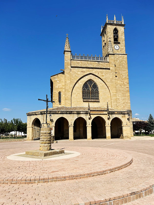
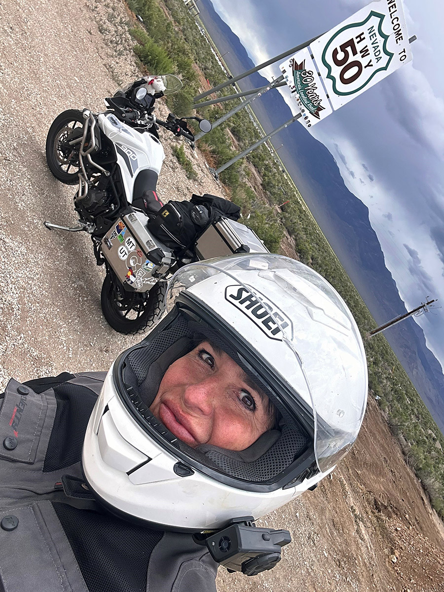
Highway 50, stretching from West Sacramento, California, to Ocean City, Maryland, is a scenic route that earned its moniker from a 1986 Life magazine article that described it as desolate and isolated. The section of Highway 50 referred to as the Loneliest Road is in Nevada. This road winds through vast stretches of remote desert landscapes, featuring rugged mountains and expansive plains that contribute to its reputation.

Traveling along the Loneliest Road offers a unique experience, characterized by long stretches between services. It is essential for travelers to come well-prepared, as gas stations, restaurants, and accommodations are few. Adequate fuel, extra food and water supplies, and an acute awareness of weather conditions, particularly during extreme heat or summer and winter storms, are crucial.

Despite its reputation for solitude, the Loneliest Road in America showcases stunning natural beauty, allowing travelers to immerse themselves in the vastness of the American West. Along the route, one can encounter remarkable attractions such as the Great Basin National Park, Lehman Caves, and several ghost towns. These highlights offer a glimpse into the unique charm and allure of this road less traveled.

Let’s dive into my own epic experience along this renowned route.

My journey began when I left my home in Sedona, AZ, riding my trusty Triumph Tiger 900 GT Pro, affectionately nicknamed “Tippi,” as she likes to take what I call unscheduled naps tipping over often at inconvenient locations. Loaded with gear for a summer of adventure, I set off on a bright June Sunday morning, spending five days exploring North Grand Canyon, Zion, Bryce Canyon, and the captivating Highway 12, before spending two nights in Capitol Reef.

Leaving Capitol Reef, I eagerly anticipated joining the long-awaited Highway 50, where it intersected Interstate 15 in Utah. Initially, the road meandered through open plains with scattered ranches along the way, offering nothing too remarkable. However, about an hour later, the ride became more intriguing as the winds picked up. As I glanced ahead, an ominous sky threatened an impending storm. Riding past sand and salt fields, I witnessed a bewildering phenomenon—the salt in the fields seemed to defy the wind, rising straight up in vertical columns rather than blowing or swirling. Bracing myself against the wind’s force, I pulled over to capture this puzzling sight but struggled to capture it adequately, settling for a short video clip as proof of my encounter.

Continuing across more plains, I found myself nearing the turnoff to Baker and the Great Basin National Park, my intended destination for two nights of camping and sightseeing. As I gazed at the mountain, I found an angry and ominous sky with snow-covered peaks that seemed to dare me to face the challenges of reaching its 7700-foot elevation to my destination at Upper Lehman Campground. Rain and lightning accompanied me as I rode into the tiny town of Baker, where I hastily stopped at the Visitor Center to check the weather report and determine how cold it would get during the night. Assured of temperatures above freezing, I pressed onward, rewarded with an epic campsite at Great Basin. Nestled alongside the rushing Lehman River, my campsite offered complete privacy, and I reveled in the wonders of the park over the next two rain-filled days and nights. The Lehman Cave tour was an unforgettable highlight not to be missed. As an avid hiker I loved that I was able to experience an epic 7-mile round trip hike along the mountain following ever upwards along the Lehman River complete with snow covered meadows and towering views of the mountain summit.

During my stay in Baker, Nevada, I discovered two places that I highly recommend. The first is the 489 Grill and Whispering Elms Motel and RV Park, which boasts a bar, RV and tent camping facilities, firewood, and the best burger I have ever tasted. Trust me when I say this is a significant claim, as I am a true burger aficionado. The food is not the only remarkable aspect; the owner and staff are incredibly hospitable, making your visit all the more enjoyable. The second recommendation is the Bristlecone General Store, a quaint establishment offering unique local gifts, an unexpectedly diverse selection of food options given its small size, and a coffee bar serving locally roasted beans by a blind roaster with an extraordinary sense of smell, resulting in a delightful brew devoid of the bitterness found in commercial beans. Among the store’s charms, one staff member named Rachel stood out for her warmth, hospitality, and willingness to share insights about Baker and local hidden gems. I was informed that Sandra’s Food Truck serves excellent and affordable Mexican cuisine—an experience I now eagerly anticipate for my future visits.

Reluctantly bidding farewell to Baker, I rejoined Highway 50, heading towards my next destination, South Lake Tahoe. Contrary to the dire warnings of scarce gas stations, I discovered that this notion was unfounded. Approximately 70 miles down the road, I arrived at Ely, another small mining town with plenty of services. After a quick refuel, I resumed my journey, realizing that the otherwise flat stretches of road were intermittently punctuated by mountain passes exceeding 7000 feet in elevation. These segments offered breathtaking vistas and enough twists and turns to satisfy both Tippi and me.

My first mountain pass, before descending into Ely, Nevada, presented an exhilarating ordeal with rain, lightning, and a brief ten-minute ride through hail. Eighty miles further, I found myself in the town of Eureka, where the threatening skies curtailed my exploration time. Nevertheless, I managed to visit a few must-see attractions, including the Opera House, built in 1879, the still-functional Courthouse of the same vintage, and a brief excursion to the town’s cemetery, where a variety of burial sites represented different social organizations, religious groups, and ethnicities. This walk-through history provided a fascinating glimpse into the town’s past.

Continuing on Highway 50, with the ominous skies in my rearview mirrors, I was reminded of the urgency to press on towards my next stop—Austin, NV. This old mining camp retains its rustic charm and has evolved into a haven for camping, hiking, and mountain biking, thanks to its proximity to the towering Toiyabe Mountains. During a pit stop, I encountered a large group of riders following the Pony Express Trail, who praised my adventure, while I vowed to return in the near future to explore that historic route.

Reluctantly bidding farewell to this enchanting mountain town, I embarked on another 112-mile stretch to Fallon, Nevada. This promised a well-deserved lunch break and refueling opportunity before the final leg of my journey to Lake Tahoe. As hunger pangs intensified, I hurriedly pulled into the first gas station I encountered. Curiously, the ground appeared slanted, making it impossible to safely park my bike with its kickstand without an extreme lean. Oddly, as my kickstand tends to be a bit high, I often worry about Tippi toppling over. Trying another station, I realized that my kickstand was not misaligned but broken—a sudden and unfortunate realization. With every ounce of strength, I fought to prevent Tippi’s full weight from pinning me between the gas pump curb and the engine crash bar. As I cried out for help, a kind soul named Caleb rushed to my aid, assisting me in righting Tippi. Examining the kickstand, I conceded that my lunch break was a lost cause. I refueled while seated on my bike and came to terms with the fact that I would have to ride the rest of the way without lunch and with a dangling kickstand, just inches off the ground.

Determined to soldier on, I pushed forward to Carson City, Nevada, before ascending the switchbacks and descending towards Lake Tahoe. The ride and the stunning view of the lake were awe-inspiring. I completed the remaining portion of my day’s journey with ease, covering over 400 miles. A warm hotel bed awaited me after seven nights of camping, and I eagerly anticipated reuniting with my boyfriend, Mike Huber, a fellow adventure rider who also happens to be a badass. I recommend checking out his posts on ExhaustNotes for a combination of insightful rides and outrageous travel stories.

In conclusion, my time on the Loneliest Road in America was an unforgettable experience. Despite the dire warnings I received, I found this historic stretch of highway to be well worth the ride. Contrary to popular belief, there are plenty of services available along the route, and the road itself is intermittently adorned with scenic mountain passes. The friendly locals and the sense of freedom that permeates this lightly traveled road are rare treasures that I seldom encounter. If you’re seeking a unique journey through the American West, I wholeheartedly recommend venturing onto the Loneliest Road in America.


Don’t forget to help bring content to you:  Please click on the popup ads!


Never miss an ExNotes blog:

My Favorite Ride in the USA: Utah’s Highway 12

By Bobby Surber

Highway 12, also known as Utah State Route 12, is an awe-inspiring scenic byway in southern Utah that holds the prestigious title of being an “All-American Road.” Stretching approximately 124 miles, this route captivates travelers with its breathtaking landscapes and unforgettable views.

Starting near Panguitch, my journey along Highway 12 began with mounting excitement as the first red arches came into view. I took a short detour off of Route 12 to immerse myself in the famous hoodoos and trails of Bryce Canyon National Park. Lucky enough to secure a campsite at Sunset Campground, I made quick work of setting up my camp and heading out for a long afternoon hike. The next morning I witnessed a magnificent sunrise casting a warm glow over the canyon, illuminating the striking hoodoos and crimson rocks, a memory I won’t forget!  A one-night stay in Bryce leaves one unsatisfied and longing for more time to explore her magnificent trails.

Continuing my adventure the following morning, I eagerly resumed my route on Highway 12, heading towards my favorite section of the road, high above the captivating Grand Staircase-Escalante National Monument. This expansive and remote region boasts rugged canyons, vibrant cliffs, and extraordinary geological formations. The landscape and its impossible rock formations treated me to endless twisties, creating a sense of otherworldliness. My Triumph Tiger 900 GT Pro was as happy as I was as I relaxed into the ride and allowed her to remind me again what her three cylinders can do. Both of us were in sync as we leaned into curve after curve and blasted down to the bottom of the canyon.

For those with extra time, I highly recommend exploring nearby slot canyons such as Peek-a-Boo and Spooky Gulch, which offer outstanding hiking experiences.

Don’t miss the enchanting Calf Creek Falls nestled at the bottom of a lush canyon. A short hike leads to a captivating waterfall.  While leaving Calf Creek be sure to watch for a dirt road on the left with a sign for coffee. Take that turn and savor a cup of Joe with a view that will leave you speechless.

As I reluctantly approached the tiny town of Boulder, Utah, I realized I had made remarkable progress through the twisties.  I was unexpectedly greeted by an old-school cattle round-up, complete with cowgirls and boys herding a large herd down Highway 12! After a brief turnaround, I found solace in my favorite restaurant, the Burr Trail Grill. Their farm-fresh ingredients delighted my taste buds, whether it was their fresh arugula salad topped with local goat cheese or their beastly-sized burgers that proved a challenge to conquer.

Resuming my journey on Highway 12, I found myself in an unexpected predicament. The cattle herd’s progress was slow and I crawled along clutching endlessly as I felt my left hand about to begin a serious complaint! Amidst the frustration, two memorable moments emerged.  First, a passerby exclaimed, “Dude, you have the sweetest bike and setup!” We shared a laugh as he realized I was indeed “dudeless.” Second, after navigating my way to the front of the line, I convinced the lead cowboy to move the herd slightly to the right, allowing me to pass. Maneuvering my bike through the cows became a comical adventure, with prayers that the sound of my motor wouldn’t startle them. Experiencing this traditional cattle drive in 2023 felt like a slice of Americana and added yet another reason to love Utah.

Leaving the cattle behind I ascended Boulder Mountain, where endless views revealed the back of Capitol Reef on the right and scenic meadows with clusters of aspen, fir, and spruce trees on the left. Surprisingly, the mountain still boasted more snow than I expected in June. Camping, fishing, and wildlife viewing opportunities abound in this mountainous region, with numerous sites available. I’ve spent nights here savoring the breathtaking vista overlooking Capitol Reef and the sprawling valley floor.

As I arrived in Torrey, Utah, the end of Highway 12, I couldn’t help but lament the route’s brevity. With just 125 miles of captivating beauty, I yearned to turn around and experience it all over again. However, the call of the canyon beckoned me for a rewarding hike, followed by a well-deserved whisky to bring an end to a truly perfect ride.

Highway 12, Utah—truly a magical journey that captures the heart and leaves an indelible mark on the soul.


Never miss an ExNotes blog:


Help us keep the content coming:  Please click on the popup ads!

Three Favorite Sedona Hikes

By Bobbie Surber

Arizona’s Sedona area offers fantastic hiking.  This blog describes three of my favorites.

Bear Mountain Trail

Bear Mountain provides fantastic red rock views. The start of the trail is at about 4600 feet in elevation from the parking lot. At the final summit, the elevation reaches 6150 feet.  At the summit of Bear Mountain, you can see the San Francisco Peaks in Flagstaff, views of Bell Rock in the Village of Oak Creek, Verde Valley, peaks of Sycamore Canyon, and all West Sedona.

Bear Mountain hiking trails. From top left, going clockwise: Bear Mountain Canyon views, start of the Bear Mountain Trail, the Bear Mountain trailhead, and me atop Bear Mountain.

A warm spring day found me on the Bear Mountain Trail with a new friend I met during a Sedona Meet Up Hiking event. Linda is from New Jersey and is an avid outdoorswoman, hiker, and yoga devotee. I enjoyed Linda’s company as we marveled at the views and shared about our lives, family, and career paths.

I was happy that the Bear Mountain Trail DID NOT kick me in the behind. A challenging hike with an 1800 ft gain over the course of 3 levels of summits. This is a designated wilderness area, so there aren’t any trail markers once you enter the designated area. Watch for trail markings carefully and pay attention, as you will encounter several false summits before reaching the peak. Views along the way revealed stunning red rock slot canyons and an area resembling a mini Grand Canyon. This is a steep trail with some rock scrambling. Please pay attention to the trail, as it is easy to get off track. 2 liters of water is the minimum recommended for this strenuous hike, more on a hot day. A hat and walking poles are also very helpful.

This hike is advanced and difficult. You should be prepared with proper footwear, water, food, and layers of clothes.

Sugarloaf to Lizard Head to Chuck Wagon to Brins Mesa, returning via Jordan Trail

Sunday morning started with a chill in the air and an overcast sky. I postponed getting out of bed and decided on another cup of coffee; my favorite, extra dark roast made strong enough to curl your hair worked its magic as I continued to procrastinate a few moments longer with a leisurely read of the Sunday paper. My hiking shoes waited anxiously beside my bed for the impending long hike. Not sure if it was the regret of a wasted Sunday or the sudden clearing of the clouds, whatever it was, I surrendered, dumped the remainder of my brew, got the hiking shoes on, and headed out the front door.

Coffee Pot Rock.

My goal was to try out Day 1 of a planned 3-day hike in Sedona and the Village of Oak Creek. I headed to the Sugarloaf Trailhead catching the Andante trail over to Chimney Rock Saddle to connect to the Lizard Head trail. This is where I was momentarily lost. OK, not momentarily lost… but I could not locate the %&# trail for about an hour! Man, talk about the embarrassment of getting lost in my backyard!

After bushwhacking and following a new chain-link fence, I found Lizard Head and started the ascent. Within a half hour, I was high up on the side of the mountain, and sure, I was too high for this trail. Thank goodness for cell phones and a call to my friend Doug, the master of all things related to Sedona trails, who knew exactly where I was and assured me I only needed to butt-scoot down the rocks about 100 ft and begin my descent to the bottom of the trail. He was dead on!

The Brins Mesa marker.

Besides my inability to navigate easy-to-locate trails in my backyard, I did not care for this section due to road noise off Dry Creek Rd. This, however, was short-lived as Lizard Head connected to Chuck Wagon trailhead with a lovely new picnic area, maps, and toilets. A fast rest and lunch, and I was back on the Chuck Wagon trail heading to the Brins Mesa trail. Chuck Wagon trail meanders through open vistas and dry gullies with views over Boynton and Secret Canyon. A wonderfully easy trail with outstanding red rock views. By 3 pm, I was at the trailhead of Brins Mesa with the much-needed forest to cool me off. Brins Mesa is always my favorite. Not sure why; perhaps it is the rebirth after the fire of 2006 or the feeling of others that have walked this Mesa for hundreds of years. Whatever the reason, I had a surge of endorphins firing off in my brain, and I was in complete bliss despite a longer-than-expected day of hiking and a start of a dreaded blister on my little toe.

After an enjoyable day of hiking, one might think that nothing could top it. However, heading to the Oak Creek Brewery from the Jordan trailhead for a delicious hotdog and refreshing beer further elevated my experience in Red Rock Country. Spending a Sunday in this manner gives a new meaning to Sunday Funday!

This 12-mile hike is moderate difficulty. Bring plenty of water.

West Fork Trail in Oak Creek Canyon

The West Fork Trail is a moderate hiking trail known for its picturesque views of the red rock canyons and the crystal-clear waters of Oak Creek. The out-and-back trail follows the creek for about 6.4 miles and takes around 2 to 4 hours to complete. It is suitable for hikers of all levels, including families with children. Hikers should wear appropriate gear and bring plenty of water and snacks. You will make numerous water crossings and find that water shoes make the trail more manageable; check the weather forecast for storms and potential flooding.

On the West Fork Trail.

My morning could not have been more perfect. Hot coffee served bedside, the sun shining brightly, two soft-boiled eggs just the way I like them, and an 8 am date with Elaine to hike the Oak Creek Canyon.

West Fork leaves, and the West Fork trailhead.

What I did not expect was to hit the famed West Fork Trail at the perfect date and time to see our Arizona fall leaves at the most glorious time of year. The morning light was enchanting as it filtered into the canyon, backlighting the trees and setting the red rock cliffs glowing with burnt orange with soft buttery yellows and rust red. Childhood joy resurfaced as we worked our way back and forth across Oak Creek; with each turn along the trail, nature revealed yet another excellent view of the Canyon.

West Fork Trail scenes.

It is difficult to describe this trail’s beauty in the fall. The experience goes beyond language; one must turn inward and fully immerse themselves in the earth’s magic beneath their feet. The power of the running creek and the ever-changing red rocks add to the enchantment of the surroundings, creating a truly indescribable experience. The company was as wonderful as the views along this hike.  It was so nice to have some Elaine time and, for a moment, remember what it is like to be removed far from our hectic busy lives and reacquaint with an old friend in an enchanted setting such as this.

Be prepared to face water crossings.


Sedona and the surrounding areas have an abundance of hiking opportunities. Thirty-seven years of living in this Red Rock paradise, and I still have hikes on my list yet to be explored. If you are planning a trip to Sedona, consider using All-Trails and stopping by the Forest Service office for up-to-date restrictions and trail conditions.  If hiking is what gets your mojo on, then Sedona will not disappoint!

A Walk Along The Famous Dingle Way: Part II

By Bobbie Surber

The Dingle Way is a 112-mile-long walking trail that circles the Dingle Peninsula in County Kerry, Ireland. The trail takes walkers through diverse landscapes, including rugged coastlines, sandy beaches, rolling hills, and picturesque villages. Along the way, walkers can enjoy stunning views of the Atlantic Ocean and ancient archaeological sites and historic landmarks, such as the Gallarus Oratory, a well-preserved early Christian church dating back to the 7th or 8th century.  I previously wrote about the first part of this trip; you can read that blog here.  This blog completes the trip.

Day 3: Inch Strand to Dingle

After a filling Irish breakfast at Inch Strand, I embarked on my journey, following trails and secondary roads that provided stunning bay views. As I turned inland towards Annascaul, I continued along more secondary roads that eventually led me to a rocky beach and castle. The scenery along the way was breathtaking, and I frequently stopped to soak in the beauty of my surroundings. Leaving the beach behind, it was just a few miles to Lispole before arriving at the day’s final destination in the town of Dingle. As I approached the village, I was struck by how small and easy it was to navigate on foot. Music could be heard at every turn, and the town was bustling with activity. The shops were fantastic; it was a great place to restock and prepare for the remainder of the trail.

Dick Mack’s for whiskey tasting.

One of the highlights of my stay in Dingle was visiting Dick Mack’s Pub. As a whiskey lover, I was thrilled to discover that the pub was known for its extensive Irish whiskey collection. The bartenders were incredibly knowledgeable and passionate about the spirits, and I spent a delightful evening sampling various types of whiskey and learning about their unique flavors, meeting locals, and developing the start of some new friendships.

For those interested in live music, Dingle is a great destination. Just pop your head into any pub, and you’ll likely find Ireland’s version of Nashville, with hundreds of talented musicians on every corner. One of my favorite spots was the Courthouse Pub, a tiny establishment with an impossibly low ceiling, friendly staff, and some of the best music in Dingle.

 Day 4: Dingle to Dunquin

This was the hardest day of the trail so far, with a 14-mile trek that started by departing Dingle and heading to Ventry. The first four miles were relatively easy, except that the surface was entirely hard, making it quite taxing. In Ventry, I found a small post office with a combination grocery store, and I took a nice break to restock and meet some very kind local ladies hosting a fundraiser for hospice care. The locals had baked their best desserts for the event and invited me to join in, and I couldn’t resist the temptation of the delicious treats.

One of Day 4’s views.

As soon as I left Ventry, I was treated to a beautiful long beach walk to the other side of the bay. Schoolchildren were busy cleaning the beach, and locals walked along the shore, enjoying some sunshine. Next up was a bit of road walking along Sledge Drive, with dramatic sea views before turning to Mount Eagle. The climb was tough, taking several hours through sheep pastures and offering dramatic sea views.

A view of the Atlantic long the Trail.
Another dramatic coast view.

The trail was wet, uneven, and a real thigh workout, but the day was as lovely and magical as possible. It’s hard to describe the uniqueness of walking through a new land – the way the vista unfolds before you, the smell of the earth, the local bakery, the scent of livestock, and the chance to witness the locals going about their daily lives. You experience a level of intimacy that cannot be duplicated by any other mode of transportation other than your own two feet.

An ancient beehive dwelling.
Beehive dwelling ruins.

Besides the breathtaking views and walking along ancient stone walls, I saw many Beehive ruins and ancient dwellings from the 9th century. About when I thought I couldn’t go uphill anymore, the trail took a steep decline down to the road and the start of the entry to Dunquin. I stopped for coffee and continued another two miles on the hard road to the Youth Hostel and the exceptionally kind host who took great care of her guests. Another great day!

A castle along the Dingle Way Trail.
A scene on the Trail.
More ruins along the Dingle Way Trail.

Day 5, 6, and 7: Dunquin to Ballydavid and Kilcummin

The following day, my friend Patrick generously offered to drive me back to the trailhead for my hike over the pass of Mt. Brandon. Despite the less-than-ideal weather conditions and concerns from locals about my solo hike, I assured them that I would turn back if the fog worsened. Nonetheless, as I gazed upon the climb ahead of me, I couldn’t help but feel a moment of nervousness.

The hike to the top of Mt. Brandon was a challenging 3.5-mile ascent, with no switchbacks and only soggy, boggy, and uneven terrain underfoot. The descent was equally difficult, with even less stable footing. It wasn’t until I reached the 6-mile mark that I could finally walk on a dirt, mud-filled road and breathe a sigh of relief.

Nephew Brandon and his wife.

This day was significant to me, as I had set out to summit Mt. Brandon in honor of my nephew. Despite the thick fog that prevented me from reaching the peak, I made it to the saddle, with the peak looming above me. Looking back at the mountain while standing on that muddy road, I witnessed a moment of awe-inspiring magic. The fog slowly crept down the mountain, lifting to the heavens and spreading its fingers across the valley floor. It felt like a blessing, a gift I didn’t deserve but received nonetheless.

At that moment, I realized that reaching the peak wasn’t as important as the day of remembrance I had dedicated to my nephew. I knew Brandon would have been proud, and I felt grateful for the time I had shared with him. I had promised to honor his love for the outdoors, his welcoming spirit toward everyone he met, and his devotion to his family.  The day had been physically and emotionally draining, but it was a perfect day I will never forget. To my dear Brandon, the boy who will forever live in my heart, I raise a glass and say, Sláinte.

Entering the town of Brandon, I stumbled into a bar and enjoyed a delicious meal of homemade soup and bread with a pint of Guinness and a shot of Green Spot to revive and celebrate my hard passage. The café was warm and welcoming, and the owners were friendly and eager to chat about the beauty and challenges of the trail.

Following a satisfying lunch, I continued my journey, passing through more rolling hills, herds of sheep, and farmland until I reached the charming village of Kilcummin. As I approached, I was treated again to awe-inspiring views of the Dingle Peninsula and the vast expanse of the Atlantic Ocean. Fortunately, I found the perfect B&B, a lovely farmhouse in the countryside’s heart. The hosts were warm and welcoming, and I enjoyed a peaceful and restful night’s sleep after a long day of hiking.

Day 8: Kilcummin to Tralee

The week had passed quickly, and I was both sad and excited to confront my final day on the Dingle Way. The day brought plenty of sunshine and was a relatively easy one, with just over 8 miles of walking to the town of Tralee. The trail took us through more picturesque countryside, with fields of sheep and cows grazing lazily in the sunshine.

John the Baptist well.

Passing through the village of Castlemaine, which is famous for its links to the legendary outlaw, Daniel O’Connell. O’Connell was a lawyer and politician who fought for Catholic emancipation in Ireland in the 19th century, and he was a hero to many Irish people. Castlemaine is also home to a small museum dedicated to the area’s history.

Another scenic spot along the Trail.

Approaching Tralee, you could see the town’s famous landmark, the Rose of Tralee statue, dedicated to the same name’s song. The statue depicts a young woman holding a rose, and it is a popular spot for tourists to take photos. What a wonderful end to the Dingle Way trail with an afternoon exploring Tralee by spending time exploring the town’s shops, restaurants, and museums. Tralee is a bustling town with a rich history and worth much time exploring.

Conclusion

The Dingle Way is a truly magical experience, offering breathtaking views, fascinating history, and the chance to connect profoundly with the natural world. From the windswept beaches of Inch Strand to the rolling hills of Kilcummin, the pure joy to be found in the town of Dingle, the trail takes you on a journey through some of Ireland’s most stunning landscapes.

An Irish sunset.

Along the way, I met countless friendly locals who took me instantly in as one of their own with legendary hospitality that is well deserved and a balm to the heart of an American. Take your time to enjoy delicious food and drink. Lean into the culture and history of the Dingle Peninsula. The trail is sometimes challenging, but the rewards and friendships made along the way are more than worth it.

I can’t wait to go back and do it all over again!

Part 1 of the Dingle Way, Ireland – Tralee to Camp

By Bobbie Surber

The Dingle Way trail in Ireland was an epic adventure that left me feeling invigorated and alive. As a lover of hiking and long-distance walking, I knew that Ireland would offer the perfect landscape to immerse myself in nature and challenge my physical limits. I was torn between the Ring of Kerry and the Dingle Way, but after much research and the advice of a dear friend, I chose the latter for its remoteness and stunning vistas.

The Dingle Way is a long-distance walking trail that spans approximately 115 miles across the southwestern region of Ireland. The trail begins and ends in the charming town of Tralee, passing through the picturesque town of Dingle and the stunning Dingle Peninsula. The views along the way are nothing short of breathtaking, with panoramic views of the Atlantic Ocean, the Blasket Islands, and the Macgillycuddy’s Reeks mountain range.

After a long train ride from Dublin, I arrived in Tralee, a charming town in County Kerry. The town is known for its friendly locals, rich history, and stunning natural beauty. It serves as the county seat of Kerry and is the starting point for both the Dingle Way and Kerry Camino trails. After checking into my room for the night, I took advantage and visited the famous Roses of Tralee, the nearby Tralee Bay, and the breathtaking views of the Atlantic Ocean, rugged cliffs, and rolling hills. My day ended with a hearty bowl of vegetable soup and my newfound love of Red Breast single pot Irish Whisky. Aided by a wee drop of Red Breast, I returned to my lodging and fell into a dreamless sleep.

I woke early the next morning in time to see the light break through a brooding overcast sky. As I sat enjoying the conversation of my host, Veronica, I could not help but linger over my stellar Irish breakfast and excellent strong coffee. Reluctantly I said my farewells and set out for the official first day of my journey. I felt a wave of nostalgia for my past adventures and growing excitement for this one. The weather was typically Irish, with epic wind and rain pounding the trail, but I relished the challenge and pushed myself to keep going. The dark sky contrasted sharply with the emerald foothills, and the wind dared me to remain upright with the weight of my backpack. But I felt alive with the excitement of the adventure.

As the day wore on, I stumbled upon a cozy sliver of a pub in the village of Camp. The bartender’s great-grandfather built the pub, adding a touch of history to my visit. Stepping inside, I was immediately enveloped in warmth and hospitality. The locals were friendly and welcoming, and the music and laughter echoed off the walls. It was the perfect place to recover from a long day on the trail.


Have you clicked on any of the popup ads yet?


Sipping on a pint of Guinness and chatting with the locals, I felt a deep contentment and gratitude. Despite the day’s challenges, I had made it to this cozy pub, surrounded by new friends and Ireland’s rich history. Moments like these made me fall in love with travel and the thrill of adventure.

After a quick stop at the B&B, I couldn’t resist the allure of the Railroad Pub. Sunday nights were special, with locals gathering to play their instruments and sing. As I walked in, I felt like I had stumbled onto the set of a small Irish independent film. The pub was alive with energy, music, and laughter spilling out onto the street.

The characters inside embodied everything I had imagined about rural Ireland – warm, friendly, and full of life. They welcomed me with open arms, inviting me to join the festivities. I grabbed a pint of ale and found a spot at the bar, taking in the sounds and smells around me.

As the night wore on, the music grew louder and the dancing more exuberant. I couldn’t resist the urge to join in, stumbling onto the dance floor with newfound confidence. The locals cheered me on, and soon I was lost in the moment of joy.

Despite being busy behind the bar, Mike, the owner, took the time to chat with us and ensure we were taken care of. His kindness and generosity added to the magic of the night, making it one I’ll never forget. As I stumbled back to the B&B, my heart full of the music and memories of the night, I knew this trip would be one for the books. The traditional music and singing had truly been the highlight of my journey so far, and I couldn’t wait to see what adventures awaited me on the rest of the Dingle Way/Kerry Camino. With cozy pubs, delicious food, and breathtaking views, I knew this adventure would be epic!


Never miss an ExNotes blog:

Dublin: A Lively Pub and Friendly Locals

By Bobbie Surber

I set off for Ireland with a one-night stay in Dublin as a stopover before traveling via train to walk the Dingle Way, a long-distance walking trail that circles the Dingle Peninsula in County Kerry. It is a 179 km (111 mi) trail that takes about 8 to 10 days to complete, and it is considered one of the most scenic walking routes in Ireland. I will write more about this epic trail in my next post.

After a long flight from the USA, I arrived at Dublin Airport and took a bus to the city center. A half-hour later, I arrived at Temple Bar neighborhood with a blustery short 10-minute walk to my Hostel. I planned to check in and get a recommendation from the staff on their favorite local pub to enjoy a good dinner and a pint of beer before turning in early for a much-needed sleep and an early morning train to start my long-distance walk.


Have you clicked on your popup ads today?


Well, that was the plan I had scripted for myself, but Dublin had other plans in store for me.

Walking into a local pub packed to the roof with Friday night revelers, I barely had enough room to squeeze inside the entrance door. The pub was so full that it seemed impossible to get to the bar, let alone a table for my dinner or to order my wee pint of beer!  I was turning around and determined to leave when a friendly Irishman quickly put me at ease with his warm welcome and offered me a pint of Guinness. Despite the crowded bar, he skillfully navigated through the throngs of people to a table where a group of Germans welcomed us to join them. Over the course of the night, we enjoyed several pints (okay many pints) and shots of Green Spot Irish whiskey while the lively music had the entire bar singing and dancing. I even danced with my Irishman and a sweet-hearted German with a great sense of humor. At around 2 am, we stumbled out of the pub and continued the revelry at a local place where you got it; more pints and shots were served.

I never actually made it to bed that night; my head was pounding, and my vision was blurry when I returned to the hostel just in time to witness the sunrise and the city come back to life. With barely enough time to collect my backpack, I set out for the next leg of my adventures in Ireland. Despite the hangover and lack of sleep, I called an Uber lift to take me to the train station, and during the ride, the driver asked me about my sightseeing experiences the previous day. When I revealed that I had only visited one small pub, he laughed and declared me a true Irishwoman at heart. Regrettably, I never had dinner that night, but the memories of the vibrant pub and the friendly locals I encountered will remain with me forever.

Sláinte!


Never miss an ExNotes blog:

Minimizing Travel Expenses: Three Significant Factors

By Bobbie Surber

Since I usually travel 50 percent of the year, I am frequently asked if I have an endless income stream or receive payments from dubious sources to afford this lifestyle.  The answer is no to both. Many people need help understanding that traveling can be as cheap or cheaper as living your normal day-to-day life.  This is especially true once choosing to travel outside the United States of America.  This blog will cover the three most significant factors that keep expenses to a minimum: airfare, lodging, and packing. Before going any further on this topic, I will provide this disclaimer: If you like luxury travel, skip this blog post! To travel successfully and feel the true heartbeat of any location requires you to be one with the locals and travel very modestly.

Airfare

I’ve tried many search engines over the years and found Google Flights the best. Learn the basics, and if you use Chrome, add Chrome Extensions, as this will give you average leg distance for each flight.

Some general rules follow.

Book in advance. Generally, the earlier you book your tickets, the cheaper they will be. Booking at least 2-3 months in advance can help you find better deals.

Avoid peak travel times. For example, consider traveling in the spring and fall if your destination is Europe. Prices will be 30-70% less, and you benefit from fewer tourists than in the busy and often hot summer months.


Help us help you:  Please click on the popup ads!


If traveling from the USA to Europe, don’t be focused on your final destination; instead, look into the least expensive port to fly into. Once in Europe, you can take an inexpensive local airline to your final destination. I often fly into Madrid, Spain, Frankfort, Germany, and Paris, France, spend a day sightseeing or revisiting favorite haunts, then the next day or two, I fly to my final destination. Ryan Air, Vueling, Easy Jet are the three I fly the most often.

Be flexible with your travel dates. If you have some flexibility in your travel dates, you can compare prices across different days and choose the cheapest option. Google Flights calendar will let you see the prices daily, allowing you to modify the departure and return date for the most significant savings. Pop-up suggestions from Google will give you different dates and/or a less expensive nearby airport.

Consider alternative airports. Flying in and out of smaller or alternative airports is often cheaper than flying into major airports. I live in Sedona, Arizona, and my saved airports are Phoenix, AZ, Tucson, AZ, Albuquerque, NM, and Las Vegas, NV. I have often found tickets that are hundreds of dollars less leaving out of LAX as well.

Sign up for airline newsletters. Airlines often send out promotions and discounts to their email subscribers, so signing up for their newsletters can be an excellent way to stay informed.

Use reward points or miles. If you have reward points or miles from a frequent flyer program, you can use them to offset the cost of your ticket. Also, get an Airline credit card that pays you in travel miles and awards for everyday purchases.

Lodging

If traveling alone, consider staying in a hostel. Many have private rooms that are less expensive than a hotel. Especially in Europe and Asia, hostels are for more than just the youth. You can easily filter out hostels that cater to the party crowd.

Consider alternative accommodation options. Instead of booking a traditional hotel room, be open to alternative options such as vacation rentals, Home Exchange, Couch Surfing, or Bed and Breakfasts. These can often be cheaper and offer a unique experience. My favorite booking sites are Booking.com, HostelWorld.com, And Airbnb. When in Europe, I like Momondo.com

Avoid staying in tourist neighborhoods. Often, I can save 50% by selecting lodging a short walk away from the tourist areas with the added benefit of seeing and interacting with more locals.

Book in advance.  Like airline tickets, booking your hotel can help you find better deals. Hotels often offer discounts for early bookings. A disclaimer, If you want a more extended trip, don’t box yourself in by booking every portion of your travels; consider booking the first three nights when possible. This will allow you to adjust your itinerary and avoid cancelation fees.

Sign up for hotel loyalty programs. Many hotel chains offer loyalty programs that can provide you with discounts, free upgrades, and other perks.

Travel during off-peak times. Like airline tickets, traveling during off-peak times can often result in lower hotel prices.

Use credit card rewards. Some credit cards offer rewards points or cashback for hotel bookings. Check to see if your credit card has any rewards programs that can be used for hotels.

Negotiate directly with the hotel. Try negotiating the price if you book a hotel room. Sometimes hotels will be willing to offer a discount if you ask.

Packing: Why It’s Crucial 

Packing lightly for travel is a great way to save time, money and reduce stress. You will also avoid paying check-in luggage fees, avoid lost luggage, and have far more freedom to choose buses and trains for transportation rather than expensive taxis.

Here are a few strategies that I find helpful.

Make a packing list. Before you start packing, list all the items you must bring. This will help you avoid overpacking and ensure that you remember everything necessary.

Choose the right luggage. Use a lightweight, durable suitcase or backpack that is the appropriate size for your trip. A smaller bag will encourage you to pack less and help you avoid excess baggage fees. Consider using a small daypack or travel backpack that will fit under your seat and avoid the struggles of pushing luggage with wheels on a city’s cobblestone street.

Pack versatile clothing. Choose items that can be mixed and matched to create different outfits. Stick to neutral colors and avoid bulky items that take up much space. I pack only neutrals and then add one or two colorful scarves to add interest to my limited wardrobe.

Use packing cubes. Packing cubes can help you organize your belongings and maximize space in your luggage. They also make it easier to find what you need without unpacking everything.

Limit toiletries. Instead of bringing full-size toiletries, opt for travel-sized items or only the essentials. You can always buy more toiletries at your destination if you run out.

Wear your bulkiest items. If you need bulky items such as a jacket or boots, wear them during travel to free up space in your luggage.

Avoid packing “just in case” items: Avoid packing items you might not need. Be realistic about what you will use during your trip.

Assemble your luggage/backpack several days in advance and critically look at what you can leave behind.


If you are like me and would rather spend your money on experiences instead of expensive airfare, lodging, and overpacking remember to be flexible and open yourself up to the experience of being a local rather than a tourist. Study up on airfare and lodging costs to better locate deals. Most importantly, get out there and travel!


Never miss an ExNotes blog:

Bobbie’s Solo Baja Ride: Part 3

By Bobbie Surber

Do you ever have those moments when you wake up unsure of where you are? I awoke to the sound of birds, more specifically, parrots, and the smell of fresh tortillas and knew instantly that this was not home; I was in Baja in Mulege and wholly smitten with my room with her stone walls, comfy bed, and protective mosquito netting. I didn’t want to get out of bed until I remembered that I had made plans to go horseback riding to the bay.


Keep us going…please click on the popup ads!


Throwing on my clothes and double-timing it to the restaurant, I had just enough time for a cup of coffee and water before my guide arrived to take me to the ranch, which was less of a ranch and more of a lean-to along the highway with both our horses tied and already saddled. I met my girl for the day, Lupita. She had enough spunk to whinny at our arrival and appreciate the carrots I brought to help form this new friendship. Our saddlebag were loaded with swimwear and lunch, and we set off for a leisurely ride to the bay.

Horseback riding in the Sea of Cortez.

Muscle memory took over from riding horses in my youth, and I gave in to the morning’s joy and the view of Conception Bay. Riding down the beach at a slow gallop letting our horses have their lead and finding a bit of shade, we stopped for an early lunch of fresh fruit, good tequila, and some freshly made empanadas. After lunch, I asked if I could take off the saddle and ride bareback, something I had not done since childhood. It seemed a perfect idea for this glorious morning. Surprisingly my guide said yes and permitted me to ride Lupita bareback into the bay to enjoy a good swim. I had forgotten the thrill of entering a body of water on horseback; Lupita seemed to enjoy the experience as she left the security of the ocean bottom and took us further out into the bay. The morning flew by and soon it was time to return to the beach and make our way back to the corral.

Sunrise on the Rio Mulege.
A river runs through it…the Rio Mulege in Mulege.

Returning to Historica Casita in the heat of the early afternoon, I did what any sensible local would do. I retreated to the coolness of my room for a proper afternoon siesta. After a cold shower and fresh clothes, I headed out to explore. With the help of a newfound local friend and a Google search, I learned that the Mulege indigenous population has a long and rich history that dates back centuries. It is believed that the region’s first inhabitants were hunter-gatherers who lived in small bands, but the arrival of the Mission changed their lives forever. Spanish missionaries established the mission in 1730, teaching the local population how to farm and build adobe structures and simple homes. I was also happy to learn there has been an effort to preserve their history by preserving ancient artifacts and teaching younger generations about their heritage.

The Mission in Mulege.

While the Mission was closed, I could still walk the grounds and view the river from the vantage point of the Mission, as it is built on one of the highest points in Mulege. Wandering back down the hill, I walked the river’s edge, exploring the town and the small community of locals and ex-pats. As I made my way back to the hotel, I realized how hungry I was and looked forward to an evening in the hotel courtyard, a good dinner, and a freshly squeezed margarita. The evening did not disappoint as I sat visiting with locals and a young family visiting from the mainland. Soon I was off to bed with the promise of an early rise and the chance to explore the many beaches along Conception Bay.

Sunrise on the Sea of Cortez.
A fine Mulege breakfast.

The following day I was back on my bike and headed towards my next stop, Playa Santispac, a short 25 kilometers south on Highway 1. I knew I only had a few hours before the oppressive heat and humidity would force me back to the room, and I was determined to make the most of the day. Cresting the ridge, I was overlooking the bay with her teal-colored water inviting a closer look. Santispac beach has a restaurant and several palapas stationed along the beach; as I rode my bike down the beach, I decided a swim was in order, followed by a hearty breakfast at the modest beachside restaurant.

An overlanding rig.
My BMW on a beach in Mexico.

Swim and breakfast completed, I headed further south, stopping at each beach I passed and settling on what has become one of my favorite beaches, Playa el Requeson. The white sand and sand spit at low tide, taking you to a small island, was more than I could resist. Setting up my camp chair, I soon made friends with an overlander couple from England. Borrowing their snorkeling gear I enjoyed a quick swim out to the island, enjoying the starfish and rockfish along the shore. I reluctantly returned for one last night in Mulege with a new plan for the following day, to ride to Loreto for lunch and then return to Playa el Requeson to camp for two nights.

Loreto’s Malecon.
Loreto has a rich history.

Loreto has a rich history that dates back to the 16th century when Spanish missionaries established the first mission in the area. Indigenous people then populated the area, and over time, it became an important fishing port for the region. Today Loreto is a popular tourist destination complete with a Malecon along her waterfront. Loreto has an historic town square with a well-preserved mission and museum. With a population of around 25,000, finding lodging at every price point is easy, as are the town’s many services.

The Loreto Mission.

After a lovely day sightseeing, I headed about an hour and a half back north to Playa el Requeson to find a bit of shade and a good place for my tent. The afternoon was blazing hot as I headed inland along Hwy 1, as I once again cursed myself for selecting June to make this ride. Complaining aside, I arrived and indulged in a long swim to take the sting out of the day’s heat. I found my new friends in the overlanding vehicle who gave me the gift of a cold drink with ice and offered the shade of their massive vehicle to pitch my tent. The day gave way to a glorious sunset, and soon, we had a modest fire complete with fresh fish for dinner. With a million stars out for our pleasure, full bellies, and the delight of margaritas on the beach, the night was spent with storytelling of our past adventures. Both Stephen and Shelly’s stories surpassed mine as they shared their adventures traveling through three continents over the past several years.

The two days camping on the beach flew by, and it was sadly time to make my way back north. I planned to head to San Felipe, but the reality of the heat made heading back to the Pacific side an easy choice. Retracing my ride through Baja allowed me to revisit a few of my favorite places and discover a few new ones to ensure this would not be my last ride there!


Part 1 of my Baja adventure is herePart 2 is here.


Never miss an ExNotes blog:


Venturing into Baja?  Insure with the best:  BajaBound.  It’s what we use.


Want more Baja info? It’s right here!


Want to read more stories about riding in Baja? Pick up a copy of Moto Baja!