My Favorite Ride in the USA: Utah’s Highway 12

By Bobby Surber

Highway 12, also known as Utah State Route 12, is an awe-inspiring scenic byway in southern Utah that holds the prestigious title of being an “All-American Road.” Stretching approximately 124 miles, this route captivates travelers with its breathtaking landscapes and unforgettable views.

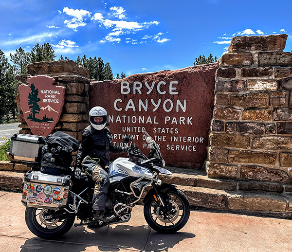
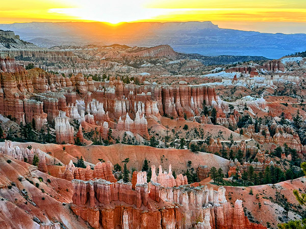
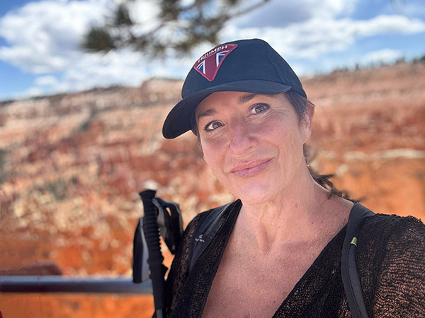
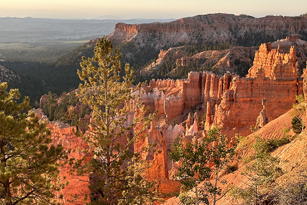
Starting near Panguitch, my journey along Highway 12 began with mounting excitement as the first red arches came into view. I took a short detour off of Route 12 to immerse myself in the famous hoodoos and trails of Bryce Canyon National Park. Lucky enough to secure a campsite at Sunset Campground, I made quick work of setting up my camp and heading out for a long afternoon hike. The next morning I witnessed a magnificent sunrise casting a warm glow over the canyon, illuminating the striking hoodoos and crimson rocks, a memory I won’t forget!  A one-night stay in Bryce leaves one unsatisfied and longing for more time to explore her magnificent trails.

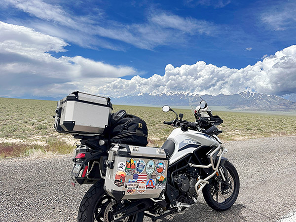
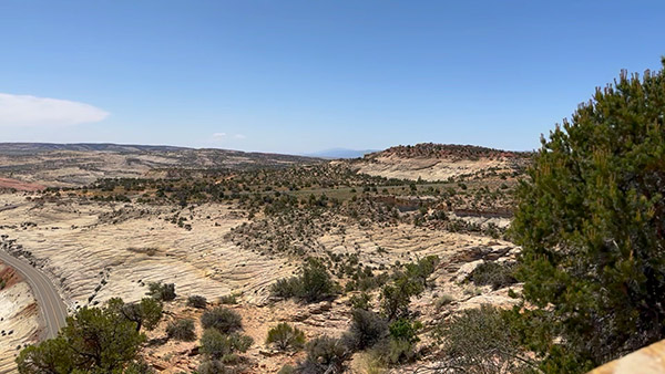
Continuing my adventure the following morning, I eagerly resumed my route on Highway 12, heading towards my favorite section of the road, high above the captivating Grand Staircase-Escalante National Monument. This expansive and remote region boasts rugged canyons, vibrant cliffs, and extraordinary geological formations. The landscape and its impossible rock formations treated me to endless twisties, creating a sense of otherworldliness. My Triumph Tiger 900 GT Pro was as happy as I was as I relaxed into the ride and allowed her to remind me again what her three cylinders can do. Both of us were in sync as we leaned into curve after curve and blasted down to the bottom of the canyon.

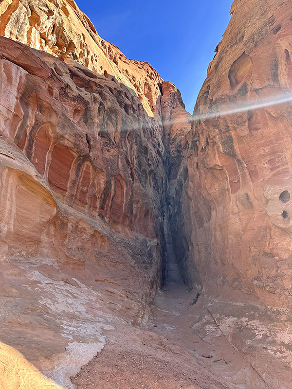
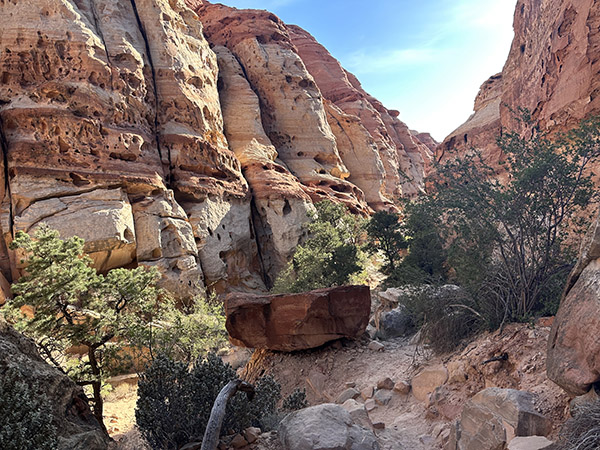
For those with extra time, I highly recommend exploring nearby slot canyons such as Peek-a-Boo and Spooky Gulch, which offer outstanding hiking experiences.

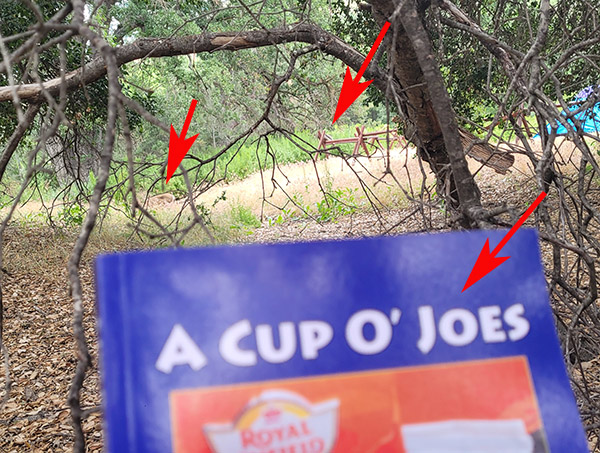
Don’t miss the enchanting Calf Creek Falls nestled at the bottom of a lush canyon. A short hike leads to a captivating waterfall.  While leaving Calf Creek be sure to watch for a dirt road on the left with a sign for coffee. Take that turn and savor a cup of Joe with a view that will leave you speechless.

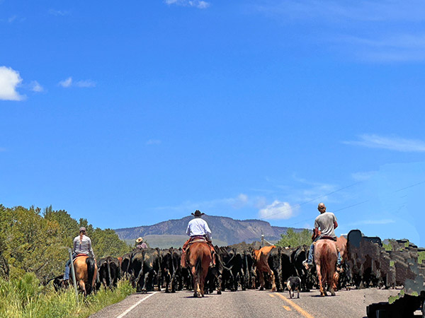
As I reluctantly approached the tiny town of Boulder, Utah, I realized I had made remarkable progress through the twisties.  I was unexpectedly greeted by an old-school cattle round-up, complete with cowgirls and boys herding a large herd down Highway 12! After a brief turnaround, I found solace in my favorite restaurant, the Burr Trail Grill. Their farm-fresh ingredients delighted my taste buds, whether it was their fresh arugula salad topped with local goat cheese or their beastly-sized burgers that proved a challenge to conquer.

Resuming my journey on Highway 12, I found myself in an unexpected predicament. The cattle herd’s progress was slow and I crawled along clutching endlessly as I felt my left hand about to begin a serious complaint! Amidst the frustration, two memorable moments emerged.  First, a passerby exclaimed, “Dude, you have the sweetest bike and setup!” We shared a laugh as he realized I was indeed “dudeless.” Second, after navigating my way to the front of the line, I convinced the lead cowboy to move the herd slightly to the right, allowing me to pass. Maneuvering my bike through the cows became a comical adventure, with prayers that the sound of my motor wouldn’t startle them. Experiencing this traditional cattle drive in 2023 felt like a slice of Americana and added yet another reason to love Utah.

Leaving the cattle behind I ascended Boulder Mountain, where endless views revealed the back of Capitol Reef on the right and scenic meadows with clusters of aspen, fir, and spruce trees on the left. Surprisingly, the mountain still boasted more snow than I expected in June. Camping, fishing, and wildlife viewing opportunities abound in this mountainous region, with numerous sites available. I’ve spent nights here savoring the breathtaking vista overlooking Capitol Reef and the sprawling valley floor.

As I arrived in Torrey, Utah, the end of Highway 12, I couldn’t help but lament the route’s brevity. With just 125 miles of captivating beauty, I yearned to turn around and experience it all over again. However, the call of the canyon beckoned me for a rewarding hike, followed by a well-deserved whisky to bring an end to a truly perfect ride.

Highway 12, Utah—truly a magical journey that captures the heart and leaves an indelible mark on the soul.


Never miss an ExNotes blog:


Help us keep the content coming:  Please click on the popup ads!

El Condor Comida

By Mike Huber

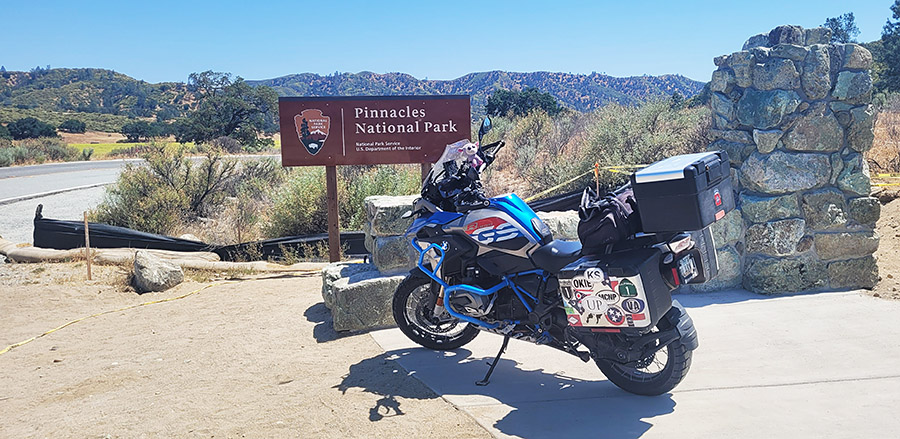
Pinnacles National Park is the 50th National Park I visited. I believe there are 63 National Parks total (National Park Service keeps adding them yearly, so…).  As with all the parks it is rare to be disappointed with a visit to any of them.  In fact, I have visited some of the parks numerous times just to be sure to fully embrace each part of them as many are quite large.

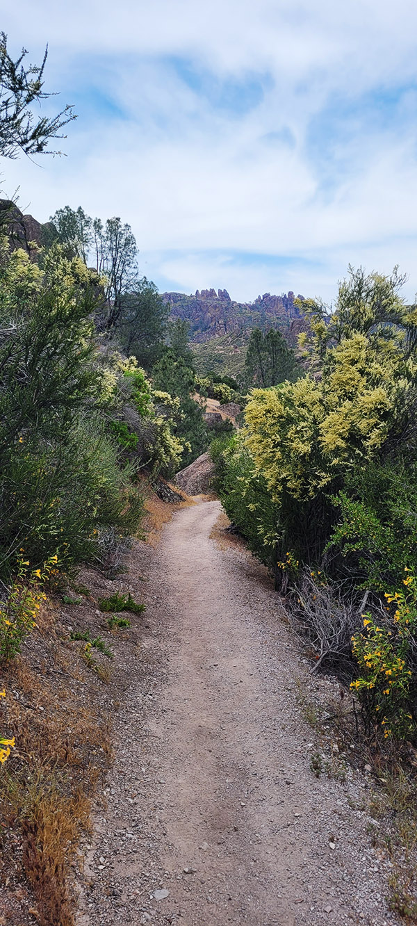
Pinnacles National Park is one of the lesser visited National Parks, which I find refreshing since there are fewer tourists than other National Parks, like Yellowstone and Yosemite where the crowds can be almost overwhelming and detract from the experience. For Pinnacles I had reserved two nights camping so once I arrived late in the day, I could knock out a shorter hike and complete a long hike on the spare day.  The longer hike I chose was to summit the highest peak in the park, Chalone Peak, which reaches 3,304 feet in elevation.  That isn’t that bad because there is only a 2,034-foot elevation gain from the base. This is a 9-mile trail that snakes through beautiful hills. Every turn provided an incredible panoramic view of the fields below and the mountains that stretched to the sky.

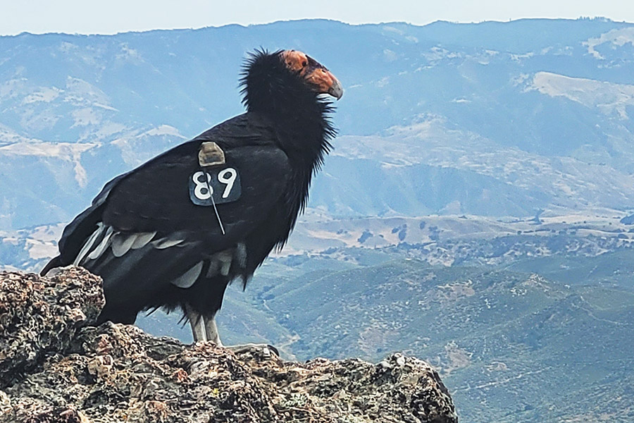
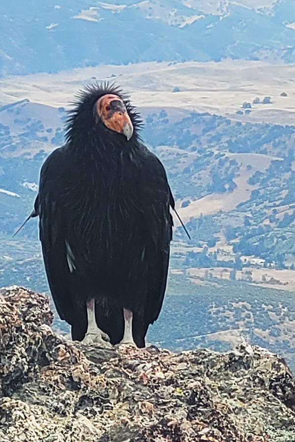
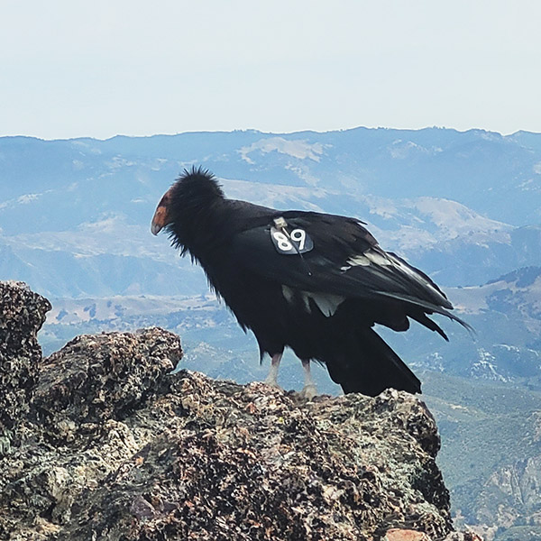
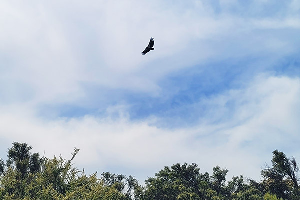
Once summitting the peak, it was time to rehydrate and fuel up with lunch for the hike back.  As I sat down, I heard what sounded like someone vomiting.  Looking to my left I saw I was sitting about 25 feet from a California condor.  It was tagged with No. 89.  The National Park Service tags these rare birds to track and follow them at a level not seen since Facebook started tracking me. Having researched No. 89, I learned this guy was born in captivity in Idaho in 2011. There are under 600 of these massive birds remaining in the world. To have the rare opportunity to see one was magical, but to be able to sit next to one for 30 minutes as I ate lunch was something spiritual, equivalent to petting the gray whales in Baja.

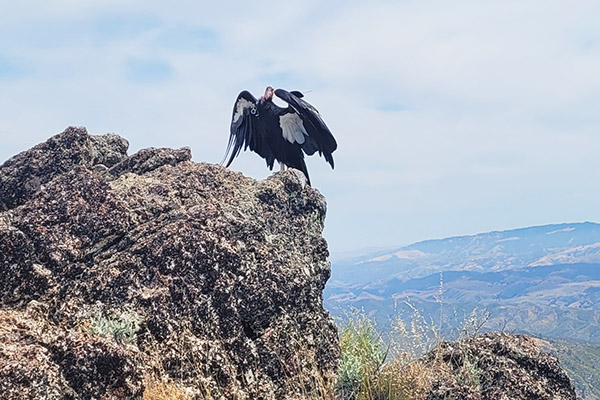
As I sat eating my lunch the condor and I constantly exchanged gazes.  Every so often it would spread its wings to show off its true size.  Not only did it not seem bothered by me, it seemed to enjoy my company (I mean, who doesn’t?).  After about 30 minutes I began wrapping up lunch and as I packed up, No. 89 silently turned away, spread its wings, and leapt off the rock like a hang glider sailing down about 100 feet and then turning upward it flew off into the distance.

This magical encounter reinvigorated me for the 4.5-mile hike to the base of the mountain. I had a solid buzz from the encounter for the remainder of the day.  Just like all the close encounters I have had in nature, that buzz never seems to fade and it has me looking forward to National Park Number 51.


Please click on the popup ads!


Never miss an ExNotes blog:

Chaco Canyon, New Mexico

By Joe Gresh 

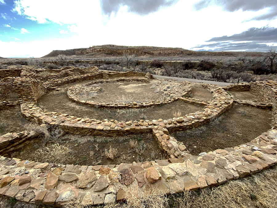
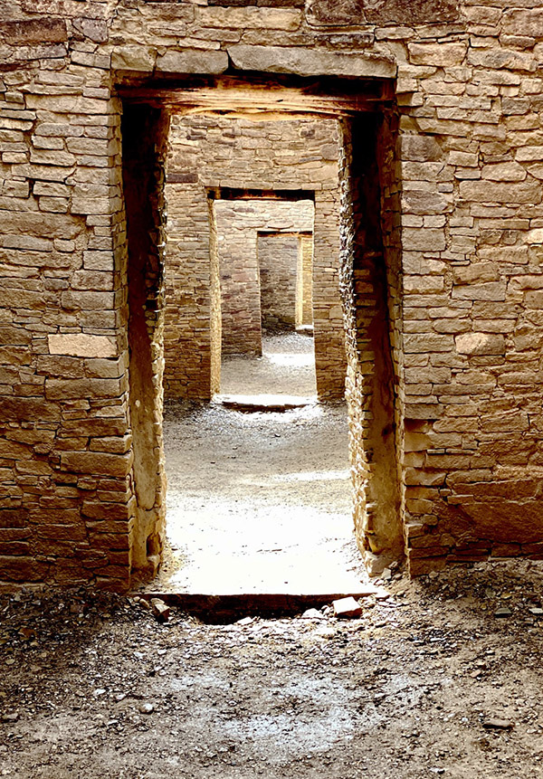
In 2019 we booked a campsite at Chaco Canyon in northern New Mexico. Chaco Canyon was a fairly large Native American city that served as the capital for the Chaco people a thousand years ago. Strung out along the canyon within walking distance of each other there are several large, condominium-style structures, some reaching 5 stories high and all of them with courtyards, living areas, kivas, and storage rooms. The condos were built with fantastically intricate stonework consisting of millions of large and small stones. Chaco society was well organized and their mathematics and architectural engineering were well advanced, as it would need to be in order to produce such big, complex buildings.

Also in 2019 the plague hit and Chaco Canyon was closed to visitors, so we never made it to the campground. The same thing happened in 2020, so we missed Chaco that year and instead spent our time arguing on the Internet about masks and vaccines with medically-trained basement dwellers. In 2021 we had a reserved campsite near the cliffs of the canyon and not long before we were due to arrive the cliff calved, covering our campsite with boulders. The campground was closed in order to clean up the rubble. The section where we were booked is still closed.

In 2022 we again called the ranger station at Chaco Canyon and reserved a site.  All looked well in 2022 but a day or two before we were to leave CT came down with a nasty cold and we decided camping would be no fun with one of us sick in bed. Reluctantly, we cancelled our reservations yet again. Our efforts to see Chaco Canyon seemed cursed. We decided to try again in 2023 and figured March would be a good time to go. We wanted to avoid the hot summer months. Building up to March everything was going swimmingly; this would be the year we finally made it to the historic Native American site.

And then the rain started. We watched the weather reports coming in from Chaco Canyon: rain, snow, hail. It rained at Chaco Canyon every day the week before we were to go. All roads leading to Chaco Canyon involve quite a few miles of dirt. The rougher, south entrance to the canyon was closed due to the muddy road being impassable. We didn’t care: we were going to Chaco even if we drowned in mud. Farmington was our staging area for the camping expedition and we drove in spotty rain all day to get there. Turning north out of Albuquerque on Highway 550 we stopped for gas. While I was filling the gas tank it started snowing. Then the wind picked up to a brisk gale. The last 50 miles to Farmington were in a drizzly rain mixed with sleet. We made it to our motel where it rained all night long. The normally well-maintained north entrance road to Chaco Canyon was starting to look a bit iffy.

The next day was overcast and rain threatened, but the morning was drama free with only a light dusting of snow on our way to the entrance to Chaco. If you’re going to visit Chaco Canyon you’ll no doubt read horror stories about how rough the road is leading to the canyon. Keep in mind the people fretting about the road are driving giant RVs held together with staples and chewing gum. You may lose a kitchen cabinet or an ill-considered propane tank. If you are driving a car or truck you’ll be fine. Unless it has rained five days straight before you arrived.

Turning off Highway 550, the first 8 miles to Chaco Canyon are paved and then the road turns into wide, graded dirt. This section was very muddy and CT put her Jeep in 4-wheel low and locked the front and rear differentials. She couldn’t go very fast because the Jeep wanted to spin into the ditch at the slightest sign of ham-fisted steering. Down hills were exciting; the Jeep kind of drifted to the bottom in a semi-controlled slide. The mud wasn’t deep, only a few inches, but it was like driving on ice covered with ball bearings and oil.

We saw two other vehicles on our 23-mile ride and one of them was stuck in a ditch. CT is a big believer in recovery gear so she has straps and chains onboard at all times. Unfortunately this means we have to stop and help people who get stuck in a mud bog. The guy was so glad to see us. We came to a gentle stop 30 feet past the deepest part of the mud hole. “You got a rope?” I asked Mr. Stucky.

“No I sure don’t,” he said. I gave a dejected look at the mud.

“Do you guys have anything we can use?” he asked.

“Yeah, we got something.” I stepped into the mud and pulled CT’s clean ARB tow strap out of its clean zipper case.

“I think if you can pull me back onto the road I’ll be ok. I was going too fast and spun out.”

I was only half listening to Stucky.  All I could think of was that this means we have to get CT’s ARB tow strap muddy with this sticky goo and then I’ll have to clean it later.

Walking was hard due to the mud sticking to our boots and the slipperiness, but we managed to connect our nice, clean, tow strap to Stucky’s SUV and pulled his rig backwards towards a less muddy area. Stucky’s mini SUV didn’t want to leave the ditch and it crabbed along spinning wheels and slinging mud for 100 feet before it popped out of the rut and onto what passed for the road. I started to wind up the tow strap when Stucky, sensing my disappointment, said, “Here, let me get that. No need for you to get any muddier.” I was muddy already, but I handed Stucky the strap. I wanted him to feel like he had a stake in not getting stuck again. As Stucky coiled the ARB tow strap mud oozed between each wrap. We were only a few miles to the campground from this point.

Once you make it to Chaco Canyon the roads are paved so we had no trouble finding the ranger station or our campsite. The place was nearly deserted. Stucky’s little teardrop trailer was the only other camper at Chaco that day. Fast moving clouds scudded from west to east bringing alternate periods of sunshine, snow, rain and hail. During a sunny spell we set our Campros tent up on the nice, raised tent platforms provided to each camping spot. The raised tent spots are built from pressure treated 8×8 beams laid out in a square totaling 14 feet by 14 feet. The squares were filled with nice, soft dirt and we were damn near glamping, you know? I guess if I were more observant, the tie down clevises screwed into the pressure treated lumber would have given me a hint about wind speeds in Chaco Canyon.

We watched the looping, 15-minute Chaco Canyon video at the ranger station’s little movie theater and then decided to set up and get our junk sorted out. It was windy and cold but we had plenty of warm clothing to wear. CT brought along 6 jackets, 7 hats, and 3 duffle bags full of thermal underwear. The tent was heaving and snapping; it took two people to hold it still long enough to assemble the thing. The temperature started dropping as soon as the sun went down. A campfire was out of the question in this wind so we made our bed, ate a little cold-cut snack for dinner, drank hot, Dancing Goats coffee and sat at opposite sides of the tent holding the corners down.

Moving all the heavy gear to the perimeter of the Campros tent seemed to keep it from blowing over. We were able to snuggle together in the sleeping bag and kept from freezing, which was the whole reason I wanted to go camping with CT in the first place. We saw 27 degrees that night and the wind never stopped blowing. The next day was slightly warmer and the sun was peeking out from the clouds, but it was even windier.

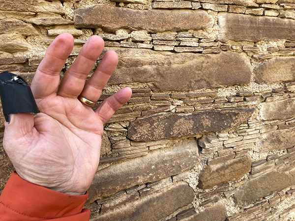
Due to the weather all the ranger presentations were cancelled. We signed up for a Chaco tour led by a Navajo business called Navajo Tours USA. We used these guys before at the Bisti Badlands and they are great fun. The tour started at 10 a.m. and we went to each condominium and wandered around while our guide told us about the different stone patterns and construction details of the buildings. Usually Chaco great houses have a basement level and many of the places we were walking had filled in with dust and sand over the preceding thousand years.

Above the basement there were three or four stories. Each level was accessed by a ladder from the level below. This system continued on until you reached the roof. The floors were made from large wood beams, called vigas in Spanish.  Over the beams were placed smaller sticks and an adobe floor. The vigas hauled to Chaco came from the mountains many miles away. I figure there must have been some sort of money or economy that would have allowed workers to drag those beams and still be able to sustain a living wage.

The walls of the condos were fairly thick. Starting at the bottom the walls were three feet thick or more. The walls tapered as they rose, becoming thinner floor-by-floor.  Top-floor walls might only be one foot thick. Originally, the inner walls were plastered smooth with some sort of lime coating. In a few spots you could still see the factory stucco. There were windows that let light into the rooms.  Inner rooms were dark but they had openings that aligned with outer windows that allowed outside light to penetrate several rooms deep. The outside windows had wooden shutters for winter use.

The winds, strong already, were picking up and at times you’d be blown off balance. Each gust brought a stinging blast of sand and my eyes were getting full of grit. The Chaco people situated their buildings according to astronomical events. Usually one long, straight wall aligned with the rising sun at the solstices. Sometimes the wall pointed towards a particular star. The building was a giant calendar.

There is a lot more to the Chaco culture, the long, straight roads they built, where their food came from, and why the city was abandoned after only a few hundred years, but it was late in the afternoon and getting colder. The wind was so strong I couldn’t hear our guide very well. Light hail was falling and wisps of snowflakes juked and stutter stepped in the air. As much as I enjoyed the lecture I was glad when it was over. I like it outside but there is such a thing as too much outdoors. We went back to the campsite to have a little hot tea.

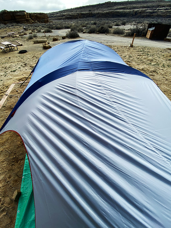
Camp was a disaster. Our Campros tent looked like a downed weather balloon. Tent poles had broken, stakes were pulled out and the rain fly was detached and flapping in the breeze. Inside the tent everything was covered in dirt blown in through the screened roof.  We tried to get the tent propped back up but when I pulled on it things started ripping. We managed to get the rain fly back over the wreckage and placed large boulders on the corners to hold it in place. It was snowing again. There was nothing to be done with the wind blowing so we went to the ranger station and loitered. I bought a ceramic coffee cup with a Chao Canyon logo; it was good to be out of the wind.

By 7 p.m. the wind eased up a little and we went back to camp to try to salvage what we could. Our first chore was emptying the Jeep before it got dark. The idea being if we couldn’t fix the tent we could retreat to the Jeep and sleep in the back. Sure it would be cramped but at least we had a heater in the car. And the car wouldn’t blow over. Maybe.

We managed to get the tent propped back up with the short, broken poles. The short poles made every other dimension wrong. The main ridge pole had a huge S curve and there were wrinkles all over the place. It wasn’t a thing of beauty. Besides the broken poles, the upwind corners were ripped where the tent stake loops attach. We propped heavy stuff in those corners to hold the tent’s shape. Next we cleaned up all the sand as best we could and finally got organized enough to have another cold dinner and hot coffee. A campfire was out of the question because neither of us wanted to bother.  In retrospect, when we left that morning we should have lowered the tent and placed rocks on the rain fly to hold it down. I believe it would have survived without a problem. I have no gripe against the tent: it went through a hurricane.

The jury-rigged tent stayed up all night long and by morning the sun was out and it was a relatively warm 40 degrees. Blue sky shined in through our open tent door and the wind was a gentle breeze. If our reservations were made just two days later we would have had a totally different feel for Chaco Canyon. It would have been nice Chaco Canyon instead of mean Chaco Canyon. The muddy road had dried up and was now passable by standard automobile. The campground started filling up as we packed our gear. Old Joe would have folded up the battered tent with the broken poles and torn corners, taken it home and stored it for 43 years thinking he was going to fix it one day. New Joe tossed it in the dumpster.

Those long-ago Chaco people had it much better in their thick stone buildings. Maybe the climate was different then, but I suspect not that much different. And it was an unusual weather pattern that saw all the other campers cancel their reservations leaving only Stucky, his dog and us in the entire joint.  The campgrounds were nice with clean bathrooms, flush toilets and heat, but no showers. We never did get to see all the buildings because it was so windy and cold. CT and I want to back to Chaco Canyon and explore more but maybe next time we’ll go when the weather is more clement.


Never miss an ExNotes blog:

You know what to do:  Please click on the popup ads!

Three Favorite Sedona Hikes

By Bobbie Surber

Arizona’s Sedona area offers fantastic hiking.  This blog describes three of my favorites.

Bear Mountain Trail

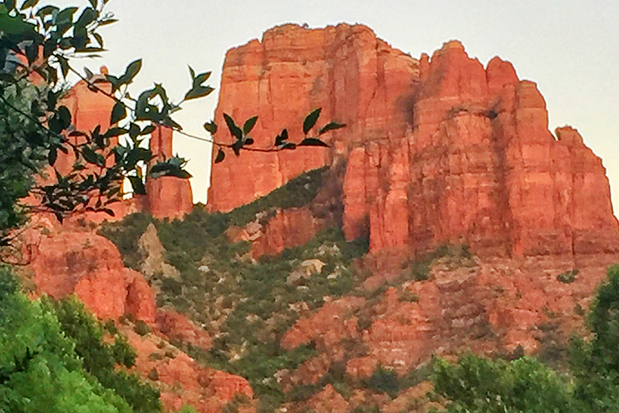
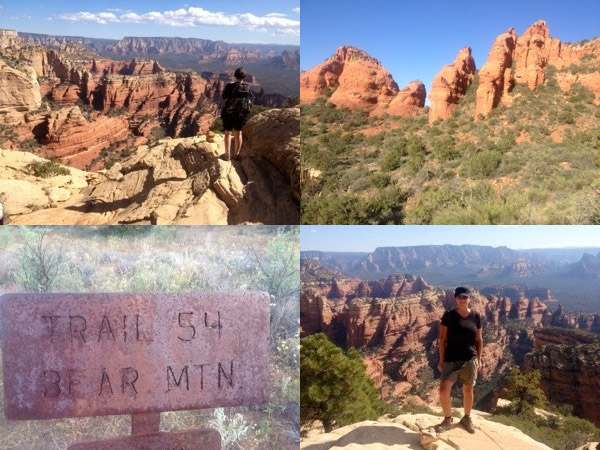
Bear Mountain provides fantastic red rock views. The start of the trail is at about 4600 feet in elevation from the parking lot. At the final summit, the elevation reaches 6150 feet.  At the summit of Bear Mountain, you can see the San Francisco Peaks in Flagstaff, views of Bell Rock in the Village of Oak Creek, Verde Valley, peaks of Sycamore Canyon, and all West Sedona.

Bear Mountain hiking trails. From top left, going clockwise: Bear Mountain Canyon views, start of the Bear Mountain Trail, the Bear Mountain trailhead, and me atop Bear Mountain.

A warm spring day found me on the Bear Mountain Trail with a new friend I met during a Sedona Meet Up Hiking event. Linda is from New Jersey and is an avid outdoorswoman, hiker, and yoga devotee. I enjoyed Linda’s company as we marveled at the views and shared about our lives, family, and career paths.

I was happy that the Bear Mountain Trail DID NOT kick me in the behind. A challenging hike with an 1800 ft gain over the course of 3 levels of summits. This is a designated wilderness area, so there aren’t any trail markers once you enter the designated area. Watch for trail markings carefully and pay attention, as you will encounter several false summits before reaching the peak. Views along the way revealed stunning red rock slot canyons and an area resembling a mini Grand Canyon. This is a steep trail with some rock scrambling. Please pay attention to the trail, as it is easy to get off track. 2 liters of water is the minimum recommended for this strenuous hike, more on a hot day. A hat and walking poles are also very helpful.

This hike is advanced and difficult. You should be prepared with proper footwear, water, food, and layers of clothes.

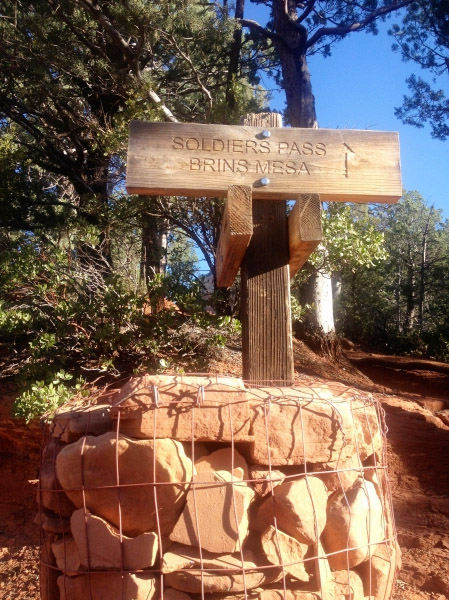
Sugarloaf to Lizard Head to Chuck Wagon to Brins Mesa, returning via Jordan Trail

Sunday morning started with a chill in the air and an overcast sky. I postponed getting out of bed and decided on another cup of coffee; my favorite, extra dark roast made strong enough to curl your hair worked its magic as I continued to procrastinate a few moments longer with a leisurely read of the Sunday paper. My hiking shoes waited anxiously beside my bed for the impending long hike. Not sure if it was the regret of a wasted Sunday or the sudden clearing of the clouds, whatever it was, I surrendered, dumped the remainder of my brew, got the hiking shoes on, and headed out the front door.

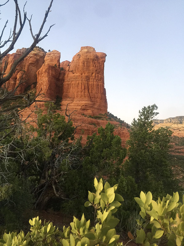
Coffee Pot Rock.

My goal was to try out Day 1 of a planned 3-day hike in Sedona and the Village of Oak Creek. I headed to the Sugarloaf Trailhead catching the Andante trail over to Chimney Rock Saddle to connect to the Lizard Head trail. This is where I was momentarily lost. OK, not momentarily lost… but I could not locate the %&# trail for about an hour! Man, talk about the embarrassment of getting lost in my backyard!

After bushwhacking and following a new chain-link fence, I found Lizard Head and started the ascent. Within a half hour, I was high up on the side of the mountain, and sure, I was too high for this trail. Thank goodness for cell phones and a call to my friend Doug, the master of all things related to Sedona trails, who knew exactly where I was and assured me I only needed to butt-scoot down the rocks about 100 ft and begin my descent to the bottom of the trail. He was dead on!

The Brins Mesa marker.

Besides my inability to navigate easy-to-locate trails in my backyard, I did not care for this section due to road noise off Dry Creek Rd. This, however, was short-lived as Lizard Head connected to Chuck Wagon trailhead with a lovely new picnic area, maps, and toilets. A fast rest and lunch, and I was back on the Chuck Wagon trail heading to the Brins Mesa trail. Chuck Wagon trail meanders through open vistas and dry gullies with views over Boynton and Secret Canyon. A wonderfully easy trail with outstanding red rock views. By 3 pm, I was at the trailhead of Brins Mesa with the much-needed forest to cool me off. Brins Mesa is always my favorite. Not sure why; perhaps it is the rebirth after the fire of 2006 or the feeling of others that have walked this Mesa for hundreds of years. Whatever the reason, I had a surge of endorphins firing off in my brain, and I was in complete bliss despite a longer-than-expected day of hiking and a start of a dreaded blister on my little toe.

After an enjoyable day of hiking, one might think that nothing could top it. However, heading to the Oak Creek Brewery from the Jordan trailhead for a delicious hotdog and refreshing beer further elevated my experience in Red Rock Country. Spending a Sunday in this manner gives a new meaning to Sunday Funday!

This 12-mile hike is moderate difficulty. Bring plenty of water.

West Fork Trail in Oak Creek Canyon

The West Fork Trail is a moderate hiking trail known for its picturesque views of the red rock canyons and the crystal-clear waters of Oak Creek. The out-and-back trail follows the creek for about 6.4 miles and takes around 2 to 4 hours to complete. It is suitable for hikers of all levels, including families with children. Hikers should wear appropriate gear and bring plenty of water and snacks. You will make numerous water crossings and find that water shoes make the trail more manageable; check the weather forecast for storms and potential flooding.

On the West Fork Trail.

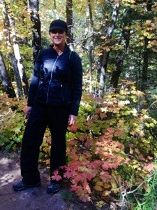
My morning could not have been more perfect. Hot coffee served bedside, the sun shining brightly, two soft-boiled eggs just the way I like them, and an 8 am date with Elaine to hike the Oak Creek Canyon.

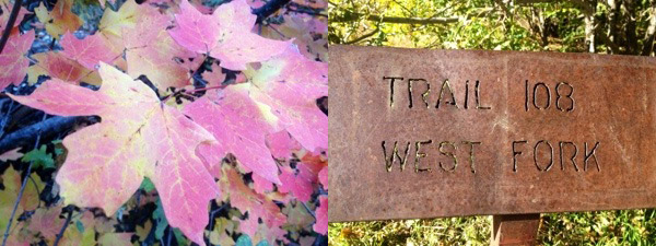
West Fork leaves, and the West Fork trailhead.

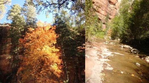
What I did not expect was to hit the famed West Fork Trail at the perfect date and time to see our Arizona fall leaves at the most glorious time of year. The morning light was enchanting as it filtered into the canyon, backlighting the trees and setting the red rock cliffs glowing with burnt orange with soft buttery yellows and rust red. Childhood joy resurfaced as we worked our way back and forth across Oak Creek; with each turn along the trail, nature revealed yet another excellent view of the Canyon.

West Fork Trail scenes.

It is difficult to describe this trail’s beauty in the fall. The experience goes beyond language; one must turn inward and fully immerse themselves in the earth’s magic beneath their feet. The power of the running creek and the ever-changing red rocks add to the enchantment of the surroundings, creating a truly indescribable experience. The company was as wonderful as the views along this hike.  It was so nice to have some Elaine time and, for a moment, remember what it is like to be removed far from our hectic busy lives and reacquaint with an old friend in an enchanted setting such as this.

Be prepared to face water crossings.


Sedona and the surrounding areas have an abundance of hiking opportunities. Thirty-seven years of living in this Red Rock paradise, and I still have hikes on my list yet to be explored. If you are planning a trip to Sedona, consider using All-Trails and stopping by the Forest Service office for up-to-date restrictions and trail conditions.  If hiking is what gets your mojo on, then Sedona will not disappoint!

Moto Fishing

By Mike Huber

Having grown up in Maine, I used to love fishing.  I lived just off the Kennebec River, so it was only a short walk through some pines to Maine’s largest river where I had miles of it to myself.  After leaving Maine for the Army, my fishing fell by the wayside.  Until recently, that is.

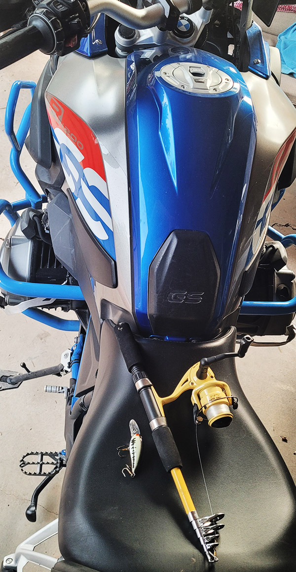
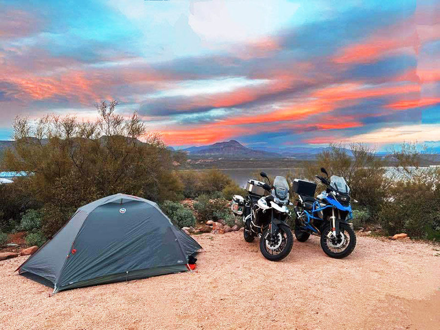
Last month in Sedona I met a friend of a friend and invited him to go camping with us along a lake in southern Arizona.  Even though he was from the east coast he brought his fishing gear and purchased a 1-day license.  One of his objectives is to fish in every state in the USA, a pretty formidable goal in my opinion. Almost as soon as I processed his story it hit me: Why am I not fishing as I camp throughout the United States on my BMW GS1200?  The next day I made a trip to Walmart (which I rarely do) and bought a $10 collapsible fishing rod (one that fits in my BMW’s panniers), swivels, and a few lures (including a red and white Daredevil).  The Daredevil always worked for me as a kid.

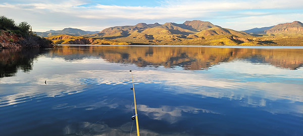
Due to an unusually wet winter in Arizona, the lakes are above their normal capacity. This made the Daredevil more of a hindrance as it kept getting caught on the weeds just under water.  After losing four lures I blasted to a local supply store and picked up a couple of spinners that would stay on top of the water and prevent (or at least minimize) my losses. I was now four deep in lost lures and was starting to feel like I do during my golf game in terms of losing balls in the water hazards. Maybe having a new angle with this top floating lure would renew my confidence and allow me to catch something (or at least not lose another $5 lure).

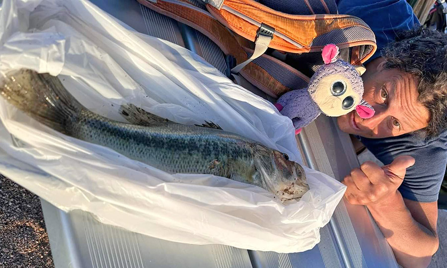
As sunset approached, I thought it was about time for a beer.  A nice cold IPA would surely ease the frustration of losing lures earlier in the evening.  Well, the IPA must have drawn the fish because within 15 minutes I caught a solid 18-inch striped bass. With this being the first fish I caught in several decades I wanted to tell you about what a fight it put up and all the time and effort it took to land this beast, but I won’t embellish my fish story.  The scene did, however, turn comical as another fishing boat approached.  They had been out all day and they had only caught one fish.  When they asked how long mine took, I picked up my half-empty IPA and said, “almost one beer.  We all laughed. Beer usually isn’t a time metric.

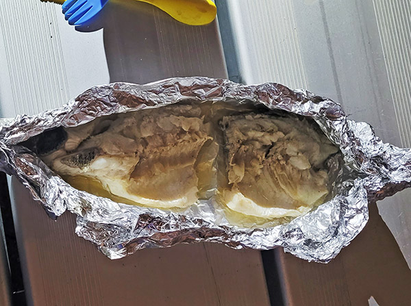
After cleaning the fish I realized that catching a fish wasn’t really part of my plan.  I was just passing the time. I now had to come up with a way to cook this monster.  Luckily, I was in a campground and earlier in the day had chatted up the hosts. It turned out they were from Maine, not too far from where I grew up.  They happily let me borrow some aluminum foil.  I figured this would be all I would need to cook over the grill.  Pouring the remainder of my beer into the foil and over the fish made for great flavoring. Once having the fish “properly seasoned” I threw it on the grill for about 5 minutes per side, removed it from the fire, and enjoyed it along with a pack of spicey Shin Ramen.  This was the perfect meal to enjoy while sitting around a glowing campfire and taking in the sun’s final rays over the Four Peaks Mountains.

The past two weekends I have returned to moto camp and fish with similar results.  This summer I will travel the west coast and spend time motorcycling, camping, and fishing as I meander up to British Columbia.  This renewed hobby will greatly compliment my finely honed skills of laying in my hammock, messing around with the campfire, and drinking cold beer in each region I travel though. There are few activities that can get your adrenaline rushing in an instant; the jolt from a fish on the line is one. I look forward to that rush as frequently as possible in my future travels.

Arizona Moto Camping

By Mike Huber

One of the advantages of living in Arizona most of the year is that you can ride every day, comfortably (I added “comfortably” because I know there is some guy or gal in Maine riding year-round in sub-arctic temps with snow).  We in Arizona can enjoy our passion for camping in all four seasons because of the extreme elevation changes, which allow moving to different climates with a one or two hour drive.

Arizona has an endless amount of camping areas, both dispersed and in formal campgrounds.  I thought highlighting two ends of the spectrum in would be a great way to convey the vast diversity Arizona offers.

Forest Road 300: Mogollon Rim

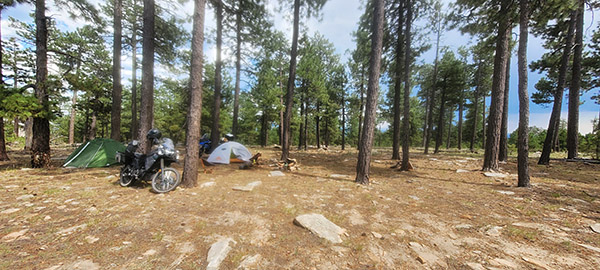
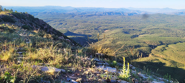
Forest Road 300 begins in the west off Arizona State Road 260 and ends 42 miles later near Payson’s Arizona State Road 87. The Mogollon Rim is home to the largest ponderosa forest on earth.  Although there are maintained campgrounds along this road, I prefer to disperse camp.  This provides one with the rare opportunity of awaking to an overlook in which you can see for over a hundred miles.  This spectacular view is something that a formal campsite cannot provide.  The road for the most part is in decent shape (excessive rains this year may have changed this however) and can be completed without a 4-wheel drive vehicle.

When traversing the 7,000+ ft elevation of the Mogollon Rim I will usually just ride down the many side roads until I come upon a campsite that isn’t too crowded or exposed, which I can then call home for the evening.  One of the main risks as you are indeed so exposed is that of lightning strike.  You may be able to find a perfect cliffside dispersed campsite but be aware that weather changes frequently and it is never okay to set up camp outside the tree line in this area. In fact, as you scout out your site it is wise to look up at the trees.  If you see many that have been damaged from previous lightning strikes, this is not a location in which you want to camp.

Another benefit to this area is the cooler weather at these elevations, which makes for a perfect Arizona summer trip.  The temperatures can be easily 20 degrees cooler than it is in Payson, which sits at 5,000 feet.  The refreshing temperatures and light breezes in the summer make this a perfect location for spending an evening around a campfire with friends while you enjoy the endless views.

Lake Roosevelt: Cholla Campground

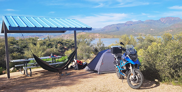
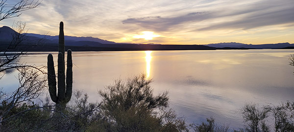
I was hesitant to write about this location as it is my go-to happy place in winter and probably one of my favorite campgrounds in the southwest.  In winter it can be a cold drive if you are in northern Arizona until you drop into Payson, where the temperatures quickly gain 15 to 20 degrees and provide reassurance you’ll experience a perfect lakeside camping night (lakeside camping is a rare treat in Arizona).

Cholla Campground is part of the National Park Service so if you have a Senior or Veterans pass the fee is only $12 ($24 without the pass).  The site provides water, showers, toilets, and a beautiful lakeside view with an abundance of wildlife.  Having an elevation of just over 2,000 feet assures that on most nights, even in winter, it doesn’t get uncomfortably cold.

Another advantage to this campground is there are “tent only” loops so you can distance yourself from those noisy generators and the RV crowd if you choose to.   Choosing these loops provides a quiet night as you watch eagles fly by in the evening with their dinner in their talons while you cook a steak over hot coals while having a 360-degree view of the best sunsets.

Arizona is a much more diverse region than most people think it is.  This unique state isn’t all cactus and barren desert, and the above two locations highlight this diversity.  Motorcycle camping in Arizona can be a year-round pastime without being smothered in heat or waking up with a frozen water bottle (both still seem to happen to me all too frequently).

What are your favorite camp locations in your home state?


Never miss an ExNotes blog:

Have you clicked on the popup ads today?


Please share this blog on your social media!

Wildlife in The Southwest: Javelina

By Mike Huber

Having grown up in Maine I spent most of my childhood experiencing life up close with nature. I have always been drawn to the unique wildlife in different regions of our country.  In the Southwest this is especially true as the terrain is so different than Maine, or really anywhere else I have traveled.  Many people think desert and cactus, sand, maybe an old cow skull on a fence post and envision a region void of life.  This couldn’t be further from the truth.  Once you get out exploring this fragile ecosystem it’s easy to see and hear how much life there is in this harsh environment.

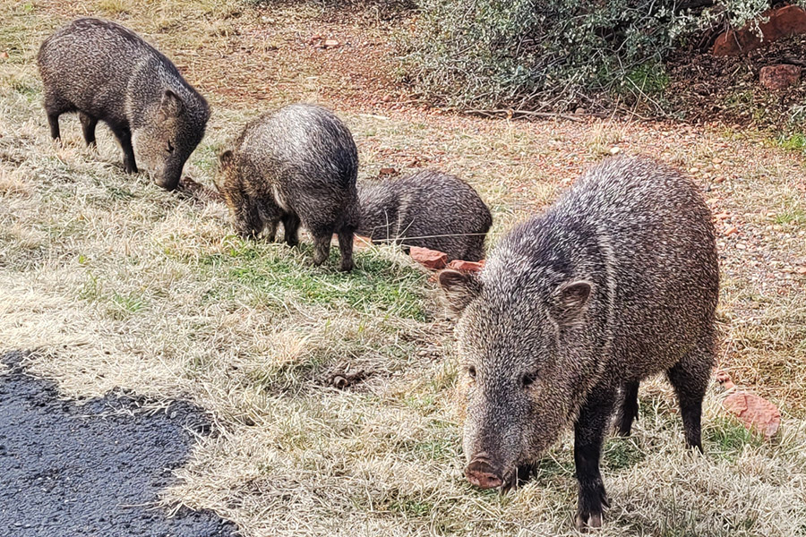
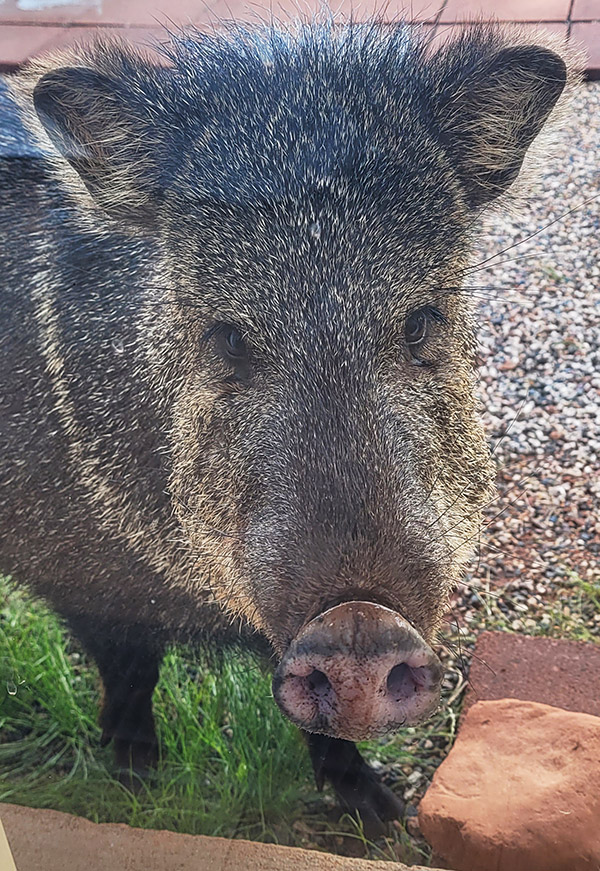
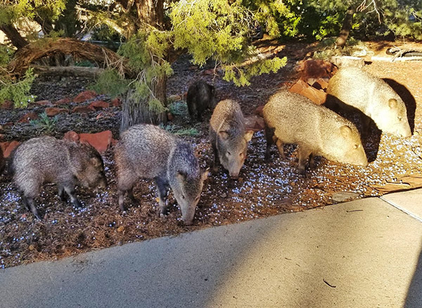
One of the coolest animals I have seen along my travels is the javelina.  These beady eyed little critters look very similar to boars or wild pigs but are actually in the rodent family.  If you are in the desert during a full moon and the wind is just right, and if you are lucky, you can hear a pack of these little guys chomping up prickly pear cactus and tearing up people’s lawns.  They are a little local gang of hoodlums causing mischief throughout the neighborhood and then disappearing into the thick desert underbrush as quickly as they appeared from it.

The first time I saw javelina was while camping along the Arizona and Mexican border.  Sleeping in a tiny one-man tent I woke up to what I thought were wild horses munching on some leaves.  The sound got louder and closer as whatever it was moved in on my position. I wasn’t quite sure what to do but wanted to be certain I wasn’t trampled by horses in my tent (that’s one way to end the story). I popped out of my tent and flicked my flashlight on.  What I saw was about 10 pairs of beady little eyes staring back at me and snouts wiggling in all directions.  Not having any idea what these things were and not being armed I began shouting at them “Quit screwing around!”  Little did I know that is the exact command they understood and followed.  After a few moments of a harrowing standoff, they took the hint and went around my tent without missing one leaf. The strange-looking beasts made their way into the rugged desert terrain as I stood outside my tent still trying to figure out what had just marched through my campsite.

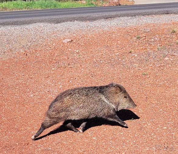
Frequently wintering in the southwest I am now very accustomed to these little troublemakers, and it always brings me great joy in seeing them marching across the street like the Beatles on the Abbey Road Album cover.  On more then one occasion when I see them in the backyard, I will close the gate and jokingly say “We got us a petting zoo!”  In my experience the javelina are pretty focused on obtaining food and don’t pay much attention to us humans being near them. except if you move quickly, make loud noises, or they have babies in their herd.

So, whether these little Star Wars looking creatures are hanging out around my campsite in the middle of the desert or foraging through the neighbors’ yards, they are a pleasant reminder that the environments I travel through change in many ways. The javelina are a vital part of the desert’s fragile ecosystem that we are guests in to enjoy and embrace.


Disclaimer: Opening a javelina petting zoo is a foolish thing to do. Do not attempt to pet, embrace, or feed them either as they can turn on you and attack.


Never miss an ExNotes blog:
Bobbie’s Solo Baja Ride: Part 3

By Bobbie Surber

Do you ever have those moments when you wake up unsure of where you are? I awoke to the sound of birds, more specifically, parrots, and the smell of fresh tortillas and knew instantly that this was not home; I was in Baja in Mulege and wholly smitten with my room with her stone walls, comfy bed, and protective mosquito netting. I didn’t want to get out of bed until I remembered that I had made plans to go horseback riding to the bay.


Keep us going…please click on the popup ads!


Throwing on my clothes and double-timing it to the restaurant, I had just enough time for a cup of coffee and water before my guide arrived to take me to the ranch, which was less of a ranch and more of a lean-to along the highway with both our horses tied and already saddled. I met my girl for the day, Lupita. She had enough spunk to whinny at our arrival and appreciate the carrots I brought to help form this new friendship. Our saddlebag were loaded with swimwear and lunch, and we set off for a leisurely ride to the bay.

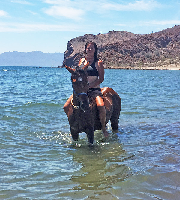
Horseback riding in the Sea of Cortez.

Muscle memory took over from riding horses in my youth, and I gave in to the morning’s joy and the view of Conception Bay. Riding down the beach at a slow gallop letting our horses have their lead and finding a bit of shade, we stopped for an early lunch of fresh fruit, good tequila, and some freshly made empanadas. After lunch, I asked if I could take off the saddle and ride bareback, something I had not done since childhood. It seemed a perfect idea for this glorious morning. Surprisingly my guide said yes and permitted me to ride Lupita bareback into the bay to enjoy a good swim. I had forgotten the thrill of entering a body of water on horseback; Lupita seemed to enjoy the experience as she left the security of the ocean bottom and took us further out into the bay. The morning flew by and soon it was time to return to the beach and make our way back to the corral.

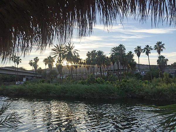
Sunrise on the Rio Mulege.
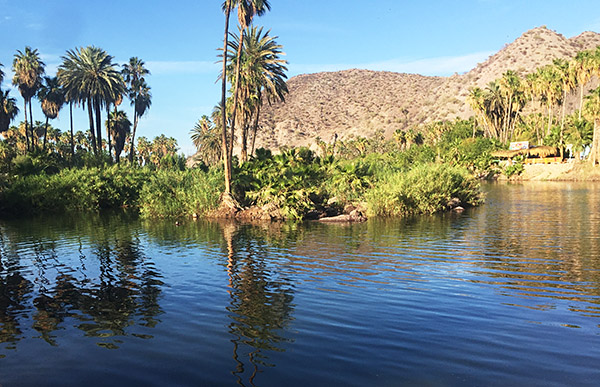
A river runs through it…the Rio Mulege in Mulege.

Returning to Historica Casita in the heat of the early afternoon, I did what any sensible local would do. I retreated to the coolness of my room for a proper afternoon siesta. After a cold shower and fresh clothes, I headed out to explore. With the help of a newfound local friend and a Google search, I learned that the Mulege indigenous population has a long and rich history that dates back centuries. It is believed that the region’s first inhabitants were hunter-gatherers who lived in small bands, but the arrival of the Mission changed their lives forever. Spanish missionaries established the mission in 1730, teaching the local population how to farm and build adobe structures and simple homes. I was also happy to learn there has been an effort to preserve their history by preserving ancient artifacts and teaching younger generations about their heritage.

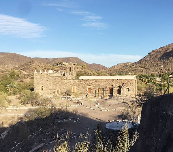
The Mission in Mulege.

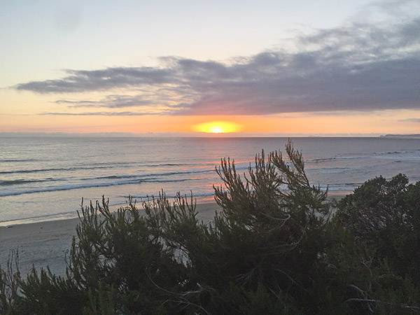
While the Mission was closed, I could still walk the grounds and view the river from the vantage point of the Mission, as it is built on one of the highest points in Mulege. Wandering back down the hill, I walked the river’s edge, exploring the town and the small community of locals and ex-pats. As I made my way back to the hotel, I realized how hungry I was and looked forward to an evening in the hotel courtyard, a good dinner, and a freshly squeezed margarita. The evening did not disappoint as I sat visiting with locals and a young family visiting from the mainland. Soon I was off to bed with the promise of an early rise and the chance to explore the many beaches along Conception Bay.

Sunrise on the Sea of Cortez.
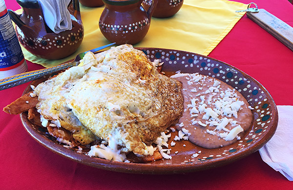
A fine Mulege breakfast.

The following day I was back on my bike and headed towards my next stop, Playa Santispac, a short 25 kilometers south on Highway 1. I knew I only had a few hours before the oppressive heat and humidity would force me back to the room, and I was determined to make the most of the day. Cresting the ridge, I was overlooking the bay with her teal-colored water inviting a closer look. Santispac beach has a restaurant and several palapas stationed along the beach; as I rode my bike down the beach, I decided a swim was in order, followed by a hearty breakfast at the modest beachside restaurant.

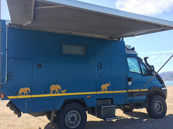
An overlanding rig.
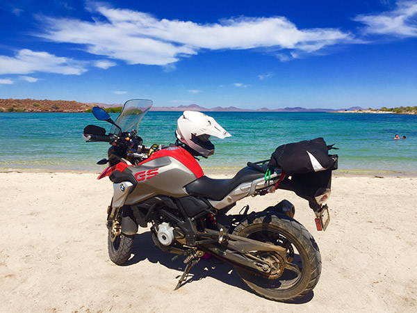
My BMW on a beach in Mexico.

Swim and breakfast completed, I headed further south, stopping at each beach I passed and settling on what has become one of my favorite beaches, Playa el Requeson. The white sand and sand spit at low tide, taking you to a small island, was more than I could resist. Setting up my camp chair, I soon made friends with an overlander couple from England. Borrowing their snorkeling gear I enjoyed a quick swim out to the island, enjoying the starfish and rockfish along the shore. I reluctantly returned for one last night in Mulege with a new plan for the following day, to ride to Loreto for lunch and then return to Playa el Requeson to camp for two nights.

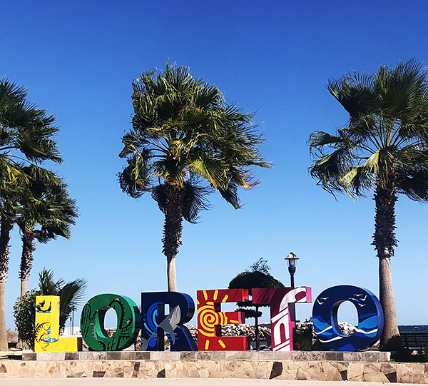
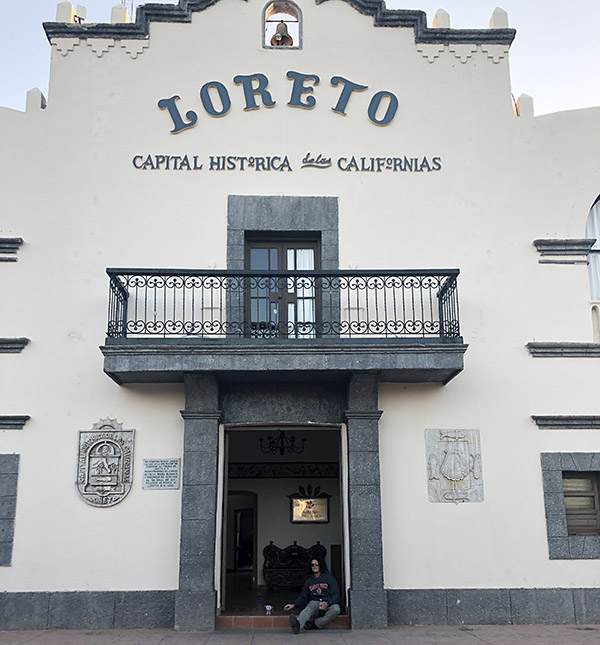
Loreto’s Malecon.
Loreto has a rich history.

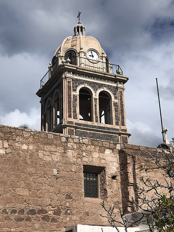
Loreto has a rich history that dates back to the 16th century when Spanish missionaries established the first mission in the area. Indigenous people then populated the area, and over time, it became an important fishing port for the region. Today Loreto is a popular tourist destination complete with a Malecon along her waterfront. Loreto has an historic town square with a well-preserved mission and museum. With a population of around 25,000, finding lodging at every price point is easy, as are the town’s many services.

The Loreto Mission.

After a lovely day sightseeing, I headed about an hour and a half back north to Playa el Requeson to find a bit of shade and a good place for my tent. The afternoon was blazing hot as I headed inland along Hwy 1, as I once again cursed myself for selecting June to make this ride. Complaining aside, I arrived and indulged in a long swim to take the sting out of the day’s heat. I found my new friends in the overlanding vehicle who gave me the gift of a cold drink with ice and offered the shade of their massive vehicle to pitch my tent. The day gave way to a glorious sunset, and soon, we had a modest fire complete with fresh fish for dinner. With a million stars out for our pleasure, full bellies, and the delight of margaritas on the beach, the night was spent with storytelling of our past adventures. Both Stephen and Shelly’s stories surpassed mine as they shared their adventures traveling through three continents over the past several years.

The two days camping on the beach flew by, and it was sadly time to make my way back north. I planned to head to San Felipe, but the reality of the heat made heading back to the Pacific side an easy choice. Retracing my ride through Baja allowed me to revisit a few of my favorite places and discover a few new ones to ensure this would not be my last ride there!


Part 1 of my Baja adventure is herePart 2 is here.


Never miss an ExNotes blog:

Venturing into Baja?  Insure with the best:  BajaBound.  It’s what we use.


Want more Baja info? It’s right here!


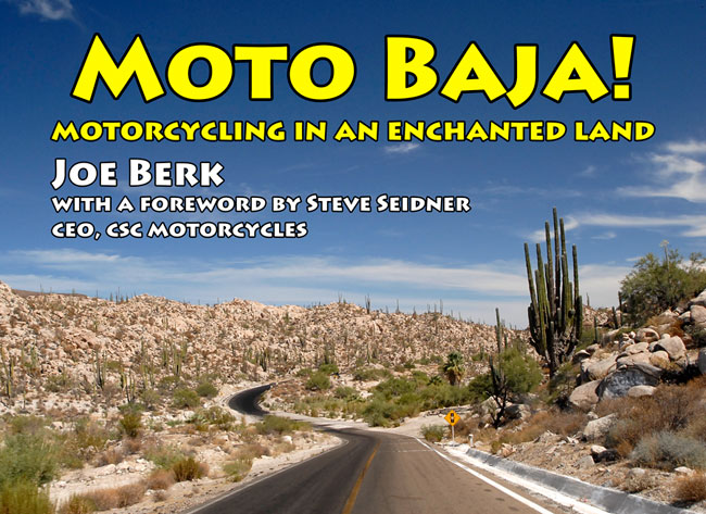
Want to read more stories about riding in Baja? Pick up a copy of Moto Baja!

Bobbie’s Solo Baja Ride: Part 2

By Bobbie Surber

In Part 1 I shared with you my adventure from Sedona, AZ, crossing the border for the first time on a bike, and heading down Mexico’s Transpeninsular Highway to Guerrero Negro.   This blog continues the adventure.


After an early morning departure leaving behind the comforts of the Hotel Mision Cataviña, I continued on Highway 1, enjoying a quiet morning and the rare good luck of an empty road. Settling into the ride with a deep breath that allowed me to loosen my tight muscles after two long days of riding, I felt the joy start to creep in as I took in the vastness and emptiness of the Sonoran Desert. The fierceness of the summer sun had already begun turning the winter greenness to a light wheat color. This did not diminish the stark beauty of her desert, with the surrounding hills in the distance with their deep purple shadows demanding a second look. My bike was doing great; her little single-cylinder engine was a gem off-road and could manage up to 80 miles an hour, more than enough in Baja. She was a perfect bike for the moment, made for Baja.

The desert south of Cataviña.

Rolling down into Villa Jesus Maria I was more than ready for a break, something cold to drink and some much-needed gasoline. I did well with the drink and break, but as can happen in Baja, the Pemex had no gas. It was another 40 kilometers to Guerrero Negro; as I emptied my MSR liter of gas into my tank, I said a little prayer to both Jesus and Maria to extend my range to Guerrero Negro.

In the Guerrero Negro salt flats.
At Scammon’s Lagoon in Guerrero Negro.

Prayers answered, by perhaps both Jesus and Maria, I arrived with a smidgin of gas fumes left in my tank. Reaching Hotel Don Gus, which several riders had recommended as both affordable and bike safe, I pulled into the dirt parking lot to check in. This is a typical motel-style lodging with comfortable rooms and a simple restaurant serving hearty portions. My room settled, I headed for a taco truck that every rider raves about, Tony’s Fish Tacos. Let me tell you, I often dream of Tony’s fish and shrimp tacos with the perfect batter and lime crema!


Keep us going…please click on the popup ads!


Fully satisfied and with still enough daylight left, I went to explore the salt flats famous in this area. A short ride from town, the salt flats looked like a mirage at times, fooling the eye into believing it was a vast lake. This soon gave way to the commercial operation with magnificent mounds of salt with trucks and bulldozers on the top of the salt hill so high that the trucks looked like toys. Soon I was passing the small boat dock and positioned my bike for a good pic. The sun was warm but blissfully not hot with the Pacific breeze. I set up my small camp chair, pulled out a flask filled with an excellent local Vino Tinto, and gave a silent toast to a perfect Baja day.

A Don Gus Hotel selfie.

I woke the following day with growing excitement, and unable to wait for daybreak I loaded my bike impatiently, waiting for the restaurant to open for a much-needed cup of joe. You will often find that opening and closing times in Baja are more of a suggestion than a hard rule. A half-hour later, I was in my room, firing up my rocket pocket stove and making do with a Starbucks instant coffee and some leftover tortillas. Bike ready and stomach full, I headed to the gas station to fill up Red, only to find I had caused a stir and was noticed by a few locals who wanted to meet the female American solo rider. A few of the younger ones asked what seemed like endless questions, wanting to know where I had been and where I was going. This completed, I was on the road heading to the part of Baja I had been waiting for, Mulege and the famous Bahia Conception.

The road out of town was uneventful, an endlessly flat straight that challenged me to stay awake and focused. About an hour later, I passed the midsize town of Villa Alberto with plenty of gas, shopping, and lodging. I stopped long enough for gas and was back on the road. My interest in the highway picked up as I neared San Ignacio. A few kilometers before San Ignacio there was another military stop, which was uneventful other than the guard looking at me, my bike, and a long look down the road with was becoming the norm question and answer: Solo? Si Solo! With an astonished look, he waved me on, wishing me a safe ride. My next stop was a visit to the Baja 1000 popular pit stop, Rice and Beans, a restaurant and hotel just off the highway with good food and cold beer. I left satisfied and headed to the main square of San Ignacio.

Inside the Rice and Beans Restaurant in San Ignacio.

The town of San Ignacio is a true desert oasis with more palm trees than you could count and a river running through the town. San Ignacio seems caught in a time warp as elderly men sit in the shade of the massive trees that frame the small-town square, reading and playing cards as they eye me parking my bike. Curious about this gem, I found just enough cell coverage to look up her history. San Ignacio was founded in 1706 by the Cochimi tribe. In 1728, missionary Juan Bautista de Luyando discovered San Ignacio and committed to building Misión San Ignacio Kadakaamán. The building is made of volcanic rock from the nearby mountains. Her mission sits quietly, waiting for the next visitor, and I was lucky to find her open and welcoming.

The San Ignacio Mission.
San Ignacio’s town square.
A restaurant in San Ignacio.

I reluctantly got back on my bike, heading back to the highway with a promise that I would return to San Ignacio for further exploration and to enjoy her peaceful river and nearby lagoon. With one more top off of gas, I headed down the road finding the excitement of endless twisties and, on the horizon to my left, the peaks of Tres Virgenes. One last climb took me to another peak, with soon a sweeping view of the Sea of Cortez. Massive winds kept me alert. The heat was near overwhelming, and the wind only accelerated my dehydration. I was physically spent with still another hour to my destination. Pulling into Santa Rosalia, I sadly passed her mission for another time. I stopped just long enough to douse myself with water at the gas station, drink as much water as possible, and get back on the road.

Soon I was riding through the arches that welcome you to the proper start of the town of Mulege. My destination was Historico Las Casitas. After several attempts to find the hotel cursing my Google Maps, I finally arrived. I walked in, took off my riding gear, and as if they were waiting for me to arrive, a young man said not a single word; instead, he handed me a glass of lemonade, a drink from heaven made with fresh limes, lemon, and cane sugar. I emptied my glass in two long swings. Gratefully finding an ounce of composure, I asked about a room for the night. I soon settled into my volcano rock room with mosquito netting; it took me no time to pass out with cold air soothing my heat-exhausted body.

The Hotel Las Casitas courtyard.
My room in the Las Casitas.

Waking in the late afternoon, I discovered the L-shaped courtyard covered in vines and trees, allowing for continual shade against the heat of the June sun. My bike was safely parked in the courtyard; I made my way to the bar to the young man who had saved me with his magical lemon concoction and ordered another (with tequila this time). Sufficiently recovered, I headed out to discover the town and look for another perfect taco. Mulege, another mission town founded in the early 1700s and known for the beauty of the river that runs her length ending at the Sea of Cortez, her proud mission sets up on a hill overlooking the palm trees and river. Sadly not open, I wandered around the grounds taking in the softness of the sunset overlooking the river. I headed back to the town square, and with a food stand next to the market, I had a satisfying plate of carne asada tacos with the best beans I’ve had in Baja. Heading back to the hotel, I found the courtyard packed with locals and visitors enjoying the evening coolness. I was lucky to be greeted by the owner, I learned more about the hotel’s history, and I met a friend of his who could take me horseback riding the following morning. With plans set for the next day I gratefully slipped between the crisp white sheets, pulled my mosquito netting around me, and drifted off to sleep dreaming of the adventures ahead.


Part 1 of my Baja adventure is here.


Never miss an ExNotes blog:

Venturing into Baja?  Insure with the best:  BajaBound.  It’s what we use.

Want more Baja info? It’s right here!


Want to read more stories about riding in Baja? Pick up a copy of Moto Baja!

Three Steps to Ease into Moto Camping

By Mike Huber

I know many people on this page camp and ride, but some have yet to dive into mixing these two great passions.  My objective in this article is to help you bridge riding and camping, alleviate any concerns on this topic, and build a foundation of knowledge for those new to motorcycle camping. In doing so you will discover a deeper level of motorcycling that many riders experience.


Help us bring more to you…please click on the popup ads!


Start with Less

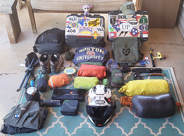
With all the social media posts of riders from around the world sharing their epic adventures and providing reviews of the gear they use can cause anxiety.  Intimidation from the expense and amount of equipment people use for moto camping can become overwhelming when starting this hobby.  I’m not saying any of these riders are wrong in the gear (or the amount) they use, but my philosophy while motorcycle camping is less gear is much more efficient and cheaper. My first time moto camping I had nothing other than a one-person Kelty tent (which I still use), a sleeping bag, and a small personal hygiene kit.  I planned to give moto camping a shot and figured I could survive one night out on Washington’s Olympic peninsula even if I was a bit uncomfortable.

I wasn’t uncomfortable at all.  In fact, other than adding a 6-pack of beer and a crushed Subway sandwich my gear didn’t grow or change for the next 8 more years (even after “maturing” from a Ducati Monster M1100 to a BMW GS1200).  Would I have been more comfortable with a sleeping pad, cooking set up, and maybe even a chair?  Yes, but that came years later after learning from others (I am a bit set in my ways even if they force me to be uncomfortable). Starting from such a minimalist perspective and adding gear slowly allowed me to tailor my equipment perfectly.  You will find everyone has a “better” way of doing things; you might want to learn what works best for you and expand slowly.

Start in a Familiar Location

Roaring through the dense rainforest of the Olympic Peninsula on my Ducati Monster I was excited to be camping with my motorcycle for the first time.  In hindsight this choice was probably a further and more isolated location than I should have started with, but it worked for the most part. I had ridden the road several times, I was comfortable with the distance, and I was aware of the ever-changing weather conditions.  Being new to this I didn’t pack rain gear and of course it rained heavily that night (I was forced into my tent by the weather by 7:00 p.m.).  You must pack raingear if you want to ensure it never rains on your moto camping trip.   But even with the weather not cooperating it was a fun first night and it was enough to get me hooked on the lifestyle.

Looking back, a more comfortable way to experience my first moto camping adventure would have been a more controlled environment.  Even for those well-seasoned campers, testing new gear in your home or backyard to learn how to set up, adjust, and break down the equipment makes for a less stressful time in a real-world environment. Purchasing lots of expensive gear, not testing it, and going on a multi-state tour can be a painful way to learn the gear isn’t right for you or the climate.  Another way to learn your equipment and build experience is at a state park close to your home or a KOA.  Even if you have to retreat to the KOA store or end up back inside your house, don’t be discouraged.   That’s what this step is for.  Take notes on what worked and what didn’t, and build off that until you are comfortable with the next step, which can be dispersed camping or a longer distance ride.  It is better to learn in this semi-controlled environment than to have a horrific night with improper gear in poor weather and become completely deterred from ever moto camping again.

Learn From Experience

Having completed a successful test runs with your gear it is now time to begin learning how to increase your confidence in harsher and more remote environments. This point in your experience level is also the perfect time to make gear adjustments based on your notes.  With a few nights camping under your belt you can seek advice and learn from others, including their set up tricks and in what type of climate they moto camp.  In doing so you will fine tune your camping outfit so that it is perfect for you, your motorcycle, and the climate.

During this phase it is important to remain open minded.  Everyone has a method that works best for them.  For some it is a half shelter at a roadside pullout, for others it can be as elaborate as a 6-man tent with copious gear that requires 2 hours to pack.  Normally when I travel and moto camp it isn’t for just one night.   I’m on the road for two to three months at a time with Airbnbs or hotels as resting points or for working.  Even though I am comfortable with my moto camping equipment it’s always fun to chat up other motorcyclists. In most cases, even if their set up is completely different there is usually one or two takeaways I learn from conversing with them.

Conclusions

Moto camping is an easy and inexpensive way to escape the rat race with less effort than many would think.  These experiences and the people I meet along the journey are some of the most best I have had.  Being so removed from everything as you sit relaxing in the glow of a warm campfire reflecting off your moto is a fulfilling feeling that few venture to achieve.


Never miss an ExNotes blog: