Volcan Nevado del Ruiz

By Joe Berk

That big photo above?  That’s my old HJC carbon fiber helmet at an elevation of 13,576 feet, and the gunk you see on it is ash.  As in volcanic ash.  We’ve written about Colombia’s Volcan Nevado del Ruiz before here on ExNotes.  I’m writing about my ride there again because it seems the old girl has awakened again.

The view from afar. I would be a several hour ride and a monstrous elevation climb (but on amazing roads) to get to the Volcan Nevado del Ruiz.

Volcan Nevado del Ruiz is an active Colombian volcano 80 miles west of Bogotá.  Starting in April of this year, it started acting up again.  I say “again” because in 1985, Nevado del Ruiz erupted and killed 25,000 Colombians. That event was not only Colombia’s deadliest eruption…it was all of South America’s.

The National Park entrance. They turned us around a half hour after we arrived when the volcano started spewing ash.

I’ve been to the Volcan Nevado del Ruiz.  I rode to the top on a motorcycle with good buddies Juan and Carlos.  We were there in 2015, and a short while after we entered the Colombia’s Brisas National Park at the 4,138-meter summit, the park rangers told us we had to leave because the volcano was active.  It had started spewing ash.  It was snowing at that elevation, too.  It made for a fine mess and exciting riding.

The ride up to the top of the Volcan Nevado del Ruiz was awesome.  The roads were typical Andes Mountains Colombian switchbacks and we were in rare form.  The day was beautiful at the lower elevations, but that was about to change as we continued our Andean ascent.

Ah, the Andes. The riding in Colombia is amazing.

On that ride, we were mounted on AKT Motos RS3 motorcycles.  That’s the Colombian equivalent of CSC’s RX3, but with carburetors instead of fuel injectors.  The fuel is a bit more flaky in Colombia, so AKT opted for carbs instead of injectors.  People have asked if the carbs were problematic or if the bikes were slower than the US RX3.  I couldn’t tell the difference.

Volcanic ash on my beautiful black AKT motorcycle.

Colombia has a pretty good deal for AKT making Zongshen motorcycles over there.  If AKT brings in assembled bikes, they would have to pay a 30% import duty on them.  If they components from Zongshen and then buy 15% of the bikes’ content in Colombia (thus encouraging Colombian manufacturing), AKT pays only a 2% import duty.  Ah, if only our politicians were that smart.
Carlos and I at the park entrance. It was cold, wet, and gritty with the airborne volcanic ash mixing with the snow.  This wasn’t a beer and burger run to Cook’s Corner!
My Olympia motorcycle jacket, spotted with ash and my CSC pilot wings.

After running to the top of Volcan Nevado del Ruiz, we descended along dirt roads to a magnificent Colombian hotel just a few miles down the road, the Termales Del Ruiz.  My buddy Juan knows how to organize a great ride, and I sure had an awesome time.  The Termales Del Ruiz is at the end of that dirt road somewhere in the fog, and it’s at 3,500 meters above sea level (still pretty high).  It has a thermal pool fed by water (heated by the volcano, I guess) and that water was hot!  The air was bitter cold, but the water was nice.  It was one of the best nights in Colombia, and that’s saying something.   Every night was awesome.

So, back to the Volcan Nevado del Ruiz going live again:  It’s really happening, and it wasn’t that many years ago that this same volcano killed 25,000 people in Colombia.  Here’s a recent news story on what’s happening now:


Subscribed but not getting your ExNotes new post notifications?  Check your email spam folder and tell your email provider we’re the real deal!

A Triumphant Change from my BMW

By Mike Huber

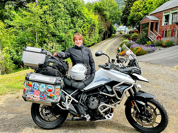
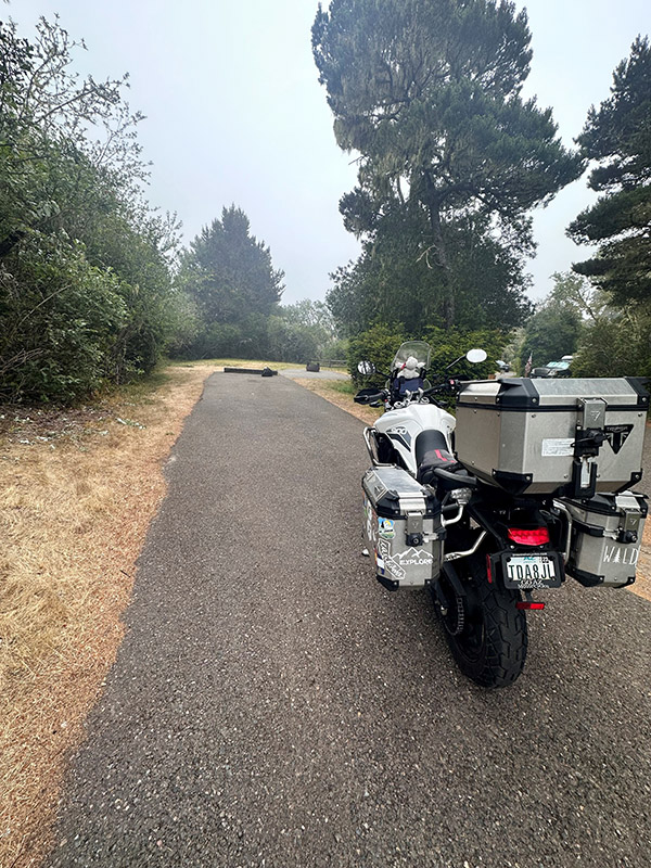
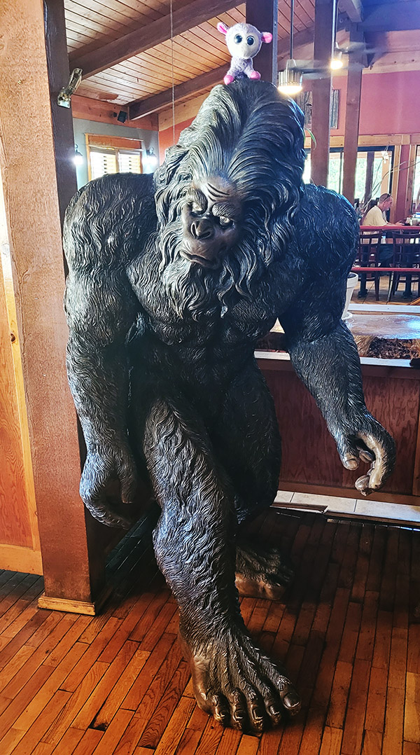
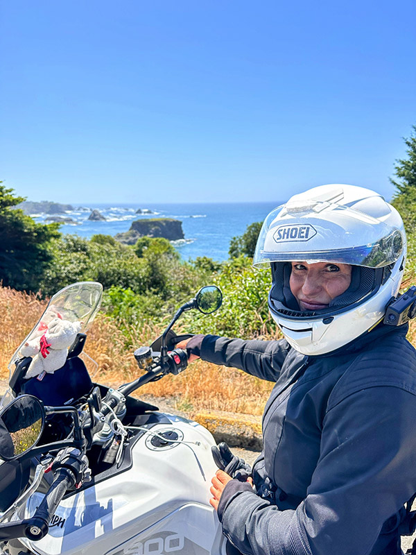
The 4th of July is a perfect time to tell my riding story from this weekend spending two days riding a British motorcycle. This was a 180 from my usual chant this time of year of “Screw the British,” but my BMW GS1200 happened to be in the shop for another week waiting parts from Germany so getting on any bike for a weekend was just what my soul needed. My girlfriend allowed me the honor of taking her 2023 Triumph Tiger 900 GT Pro out to tear up 200 miles of Route 299 through northern California.  Along this stretch of highway, it is more important than ever to be alert as it is Sasquatch Country.

I was excited to ride this portion of northern California but didn’t expect to be that impressed with the Triumph.  Previously having test rode several Triumphs I was familiar with them.  They are wonderful machines but they never really spoke to me or my riding style, so I steered towards Ducati or BMW. However, one of my favorite guitar players, Billy Duffy (from the band The Cult) is a HUGE Triumph rider.  I had the pleasure of meeting him last November and being semi star struck.  All I could mutter was “I am sorry I ride a BMW GS, but my girlfriend rides a Triumph, and oh yeah…you’re an incredible guitarist.”  I guess there have been worse encounters with celebrities than that.  He high fived me, we shook hands, and we had a laugh over my awkwardness (more him than myself I am sure).  Anyway, back to the Triumph Tiger and Sasquatch hunting along Route 299.

This bike is fast.  It doesn’t hesitate to go once you twist that throttle, and the acceleration is smooth.  Coming from a background where torque is king it was almost a relief to not have to worry about your front wheel leaving the earth every time you go to pass someone, although I have always felt wheelieing by cars as you pass them is just…. Well, it’s cool.

The Tiger is 60 pounds lighter than my BMW GS1200, and the weight is distributed much lower.  This makes it extremely easy to just throw into turns, which I did numerous times along Route 299.  There are no longer chicken strips on the tires.  The Tiger is also much easier to maneuver due to this, which is helpful in sand, difficult terrain, or having to move it 8 feet into a different parking spot.  

Changing modes on the BMW when switching from on road to offroad modes you simply hit the button and shift gears.  With the Tiger you need to stop the bike, place it in neutral and switch modes.  This is a minor complaint I understand, but I was in the heart of sasquatch country and any delay could result in serious injury or death by being mauled by one of these magnificent beasts.

For some reason Triumph didn’t add a steering damper, or weights on the handlebars ends.  This can at times cause a wobble at high speeds and it is not a wind friendly design.  When bringing this up to the Triumph dealer they stated it wasn’t supposed to go over 85 MPH with a full load and he asked how fast I was riding it.  Without divulging the answer in this write up I will say he raised his hands and walked away at my answer (this happens frequently with me when I am too honest).

Overall, I am much more impressed with this motorcycle now than I was previously. It was a breathtaking 200-mile ride in northern California as the road snaked along the Trinity River and in Six Rivers National Forest. The twisties were a blast and by simply clicking down two gears I was able to rocket past slower vehicles with no problem and put any threats far in my rearview mirror (to include Sasquatch).  Speaking of which, we didn’t see any Sasquatch along this route.  I swore I could smell them as I dropped into Humboldt County but I suppose that could have just been the marijuana cultivation.


Disclaimer- I moved the Triumph to the other side of the Starbucks parking lot as soon as I saw several GS riders pull up.

Highway 50: The Loneliest Road in America

By Bobbie Surber

Embarking on a motorcycle trip from Arizona to British Columbia I set two goals for myself: to visit as many national parks as possible and to explore remote and intriguing roads.  During my pursuit of the latter that I stumbled upon Highway 50, also known as the “Loneliest Road in America.” It offered the bonus of passing through the Great Basin National Park.

Like any good planner, I turned to social media for advice on surviving this desolate route (add in a touch of sarcasm). The responses I received were mostly negative, with warnings about the challenges of riding alone, extreme heat, lack of gas stations, and overall boredom. However, a few seasoned riders who were familiar with the road reassured me that not only would I survive, but I would also have the opportunity to earn a certificate attesting to my survival. With this mixed bag of feedback, I embarked on my journey, eager to uncover the truth about the Loneliest Road.

Highway 50, stretching from West Sacramento, California, to Ocean City, Maryland, is a scenic route that earned its moniker from a 1986 Life magazine article that described it as desolate and isolated. The section of Highway 50 referred to as the Loneliest Road is in Nevada. This road winds through vast stretches of remote desert landscapes, featuring rugged mountains and expansive plains that contribute to its reputation.

Traveling along the Loneliest Road offers a unique experience, characterized by long stretches between services. It is essential for travelers to come well-prepared, as gas stations, restaurants, and accommodations are few. Adequate fuel, extra food and water supplies, and an acute awareness of weather conditions, particularly during extreme heat or summer and winter storms, are crucial.

Despite its reputation for solitude, the Loneliest Road in America showcases stunning natural beauty, allowing travelers to immerse themselves in the vastness of the American West. Along the route, one can encounter remarkable attractions such as the Great Basin National Park, Lehman Caves, and several ghost towns. These highlights offer a glimpse into the unique charm and allure of this road less traveled.

Let’s dive into my own epic experience along this renowned route.

My journey began when I left my home in Sedona, AZ, riding my trusty Triumph Tiger 900 GT Pro, affectionately nicknamed “Tippi,” as she likes to take what I call unscheduled naps tipping over often at inconvenient locations. Loaded with gear for a summer of adventure, I set off on a bright June Sunday morning, spending five days exploring North Grand Canyon, Zion, Bryce Canyon, and the captivating Highway 12, before spending two nights in Capitol Reef.

Leaving Capitol Reef, I eagerly anticipated joining the long-awaited Highway 50, where it intersected Interstate 15 in Utah. Initially, the road meandered through open plains with scattered ranches along the way, offering nothing too remarkable. However, about an hour later, the ride became more intriguing as the winds picked up. As I glanced ahead, an ominous sky threatened an impending storm. Riding past sand and salt fields, I witnessed a bewildering phenomenon—the salt in the fields seemed to defy the wind, rising straight up in vertical columns rather than blowing or swirling. Bracing myself against the wind’s force, I pulled over to capture this puzzling sight but struggled to capture it adequately, settling for a short video clip as proof of my encounter.

Continuing across more plains, I found myself nearing the turnoff to Baker and the Great Basin National Park, my intended destination for two nights of camping and sightseeing. As I gazed at the mountain, I found an angry and ominous sky with snow-covered peaks that seemed to dare me to face the challenges of reaching its 7700-foot elevation to my destination at Upper Lehman Campground. Rain and lightning accompanied me as I rode into the tiny town of Baker, where I hastily stopped at the Visitor Center to check the weather report and determine how cold it would get during the night. Assured of temperatures above freezing, I pressed onward, rewarded with an epic campsite at Great Basin. Nestled alongside the rushing Lehman River, my campsite offered complete privacy, and I reveled in the wonders of the park over the next two rain-filled days and nights. The Lehman Cave tour was an unforgettable highlight not to be missed. As an avid hiker I loved that I was able to experience an epic 7-mile round trip hike along the mountain following ever upwards along the Lehman River complete with snow covered meadows and towering views of the mountain summit.

During my stay in Baker, Nevada, I discovered two places that I highly recommend. The first is the 489 Grill and Whispering Elms Motel and RV Park, which boasts a bar, RV and tent camping facilities, firewood, and the best burger I have ever tasted. Trust me when I say this is a significant claim, as I am a true burger aficionado. The food is not the only remarkable aspect; the owner and staff are incredibly hospitable, making your visit all the more enjoyable. The second recommendation is the Bristlecone General Store, a quaint establishment offering unique local gifts, an unexpectedly diverse selection of food options given its small size, and a coffee bar serving locally roasted beans by a blind roaster with an extraordinary sense of smell, resulting in a delightful brew devoid of the bitterness found in commercial beans. Among the store’s charms, one staff member named Rachel stood out for her warmth, hospitality, and willingness to share insights about Baker and local hidden gems. I was informed that Sandra’s Food Truck serves excellent and affordable Mexican cuisine—an experience I now eagerly anticipate for my future visits.

Reluctantly bidding farewell to Baker, I rejoined Highway 50, heading towards my next destination, South Lake Tahoe. Contrary to the dire warnings of scarce gas stations, I discovered that this notion was unfounded. Approximately 70 miles down the road, I arrived at Ely, another small mining town with plenty of services. After a quick refuel, I resumed my journey, realizing that the otherwise flat stretches of road were intermittently punctuated by mountain passes exceeding 7000 feet in elevation. These segments offered breathtaking vistas and enough twists and turns to satisfy both Tippi and me.

My first mountain pass, before descending into Ely, Nevada, presented an exhilarating ordeal with rain, lightning, and a brief ten-minute ride through hail. Eighty miles further, I found myself in the town of Eureka, where the threatening skies curtailed my exploration time. Nevertheless, I managed to visit a few must-see attractions, including the Opera House, built in 1879, the still-functional Courthouse of the same vintage, and a brief excursion to the town’s cemetery, where a variety of burial sites represented different social organizations, religious groups, and ethnicities. This walk-through history provided a fascinating glimpse into the town’s past.

Continuing on Highway 50, with the ominous skies in my rearview mirrors, I was reminded of the urgency to press on towards my next stop—Austin, NV. This old mining camp retains its rustic charm and has evolved into a haven for camping, hiking, and mountain biking, thanks to its proximity to the towering Toiyabe Mountains. During a pit stop, I encountered a large group of riders following the Pony Express Trail, who praised my adventure, while I vowed to return in the near future to explore that historic route.

Reluctantly bidding farewell to this enchanting mountain town, I embarked on another 112-mile stretch to Fallon, Nevada. This promised a well-deserved lunch break and refueling opportunity before the final leg of my journey to Lake Tahoe. As hunger pangs intensified, I hurriedly pulled into the first gas station I encountered. Curiously, the ground appeared slanted, making it impossible to safely park my bike with its kickstand without an extreme lean. Oddly, as my kickstand tends to be a bit high, I often worry about Tippi toppling over. Trying another station, I realized that my kickstand was not misaligned but broken—a sudden and unfortunate realization. With every ounce of strength, I fought to prevent Tippi’s full weight from pinning me between the gas pump curb and the engine crash bar. As I cried out for help, a kind soul named Caleb rushed to my aid, assisting me in righting Tippi. Examining the kickstand, I conceded that my lunch break was a lost cause. I refueled while seated on my bike and came to terms with the fact that I would have to ride the rest of the way without lunch and with a dangling kickstand, just inches off the ground.

Determined to soldier on, I pushed forward to Carson City, Nevada, before ascending the switchbacks and descending towards Lake Tahoe. The ride and the stunning view of the lake were awe-inspiring. I completed the remaining portion of my day’s journey with ease, covering over 400 miles. A warm hotel bed awaited me after seven nights of camping, and I eagerly anticipated reuniting with my boyfriend, Mike Huber, a fellow adventure rider who also happens to be a badass. I recommend checking out his posts on ExhaustNotes for a combination of insightful rides and outrageous travel stories.

In conclusion, my time on the Loneliest Road in America was an unforgettable experience. Despite the dire warnings I received, I found this historic stretch of highway to be well worth the ride. Contrary to popular belief, there are plenty of services available along the route, and the road itself is intermittently adorned with scenic mountain passes. The friendly locals and the sense of freedom that permeates this lightly traveled road are rare treasures that I seldom encounter. If you’re seeking a unique journey through the American West, I wholeheartedly recommend venturing onto the Loneliest Road in America.


Don’t forget to help bring content to you:  Please click on the popup ads!


Never miss an ExNotes blog:

The Wayback Machine: Romania’s Transfagarasan Highway

By Mike Huber

Throughout my adult life (although, many will argue I have yet to reach mature adulthood) one of my greatest passions is motorcycling.  Like many of you, I seek out the most beautiful and exciting roads to experience on two wheels.  Whenever possible I try to achieve this on a global level and not limit this quest to just my state, or even my country. This isn’t always the easiest objective to reach. Many roads that are the pinnacle of any rider’s dreams are usually quite far off the beaten path.  This can seem like a deterrent to many, but my mindset is to use the distance to reach these places only adds more depth to the adventure and in doing so adds not only miles, but new friends and stories to each road.

Transfagarasan Highway

If you perform a Google search on “best motorcycle roads on Earth” or any similar phrase, what will appear before you in the top images will be a photo of the Transfagarasan Highway. This mind-blowing highway is nestled deep in the Transylvania Mountains of Romania, and for us it was a four-day ride from Krakow, Poland.  This is where my girlfriend Bobbie and I rented our Honda motorcycles (she had a CBX500 and I had the CB600F).

We began the day waking up in a yurt at an amazing moto camp in Sibiu, Romania that is hosted by Doru Dobrota.  Doru has been running this camp out of his family’s old mountain cabin for years and over that time has meticulously grown the camp to a perfect launching point to the many beautifully challenging roads of Romania. Once we finished breakfast, confirmed the weather would cooperate with us, performed routine maintenance checks on the bikes, and a had chat with some other riders staying at the camp, we were ready to set out for one of the greatest days possible on a motorcycle.

It was a two-hour ride through some remote Romanian villages that we had to remain alert for deer, cattle, horses, and the usual obstacles to dodge around as we traveled from Sibiu to the base of the mountain pass where the roads started really becoming fun.  Once the switchbacks began in the lower parts of the pine forests, we quickly twisted the throttle and leaned into the perfectly paved corners as we begin to ascend the highway to where you eventually are at the bottom of what would be like in skiing terms a giant bowl.  Looking up I am instantly in awe of what looks like a gigantic matchbox car racetrack thrown recklessly together by a 6-year-old.

After regaining our emotions of what lies before us, we jump on the Hondas and hit the throttles hard. The road has nonstop switchbacks but since its so open it allows you the ability to constantly overtake any vehicle in front of you easily. This enables us to really lean in deep to each corner pushing the red line of these little Hondas, as well as challenging our own riding abilities.  We continue to traverse the switchbacks for what seemed like forever and just as we summit the pass, we stop for a quick breather at a waterfall to absorb what we have just completed and imagine what was ahead of us.

We now begin our decent down the south side of the pass.  The southern side is less dramatic but nonetheless has spectacular views for miles until we are well below the tree line and back into another tight pine forest with switchbacks. This seemed less dramatic until out of the corner of my left eye I spotted something crawling onto the road.  At this point the road has some sand on it, so we were only traveling at about 25 miles per hour.  My first thought was a deer, but when I was able to decipher what it was, I had to stop and shake my head.  It was a grizzly bear eating a bagel.  Now THAT is worth stopping for a photo of.  As I am taking the picture, I hear a loud shout through my headset “Go! Go! Go!”

I looked in front of me and there were three more grizzlies.  What was so concerning at this point was they consisted of a mother bear and two cubs, fully blocking the road. So, I have one next to me eating a bagel and three in front of me. I hang my head down and reply over the headset with my usual response to when I am in a bad situation “So this is how it ends…”  We sat extremely still on the bikes for a few minutes until the bears dispersed in front of us, retreating into the thick pine forest.

As the sunlight retreated into the dense forests, we still were admiring the beauty of the road and what Romania had shined upon us this day.  After a fresh fish dinner and the semi comfort of a hostel bed we were able to fully absorb and appreciate the experience for having ridden one of the greatest roads on Earth: The Tranfagarasan Highway.


Keep us in clover…click on those popup ads!


Never miss an ExNotes blog:


We stayed at Motocamp in Romania.

We rented our motorcycles from Motonasezon in Poland.

Packing for a Long-Distance Motorcycle Trip

By Mike Huber 

It feels like the perfect time to do a write up on packing for a long-distance motorcycle trip.  I left Sedona, Arizona, two weeks ago for a motorcycle journey to British Columbia on my BMW GS1200.  I didn’t quite pack everything I own, but close to it.  Having recently taken a hiatus from my day job there is no time frame for returning to Arizona other than when the weather changes in the Fall. With this being the case packing had to be tight, yet diverse enough for every possible type of weather that I may encounter.

My philosophy has always been less is better. This holds even more true when you have such minimal storage space on a motorcycle.  There is no need to have every centimeter packed to the gills.  Having a bit of remaining space allocated is important in the event you need to add gear or choose to pack sloppily after camping in the rain.  That buffer space should be held sacred. So, here is everything I am bringing along this journey.

      • Kelty 1-person Tent
      • Enu 2-person hammock (I like a larger hammock so I can wrap up if it’s cold)
      • Big Agnes sleeping bag (15 degree rated)
      • Laptop bag with chargers and backup portable battery
      • Luci Llight
      • Hiking boots
      • Stool
      • Cooking pot, cup, utensil, propane
      • Towel
      • Portable grill (for throwing a steak or freshly caught fish on top of some coals)
      • 25ft of paracord (usually for additional hammock straps as needed)
      • Day pack for hiking
      • Tire repair kit
      • Compressor
      • Fishing gear
      • Jumpmaster knife
      • Hatchet
      • Air mattress
      • Air pillow
      • Raingear (top and bottom)
      • Leatherman
      • SpotGen3 GPS (My Mom likes to know I made it to camp alive)
      • Headlamp
      • 3-liter expandable water blivit
      • Swimsuit
      • 2 pairs of pants
      • 3 pairs of socks
      • 3 pairs of underwear
      • 3 t-shirts
      • 1 pair of shorts
      • Duct tape
      • Electrical tape
      • Sweatshirt
      • Baseball hat
      • Riding jacket
      • Lambykins
      • Military side pack (for all fishing gear)
      • Winter hat (my Mom knitted)

Currently 10 days into this trip with 8 nights of camping in numerous weather conditions and I have remained quite comfortable.  Another barometer of success is when someone walks by my campsite as I am laying in my hammock reading a book and they comment “WOW, you fit ALL that on your motorcycle?”

I just smile and reply with a “yup.” I am now in northern California and will start hitting possibly more wet and cold weather so I will see how my gear continues to stack up against the elements as I travel further north with no real itinerary.  The main objective of this trip is to slow down, enjoy the moment, be present, and meet up with old and new friends along the ride.

Let me know if there is a piece of gear you feel I am missing or that you hold close during your long-distance motorcycle trips. I am always interested in improving my packing and living conditions while on the motorcycle.


Hey, a quick photo from this trip…there are two Joes, a deer, and two wild turkeys in the picture below.


Please click on the popup ads!


Never miss an ExNotes blog:

Granada and the Alhambra

By Joe Berk

It doesn’t get more Spanish than the Alhambra.   Until this visit if anyone had mentioned Alhambra I would have thought of our Alhambra here in California, but this was the real deal:  The original Alhambra in Granada, Spain.

Walking the streets in and around the original Alhambra fortress. The red comes from iron in the clay brick construction. The walls aren’t really curved; the curvature here is from my Rokinon 8mm lens. It’s manual everything (f-stop, shutter speed, and focus) when mounted on my Nikon D3300 digital camera.

Alhambra translates from Arabic as “the red fortress.”   The Moors controlled the Iberian peninsula from the early 8th to the 15th centuries, and many Spanish words and names include the syllable “al” (Alava, Alvarez, etc.).  “Al” in Arabic means “the.”  “Al” became “el” in Spanish; “al” remains the first syllable many Spanish words.

The foundations of an earlier structure show the area was first fortified in the 8th century by Visigoths (Germanic people who were part of the Roman Empire).  The Arabs arrived next, and they hung around for 800 years.  Our visit to the Iberian peninsula was a bit shorter (we were there for 15 days).

A wide angle photo of the Alcazaba (the Citadel) and its interior.  This is the oldest part of the Alhambra.

The Alhambra’s ownership changed many times.  Moorish rule ended in 1492 when the Emirate of Granada surrendered to King Ferdinand II and Queen Isabella (she financed Christopher Columbus’s expedition to America).  Ferdinand II and Isabella only lived in the Alhambra for a tumultuous few months.  While there, old Ferdinand and Isabella expelled Spain’s Jews unless they converted to Christianity, and that started the horror known as the Spanish Inquisition.  I didn’t know this when we visited the Alhambra; I learned it while writing this blog.  I suppose that’s good; I might not have enjoyed the Alhambra as much if I knew this while I was there.
Inside the Palace of Charles V’s courtyard, an Italian-inspired building commissioned in 1527.

We walked the grounds of the Alhambra most of the morning.  There were the fortress and palace buildings described above, the inevitable souvenir and trinket shops, and stunning gardens and courtyards.

One of several pools and gardens in the Alhambra. It was almost too much to take in on a single visit. I think I just decided a return is necessary.
A magnicently-framed photo of the Convent of St. Francis, also known as the Palacio del Convento de San Francisco. It was built over a Moorish building. Today, it is a hotel.  I shot this photo with the Nikon kit 15-55mm lens, which is not a high end lens.  The original photo doesn’t show the rich greens you see here (they were all very dark), but because I shot in RAW, Photoshop’s auto adjustment really made the picture come alive.  The is the same structure and vantage point you see in the photo at the top of this blog.

After taking in the courtyards we entered the fortress area.  The photo ops were phenomenal.

The view from the Alhambra overlooking Granada.
Another view of Granada from the Alhambra.

There’s a beautiful pathway that leads from the Alhambra to Granada.  It has good shade, it was cool, and the walk was all downhill.

Fellow traveler Ibrahim seizing the moment. Ibrahim showed several of his photos to me from this and previous adventures; he is an exceptionally talented photographer.
Walking into Grenada from the Alhambra. The day was magnificent; the weather was perfect.

Granada is located at the base of Spain’s Sierra Nevada Mountains.  It’s history and occupations parallel those of the Alhambra.  The surrounding area is believed to have been populated since at least 5500 B.C. Nobody is certain what “Granada” means in either Spanish or Arabic.  The city is the capital of the Spanish province of Granada.

A Granada sign explaining the Albaicin area, an historic area that retains its medieval look and streets.
One of many photogenic doorways in Granada.
Exterior artwork that demanded a photo.
As always, an ornate Spanish knocker.
Decorative borders for sale in a Granada shop.

Granada’s city center has a beautiful town square, bordered at one end by the Santa Iglesia Catedral Metropolitana de la Encarnación de Granada.  We stopped to take it all in after we enjoyed a lunch in one of Granada’s many sidewalk cafe restaurants.  The first hit of empanadas there was free, but our initial empenada serving was a seafood medley with little octopuses (octopi?) we didn’t like.   Our waiter picked up on that, took them away, and returned with chicken empanadas.  Lunch was great.

Anything for a few likes, I guess. These young gals staged an impromptu belly dance video in front of the Santa Iglesia Catedral Metropolitana de la Encarnación de Granada.

As was the case in every city we visited in Spain and Portugal, two-wheeled transportation is part of the culture.  Our tour was by bus and high speed rail and it was great, but I missed being on a motorcycle.  The traffic didn’t look too crazy and on previous motoadventures I made it through China and Colombia.  I think I could handle Spain and Portugal on a motorcycle. Maybe next time.
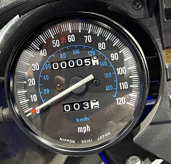
A strong motoculture….my kind of place.

Granada was great.   That evening, we had a wild taxi ride to the top of a mountain to watch the Flamenco dancers.  That’s coming up next, so stay tuned.

Watch for our next blog on the Iberian adventure!

Here are links to more Spain and Portugal articles:

Basilippo: A Spanish Olive Plantation
Coimbra
Spain and Portugal
Camino de Santiago:  Part 1
The Sportster of Seville
Évora
Lisbon
Gibraltar


Help us keep the content flowing…please click on the popup ads!


Never miss an ExNotes blog:

My Favorite Ride in the USA: Utah’s Highway 12

By Bobby Surber

Highway 12, also known as Utah State Route 12, is an awe-inspiring scenic byway in southern Utah that holds the prestigious title of being an “All-American Road.” Stretching approximately 124 miles, this route captivates travelers with its breathtaking landscapes and unforgettable views.

Starting near Panguitch, my journey along Highway 12 began with mounting excitement as the first red arches came into view. I took a short detour off of Route 12 to immerse myself in the famous hoodoos and trails of Bryce Canyon National Park. Lucky enough to secure a campsite at Sunset Campground, I made quick work of setting up my camp and heading out for a long afternoon hike. The next morning I witnessed a magnificent sunrise casting a warm glow over the canyon, illuminating the striking hoodoos and crimson rocks, a memory I won’t forget!  A one-night stay in Bryce leaves one unsatisfied and longing for more time to explore her magnificent trails.

Continuing my adventure the following morning, I eagerly resumed my route on Highway 12, heading towards my favorite section of the road, high above the captivating Grand Staircase-Escalante National Monument. This expansive and remote region boasts rugged canyons, vibrant cliffs, and extraordinary geological formations. The landscape and its impossible rock formations treated me to endless twisties, creating a sense of otherworldliness. My Triumph Tiger 900 GT Pro was as happy as I was as I relaxed into the ride and allowed her to remind me again what her three cylinders can do. Both of us were in sync as we leaned into curve after curve and blasted down to the bottom of the canyon.

For those with extra time, I highly recommend exploring nearby slot canyons such as Peek-a-Boo and Spooky Gulch, which offer outstanding hiking experiences.

Don’t miss the enchanting Calf Creek Falls nestled at the bottom of a lush canyon. A short hike leads to a captivating waterfall.  While leaving Calf Creek be sure to watch for a dirt road on the left with a sign for coffee. Take that turn and savor a cup of Joe with a view that will leave you speechless.

As I reluctantly approached the tiny town of Boulder, Utah, I realized I had made remarkable progress through the twisties.  I was unexpectedly greeted by an old-school cattle round-up, complete with cowgirls and boys herding a large herd down Highway 12! After a brief turnaround, I found solace in my favorite restaurant, the Burr Trail Grill. Their farm-fresh ingredients delighted my taste buds, whether it was their fresh arugula salad topped with local goat cheese or their beastly-sized burgers that proved a challenge to conquer.

Resuming my journey on Highway 12, I found myself in an unexpected predicament. The cattle herd’s progress was slow and I crawled along clutching endlessly as I felt my left hand about to begin a serious complaint! Amidst the frustration, two memorable moments emerged.  First, a passerby exclaimed, “Dude, you have the sweetest bike and setup!” We shared a laugh as he realized I was indeed “dudeless.” Second, after navigating my way to the front of the line, I convinced the lead cowboy to move the herd slightly to the right, allowing me to pass. Maneuvering my bike through the cows became a comical adventure, with prayers that the sound of my motor wouldn’t startle them. Experiencing this traditional cattle drive in 2023 felt like a slice of Americana and added yet another reason to love Utah.

Leaving the cattle behind I ascended Boulder Mountain, where endless views revealed the back of Capitol Reef on the right and scenic meadows with clusters of aspen, fir, and spruce trees on the left. Surprisingly, the mountain still boasted more snow than I expected in June. Camping, fishing, and wildlife viewing opportunities abound in this mountainous region, with numerous sites available. I’ve spent nights here savoring the breathtaking vista overlooking Capitol Reef and the sprawling valley floor.

As I arrived in Torrey, Utah, the end of Highway 12, I couldn’t help but lament the route’s brevity. With just 125 miles of captivating beauty, I yearned to turn around and experience it all over again. However, the call of the canyon beckoned me for a rewarding hike, followed by a well-deserved whisky to bring an end to a truly perfect ride.

Highway 12, Utah—truly a magical journey that captures the heart and leaves an indelible mark on the soul.


Never miss an ExNotes blog:


Help us keep the content coming:  Please click on the popup ads!

El Condor Comida

By Mike Huber

Pinnacles National Park is the 50th National Park I visited. I believe there are 63 National Parks total (National Park Service keeps adding them yearly, so…).  As with all the parks it is rare to be disappointed with a visit to any of them.  In fact, I have visited some of the parks numerous times just to be sure to fully embrace each part of them as many are quite large.

Pinnacles National Park is one of the lesser visited National Parks, which I find refreshing since there are fewer tourists than other National Parks, like Yellowstone and Yosemite where the crowds can be almost overwhelming and detract from the experience. For Pinnacles I had reserved two nights camping so once I arrived late in the day, I could knock out a shorter hike and complete a long hike on the spare day.  The longer hike I chose was to summit the highest peak in the park, Chalone Peak, which reaches 3,304 feet in elevation.  That isn’t that bad because there is only a 2,034-foot elevation gain from the base. This is a 9-mile trail that snakes through beautiful hills. Every turn provided an incredible panoramic view of the fields below and the mountains that stretched to the sky.

Once summitting the peak, it was time to rehydrate and fuel up with lunch for the hike back.  As I sat down, I heard what sounded like someone vomiting.  Looking to my left I saw I was sitting about 25 feet from a California condor.  It was tagged with No. 89.  The National Park Service tags these rare birds to track and follow them at a level not seen since Facebook started tracking me. Having researched No. 89, I learned this guy was born in captivity in Idaho in 2011. There are under 600 of these massive birds remaining in the world. To have the rare opportunity to see one was magical, but to be able to sit next to one for 30 minutes as I ate lunch was something spiritual, equivalent to petting the gray whales in Baja.

As I sat eating my lunch the condor and I constantly exchanged gazes.  Every so often it would spread its wings to show off its true size.  Not only did it not seem bothered by me, it seemed to enjoy my company (I mean, who doesn’t?).  After about 30 minutes I began wrapping up lunch and as I packed up, No. 89 silently turned away, spread its wings, and leapt off the rock like a hang glider sailing down about 100 feet and then turning upward it flew off into the distance.

This magical encounter reinvigorated me for the 4.5-mile hike to the base of the mountain. I had a solid buzz from the encounter for the remainder of the day.  Just like all the close encounters I have had in nature, that buzz never seems to fade and it has me looking forward to National Park Number 51.


Please click on the popup ads!


Never miss an ExNotes blog:

Life as a Digital Nomad: Part 5 (Ecuador)

By Mike Huber

As the plane was race tracking to land in Quito, the capitol of Ecuador, I could see how large the city was and was reassured in the coin toss that had me choose this country.  This would be my third country to call home for the foreseeable future.

Having been in Panama and Nicaragua with such little luggage it was important to keep my packing to a minimum.  This wasn’t very difficult as the countries I had been visiting were tropical and very warm.  I was certain Ecuador would be the same, as Quito was on the equator.  Where could be warmer than the equator.  Well, it turns out a lot of places could be much warmer?  Quito was indeed on the equator but is also nestled in the Andean foothills at an elevation of around 10,000 feet above sea level.  To add to that it was August, so technically it was winter there (although the ambient temperature doesn’t fluctuate very much).

Quito is a beautiful city with even more beautiful people.  As the cab dropped me off, I was still over a mile from the Aparthotel I had booked for the next month.  The issue was it was Sunday and the roads all going into Mariscal Foch (the city center) were closed and open only for bicyclists. Since I had been running almost daily in Nicaragua and had dropped some weight, I slapped one backpack on my back and one on my front and thought I’d just get a nice run in as I made my way towards my Aparthotel.  This would help warm me up, too, since I was only in shorts and a t-shirt. That was another bad idea. I quickly learned that running at 10,000 feet elevation wiped me out quickly.  I think I made it 4 minutes before my hands were on my knees and the packs were sliding off my back.  This I am certain was quite a scene for the locals who were casually riding their bicycles up and down the main street staring at me as I felt like I was about to die.

Once arriving successfully to the Aparthotel I first confirmed the wi-fi to assure this location was suitable for my day job.  The connectivity worked great, but there was just one hitch. The wi-fi knocked you offline every 60 minutes.  To me this was a simple fix of logging off it before each conference call so that it wouldn’t force me off mid-stream during the calls.  That was easy enough and worked perfectly without any problems.

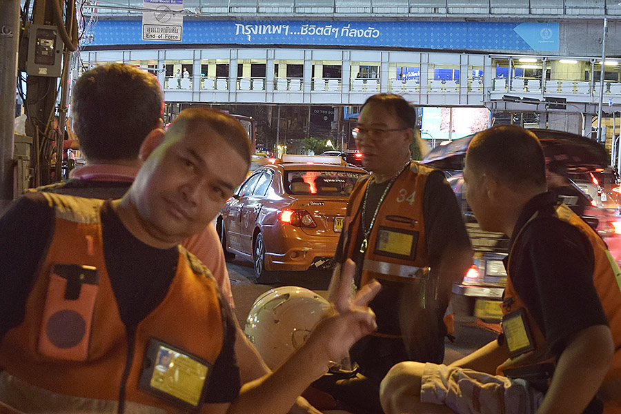
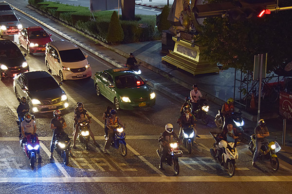
That photo at the top of this blog?  Every Friday night the police held a formation in the central square (Marisol Foch) and I would chat with the moto cops.  It was fun.

Once settled in Quito, a wave of relief fell over me knowing that I could relax and focus fully on work for the next month.  That was important as there had just been a reorganization and I had a new manager.  Three months into traveling through Central and now South America and still no one knew I was anywhere but Boston, nor did they ask.  I was fine with that and made it a point to keep it quiet, but not because I wasn’t performing. I was performing and at an elevated level, but I thought someone might be upset it they knew I was doing this and would put the kybosh on it.  I wasn’t about to let that happen, so I took steps (to include disabling my social media accounts to ensure my secret wouldn’t get out).  I had a peer who was trustworthy so I let him know just in case there was a volcanic eruption or political uprising so they could let my manager know that “Mike may not make it to work today.”  Of course, the chances of that were slim so it was time to settle into a productive routine.  I knew Ecuador might be my new home for longer than I had planned, and I had no problem with that at all.


Help us keep the content coming:  Please click on the popup ads!


Never miss an ExNotes blog:

Life as a Digital Nomad: Part 4 (Panama)

By Mike Huber

Having just left my new home in Nicaragua and boarding a local bus on a 26-hour ride to Panama had me almost second guessing my decision.  The bus was full, and the bathroom already looked like a scene out of Poltergeist.  Now, all this I was able to tolerate, but what really got my goat was that they had TVs every few rows.  You’d think “OK, we’ll watch a few movies to pass the time.”  Not on this bus.  They had a Kirk Cameron movie (Fireproof) on repeat AND in Spanish.  I had never seen this movie and by the 2nd time it rolled on I was ready to just set up camp inside the destroyed bathroom just to get a reprieve from it.

I eventually fell asleep with the help of some Flor de Caña that I smuggled onto the bus. After what felt like forever the bus came to a stop, and I noticed everyone was getting off.  I was still half asleep when I was ushered off the bus.  Still bleary eyed I looked at my watch.  It was 4:00 a.m. We were at the border of Nicaragua and Costa Rica and the border crossing didn’t open until 7:00 a.m.  I was beginning to understand why the bus ride would take 26 hours.  After sitting on the concrete for 3 hours the border finally opened, and we were welcomed into Costa Rica.

Once back on the bus my anxiety increased as we all wondered what type of obstacles we’d have to overcome to enter Panama. Entering through the Panama border was less time consuming but again the bus emptied and everyone was guided into a small room with their luggage, where we all had to open each item as dogs systematically sniffed through all the luggage, piece by piece.  Then, once back on the bus, we continued the journey to Panama City.  Fireproof was probably on its 8th showing.

The further south we traveled the landscape continued to change, as did the neighborhoods.  In Nicaragua the houses were in mostly poor condition but by the time we were in Panama they were more like those you’d find in the United States, modern and well maintained.  This was due to the Panama Canal which draws in an unreal amount of revenue for the country.

As we pulled into the terminal, I was exhausted and ready to exit the bus. Fireproof was still playing on the TVs overhead and I couldn’t leave fast enough.  It was a short taxi ride to the hotel I had picked in downtown Panama City. I quickly learned that in 2012, almost anywhere outside Panama City was difficult to find an affordable place to stay with solid wi-fi to perform my work duties.  This was frustrating as I hit wall after wall, all the while residing in a Marriott, which was not what I envisioned life in Panama would be.

After 3 days of continued failed attempts at finding a suitable home, it was time to decide to move on or return to Nicaragua.  I honestly think the thought of another 26-hour bus ride back to Nicaragua with Fireproof playing nonstop was the key factor in deciding to move onward.  But to where was the question. I was at the end of Central America so this meant I would have to fly to my next destination.  Looking at a map the logical choices were Columbia or Ecuador. I left it up to a coin toss to determine which it would be. The coin landed on heads, so Ecuador it was.  That day I booked a flight to leave in 3 days.

This decision left me with limited time to tour Panama City.  I am not huge on tourist spots but the one place I wanted to see was the Panama Canal.  It didn’t feel right to be there without seeing this engineering marvel, and I am glad I did.  The canal was extremely impressive, and they had grandstands you could sit in to watch the massive ships pass through the initial two steps of the Miraflores Locks.  These two locks manage to raise ships 54 feet higher as they let the water rush in.  The ships traveling through the locks must surrender their boats to a Panamanian captain (to include raising Panamanian Flag on their masts). Many boats were extremely large and had very little leeway on either side as they steered through the canal, so the captain piloting the boats must be certified and skilled in navigating the tight canal locks.

The remainder of the days spent in Panama consisted of getting in some short runs along the waterfront and starting the preparation for the next stop in Quito, Ecuador.  Research showed that the wi-fi in Quito was fast and reliable.  This put me at ease since the pace I was going for was a minimum of one month per country.  This pace would allow me enough time to settle and fully absorb the culture instead of just being in a vacation mode.  I wanted to be immersed in the culture and was determined to stay in Quito for that minimum length of time.  Upon landing in Quito, I instantly knew that a month there wouldn’t be enough and would require me to adjust my schedule yet again.


You know what to do:  Please click on the popup ads!