Córdoba, Spain

By Joe Berk

Until this summer, if anyone had mentioned Cordoba to me my first thoughts would have been of Fernando Llamas and fine Corinthian leather.  Men and women of a certain age will remember the Chrysler commercials of the ’70s and ’80s:

But I digress.  This blog is about the real Córdoba.  The one in Spain.  I haven’t finished telling the story about our visit to Spain (I still have three or four blogs to go).  This  blog continues the journey, and our enfoque del día (focus of the day) is Córdoba.  We traveled to Córdoba after our visit to Portugal.

Córdoba lies along the Guadalquivir, Spain’s second longest river. The Guadalquivir used to be navigable along most of its length; that is no longer the case.

Córdoba is in southern Spain (in the Andalucia Province) along the Guadalquivir River.  The photo at the top of this blog is where we walked across the Guadalquivir River into the center of the old city.  The bridge across the Guadalquivir was built by the Romans and for 2000 years it was the only bridge into the city.  As we walked across the bridge and entered Córdoba, I noticed a couple posing for wedding photos in the now dry moat.

Ah, the wonders of a decent camera (my Nikon D3300), an inexpensive lens (the Nikon 18-55 that came with the camera), and PhotoShop. I cropped this photo and adjusted its curves and levels to get the image below.
Ah, that’s better.

Córdoba is a World Heritage site with an impressive history and stunning architecture.  The city was part of the Roman Empire, then it was conquered by the Visigoths, then the Muslims (when it became part of the Caliphate of Córdoba), and finally, the Christians when they conquered it in 1236.  When the Muslims were the landlords, Córdoba became one of the world’s centers of knowledge and education.

One of Córdoba’s principal attractions is the Mezquita-Catedral.  It began life as a mosque in 784 – 786 AD when Abd al-Rahman I built it.   I took the following photos using the fisheye 8mm Rokinon lens I’ve written about before.   Using that lens requires doing everything manually (focus, shutter speed, ISO, and f/stop).  I’ll usually have to take a few shots to get the camera dialed in using the onboard histogram.   I set the ISO high (12,800) to get the speed (i.e., the camera’s light sensitivity) high enough for the dimly-lit mosque interior.   That induces a lot of noise into the photo, but the noise mostly disappears when the photos are resized from their native 6000 x 4000 pixel size (at 300 dots per inch, or dpi) down to a 600 x 400 pixel, 72 dpi size for the blog.

Inside the mosque interior with the 8mm Rokinon lens.  These interior photos were shot at a very high ISO, which adds a lot of noise to the photos that is not too visible in these reduced size images.
A cropped portion of the original photo above. The high ISO noise mentioned above is quite visible in this “actual pixels” viewing size.

Another option for these kinds of shots would be to shoot at a much lower ISO speed (say, 200 or 400 ISO) with the camera on a stable tripod.  That would get rid of the noise, but exposure times would have gone up dramatically.  I didn’t want to carry a tripod for a lot of reasons, so that approach was out.  You might be wondering about using flash, but that’s a nonstarter, too.  Most of these places don’t allow flash photography, and even if they did, the flash is only good for a few feet.  Available light, no tripod, and high ISO is the way to go here.

This area goes back about 1200 years. The Muslims built it when ruled Cordoba.
Our local tour guide explaining more about the mosque.
Another indoor photo where the lighting was a bit better.
Islamic art and architecture inside the mosque.

When the Christians conquered Córdoba in 1236 the mosque became a church.  There are a lot of churches in Spain that started life as mosques.  Sometimes several such switches in ownership and religious affiliations occurred in other parts of Europe that had been ruled by the Moors.  We’ve been in one that started as a mosque, became a church, and then reverted to a mosque as different factions occupied conquered lands (the one I’m thinking of is San Sofia in Istanbul, which I may get around to writing about one of these days).

So the mosque became a church as the Christians “converted” or executed all who were not Christians.   While the artwork and architecture are beautiful, the history is not.   During the Spanish Inquisition, the Jews of Córdoba had a choice:  Convert to Christianity or die (with death preceded by horrific torture).   The church is now referred to as the Mezquita-Catedral, the Great Mosque of Córdoba.  The photos below show more of the Mezquita-Catedral.

The f bell tower dominates Córdoba. It was built over the mosque’s dome.
An interior photo of the Mezquita-Catedral.
A photograph of the church ceiling.
A sculpture inside the Mezquita-Catedral.

Ferdinand and Isabella lived in Córdoba for a while when they used it as a base of operations to drive the Moors from Spain.  It’s also where the Spanish Inquisition took root.  Prior to The Inquisition, Cordoba had three synagogues and a sizable Jewish population.  Today, only one synagogue remains and it is essentially a tourist attraction.  My research indicates no Jews live in Córdoba today.

A doorway to the Mezquita-Catedral, as seen by the 8mm Rokinon lens.

What used to be the Jewish quarter retains the streets of medieval Córdoba outside the Mezquita-Catedral, and today the area is largely a tourist center.  Although the streets are not laid out in a grid pattern, the Mezquita-Catedral tower dominates the town and is visible from all directions.  It would be difficult to get lost in Córdoba.

The Mezquita-Catedral bell tower dominates the tourist area.
A door handle in Córdoba’s tourist area.
A knocker. If you look through our other posts from Spain and Portugal (I’ll provide a set of links below) you’ll see quite a few similar photos.

There are many restaurants in Córdoba, and we enjoyed lunch at one.   Most of the restaurants have tables in front on the narrow cobblestone streets, and virtually all meals are preceded by complimentary tapas.  After having lunch, we wandered around a bit more.   There are about a dozen churches in Córdoba, and most go back to medieval times.  I watched a family entering one for a wedding.

This woman was outside a church prior to a wedding. I’m guessing she’s either the bride or groom’s mother. I caught a pretty dour expression when I snapped this photo, but immediately after she broke into a huge smile. I don’t know why I didn’t hit the shutter again.

After Córdoba, it was on to Madrid.  We traveled on Spain’s high-speed rail, running at speeds of around 220 mph.  That was really cool.

A high-speed Spanish train. Their rail network is impressive.

So there you have it:  Córdoba.  I didn’t see Fernando Llamas nor did I encounter any fine Corinthian leather.  But it was still fun, the city’s dark and inhumane history notwithstanding.


Our other Spain and Portugal posts are here:

Spain and Portugal
A Portuguese Norton
Lisbon
Coimbra, Portugal
Granada and the Alhambra
A Spanish Olive Oil Plantation
The Sportster of Seville
Évora


Are you enjoying our stories?  Please help support ExhaustNotes to keep the stories coming.


Rev’d Up Coffee in Claremont, California

By Joe Berk

Wow, did I get lucky with this…a coffee and motorcycle spot just a few miles from home.  It used to be that I had to ride all the way up Angeles Crest Highway to Newcomb’s so I could hang out at a motorcycle destination where like-minded people stopped for something to eat and to admire other motorcycles.  Then Newcomb’s closed, a victim of the down economy and the pandemic.  There was another cool spot Gresh and I spent an evening at in Chongqing, but the chances of me riding the Enfield across the Pacific to get there are slim.  And then, I noticed Rev’d Up Coffee and Classics in Claremont.   Claremont is the next town over from where I live.  I’d seen Rev’d Up before, but I figured it was just another Gen X or Millennial (or whatever they’re calling themselves these day) Starbucks refugee trying to cash in on the coffee craze with a little moto mystique thrown in as sort of an artificial sweetener.  Boy, was I ever wrong; there’s nothing artificial about Rev’d Up or its owner.

Steve Solis, motorcyclist and Rev’d Up proprietor, taking a break from Bike Night cooking duties.

Steve Solis is the guy who owns and runs Rev’d Up.  He’s a good guy, a lifelong area resident, and a rider.  Steve’s personal ride, a Sportster, is usually parked inside the restaurant seating area during normal business hours, but he brings it outside during bike night.

Steve’s personal ride – a Harley Sportster with an extended front end and apehangers.

The theme of Rev’d Up is bikes, classic cars, and hot rods.  Steve has a couple of vintage bikes on display in the restaurant windows, and there are cool moto things throughout the dining and coffee sipping area.

A Honda Dream on display in one of the Rev’d Up windows.
Another vintage Honda on display at Rev’d Up.
Older motorcycle helmets. I wore one of the Peter Fonda Captain America helmets in the ’70s.

In keeping with the Rev’d Up theme, the menus are displayed on car hoods suspended from the ceiling.  One is from a Camaro, the other is from a Datsun.

The breakfast and lunch menu. On Bike Nights, Steve is out front making Philadelphia cheesesteak sandwiches. They sure smelled good.
The coffee and other specialty drink menu. I have to try the Easy Rider.

I asked Steve what the best kept secret was.  His answer?  The Easy Rider espresso.  He said it was his favorite drink.  Next time I’ll try it.

The best part of any of these gatherings is always wandering around in the parking lot, taking in the bikes, and talking to the riders.  There’s no set theme regarding the bikes.  Harleys, choppers, Ducatis, KTMs, BMWs, Triumphs, and more.  They were all there.

Check out the SU carb and the velocity stack on this Shovelhead chopper. Where does the rider’s leg go?
The Harley Panhead engine, one of the two best-looking Harley engines ever made. The other one is the EVO motor. Those Panhead valve covers are impressive.
A full view of the Panhead chopper.
Bike night is not all about choppers. The colors on this helmet and motorcycle stood out.
Another classic and beautiful motorcycle. The 748 was a later version of Ducati’s 916. They look good.
There are no better colors for a classic BMW boxer twin than gloss black with white pinstripes.
As we were leaving, this Triumph pulled into the parking lot. All marques are welcome at Rev’d Up. It’s a cool place.

Rev’d Up Coffee and Classics is located at 212 West Foothill Boulevard (that’s Route 66) in Claremont, California.  It’s definitely worth a stop, and I’d say it’s a worthwhile place to take a ride.  Maybe I’ll see you there.  Look for the orange Enfield in the parking lot; if it’s there, I will be, too.


My Solo Motorcycle Journey from Sedona to Canada: Part II

By Bobbie Surber

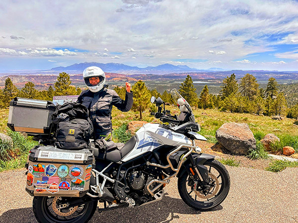
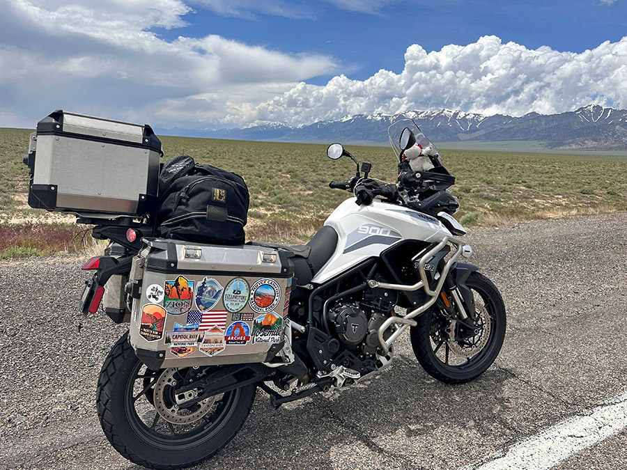
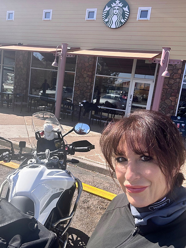
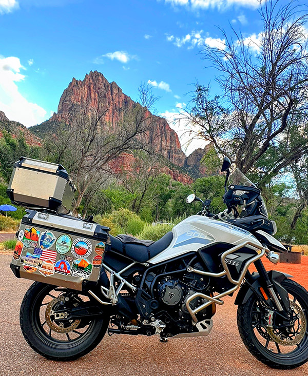
Welcome back to the next chapter of my solo motorcycle journey from my hometown of Sedona, Arizona, to the captivating landscapes of Canada. In Part One, I shared the exhilarating start of my adventure, from Sedona to the awe-inspiring beauty of the Grand Canyon and the mesmerizing Zion National Park. Now, as I continue northward on my trusty Triumph Tiger 900 GT Pro, lovingly named Tippi, join me in experiencing the next leg of this epic ride.

As I left the captivating beauty of Zion National Park behind, I couldn’t help but marvel at the magic of solo travel. The open road stretched out before me, promising new adventures and the opportunity to connect with the world in ways that only solo exploration allows. My heart swelled with anticipation as I headed north into Utah, a state known for its stunning natural landscapes.

A Return to Bryce Canyon

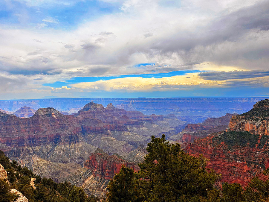
My next destination was my beloved Bryce Canyon National Park. The ride to Bryce Canyon was a scenic marvel in itself. Utah’s highway 89 to Route 12 made its way through crimson canyons, past towering rock formations, and into high-altitude forests. Every twist and turn of the road revealed a new panorama of breathtaking beauty.

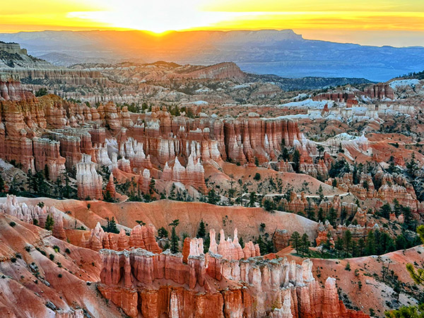
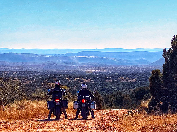
Arriving at Bryce Canyon, I was greeted by a surreal landscape of hoodoos—towering, otherworldly rock spires that seemed to defy gravity. I hiked once again the trails that wound through the park, taking in the views from vantage points like Sunrise Point and Inspiration Point. Wall Street trail was closed for repairs, but trusty old favorites satisfied my need for a day of hiking. My camp spot at Sunset Campground gave me the chance at an early morning sunrise the next morning. A predawn wakeup found me walking to the rims edge to watch the sun slowly rise below the horizon, the hoodoos took on a fiery glow, casting long, dramatic shadows that danced across the amphitheater-like terrain. Bryce Canyon’s mystical allure left an indelible mark on my soul, reminding me why I embarked on this journey in the first place. After a second night at Bryce, I was ready to tackle another epic day of riding Route 12 through Escalante to the sweetest underrated Capital Reef National Park.

Exploring Route 12 and Capitol Reef

Continuing my adventure, the following morning, I eagerly resumed my route on Highway 12, heading towards my favorite section of the road, high above the captivating Grand Staircase-Escalante National Monument. This expansive and remote region boasts rugged canyons, vibrant cliffs, and extraordinary geological formations. The landscape, with its impossible rock formations, treated me to endless twisties, creating a sense of otherworldliness. My Tiger 900 was as happy as I was as I relaxed into the ride and allowed her to remind me again what her three cylinders can do. Both of us were in sync as we leaned into curve after curve as we blasted down to the bottom of the canyon.

As I reluctantly approached the tiny town of Boulder, Utah, I realized I had made short order through the endless twisties of this section of Route 12. However, I was unexpectedly greeted by an old-school cattle round-up, complete with cowgirls and boys herding a large herd down Highway 12! After a brief turnaround, I found solace in my favorite restaurant, the Burr Trail Grill. Their farm-fresh ingredients delighted my taste buds, whether it was their fresh arugula salad topped with local goat cheese or their beastly-sized burgers that proved a challenge to conquer.

Resuming my journey on Highway 12, I found myself in an unexpected predicament. The cattle herd’s progress was slow, and I crawled along, clutching endlessly as I felt my left hand about to begin a serious complaint! Amidst the frustration, two memorable moments emerged. Firstly, a passerby exclaimed, “Dude, you have the sweetest bike and setup!” We shared a laugh as he realized I was indeed “dudeless.” Secondly, after navigating my way to the front of the line, I convinced the lead cowboy to move the herd slightly to the right, allowing me to pass. Maneuvering my bike through the cows became a comical adventure, with prayers that the sound of my motor wouldn’t startle them. Experiencing this traditional cattle drive in 2023 felt like a slice of Americana and added yet another reason to love Utah.

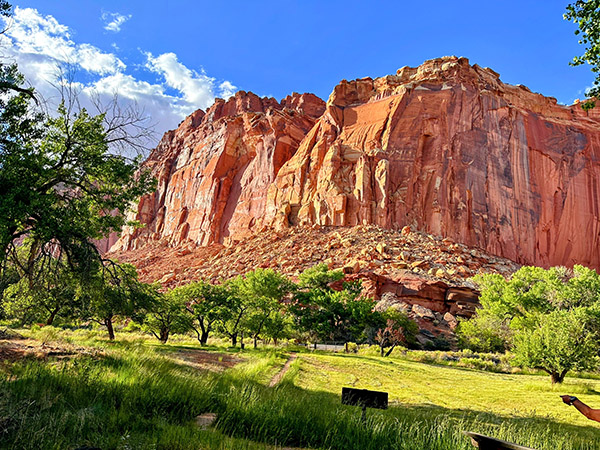
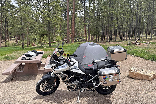
Leaving the cattle behind, I ascended Boulder Mountain, where endless views revealed the backside of Capitol Reef on the right and scenic meadows with clusters of aspen, fir, and spruce trees on the left. Surprisingly, the mountain still boasted more snow than expected for June. Camping, fishing, and wildlife viewing opportunities abound in this mountainous region, with numerous campgrounds and dispersed campsites available. I’ve personally spent nights here, savoring the breathtaking vista overlooking Capitol Reef and the sprawling valley floor. Soon enough I was descending Boulder Mountain and into the small town of Torrey, UT, and just a short few miles away from Capitol Reef National Park for two more nights of camping. A quick setup of my camp, and I was off to town for a much-needed shower and a cold beer! Later that day, a lovely couple I met in Zion joined me at my campsite and I was treated to a homecooked Korean chicken dinner, which was a far cry from the instant ramen I was planning for dinner. A lovely couple who reminded me that the gift of travel is the unexpected friends we make along the way.

The next morning found me out on the trail a hump up to the top of the mesa for a panoramic view of the park. The air was crisp with hints of the heat to follow. The trail descends into a slot canyon then an arroyo wash to the other side of the park and beyond. Reluctantly heading back, I got on Tippi and explored the nearby petroglyphs. All in all, my short stay was a rewarding two nights and now headed to the not-so-famous outside of crazy riders who seek out remote roads Highway 50, billed as the loneliest highway in America!

Highway 50: The Loneliest Highway with a Detour to Great Basin National Park

I made a short order of breaking camp, and in no time Tippi and I were on highway 24 with the goal of making it to my 5th National Park, Great Basin. Following Route 24 goes through a rural farming section of the state with many small Mormon communities and opportunity for a breaks, food, and gas. I was eager to blow through this well-familiar route to get to Highway 50 and cut my teeth on a section of road I had been warned NOT to ride.

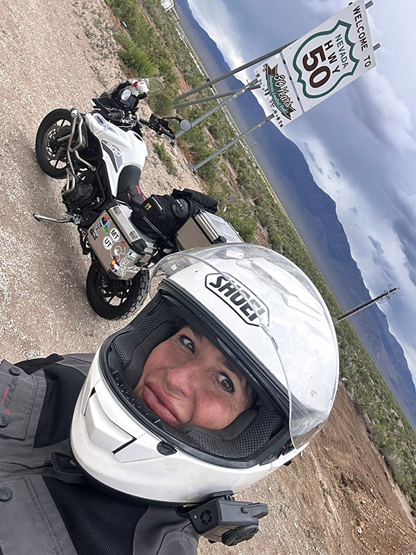
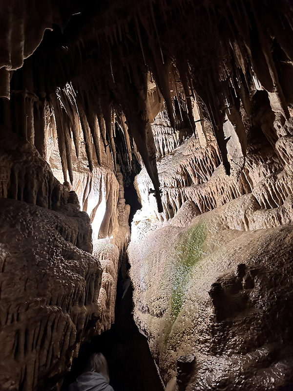
As I picked up Highway 50 off Interstate 15, I soon hit the famous first road sign and stopped to document my ride on her with a pic. With once again threatening storms, I glanced at the mountain ahead and thought how bad could it be? It was bad, I was wrong once again guessing the threat of a storm. A short very wet ride later, I left behind Highway 50 for a few days to visit the park. As a first timer to Great Basin NP, I was truly blown away! You enter the tiny town of Baker on the desert floor then 20 minutes later you are in the mountains with thick forest and views overlooking the high desert plains that seem to go on forever. Not to be missed is a guided tour of Lehman Caves. Truly the highlight of my stay. I selected one of the higher small campgrounds and was rewarded with a huge site surrounded by trees and brush with the river roaring behind me.

Reluctantly bidding farewell to Baker, I rejoined Highway 50, heading towards my next destination, South Lake Tahoe. Contrary to the dire warnings of scarce gas stations, I discovered that this notion was unfounded. Approximately 70 miles down the road, I arrived at Ely, another small mining town with plenty of services. After a quick refuel, I resumed my journey, realizing that the otherwise flat stretches of road were intermittently punctuated by mountain passes exceeding 7000 feet in elevation. These segments offered breathtaking vistas and enough twists and turns to satisfy both Tippi and me.

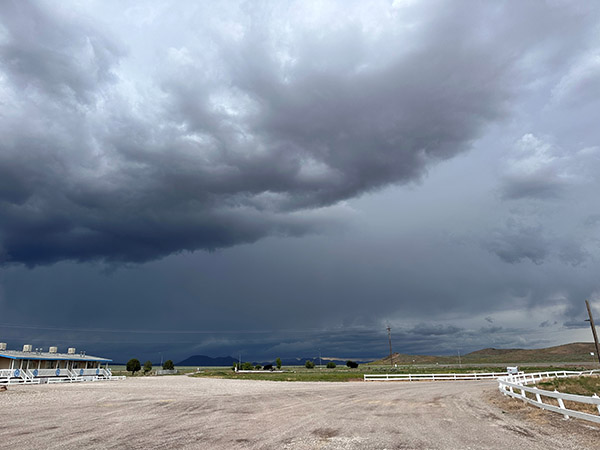
My first mountain pass, before descending into Ely, Nevada, presented an exhilarating ordeal with rain, lightning, and a brief ten-minute ride through hail. Eighty miles further, I found myself in the town of Eureka, where the threatening skies curtailed my exploration time. Nevertheless, I managed to visit a few must-see attractions, including the Opera House, built in 1879, the still-functional Courthouse of the same vintage, and a brief excursion to the town’s cemetery, where a variety of burial sites represented different social organizations, religious groups, and ethnicities. This walk-through history provided a fascinating glimpse into the town’s past.

Continuing on Highway 50, with the ominous skies in my rearview mirrors, I was reminded of the urgency to press on towards my next stop—Austin, Nevada. This old mining camp retains its rustic charm and has evolved into a haven for camping, hiking, and mountain biking, thanks to its proximity to the towering Toiyabe Mountains. During a pit stop, I encountered a large group of riders following the Pony Express Trail, who praised my adventure, while I vowed to return in the near future to explore that historic route.

Reluctantly bidding farewell to this enchanting mountain town, I embarked on another 112-mile stretch to Fallon, Nevada. This promised a well-deserved lunch break and refueling opportunity before the final leg of my journey to Lake Tahoe. As hunger pangs intensified, I hurriedly pulled into the first gas station I encountered. Curiously, the ground appeared slanted, making it impossible to safely park my bike with its kickstand without an extreme lean. Oddly, as my kickstand tends to be a bit high, I often worry about Tippi toppling over. Trying another station, I realized that my kickstand was not misaligned but broken—a sudden and unfortunate realization. With every ounce of strength, I fought to prevent Tippi’s full weight from pinning me between the gas pump curb and the engine crash bar. As I cried out for help, a kind soul named Caleb rushed to my aid, assisting me in righting Tippi. Examining the kickstand, I conceded that my lunch break was a lost cause. I refueled while seated on my bike and came to terms with the fact that I would have to ride the rest of the way without lunch and with a dangling kickstand, just inches off the ground.

Continuing Towards Lake Tahoe

Arriving in Lake Tahoe was like reaching an oasis after a day filled with challenges and stunning scenery. The sight of the crystal-clear waters surrounded by towering pine trees was simply breathtaking. I met up with Mike Huber, a fellow adventure rider, as we eagerly exchanged stories of our respective journeys over drinks and pizza. Mike is a seasoned rider with an incredible collection of travel stories and insights, and this blog, which is a treasure trove of motorcycle adventures.

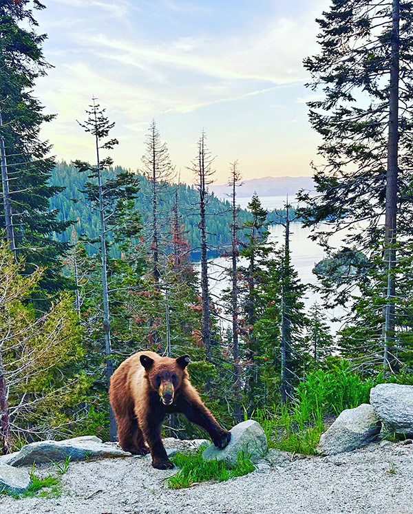
We decided to make the most of our time in Lake Tahoe by exploring the area together and spending time with our dear friend Yvette who had left Sedona for the mountains and lakes surrounding Tahoe. Two up on Tippi, our first stop was a visit to Emerald Bay State Park, a gem nestled on the lake’s southwest shore. A short hike up a roadside trail took us to a stunning vista overlooking Emerald Bay below. The clear blue waters and Fannette Island in the middle of the bay made for a postcard-perfect scene. At sunset we were even rewarded with a surprise pop up of a brown bear who a few feet away provided us with a pose straight up worthy of National Geographic!

Lake Tahoe, with its stunning shoreline, pristine waters, and surrounding mountains, offers many outdoor activities. We decided to spend the next afternoon cruising around the lake, taking in the panoramic views and stopping at scenic overlooks. Riding around Lake Tahoe was a highlight of my journey, and I couldn’t have asked for better company.

Conclusions

As I reflect on the second part of my solo motorcycle journey from Sedona to Canada, I’m filled with deep gratitude for the experiences and sights that have unfolded before me. From the awe-inspiring beauty of Bryce Canyon to the challenging twisties of Route 12, from the serene landscapes of Great Basin, this adventure has been a testament to the power of the open road and the indomitable spirit of solo travel.

Every mile has been a lesson in self-discovery, a reminder of the world’s beauty, and a celebration of the freedom that comes with embracing the unknown. The road has been my companion, and the landscapes have been my muse. And as I continue to ride north into Canada, I know the journey is far from over. There are more roads to explore, adventures to embrace, and stories to tell.

Stay tuned for the next chapter of this solo ride from Sedona to Canada. The open road beckons, and I’m eager to see where it will lead me on this journey of a lifetime.


Never miss an ExNotes blog:


Life as a Digital Nomad: Peru Part 4 (It’s Probably Time to Head Back)

By Mike Huber

Balancing life is rarely easy.  It seems there is something almost always out of sync, be it work, health, or a loved one in need of help.  Peru is one of those rare times in my life where I and everything surrounding me seemed to be in perfect harmony. I was coming up on six weeks living in Cusco and the adventures seemed endless from my home base there.  I was making a ton of new friends, but with Cusco being so much more of a tourist town these new connections were always short lived.  Surely now it’s different with so many Westerners living abroad and working remotely, but being a pioneer of this lifestyle in 2012, missing a community began to set in.  Not so much on the weekends as I was too busy, but during the weekdays a void began to drain me.

The decision to make the long journey back to the United States was not an easy one.  It took so long to get to where I was and had built connections for my next planned move to La Paz, Bolivia. I was running very low on vacation time and everything I wanted to see in Bolivia was a multiple day bus ride.  Buffering in unknowns (such as a bus breaking down in the middle of nowhere) was necessary.  I would be city bound in La Paz, and I don’t think they had as many baby llamas to pet, so Bolivia just didn’t feel right on any level.

The last week in Peru was a much deeper experience (I didn’t even know it could get deeper than where I had been).  Every moment I was out felt much more special knowing that time was short in this magical place.  There was a lot to do in my Cusco backyard that hadn’t been explored.   My focus had been on visiting remote areas such as Lake Titicaca (I had to say it again), rather than exploring the wonders closer to my home.

My final week in Peru was filled with exploring local points of interest such as the San Pedro market where there were all kinds of foods, drinks, and potions that most Westerners will never see or smell (be thankful you are missing the smell part).   The market consisted of endless types of foods.  Many of these foods seemed to be pulled straight out of an Indiana Jones movie.  It wasn’t strange to see Guinea pig’s necks being snapped, and then the animal being tossed into a boiling pot, gutted, and grilled.  Other items included horse heads, pig heads, and snakes in water jars.  This market was a plethora of sensory overload.  Normally I would just visit it to pick up a bag of coca leaves for about 30 cents and some of my “special” tea mix.

Somehow, I still managed to find time to do silly things with downtime during the weekdays. The last Sunday I was there it poured, and being bored, I was searching the apartment for something to eat while watching TV.  I found in the back of the refrigerator a beer pitcher that I had filled with coca leaves a week or so prior and added a bottle of white wine.  Well, it seems the wine had absorbed the coca leaves and turned the wine into a dark yellow.  Being that this chapter was coming to an end I thought it would be the perfect day to partake in this concoction.  Who knows, maybe it would have similar effects to the coca beer.  I drank the entire pitcher. The coca-infused wine just had this bitter earthy taste that I really enjoyed.  Like the coca beer it provided a jolt of energy with a nice light buzz that assisted me in packing and wrapping up my life in the Andean city of Cusco.

With the coca wine buzzing inside my head, a bigger question emerged: Where was I to live upon returning to the United States?  My Boston condo was rented for another five months, so that option was out.  I was not sure if it was the wine or the fact that this change may not be as simple as I had anticipated.  Throughout my travels around Central and South America, it always seemed that if things went south, I could just return to the United States. Being so preoccupied in the moment during my travels, however, I never designed a fallback plan aside from boarding a return flight.


As the week came to an end, I was now boarding that flight.  I was not, however, in too big a rush.  It felt right to instead return to Nicaragua for a couple weeks and ease my way north and see my dogs.  While I was there, Hurricane Sandy hit and knocked out power throughout the Northeast.  That morning as I watched the news, I had a decision to make:  Do I power up the laptop and be the only person in the Northeast who showed up for work, or do I continue with the “I am in Boston” charade?

I chose Option A, deciding that I was on my way back and had been outperforming most my peers for six months in five countries.  Owning my choices and riding it in felt like the correct decision.  My coworkers immediately questioned how I had internet, and my answer was simply “I saw there was a hurricane, so being remote I chose to go south to avoid it.”  Not a lie, but not totally forthcoming.  If I had replied with “I am working in the jungles of Nicaragua” no one would have believed me (this came up months later and no one did).

After the two weeks it was time to fully return to Boston to regroup.  It was a rainy November day when I touched down at Logan.  I weighed 30 pounds less and mentally I was even lighter.  I still had no plan regarding what to do once I left the aircraft in Logan.  My car was at a friend’s house.  My Ducati was at my parent’s home in Maine.  Before I had even cleared through Customs and Immigration, though, I knew this was no longer the place that called to me.  The reentry shock into the United States was too much.  I was swelling up with tears knowing It was now time to make the hard decision to leave New England, but where would I go as winter was just beginning?


Never miss an ExNotes blog:


ExNotes Book Review: Mi Papi Tiene Una Moto

By Joe Gresh

If you’re looking for the rare children’s book that features a motorcycle as the prime mover, Mi Papi Tiene Una Moto is the book for you. Mi Papi Tiene Una Moto is made of sturdy paper and the covers are thick cardboard so the thing should hold up well to repeated reading by destructive little hands.

Warning:  Spoilers ahead!

Mi Papi Tiene Una Moto is written by Isabel Quintero in Spanish so your target child will learn a few Spanish words along the way, unless they already speak Spanish. Who knows, maybe reading Mi Papi will generate a life-long interest of languages in your spawn. With my very basic Spanish skills I was able to figure out most of the text and any words I didn’t know I looked up on the Internet. Even if you don’t understand a single syllable of Spanish the beautiful illustrations by Zeke Pena tell the story in an exciting and colorful way.

The book begins with a young girl’s father coming home from his job as a carpenter and the two go for an afternoon motorcycle ride. During the ride the have various little adventures. They visit folks picking lemons; they are chased by dogs; Papi stops and chats with some fellow workers.  There’s even a fantasy sequence involving old style racecars on a circuit through town (maybe it wasn’t fantasy, my Spanish comprehension is not so good).

These micro adventures really remind me of why I like to ride a motorcycle. Simple acts seem more vital: making a turn, waving to a bored kid staring out a car window or just feeling the breeze. Mi Papi Tiene Una Moto’s motorcycle trip ends like all of them should: at the snow cone vendor for a sweet treat.

If you’re an ATGATT Nazi you probably shouldn’t get Mi Papi Tiene Una Moto.  They wear helmets but the hot weather finds them in shorts and light clothing. Spare me the clichés: “Dress for the slide not the ride.” “Gear is cheaper than skin grafts.” You make your choices and the riders in Mi Papi Tiene Una Moto made theirs.

I’ve only shown a few of Zeke Pena’s fabulous artworks in the book and just looking at the stuff made me want to go for a ride. It’s that exciting. Amazon has the book in hard cover for $17 and that’s the only way you should buy the thing. You need to feel the solid way the cover opens and the smooth, cool pages. Kids get enough content with their phones, give them a real world, tactile experience that will create a lifetime memory. I think there is an English version but reading Mi Papi Tiene Una Moto in the original Spanish makes it seem more like a secret world that only your kid can access. At least I felt special decoding the thing page by page.

Mi Papi Tiene Una Moto reminds us that we don’t need to do heroic, epic rides every time we swing a leg over our motorcycles. We don’t need the latest electronic buffoonery to enjoy the simple act of riding and interacting with our environs. I highly recommend Mi Papi Tiene Una Moto for both kids and adults who are not yet dead inside.


Never miss an ExNotes blog:

My Solo Motorcycle Journey from Sedona to Canada: Part I

By Bobbie Surber

As a passionate female solo rider, I often find myself facing a barrage of incredulous looks and questions from both strangers and friends. They ask the usual list of queries: “Is it safe?” “Where will you stay?” “What if your bike drops?” It’s become almost customary to respond by sharing my blog or articles that capture the essence of the joy I find in solo travel, whether by foot or by bike. This brings me to my latest and most epic solo adventure – a motorcycle journey from my home in the enchanting town of Sedona, Arizona, all the way up to the stunning landscapes of Canada. Covering over 6,700 miles of magical terrain, this journey was a test of my spirit and a celebration of my love for long distance motorcycle travel.

It all began last fall when the idea of a ride to Canada took hold of me. I knew that this was the journey I was meant to embark upon. I was determined to take my time, to savor the journey, and to visit as many National Parks as possible along the way. My plan was simple yet liberating: I would make up my route no more than a week in advance, pack light, and camp as much as possible off my trusty motorcycle, a three-cylinder Triumph Tiger 900 GT Pro, lovingly named Tippi.

On the crisp morning of June 2nd, with the sun just beginning to warm the high desert of Sedona, I geared up for my adventure little did I know then that I would be gone for 11 plus weeks. The air carried an unusual coolness, a welcome departure from the scorching desert temperatures. My first stop was an obligatory one – Flagstaff, Arizona, just a short 30-mile ride from Sedona. The journey up Oak Creek Canyon was a visual feast, with Red Rock views and sinuous twists and turns that are a motorcyclist’s dream. I found myself at a Starbucks in Flagstaff, sipping on a well-deserved Americano, wondering what the day had in store for me as I charted my course towards North Grand Canyon National Park.

Leaving the comfort of Flagstaff behind, I embarked on Highway 89-A, leaving the tall pines of the city in my rearview mirror. The road led me to Lees Ferry, a spot where I could steal a quick moment with the majestic Colorado River. Riding through this part of Arizona on 89A felt like transitioning to another world. The landscape shifted from rugged mountains to a breathtaking desert expanse. Sandy plains, cacti, and the awe-inspiring sight of the Colorado River slicing through towering cliffs and canyons greeted me. Every time I ride through this area, I feel like I’m letting go of the worries of the world and immersing myself in the raw beauty of nature.

Arriving at Lee’s Ferry, I gazed in wonder at the grandeur of the Colorado River. Red Rock bluffs reached skyward, casting their reflections onto the water’s surface. A few photos captured the essence of the moment, and then I was back on the road, with Tippi carrying me across the vastness of the desert landscape with mountains looming in the distance with turbulent looking skies, laden with the threat of rain seemingly daring me to press onward.

Press on I did, and by the time I arrived at Jacob Lake, I was soaked to the bone. The reward, though, was immediate and satisfying. The general store at Jacob Lake had the antidote to my damp spirits – a hot cup of coffee and the most heavenly homemade cookies I’ve ever tasted in Arizona. While I warmed up and indulged my taste buds, I chatted with fellow riders who regaled me with tales of epic early June snowstorms they’d encountered that day while riding back from the Grand Canyon. It’s moments like these, swapping stories with fellow riders, that make a solo journey so enriching.

A swift pit stop at Jacob Lake was followed by the task of setting up my tent, which proved to be a bit of a challenge in the rain. But that’s the essence of adventure riding, isn’t it? You adapt, you overcome, and you keep moving forward. With my campsite established, I wasted no time and headed to North Grand Canyon. Fortunately, I was spared the snow, but a wicked hailstorm tested my resolve as I carefully made my way further up the rim.

By the time I reached the park, the weather gods seemed to have taken pity on me. Dry weather prevailed, and I was treated to the most dramatic skies one could hope for when visiting the North Grand Canyon. As I stood there, gazing out into the vast expanse of this natural wonder, I couldn’t help but feel humbled by the forces of nature and the grandeur of the world we live in. It was a moment of pure serenity amidst the chaos of my journey.

The following morning, I bid farewell to North Grand Canyon, heading down into Kanab for a quick gas and coffee break before completing the remainder of my ride on Highway 89A, with Zion National Park as my next destination. With two days and one night to immerse myself in the beauty of Zion, I was eager to experience the park in all its glory.

Entering Zion National Park on a motorcycle is a unique adventure. The winding roads and the freedom to embrace the open road add an extra layer of exhilaration to the journey. Plus, if you time it right, like I did, arriving early can help you avoid the epic traffic jams that can plague this popular destination.

Setting up camp as quickly as possible, I wasted no time in hopping onto a shuttle ride to the park’s lodge. From there, I embarked on a day of hiking, exploring several of Zion’s shorter trails. I couldn’t resist attempting to secure a permit for Angel’s Landing, a trail known for its breathtaking, albeit nerve-wracking, vistas. Alas, the permit eluded me, but that didn’t dampen my spirits. Zion offered me an array of other trails and sights to explore, and I reveled in every step I took.

Zion’s rugged beauty is a testament to the power of nature’s sculpting hand. Towering sandstone cliffs, cascading waterfalls, and the vibrant colors of the Virgin River create a landscape that feels otherworldly. With my camera in hand, I captured every nuance of this remarkable place. Hiking a portion of the Narrows, with water rushing around me, was a highlight I’ll carry with me forever. Zion National Park, with its mesmerizing mix of desert and oasis, and once again confirming why I love this park so much.

As I lay in my tent that night, listening to the sounds of the wilderness around me, I couldn’t help but reflect on the incredible journey I’d embarked upon. From the stunning landscapes of my hometown of Sedona to the awe-inspiring grandeur of the Grand Canyon and the mesmerizing beauty of Zion, my solo motorcycle ride to Canada had already been a whirlwind of experiences. And this was just the beginning.

My journey would continue northward, taking me through more National Parks, enchanting towns, and breathtaking vistas, mountains, desolate beaches, and new friends I’d yet to meet. Each twist and turn of the road held the promise of new adventures and the opportunity to connect with the world in a way that only solo travel can offer. The open road called me, and I was more than ready to answer its invitation.


In the world of solo travel, there’s a unique freedom and self-discovery. It is a chance to test your limits, embrace the unknown, and find solace in the beauty of the world. My motorcycle journey from Sedona to Canada was not just a ride; it was a pilgrimage of the soul, an exploration of the heart, and a celebration of the indomitable spirit of the open road. As I drifted into sleep under the starry Utah sky, I couldn’t wait to see where the road would lead me next on this remarkable adventure.

My fellow adventurers, I invite you to stay tuned for the next captivating chapter of this solo ride from Sedona to Canada. The open road stretches before us, brimming with the promise of extraordinary experiences and inspiring tales yet to be written. With each twist of the throttle I embrace the unknown, and I can’t wait to share the unfolding journey of a lifetime with you.


Never miss an ExNotes blog:


Wayback Machine: British Motorcycle Gear Adventure Pants

By Joe Gresh

As any loyal reader of ExhaustNotes.us knows, I recently got all new riding gear from British Motorcycle Gear. In this blog we tackle BMG’s Adventure pants, a lighter weight alternative to BMG’s Pioneer pants. When I say lighter weight I don’t want to mislead you; the Adventure pants are still heavier than denim jeans.

The Adventures have two zippered vents on the front side that let in a lot of air when you stand up on the pegs like a real adventure rider is prone to doing whenever there is a camera around. Sitting down like a lazy chopper rider, the vent flow is less powerful but you can still feel it. There is a mesh liner that combined with the 500 denier shell gives a good compromise between protection and sweating.

One feature that stands out for me is the heat resistant, Nomex inner-calf panels. The high-mount, left-side Husqvarna exhaust system has burned a hole through several of my rain pants and street slacks. So far I haven’t been able to melt the Adventure pants.

Another feature I like on the Adventure pants are the three belt loops. I’d like to have a few more loops but three loops beat none because I wear a belt. You’d have to have a misshapen body like mine to appreciate the extra security a belt gives you in big-air situations. There’s nothing more embarrassing than getting pantsed by gravity.

On the sides of the Adventure pants are waist adjusters. These are handy for postprandial riding when your belly is bloated from too many carbohydrates. My odd combination of fat waist and short legs make finding motorcycle pants to fit a real challenge. I’ve been riding motorcycles for 50 years and the BMG Adventure pants come the closest to fitting in all those years. The 29-inch legs could be a 1/2 –inch shorter but as long as I have my belt it’s not a problem.

My Adventure pants came without armor, which is fine with me. I also have the much heavier-duty, armored BMG Pioneer pants to test but that will have to wait for cooler weather. The Adventures have long leg zippers but I didn’t need them to enter or egress the pant. If you are a weirdo who puts their boots on first, then your pants you will find the zippers handy. There is a short piece of zipper on the backside that can connect to BMG’s line of jackets. I never use those back zippers but I bet they stop drafts pretty well. The back zipper will also keep your jacket from riding up in a crash and possibly save a few square feet of road rash. Hmmm…maybe I should start using that zipper!

I’ve worn the Adventure pants down to 40 degrees with only a thin thermal underwear layer and was warm and comfortable. For my personal thermostat 40 to 80 degrees F was right in the Adventure pant wheelhouse. Above 90 and into the 100’s the Adventure pants are a bit too warm for my taste. Really, for motorcycle riding above 100 degrees shorts and flip-flops are the only way to go. Just kidding.

For New Mexico use the BMG Adventure pants are a great 3-season bit of riding kit. If you live where it rarely gets to 90 degrees or above then you can call them 4-season pants. I feel safer wearing them on a motorcycle than I do in plain old dungarees. The retail price is not out of this world when you consider the price of Levis jeans or cigarettes. Just punch in the code BMGJOES when checking out, and you’ll get an 11% discount on everything (except gear that’s already on sale, and Halcyon mirrors and goggles).  Check out the British Motorcycle Gear website; I know you’ll enjoy it.


Visit our Product Reviews page here!


Life as a Digital Nomad: Peru Part 3 (Lake Titicaca)

By Mike Huber

No trip to Peru can be complete without a journey to Lake Titicaca.  It is the largest alpine lake on the planet at an elevation of 12,500 feet, and the lifestyle of those who live on the lake is beyond fascinating.  This huge lake is nestled in a giant basin between two of the Andean mountain ranges and extends across the border to Bolivia.   And yes, it has a funny name. There was no way I was going to miss this place even though it was quite a distance from my home base in Cusco.

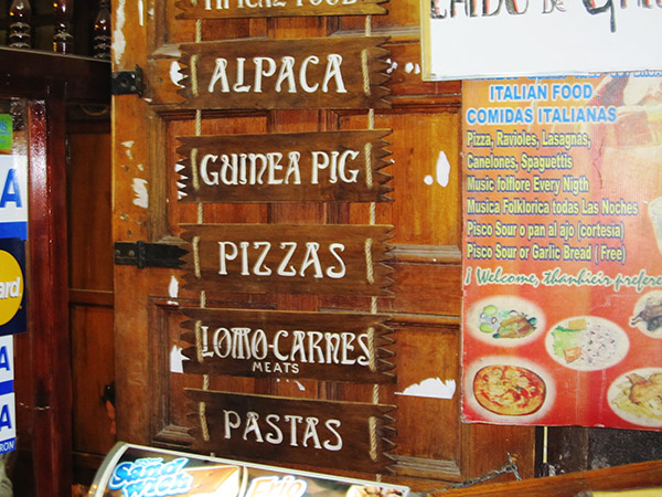
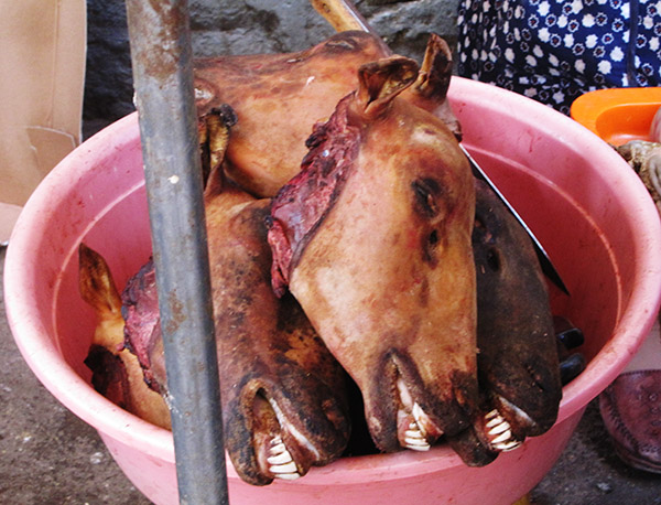
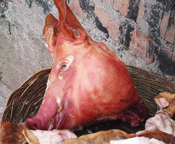
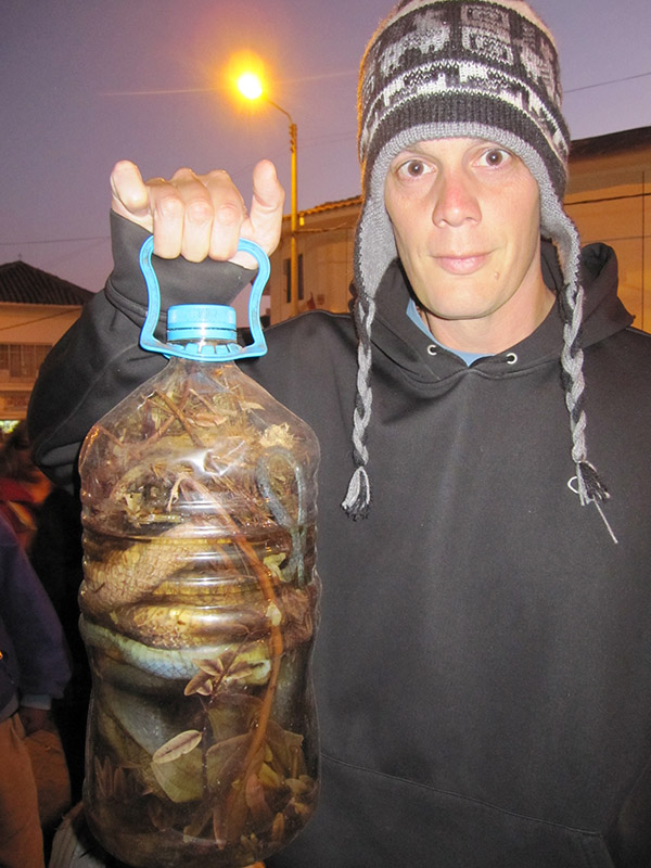
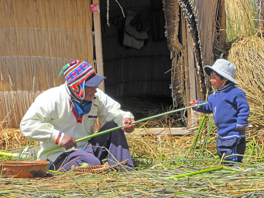
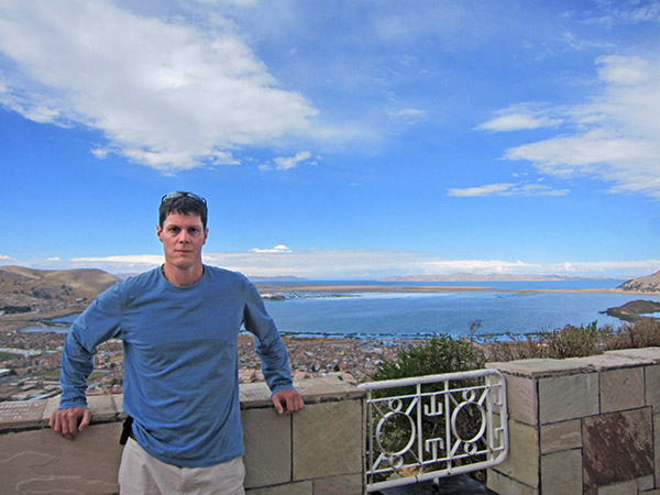
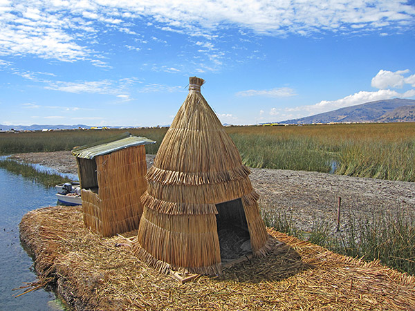
Having planned to use all my vacation time while in Peru, it wasn’t too difficult to load up on my work early in the week and take a four-day weekend to knock out Lake Titicaca (did I mention it has a funny name?).  Allowing four days would provide me with enough time to take a leisurely tour bus to this region of Peru, get some hikes and tourist attractions in along the way, and then return on an overnight bus on Sunday.  This would assure (hopefully) that I would make it to work on time Monday morning.  Instilling project management principles usually results in a successful outcome.  To me the planning of a project or a vacation followed the same rigid processes.  Of course, the vacation ones always had a few surprises along the way that I would have to adjust to, but that’s part of the fun.

The bus ride was filled with incredible beauty with stops at local markets and panoramic mountain views that had me saying to myself “wow, I am in the Andes!” over and over again.  Out of all the bus rides I’d been on, this was by far the most pleasant.  I was used to the altitude, there were no Kirk Cameron movies, and I had made a special tea to enhance the ride (PM me for details on that, but it will probably bleed into another article). The entire ride was an extremely joyful 8 hours where I had an opportunity to meet two wonderful girls from Japan (we are still friends to this day).

Feeling beyond happy but tired, we finally pulled into the lakeside city of Pulmo, Peru.  This first day here would be relaxing and adjusting to the world I had just entered.  There was a giant golden condor statue on a steep hill above the city, which provided a sense of calm. There was a large market that made for great people watching while having some coca tea and even a coca beer.  The beer was like a prehistoric provided a buzz and amp at the same time.  It almost reminded me of my Jager bomb days in Boston.  Thankfully for the people of Pulmo I didn’t take it that far.

The next day I joined a boat tour that took us to many of the man-made islands.  These islands were floating and made of dried totora, a type of papyrus the local population harvested from the lake marshes.  The people are known as the Ura.  The islands are fairly large, some of them over an acre or more in size.  There were stores, restaurants, and cafes on some of the islands.

The islands were surprisingly stable and didn’t rock as we stepped onto them.  When talking to one of the Ura (and speaking as well as I could in Spanish), I asked how they made the islands once they gathered the papyrus.  It was a constant cycle of drying the papyrus, bundling them, and tying them to the upper part of the island.  He showed me a hole cut into the center of one of the islands. It looked like a hole you would ice fish through and it was about 3 feet wide.  The hole was large enough to see the bottom reeds starting to decay and back into the water.  It was a constant process to keep their “land” from being swallowed by the lake.  Many of the Ura, not much more than a mile offshore, hardly ever returned to the mainland shores of Pulmo.  They much preferred their isolated yet tightly knit community on the lake where life was simple.

The city of Pulmo was so different from both the Amazon jungle and where I lived in Cusco.  The more I explored Peru the more diverse and mystical it became.  Sunday was a relaxing day with more coca beer and local foods with my new Japanese friends.

As the sun began to set it was time to find my way back to the bus depot and board the redeye that would return me to Cusco.  It didn’t take too long for me to peacefully fall asleep on the bus.  I didn’t wake up until the bus entered Cusco.  It was a short taxi ride to my home and just in time to lead my first conference call of the day.  Still bleary-eyed and having a buzz from the weekend (and the coca beer) my workday progressed as though the trip was just a dream.  It was an adventure I wanted to share with my co-workers, but they wouldn’t understand as they were still under the assumption I was living in my condo in Boston. Throughout the day I wondered if and when I would ever return to Boston.


The Long Haul: Riding a Motorcycle All The Way

By Joe Gresh

In these Covid-aware times being a long hauler means suffering from the effects of contracting the virus that caused so many problems a few years ago. But “long hauler” used to have a different meaning in the motorcycle community. It meant a rider that rode long distances over relatively short periods of time. The Iron Butt group sprang up to create a framework of recognition and certification for the tough riders that did 1000 miles in 24 hours and the challenges escalated from there.

I’ve never felt the desire to ride 1000 miles in 24 hours although I would have loved to run that pace the time I raced the Baja 1000. No, I usually go a few hundred miles if I’m bopping around near the ranch on a day ride. If I’m traveling long distances I’ll shoot for 400 miles a day or a little more depending on the time of year. On motorcycle trips I try to take it easy and enjoy the countryside. I’ll stop often to read historical markers or pull off the road to sip a little piping hot Dancing Goats coffee from my Thermos. I might see a stream and wander over to look for gold nuggets or stick my feet in the cold water. To me, motorcycle rides should be fun, not an endurance test.

Sometimes I end up pushing it a bit like on the ride to Laguna Seca. I clocked 590 miles from Grand Junction, Colorado, to Tonopah, Nevada. I was riding the ZRX1100, it was hot, and I had plenty of daylight, so I just kept riding. I wasn’t in any great pain and there aren’t many places to get a motel room in the wilds of Nevada. That 590-mile run may not seem like much to an Iron Butt rider but I’ve done some other long distance rides on much less capable motorcycles.

The longest single-day ride I did on my 1971 Yamaha RT1-B, 360cc Enduro was from Cross City, Florida to Big Pine Key, Florida, a distance of 530 miles. The old two-stroke, single-cylinder dirt bike is a fairly comfortable place to sit and it will happily cruise along at 60-65 miles per hour so it’s not like I was doing something all that special. At the time a hurricane had blown through Big Pine and our house was a mess, so I was hustling to get back home and start cleaning up.

Another long day in the saddle was back in the 1970s riding my 1973 BMW R75/5. I was returning from a 41-state tour around America and the last leg was Cashiers, North Carolina to Miami, Florida. I racked up 750 miles in one, national-55-mph speed limited day. Back then you had to keep your eyes glued to the speedometer because it was nearly impossible to ride a 750cc motorcycle on a wide-open highway at 55 mph. You tended to creep up and all of a sudden you’re doing 70. The 55 mph speed limits stuck around a long time because it was a huge moneymaker for the Highway Patrol and local police forces.

I rode my Husqvarna 510cc Super Motard 500 miles from Window Rock, Arizona to Caliente, Nevada in one agonizing stint. This run was the most physically demanding and it demanded it all from my butt. The Husky’s seat is narrow for ease of mobility in the dirt. It has almost zero padding towards the rear and the front area was no wider than a pack of cigarettes. I did a lot of stand up riding and crossed leg riding that day.

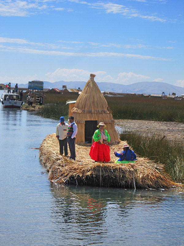
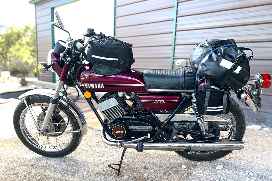
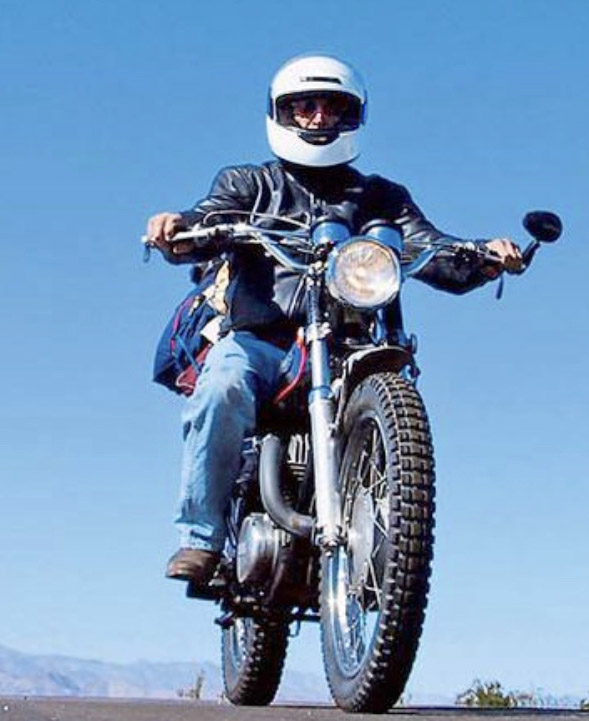
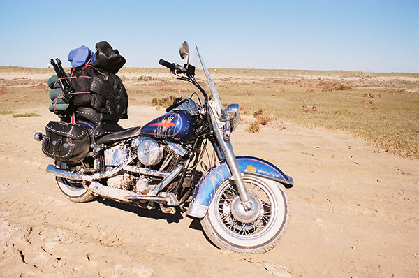
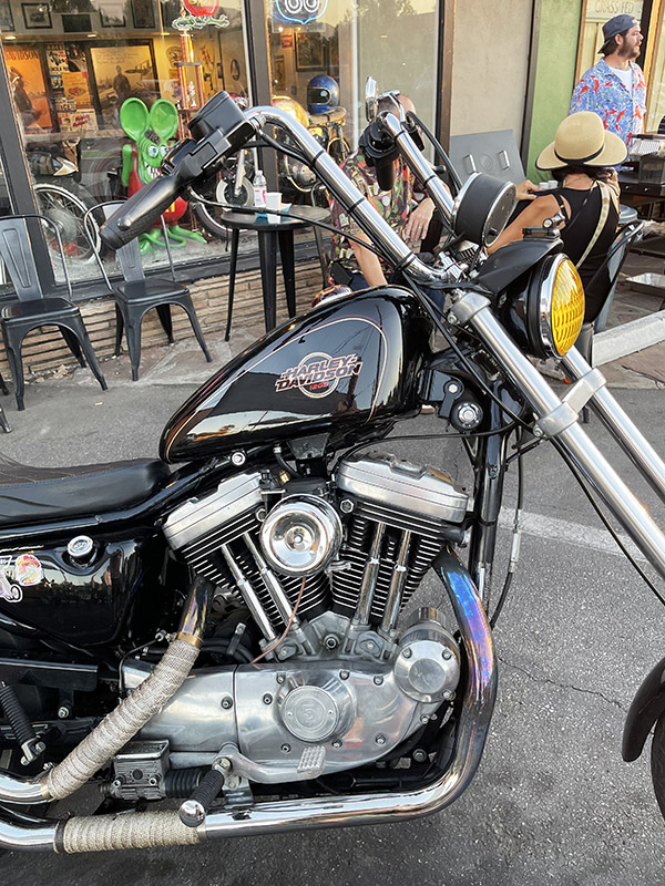
The closest I got to an Iron butt ride was on a 1968 Sportster. This motorcycle is another poor choice for long distance riding. At least the seat wasn’t 4 inches wide on the Sporty. I started out from Van Horn, Texas. It was late March, so it was still pretty chilly in the pre-dawn hours. I rode all the way to Point Loma, California and it took around 18 hours. Of course, with an old Harley all that time wasn’t spent riding. You have to twirl wrenches a bit.

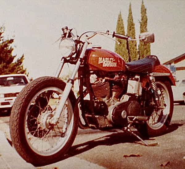
The Sportster’s charging system failed because the mechanical, coil and point type voltage regulator shook itself to pieces. Running a total loss ignition system I had to stop at gas statins and charge the battery every so often, kind of like a modern EV car. As the voltage would drop the bike would start missing due to the plugs whiskering.

Motorcycle plug whiskering isn’t common with today’s high powered ignitions and alternators but back then it was not out of the realm of possible failure modes. It happened when the plug shorted out from a tiny piece of metal stuck between the electrode and the body of the plug. The remedy was fairly easy: you had to remove the plug and clear off the bit of metal that was causing the short, then put the plug back in. Don’t ask me where the tiny pieces of metal came from; it’s best not to think about it.

At some point on the ride, I found a voltage regulator wire broken from vibration and figured out how to make the old, brush-type Harley-Davidson generator charge its battery. I made the last 200 miles at night without having to stop for a charge.  All in, I rode the Sportster 854 miles and man, were my arms tired. It’s kind of funny that the long haul effects of Covid (foggy brain, tired feeling and dizziness) were the same symptoms I felt after riding that Sportster 854 miles.

I don’t think I’ll ever do a thousand miles in 24 hours. It’s just not important to me and defeats the purpose of riding a motorcycle in the first place. I guess if it was an emergency and I had to do it I could ride the Kawasaki ZRX a thousand miles in a day, but honestly, if that situation arose, I’d rather take the Toyota truck.

What about you? Are you a long hauler? How far have you ridden in a day? Does racking up mileage for mileage’s sake mean anything to you?


Another mileage story?  You bet!

Hanford National Historic Park

By Rob Morel

Joe Gresh’s Oppenheimer review reminded me of going to the Hanford National Historic Park up here in Washington along the Columbia River in the years before Covid.  A lot of things have changed with Covid, and the tours offered by the US Park Service at the Hanford site.  This article is about the Hanford site, the tours Hanford offered before Covid, the tours currently being offered, and the photos I collected during previous visits.

Hanford is a place with a story.   Hanford was the world’s first nuclear production facility, it was designed to produce plutonium for use in nuclear weapons, and it did.  Plutonium produced here was used for testing at the Trinity Site in New Mexico during World War II and in the Fat Man bomb dropped on Nagasaki.  The Hanford plant was built along the Columbia River because the reactors used Columbia River water for cooling.  I’ve been told that Hanford was the biggest and most expensive construction site in the US.  The place covers just under 600 acres.

The air-conditioned bus that Hanford provides for getting around the site.

Hanford produced plutonium for several years after World War II.   The result was a set of serious issues with radioactive waste and contamination.  Cleanup efforts are still ongoing, and are part of the Hanford tour.

Before Covid, there were three tours available during the summer.  Today, there are two.  It’s best to check with the Hanford site before visiting to find out what is available for any planned visit.

Tour 1:  The Full Meal Deal

A tour Hanford used to offer included everything (that’s why I call it the Full Meal Deal).  This tour required registering online in advance, and I found I had to do so as soon the registration page started accepting reservations.  The tour slots filled up quickly for the entire summer.  When I last signed up, the government ran a background check on me ahead of time to make sure I was not a bad guy.

The Full Meal Deal tour started in the morning and went most of the day.  It included seeing the B Reactor (where the Nagasaki bomb plutonium was created), cleanup work that involved filtering underground water, and the vitrification plant being built to turn the highly radioactive sludge in the 1940s storage tanks into glass.   The vitrification process involves melting sand and mixing it with the radioactive waste to make it into a solid form.   This solid form can then be buried without fear of it leaching out into the water table.

The Full Meal Deal tour includes a visit to the environmental restoration disposal waste facility.  It is a covered, city-block-sized dump pit used for low level radioactive building materials, equipment, machinery, and other nasty stuff.  The pit is lined with a barrier clay that absorbs radiation.  Pumps remove any rain water that seeps into the covered materials.  Hanford buries a level of radiated items across the bottom of the pit and then they cover it.  That’s followed by burying more on top of the previous layer and covering that.  This will continue until they fill the pits. When the pits approach their capacity, Hanford plans to take any equipment used to haul the debris and bury it, too. When the pit is completely full, Hanford will to cover it.  It will look like the surrounding desert when they are done.

Tour 2:  The B Reactor Tour

The B reactor tour includes (as the name implies) the B reactor, and I believe this tour is still offered. It provides a close up look at the reactor that made the Nagasaki bomb plutonium.  As the name implies, it only includes the B Reactor.  You can stay longer at the B Reactor than the Full Meal Deal tour above allowed, and Hanford opens up more of the building to explore.  There are some places in the building you cannot go.   The off-limits area includes where the fuel rods were pushed out of the back of the reactor (after which they fell into a water tank, cooled, and were then transported by rail to a building that processed them into plutonium).

There were nine reactors built at Hanford.   Of these, seven were cocooned in concrete to contain radioactivity and cool to safe levels. By 1987 they were all shut down.  None are operational today.

I didn’t get any photos other than the B Reactor. If I remember right, there were no cell phones or cameras allowed on the Full Meal Deal tour for security purposes.  But I took photos of the B Reactor, as you can see below.

Hanford’s historic B Reactor. This reactor produced the plutonium used at Nagasaki.
Entering the belly of the beast: The Hanford B Reactor where spent nuclear fuel cells provided plutonium for the Nagasaki bomb.
A model of the nuclear reactor showing the cooling and beryllium rods used to control the reaction.
The actual reactor, with cooling pipes on each side that used Columbia River water to cool the core.
The water plumbing. Some valves are taken apart. That satisfies the Russians that the Reactor is non-operational. This is a part of the nuclear arms agreement. The Russians actually inspect the reactor to verify it is shut down. We do the same for their reactors.
A signature. Was this a previous worker at Hanford?
A clock that shows when the plant was shut down.
A control center for watching core power and temperature.
There were no computers in Hanford back in the 1940s.
More open valves.
Another view of some of the reactor controls and monitors.
The train used to transport highly radioactive highly radioactive depleted fuel rods for further processing into plutonium.
Beryllium balls used for controlling the nuclear reaction.
Massive amounts of air were needed for ventilation.
Personal Protective Equipment. Hanford was not a typical office job.
Tour 3:  The Old Hanford Town Site Pre-War Tour

In my opinion, there’s not much to see on this tour.  There’s a farming area where the previous inhabitants were told to leave at the start of the Manhattan Project. There is what’s left of the old concrete high school.  The tour guide explained that someday Hanford hopes to restore it.  You can see the old roads that went through the town and where the ferry crossed.  The history the guide presented made it worthwhile.

Another Option

You can go to www.vtours.hanford.gov and take a virtual tour if you’re not able to go in person.

The Bottom Line

Look online (Hanford  National Historic Park) for more info. I don’t think they are doing the Full Meal Deal tours since Covid (other than online virtual tours).  Hanford is offering the B Reactor and Old Hanford tours the last time I checked (on a first come, first served basis).

I recommend a visit to the Hanford site, either in person or the virtual tour.  The Hanford National Historic Park reveals a world that few of us have ever seen.  It is an important part of our history.


Like what you see?  Keep us going with your donation to the cause!