Skip Duke lived in New Mexico and died before I got the chance to meet him. I don’t know the exact date he shuffled off. Judging from the condition of Tinfiny Ranch when we first bought it from his daughter I’m guessing five or more years had elapsed between our purchase of Skip’s run-down mountain property and his death.
I never met Skip Duke but I get a strong sense of the man from the junk he left behind. I found boxes of mixed fasteners and some really nice ¼-inch by 8-inch screws with flat-topped heads. The heads are 5/8-inch wide and made so that the fastener countersinks itself like a giant deck screw. These screws are so nice I want to build something just to use them. Skip left behind two really nice red-painted, bottle jacks; one of them must be a 50-ton model. It’s a bruiser, like a foot tall and weighs 40 pounds. Skip was into radios: he was a Ham operator I’m guessing. Tinfiny had several antenna wires strung over the trees and arroyos. In his broken down shop I found a signal generator, watt meter and some other radio test gear that I couldn’t identify. That’s some old school radio stuff, man.
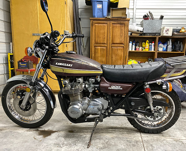
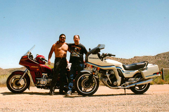
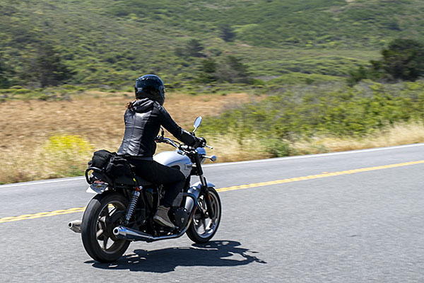
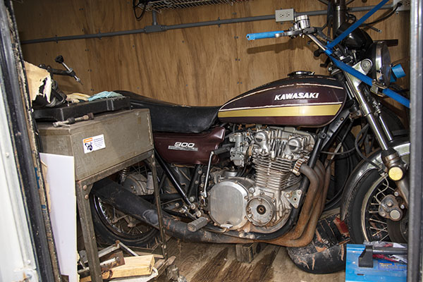
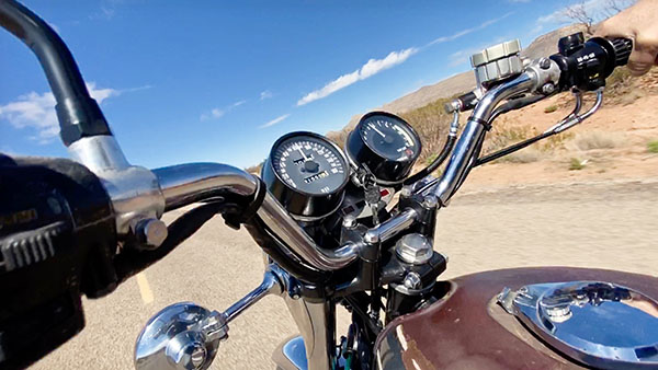
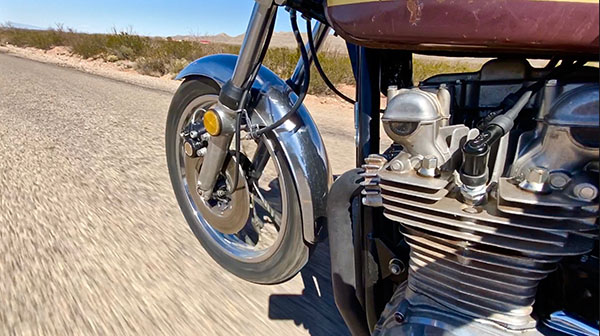
I never met Skip Duke but I think I would have liked him. Skip Duke had multiple uncompleted projects running in parallel when he died and that’s the same way I work. I get bored with one project and switch over to another, never finishing any of them. The 1975 Kawasaki 900 I call Zed was one of Skip’s unfinished projects. In the scattered debris of Skip’s life I found motorcycle magazines from the 1970’s featuring the new Z1900. The bike got universally rave reviews in the magazines, and rightfully so: the 900cc Z1 Kawasaki was a landmark motorcycle.
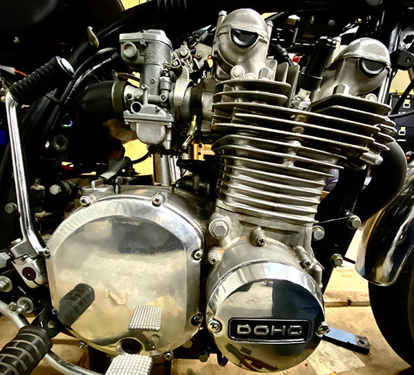
From reading old correspondence I found that Skip was having trouble with a Dyna III electronic ignition system he bought for the old Kawasaki. A melted wiring harness on Zed and no sign of the electronic ignition leads me to believe Skip sent the rotor and pick up coils back for a refund or tossed them in the bushes. One day I’m going to look for it with a metal detector. I found the original points plate in a box of MG car parts and after I cleaned them up the bike ran fine. I remember when electronic ignitions were novel, high tech stuff. I didn’t like them back then either.
Abandoned for years, Skip Duke’s house was overrun by rats when we looked at it with Ronnie, our real estate agent. A converted garage, the house had one bedroom, a living room, a kitchen and a bathroom. Maybe 500 square feet under roof. On the right side of the house was a small garage where Skip kept his tools and his motorcycles. I found a working 4-inch Makita belt sander in there. The bottom garage door panel was broken and the door hung off its track. You could walk inside. Ronnie looked around and said, “There used to be more motorcycles in here.” Next to the garage Zed was sitting outside in the weather, leading me to believe thieves had made off with Skip’s better motorcycles. As if there ever was a motorcycle better than a Z1.
We gutted Skip’s house. Every night after work I would put down 5 of those green rat poison blocks. Every morning they would be gone. Eventually the pace slowed until one day I found the poison untouched. The rats ate a total of 3 gallon-size buckets of poison but I won the war. I spent a pleasant two weeks hauling out dead rats and disinfecting the entire place with a solution of 50/50 bleach and water. My lungs burned and my vision blurred but at last the place was clean and rodent free inside.
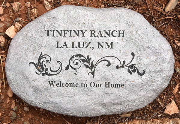
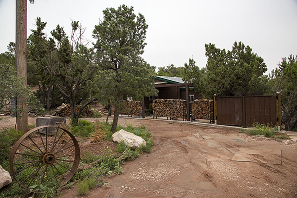
We replaced the siding, drywall and insulation, and rewired most of the the electrical system. Skip’s little garage area is now my wife CT’s walk in closet. The concrete ramp leading to the garage has been leveled off and is a 5’ X 14’ office and storage room. We re-plumbed the bathroom and redid the kitchen eliminating any appliance that hinted at being a stove. We named the little house in the arroyo “The Carriage House” hoping to boost the little shack’s confidence. New paint and tile made The Carriage House look fresh inside. Skip’s old fiberglass shower stall was hard to remove and we were running out of time so it still serves, the last remnant of a bygone owner.
Skip Duke was not satisfied with the little Carriage House and had bigger plans in the works. Further up the property there was a graded area where Skip was going to build a structure. Two large, wooden sawhorses held 8-foot x 20-foot sheets of a composite material consisting of 6” white Styrofoam sandwiched between two layers of glued-on, exterior grade, 1/2’’ oriented strand board. There was enough paneling to build a 20 X 40 insulated building. Unfortunately, death has a way of messing up the best of plans. The 20’ X 40’ structure never got built. White plastic sheeting covered the composite panels but the relentless New Mexico sun crystallized the plastic. The sheet lay in tatters and it would crumble when you tried to pick it up. Without protection the panels fell victim to the elements.
Oriented strand board is fairly weather resistant but you can’t let it remain wet for long. Stacked horizontally on the sawhorses, the panels couldn’t shed water and the pooled moisture between the panels rotted the OSB. I’m sure if Skip Duke knew he was going to die he would have stacked them vertically allowing water to run out from between the panels. I managed to salvage enough panel material to build the walls for another of Skip’s unfinished projects: the pump house.
The original pump house was a 55-gallon metal drum over the wellhead. Inside the living room was a 40-gallon pressure tank to smooth out the cycling of the well pump. I can’t figure why anyone would want a gigantic pressure tank in their living room but Skip was not a man who trifled with cosmetics. The amount of paneling I could salvage determined the size of the well house so I poured a 6’ X 10” slab with a central drain and built a small shed over the well. I moved the 40-gallon pressure tank to the new well house and installed a water softener next to the pressure tank. With 6” thick Styrofoam walls the pump house is so well insulated a 150-watt chicken coop heater keeps the pipes nice and toasty in winter. Too bad so much composite paneling was ruined; it would have made for a super energy efficient house.
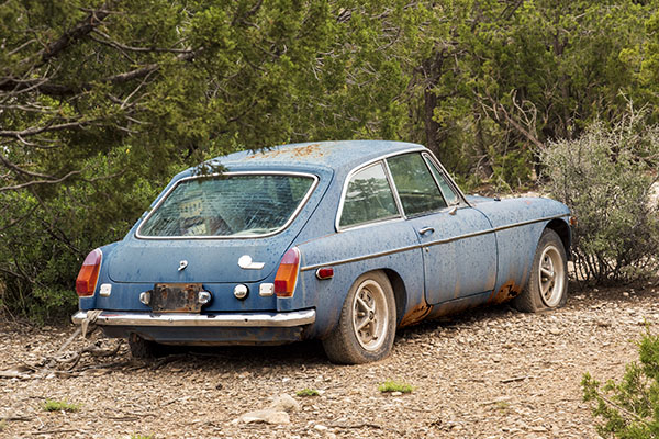
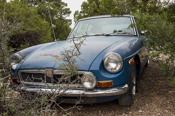
When Skip Duke died he left behind a 24-foot motorhome without an engine, an 18-foot Hobie Cat sailboat on a trailer, a 1974 MGB-GT hardtop 4-seater, a 4-person Jacuzzi with seized air and water pump motors, two large dog houses and a backyard chicken coop with camouflage netting over the top. Skip was a man who was into everything cool. I got rid of the junk except for the MG. Those hardtops with their Italian, Pininfarina-designed hatchbacks are rare. I might get it running one day.
Life is funny. I have an Internet buddy also named Skip Duke. He is very much alive and a Kawasaki Z1 guru. The living Skip Duke’s Kawasaki advice has saved me untold woe in the long restoration process of dead Skip Duke’s motorcycle. I bet the two Skips would get along famously (either that or they’d kill each other).
I never knew Skip Duke. We’ve remodeled and reused his vast pile of junk in ways he could not have foreseen. I wish he had left details of his future plans, like notes stuck to each project describing what he saw as success. I hope he’s looking down (or up as the case may be; Skip might have been a real jerk) and smiling as he sees his old Kawasaki motorcycle (now my old Kawasaki motorcycle) roaring down the highway full of life and power. I hope whatever becomes of that soulful part of a man after death is aware of the happy life CT and I have built atop the 5-acre spread he must have loved dearly. And I hope he finds joy in all that we have done.
Follow the complete Z1 resurrection here!
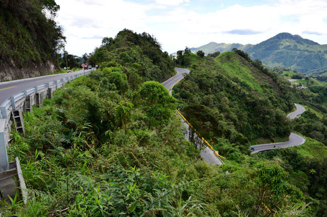
For more on Tinfiny Ranch and the Tinfiny Summit, check out the YouTube videos here!