A Stag Film?

By Joe Berk

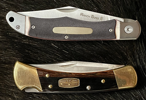
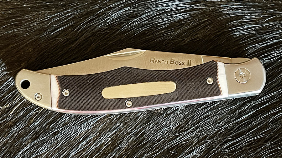
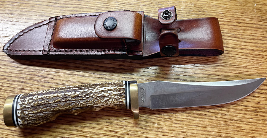
For a guy who doesn’t collect knives, I sure seem to have a lot of them laying around.  The one you see above came to me as part of what is perhaps the greatest sales gimmick of all time:  The “$100 Ships Free!” offer.

You know, the MidwayUSA.com come on…orders over $100 ship free.  I ordered a Safariland 1¾-inch wide belt in a smaller size because I lost weight, I got down to the last belt buckle hole on my old Safariland belt, and my pants were still loose.  The new belt was $71 (a lot, I know, but it works well when carrying concealed and Safariland makes a very high quality item).  If I could kick the order over $100 the belt would ship free.  Shipping if I didn’t make the $100 hurdle was $15.  So this Uncle Henry knife popped up, and it was like getting the knife for half price, because it ordinarily cost just over $30.

Bam! Add to cart.  A no brainer, if ever there was one.

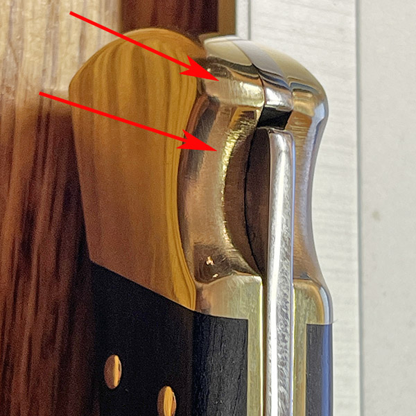
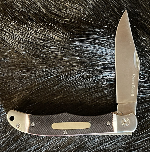
The knife is a Schrade, part of their Uncle Henry line.  I don’t know if that means it’s good or not so good.  I couldn’t find anywhere on the knife that says it’s made in China, but I guessed that it was.  A quick Google check confirmed it.  That’s not a bad thing, though.  The knife appears to be well made.  A lot of things that are made in China are good.

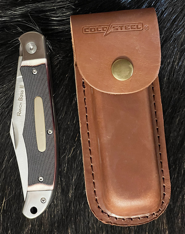
The Uncle Henry knife came with a sheath and a tiny sharpening stone in another piggy-backed sheath (the idea being that you’ll always have a way to sharpen your knife), not that I’ll ever use the sharpening stone.   The stone is small enough that I could see myself slicing my hand open trying to hold it.

The Stagalon grip material is some sort of plastic that is supposed to look like, you know, stag.  That’s okay by me.  For just over $30, I wasn’t expecting real stag.  I wasn’t expecting the Stagalon to look as good as it does, either.  That was a nice surprise.  Stagalon. I guess I could make a video of the knife and call it a stag film.  Maybe just saying stag film will result in a lot of hits.  Do they still call them stag films these days, or is that no longer politically correct?.  Isn’t that terminology kind of insulting to all the deer out there sweating out this hunting season?  Anyway, to get back to Stagalon, the handle doesn’t quite match the look and feel of real stag, but it is kind of cool and it is nice.

I’m not sure what I’m going to do with my Uncle Henry Stagalon knife, other than look at it for awhile and write a blog about it.  If I was a camper I suppose I could wear it in the woods, but I don’t camp much these days (in my golden years, I find I like motels a lot better).   No, this knife will go on the shelf, along with a bunch of other “$100 Ships Free!” knives.   It is kind of cool, though.


Join our Facebook ExNotes page!


Never miss an ExNotes blog:


Don’t forget: Visit our advertisers!


Laguna 2: More Hasty Conclusions From Laguna Seca

By Joe Gresh

Man I slept good last night. The combination of the new cot, air mattress and mummy bag worked to perfection. Add in the cool moist Monterey weather and the loudspeaker’s 8:15 call for a rider’s meeting was the first thing I heard.  I’ve really got this camping thing down. With the added capacity of the Toyota truck I was able to bring along a few luxury items. Like a chair and an ice chest.

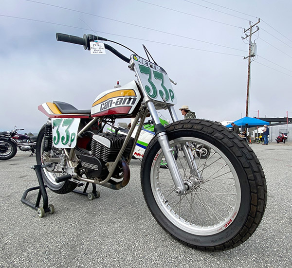
These Can Ams had huge cylinder fins.
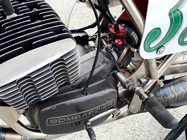
Can Ams also had a somewhat unusual disc valve with a long intake runner leading to a carb in the back of the engine next to your left foot.
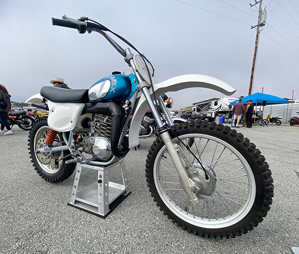
A bike I never knew about, the AMMEX motocross bike.
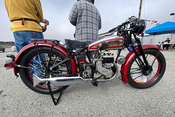
A 1930s Husqvarna. Not much different than my 2008 version.

Unlike last year, there are no food trucks in the paddock, only the Bear and Shank which has some pretty good food at reasonable (for California) prices. The ice chest frees me of food anxiety, I’ve got plenty for the weekend.

My enduro riding buddy, Gilroy Larry, stopped by with his clean TY250 Yamaha trials bike. We rode over to the trials area but it was more secure than last year.  There’s also a sweet, old-style motocross track where a guy can race his old bike without spending 95% of his time in the air. (Note to Supercross: less hang time and more racing!)

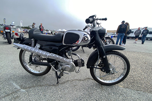
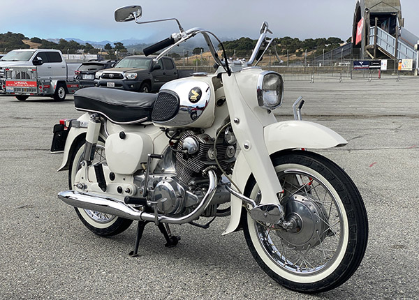
I still have one of these in boxes. It’s a C110 Honda 50. 4-speed with hand clutch and a pushrod engine. When mine ran it did around 45 miles per hour.
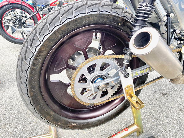
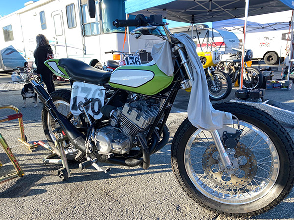
Unusual rear wheel on a Mule flat track style bike.
I had one of these also. This is a one-owner, dad’s old bike.
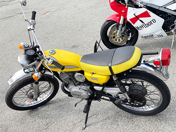
Since we are apolitical here on ExNotes I know Berk will love this Suzuki 100.
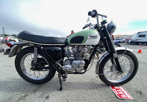
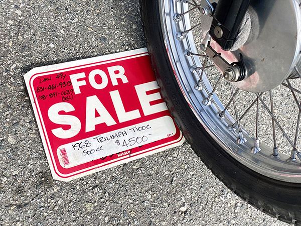
A beautiful 500 Tiger for not much money.
It’s a good thing I don’t have $4500 laying around or i’d buy the Triumph.

There are entirely too damn many four-strokes out here. My era of motorcycle racing was dominated by two strokes both on the pavement and in the dirt. Flat track was the only place four-strokes were competitive and that was by favorable rules. To me, a buzzing stroker is the sound of speed.

Bikes are warming up on Laguna’s interior roads. You’ll see a full on road racer cruise by the camp if you wake up early.

The same dense air that’s makes it so easy to sleep has Godzilla running fabulously. The grunt is amazing and the smooth, steady beat makes me want to move here rather than tune for my 6000-foot elevation.

Yesterday we had no fog and the picnic table was soaking wet in the morning. This morning diaphanous clots of fog are blowing past like smoke from a fire and the picnic table is bone dry. Listen, I don’t like using diaphanous any more than you like reading it. I guess should have paid more attention in meteorology class.

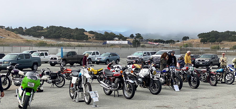
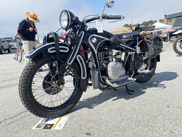
There was a vintage bike show at the track.  The show had a pretty decent turnout.  Maybe 50 bikes showed up.  I owned several of the models represented.

Nice old flathead Beemer.
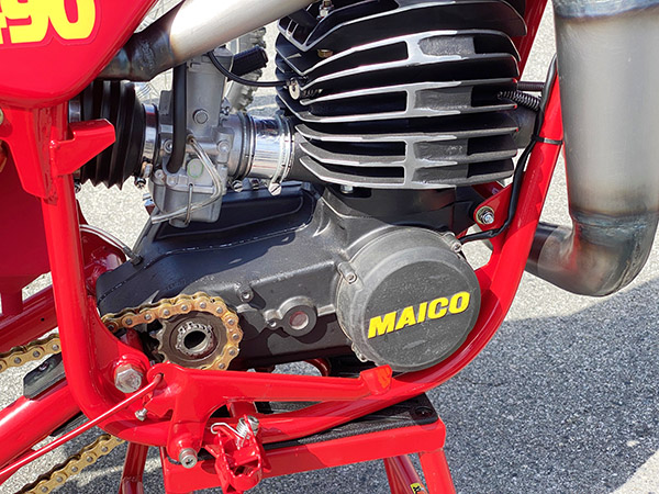
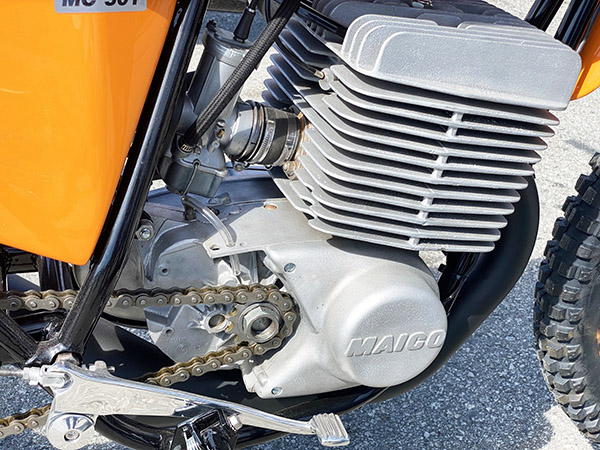
The evolution of Maico crankcases Part 1: 1970s.
The evolution of Maico crankcases Part 2: The 1980s.

It’s hard to beat looking at old CanAm motorcycles while out on the track vintage bikes are racing by at full song.

Sent from my iPhone


Never miss an ExNotes blog:


Don’t forget: Visit our advertisers!


ExNotes Hasty Conclusions: The 2024 AHRMA at Laguna Seca

By Joe Gresh

Rookie mistake: leaving your chair outside at night. The dew is heavy at Laguna Seca and my campsite is shaded from the early morning sun.

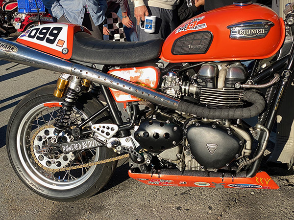
I love the pipes on this Turnip. Not likely to drag in corners!

I’ll walk around the pits instead. No food trucks yet and the Bear + Flag doesn’t open very early. Luckily I brought along some Cafe Bustello instant.

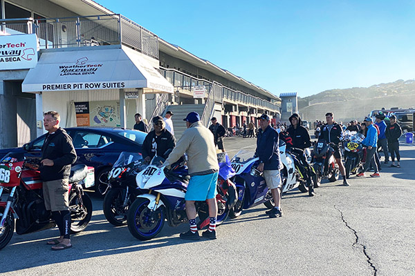
Tech inspection. The lines were long which is a good thing for AHRMA (America Historic Racing Motorcycle Association).
Triple tracker wandered into pavement world.
175 Bridgestone twin. The terror of the track back in the day. Hondas didn’t even try.
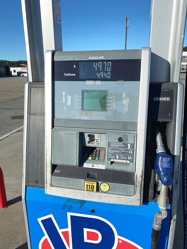
VP race fuel on site. Only a few bucks more that the 86/corn squeezed crap you buy on the street.
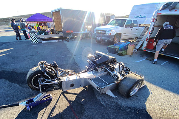
Mono framed side car. Very thin aluminum. I’m shocked it doesn’t crack.
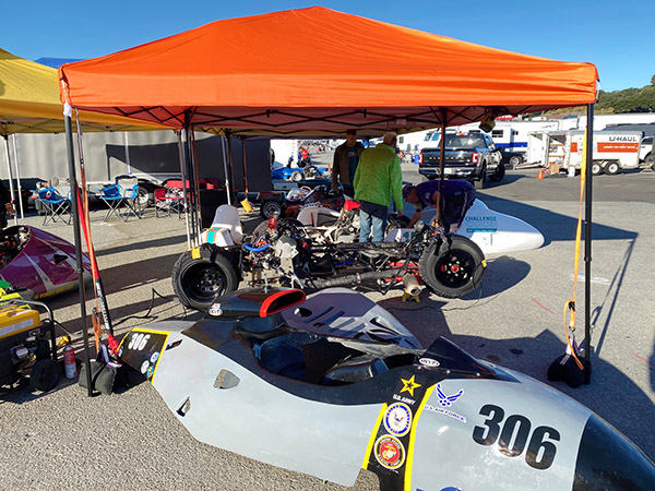
Heavy side car contingent at this year’s races.

The crowd in the pit area seems to be as large as it was last year with even more Honda 160-175 twins. These things are like cockroaches while the actual bikes that raced in the 1960’s/1970’s are thin on the ground. I guess those Hondas survived because no one raced them.

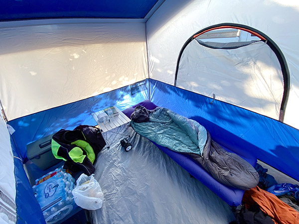
Luxury accommodations at Site 110.

Even if you don’t care for motorcycles Laguna Seca is a great place to camp. I have Site 110.  The trees have grown a bit and I’m worried about ground squirrels breaking into my tent and stealing my food.

There are lots on fairly modern bikes, too. At least they are modern to me; they are probably 25 years old.

I made the mistake riding into Monterey.  Lots of traffic. The only restaurant open was a McDonald’s. An older lady was buying a single cigarette from a guy who was out by the parking lot. I could see the bay from McDonald’s. Inside, there was no one to take your order. Electronic kiosks were set up and you entered your order then paid at the kiosk. There were about 5 people waiting, glancing down at the bits of paper the kiosk spit out. No one was getting food.  McDonald’s food is not good enough to go through the hassle, so I left.

Heading back towards the track on Highway 68 the traffic came to a halt. It took me about an hour to go 4 miles. My old Yamaha 360 did not care for this kind of treatment.  Forget going anywhere from 3:00 p.m. until 7:00 p.m.  In the evening I sat and watched the long line of motor homes making their way to the paddock. It was fun…to me.

Today is race school and practice. Tomorrow (Saturday) the racing starts in earnest.

Sent from my iPhone


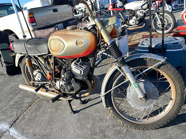
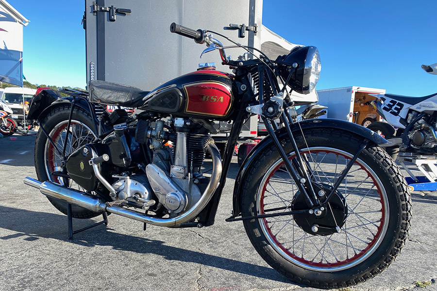
That BSA at the top of this blog was not racing.  I included it for Hack.


Never miss an ExNotes blog:


Don’t forget: Visit our advertisers!


Red Rock Canyon National Conservation Area

By Joe Berk

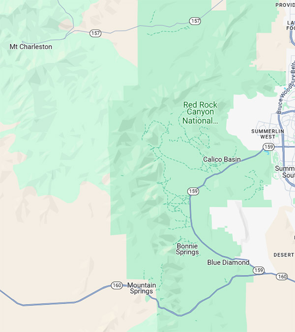
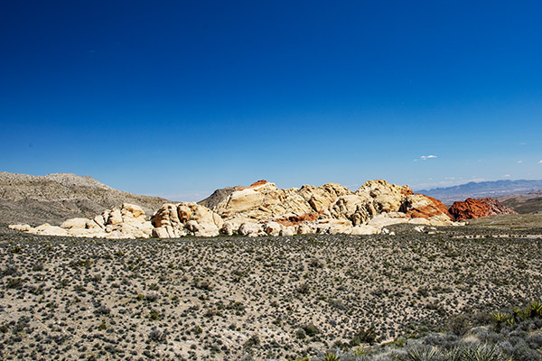
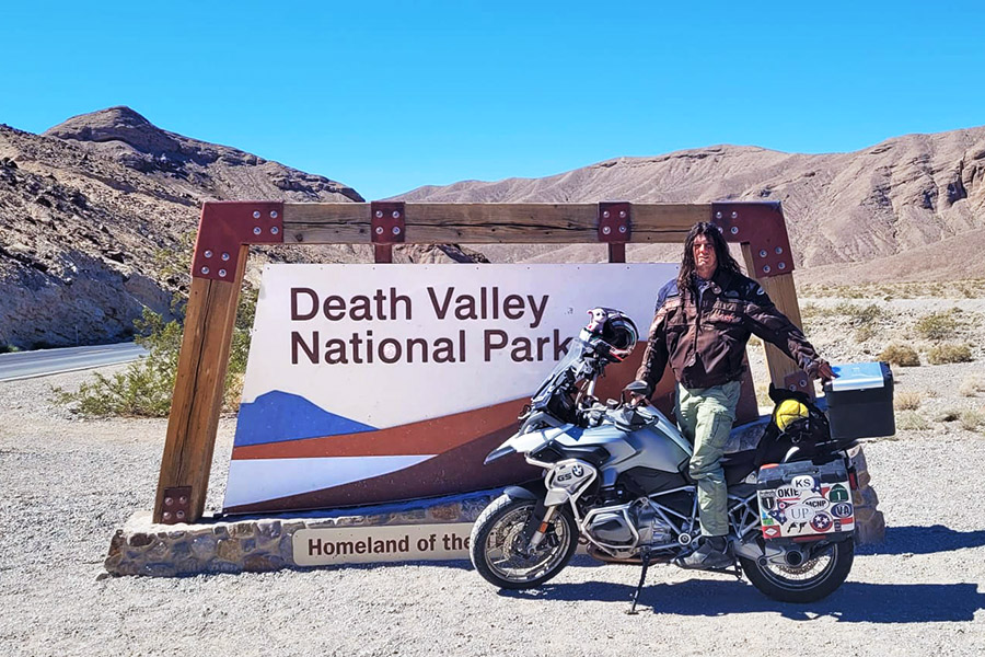
Red Rock Canyon National Conservation Area is an interesting spot located just west of Las Vegas.  During our recent visit to Death Valley, we rode to the Red Rock Canyon area after stopping for lunch at Mom’s (a great restaurant) in Pahrump.

Pahrump is 30 miles northwest of Red Rock Canyon National Conservation Area on Highway 160; Las Vegas is 17 miles to the east.

The Red Rock Canyon National Conservation Area has a good plan for managing visitors.  You have to make an online reservation that slots you into 15-minute arrival intervals.   There’s $16 entrance fee (I guess it’s per vehicle), but when we arrived the park ranger didn’t even look at my senior citizen lifetime pass.  He just waived us in.  That’s happened to me a few times at National Parks.  Maybe I just look old.

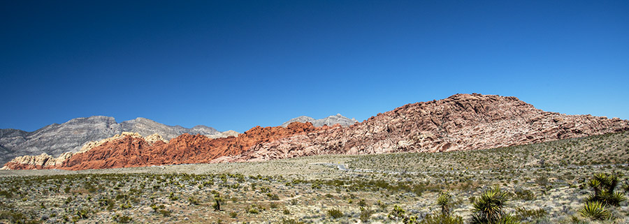
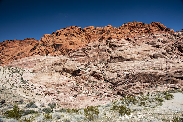
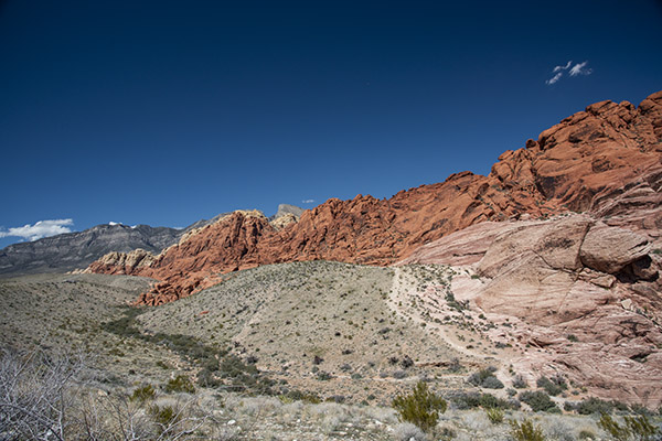
We took Highway 160 east from Pahrump and it was a pleasant ride.  As we approached Red Rock Canyon National Conservation Area, the Spring Mountains on our left (north of Highway 160) had brilliant burgundy horizontal rock layers.  The red is caused by iron oxide.  We weren’t even in the Park yet, and the views were already stunning.  It really is something to see.

Once we entered Red Rock Canyon National Conservation Area, we explored the Visitor Center and four interpretive exhibits accessible via a walkway outside.  After that, we started the 13-mile one-way ride through the park.  There are many stops offering different views of the mountains and rock formations.   Motorcycles are fine on this road, and we also saw people riding bicycles.  I’d like to do the ride on a bicycle someday.  It looked like fun.

Desert tortoises live here and there are exhibits that provide information about them.   The tortoises live near Visitor Center paths, but we didn’t see them while we were there.  That’s okay; I’ve seen desert tortoises out and about on previous treks.  As an aside, if you happen to see one, don’t pick it up.  Doing so will frighten the tortoise and literally scare the pee out of it, which can induce dehydration and kill the tortoise.  The desert tortoise is a protected species, so leave them alone.

You can hike and camp in Red Rock Canyon National Conservation Area.  When I read that I immediately thought of Mike Huber, who is wheeling and camping his way around New Zealand as I write this.

Although I’ve been to Las Vegas many times, I had never visited Red Rock Canyon National Conservation Area.  It’s about as different from Las Vegas as a place can be, and in my opinion that’s a good thing.  If you’re ever in this part of the world, Red Rock Canyon National Conservation Area is worth a stop.


Never miss an ExNotes blog:


Don’t forget: Visit our advertisers!


Zooming Through New Zealand: Part 5

By Mike Huber

I was in the tiny town of Omarama, New Zealand, having coffee and trying to wake up enough to plan the day. I was under an hour and a half away from the Hooker Trail, which I learned just a day or so ago was not too far off my original route. The Hooker Trail was one of those that I kept seeing and hearing about in any conversation about the North Island.  I normally avoid touristy places as much as possible. One of my many travel mantras is “If I run into another American I have failed.”  That’s because most Americans stay on the beaten path and rarely venture off.  The venturing off seems to be my happy place.

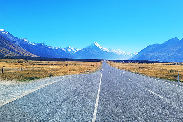
As I finished my coffee and began to put my gear back on for the ride to the Hooker Trail, I fueled up since it New Zealand was pretty devoid of towns for the next couple hundred miles, which is perfect for riding.  I was expecting Mount Cook would be similar to the other areas of New Zealand and was preparing to view a miniature copy of say, Mt. Hood.  The previous day (although incredible and diverse) was like a 70% replica of the western United States with a sprinkling of British Columbia thrown in.  Yes, I am extremely spoiled in my perspectives of motorcycle roads.  I understand this.

It didn’t take long after leaving the coffee shop before low level clouds consumed me and the road.  I had just gone through a similar area and noticed when I gained some elevation it cleared up.  I remained optimistic as I strained to see anything in front of me. The attempt to hike the Hooker Trail surely would be in vain if it continued to stay this way, as I have heard it often does up in the s, outhern Alps of New Zealand.

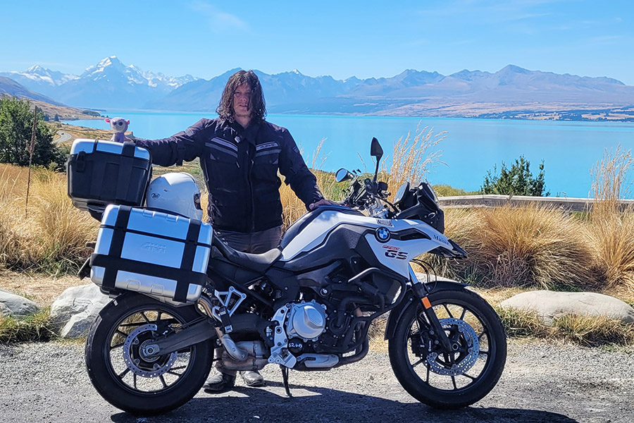
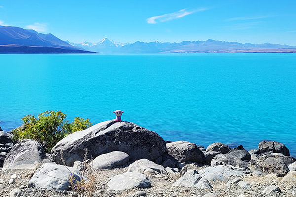
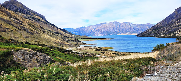
Fortunately, this wasn’t the case. Once I hit Lake Pukaki, I had obtained enough elevation to where the clouds were below me.  Lake Pukaki than came into full view and it was stunning.  The neon green water contrasted with the brown mountains surrounding the lake, and it became all I could see.  The colors were so overwhelmingly bright I had to pull over several times not only to take the views in but allow my eyes to adjust from the drab cloudbank that had me engulfed over the previous hour.

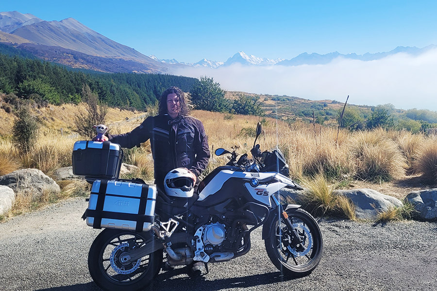
After another 30 minutes of riding along this other-worldly lake I could see Mount Cook was getting close and I was excited to finally hike the Hooker Trail.  As I entered the parking lot around noon, I noticed how crowded it was. There was hardly any parking (at least for cars).  I found a perfect spot for Massie right up front next to the trail head and swapped out my riding outfit for hiking gear.

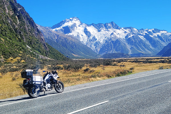
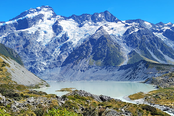
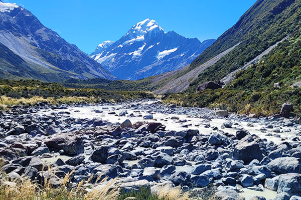
This was it: The Hooker Trail.  It wasn’t too long, only around 6 miles round trip.  Once I began hiking I understood why I had kept hearing about it in my travels and when reading random blogs and posts. It was super-crowded.  The hike was beautiful.  Around each corner was a new view of either glacial lakes or views of Mount Cook towering above. The trail ended at a glacial lake with a beach that was perfect for a quick swim.  It was mid-afternoon and it was warming up quite nicely.

Massie she was parked right where I had left her and ready to blast out our final few hours to the hostel on the edge of Lake Tekapo. The trip had taken me through what felt like a whirlwind of geographical features. There’s no question that that the roads, people, and environment in New Zealand are a dream for anyone (especially a motorcyclist). As I cracked open a cold Kea IPA on the lakeshore a sense of satisfaction came over me. I could now add New Zealand to the growing list of countries I where have motorcycled. The memories of this trip will help me pass the time while on the long flight to my next destination.  Cheers New Zealand!


Read the Mike Huber New Zealand posts here:


Never miss an ExNotes blog:


Don’t forget: Visit our advertisers!


Zooming Through New Zealand: Part 4

By Mike Huber

It was well after 6:00 p.m. and I was starting to hit my wall for riding.  My goal was to travel to this campground I stumbled upon on Google which was about 5 miles down a dirt road which had some decent reviews.  The rental company mentioned no off-roading as Massie had street tires.  I zoomed in on the map and saw “Linda Road,” so I technically was not off-roading. Check!

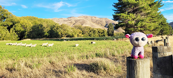
The road was a very tame forest service road with the occasional “Traffic Lamb,” as quite frequently there were herds of sheep and they would part like the Red Sea as they heard Massie’s engine roar grow closer (you can send hate mail for that joke to Joe Berk).

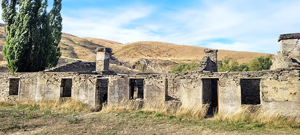
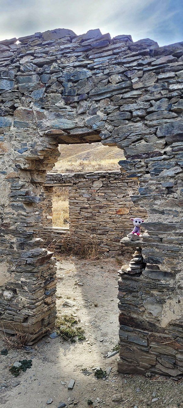
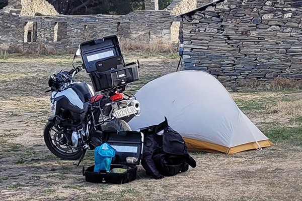
Once I neared the campsite I noticed a couple of old rundown stone buildings (from who knows how long ago) and a few van lifers dispersed around a large field.  This was a really cool spot!  Not only that, but you had views for miles of the sun beginning to set over the brown grassy mountains that surrounded the location.  This was Linda’s Camp.  It was an old short term gold mining operation from the 1860s, which switched hands a few times before finally being abandoned in the 1950s.  This was an amazing place to camp and it was far off the grid.  I didn’t even have cell service.

After setting up my tent I struck up a conversation with an old gold miner.  He was living in his van there and spent his days panning for gold off a nearby river with minimal luck.  He got a good laugh from my story about getting the boot from the coffee shop earlier that day for drying my gear there.  The rest of the evening was spent exploring the hotel ruins and a short hike up the mountain to watch the sunset.  It was one of those moments where I really was able to relax, breathe, and just be in the present.  It was a long but rewarding day and I thought having an early night was in order.  It would be another long day tomorrow to include the Hooker Trail hike, which I was greatly looking forward to.

Waking up in yet another serene location with Massie sitting just outside the tent was another perfect kickoff to this new day.  Since it was still pretty early, after packing I thought pushing the bike out of the camping area was the proper thing to do to avoid waking any of the van lifers (or the gold miner).

Once well outside the perimeter I went to start the bike. Nothing happened.  Shit.  The battery was somehow dead. I took the panniers off and attempted to manually jump start it off a small incline.  No good.  It wasn’t starting. Well, I thought, it was not so funny breaking that “stay on the road rule” now, was it? I had no cell signal either.  As I sat down weighing my options (none of which none were good) I heard a couple of pots banging together.  The old gold miner was up.  I walked over and asked if he had jumpers, and he did!  Sure enough, the bike fired right up with his help. Okay, cool I can still make the Hooker Trail even if I am an hour behind schedule.  And, the rental company would never know I was off road.

Once I was back on the main road and well on my way, the need for coffee hit me.  I pulled into a rest area to see if there was a cell signal to guide me to a coffee shop.  There was a cell signal, and there was a coffee shop not too far away.  I pulled out and began racing the Linda Pass switchbacks when suddenly all I saw was a huge yellow Scania 18-wheeler coming head on at me.  Why was he in my lane? SHIT! I was on the wrong side of the road!  In my morning fog, and my distraction from the battery issue I zoned out and drove on the right side of the road.  Even with a giant yellow arrow on Massie’s dash as a constant reminder, I somehow ignored the fact that they drive on the wrong side in New Zealand.  I didn’t have much time to react and managed to skirt along not so much of a shoulder, but a strip of grass as the truck blasted by me.

That was close.   I really didn’t need any coffee after that wakeup call, but what I did need was a moment to get my head back in the game (especially if I was to complete the Hooker Trail and find a campsite).  Due to Massie’s moody electrical system, tonight’s campsite would need to be near a town with a strong cell signal. It was still early and my confidence was high. I knew I would satisfy both objectives.


Read the Mike Huber New Zealand posts here:


Never miss an ExNotes blog:


Don’t forget: Visit our advertisers!


Zooming through New Zealand: Part 3

By Mike Huber

There are certainly worse places to wake up. I opened my eyes facing a beautiful mountain lake with loud wekas clumsily hunting for food in the brush next to my tent. Without my cooking gear it took me just about 20 minutes to pack up and load Massie, the BMW GS750 for what would be a full day of riding.  As I was packing up I was already craving a coffee and a meat pie for breakfast.  While stuffing my gear in the panniers I noticed how wet everything was from the dew and being so close to the lake.  The sun was out though, so I thought after an hour or so of riding I would dry it out as I ate breakfast.

Riding to breakfast took a bit longer than expected and the one hour turned to three.  Not that big of a deal as the sun was fully out now and would allow for my gear to dry while I researched my route and stops for the day. As I pulled into a coffee shop in a small town along my route the waitress stated how it would be a while for my food and coffee.  This was my queue to unpack my wet gear and lay it out to dry while I was researching maps and things to do for the day.

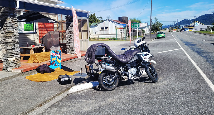
During my wait several people introduced themselves and we had some fun conversations about my gear and riding.  It was a great environment, or so I thought. After about 20 minutes my coffee and food arrived and I was told that maybe I should take it to go and it was time to pack up my gear.  I guess they didn’t like the look of my tent and equipment drying and sprawled out all over their front porch.  Which I sort of get, even though many of the clientele had been chatting me up.  I apologized and, well, it took me about as long to pack up that gear as it did for them to bring my coffee (it happened to be fully dry by the time it was packed).  I found it a bit rude, but I understood that having my gear everywhere could be viewed as a bit of a mess.  It was time to get going, anyway, as I had a long day ahead.

During my minimal research and planning at the coffee shop I discovered this one hike that I continually heard about from others.  It was the Mount Cook Hooker Trail.  The hike wasn’t too long, and it had an incredible view at the end. This was only a couple hours off my planned route.  Adding that hike meant I would have to have a long day and miss a lot of stops that tourists hit, such as the Franz and Fox Glaciers and hikes along that area.  I decided to prioritize the Hooker Trail and skip the glaciers and other coastal hikes. Having made this decision meant a 350-mile day.  Which to me didn’t seem like a lot, but the roads were tight and windy, which I thoroughly enjoyed, probably too much as I used the long day as a reason to really wear the edges of the tires in.

After close to 10 hours of aggressive riding through what I felt was like a mini version of the Western United States and British Columbia, I arrived where I thought would camp for the evening, just outside a city called Wanaka.  However, the “campground” resembled something of a tent city I would expect to find under Interstate 5 in Seattle.  That made it a hard pass for me.  I did have a second option, but it was another 45 minutes north and if it didn’t work out, I would be in a tight position as the day was beginning to wear on me.  I decided to shoot for it and hope for the best.  What I found was far more than I expected and maybe one of the coolest places I ever moto camped.


Read the Mike Huber New Zealand posts here:


Never miss an ExNotes blog:


Don’t forget: Visit our advertisers!


Top 10 California Motorcycle Roads: Part 2

By Mike Huber

This is a continuation from my previous blog highlighting ten of the best roads in the beautiful state of California.

California 198 to Sequoia National Forest

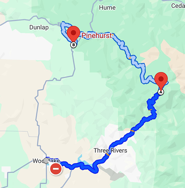
Rated 5 WheeliesRoute Details.  Yes, another mind-blowing road that goes through another National Park. This route has beautiful mountain switchbacks with no towns and minimal distractions. This allows you to lose yourself while focusing on the tight corners as you speed next to some of the largest trees on the planet. This route highlights how small you as a rider next to these majestic trees in Sequoia National Park.

    • Start to Finish Points: Wood Lake to Pinehurst
    • Distance: 78 miles
    • Ride Time / Recommended Time: 3 to 6 hours
    • Recommended Time of Year: May to October
    • Main Point Of Interest(s): General Sherman Tree
    • Cautions / Dangers: Wildlife in early morning and evenings
    • Important Contact Numbers: CHP (Visalia) 559-734-6767

Road Description.  Although this route can be completed in a day, I would recommend you take two days. The reason for taking this slower is to allow yourself to stop and enjoy the sightseeing along this national park. The road is in excellent condition as you climb the switchbacks to crest the highest point in the park. There are no gas stations along this route so it is imperative that you fill up in either Three Rivers or Hume Lake (75 miles between the two) or outside the northern part of the park near Squaw Valley (90 miles from Three Rivers).

Points of Interest.  Since this is a National Park there is plenty to do outside of riding including hiking, sightseeing, and camping. This is one of my favorite National Parks since it is so stunning but everything is a very short hike to get to. Some of the largest trees in the World reside in this park. The General Sherman Tree is the world’s largest tree and is along this route. There are many other gigantic trees that are awe inspiring and shouldn’t be missed.  These are the points of interest I recommend:

Where to Stay/Camp.  Camping and hotels are limited to what is available in the National Park. Reservations should be made ahead of time as the park can often be booked full and will leave you no other options for 50+ miles for a place to stay.  Here’s where to check:

Fort Bragg to Bodega Bay on Highway 1

Rated 4 Wheelies

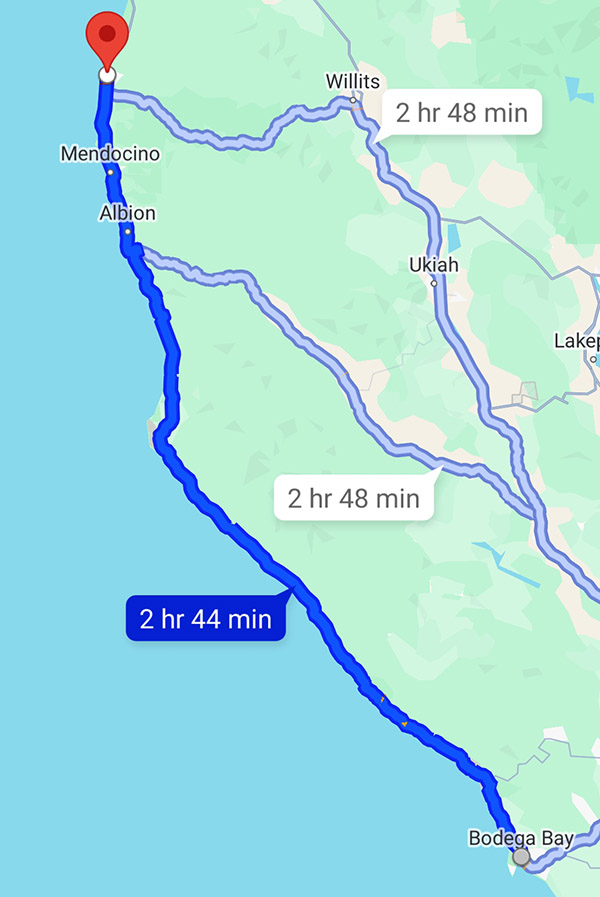
Route Details.  This route can be combined with the Fort Bragg to Garberville route, but I wanted to ensure they were written on separately as I feel the riding and terrain changes from the previous one to this route. This is Northern California at its finest. Pristine ocean views that include lighthouses and beaches for over 100 miles.

    • Start to Finish Points: Fort Bragg to Bodega Bay
    • Distance: 107 miles
    • Ride Time / Recommended Time: 3-6 hours
    • Recommended Time of Year: May to Oct
    • Main Point Of Interest(s): Numerous Beaches and Lighthouses
    • Cautions / Dangers: Possible heavy fog in the morning
    • Important Contact Number:  CHP (Ukiah) 707-467-4420

Road Description.  Beautiful sweeping corners that hug the cliffs consume this ride. You can feel your lungs cleanse as you breathe in the mist of the Pacific Ocean while blasting along one of the most well-known, yet less traveled roads in our country. The road is in great condition and there are plenty of small Oceanside towns that have locations to fuel up and allow you to stop in for meals or a beverage. It is important to ensure you soak up some sun while taking a breather and meet other riders at one of the many stops along this epic part of Highway 1.

Points of Interest.  This stretch of Highway 1 has some of the most beautiful and unpopulated beaches in the country along it. There are several lighthouses that are worth stopping by to visit. Mendocino Headlands State Park is a perfect place to stop and get a short hike in to regain focus for the upcoming curves you will be leaning heavily into. There are also several small beach communities like Mendocino, Fort Ross, and Gualala you will ride through, any of which make for a great stop for lunch or a stayover if you have the time.  Here are my favorite spots:

Where to Stay/Camp.  This stretch of road is one of the easier places to locate campgrounds and hotels due to the lack of crowds along it. As always making reservations ahead of time is recommended to ensure you have a safe place to rest for the evening. I have always had a pleasant experience staying along this route.  Any of these places are good:

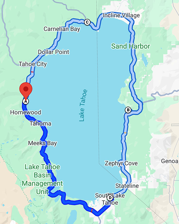
Northern Tahoe Loop

Rated 4.5 Wheelies

Route Details.  113 miles of diverse riding from open field to challenging switchbacks as you climb the cliffs along beautiful Lake Tahoe and take in some of the most intense roads and vistas in California. The road is in excellent condition with much of it newly paved. There are plenty of turnouts for taking photos, which is fortunate because the curves are very sharp and come up quickly so the ability to pull over and take in the views is an added bonus along this trip. The route is not a letdown. You and your motorcycle will be smiling all day.

    • Start to Finish Points: Kings Beach with Reno Junction in the north as your turnaround back to Kings Beach
    • Distance: 113 miles
    • Ride Time / Recommended Time: 4 to 6 hours
    • Recommended Time of Year: May to September
    • Main Point Of Interest: Lake Tahoe, Reno
    • Cautions / Dangers: Quickly changing weather conditions, especially in fall
    • Important Contact Numbers:  CHP (Truckee) 530-563-9200

Road Description.  This is one of the more picturesque and challenging rides in California. This route provides such a range in diversity, both in the scenery and the road types. You start in Kings Beach where there are rolling meadows and begin to quickly climb to over 9,000 ft. where you will be skirting the edges of cliff sides with some serious switchbacks thrown in for added intensity. This road is not for beginner riders as the technical cornering along with the beautiful views can be too dangerous for a novice to safely navigate, however, for seasoned riders on a clear day the photos from this ride will soon be the background on your laptop screen.

Points of Interest.  This route has plenty of tourism along Lake Tahoe and in Reno as you loop through the stunning Tahoe National Forest. There are plenty of pullouts along this route to catch your breath and absorb the beauty that is fully surrounding you. As you traverse this loop you will not have to worry about any long stretches without gas or places to stop for food.  Here are a few favorites:

    • Gar Woods Grille & Pier is the perfect place to start or end your day with great food, beautiful views of the lake, and live music on the weekends
    • Brewforia is perfect lunch location with excellent craft brews and delicious burritos
    • The Peavine Taphouse in Tahoe at the top of the loop it is worth pulling in to get some heavily loaded pizza to fuel up for the return trip

Where to Stay/Camp.  With Tahoe National Forest surrounding you there are plenty of opportunities for dispersed camping along this ride. There is also an abundance of hotels, both high end and budget as well as state and private campgrounds. In short there is no need to worry about finding a place to lay your head and recover or to prepare for an incredible day of riding here.

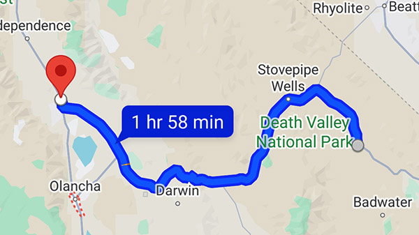
Death Valley Highway 190

Rated 4 Wheelies

Route Details.  This road is quite unique from any other road in this state. It is 135 miles of just raw desert. Ensure you carry extra water to drink although there are gas stations every 35 miles or so. However, with this area having some of the hottest weather on the planet keeping an extra gallon of water (at least) on you is a wise move. The road is as desolate as you can find on a motorcycle, and the topography is like something from another planet. Even though the roads are straighter as compared to other rides I have listed, it’s the region and scenery that really make this road jaw dropping. Be very aware of the weather prior to traveling through this area.

    • Start to Finish Points: Lone Pine to Death Valley Junction
    • Distance: 135 miles
    • Ride Time/Recommended Time: 4 to 6 hours
    • Recommended Time of Year: September to early May
    • Main Point Of Interest: Death Valley National Park
    • Cautions/Dangers: Extreme heat conditions, possible sand in road
    • Important Contact Numbers:  CHP (Bishop) 760-872-5150

Road Description.  If you’ve ever dreamed of driving a motorcycle on Mars this is what it would be like. This road is one that you will never forget due to the dramatic landscape and post-apocalyptic feeling as you roll through the desolate desert of this National Park. The temperatures are extremely hot so I will mention this again to confirm the weather prior to embarking on this route. Early morning is a perfect time to go if you are traveling east to west to watch the landscape change colors in front of you while you are riding.

Points of Interest.  The main attraction of this part of the country is Death Valley National Park. This area is home to the lowest point in the southern 48 with an elevation of 280 feet below sea level. As you stand in the depths of that point and turn northward you can see Mt. Whitney in the distance. Mt. Whitney is the highest point in the lower 48 rising up at over 14,000 feet. During springtime the desert erupts with beautiful fields of wildflowers that stretch across the desert. This makes February and March one of the best times to visit this area. This time also provides relief from the extreme heat of this National Park.  There’s more info on Death Valley National Park here.

Where to Stay/Camp.  This road has only a few places to stop along the way so it is important to ensure your water and fuel levels are topped off at each stop. Even though there are so few places to eat there is plenty of camping along the way during cooler months.  Here are the spots I recommend:

    • The Panamint Springs Hotel is the only place in Panamint Springs to get food, water, and a hotel room
    • Just prior to entering the National Park the Death Valley Hotel is the perfect mid-way point to either grab lunch, camp or a hotel room
    • The Oasis at Death Valley resort has a great steakhouse and saloon that is perfect for a beverage to wind out your day; on the eastern side of the park this resort will be a welcome break from the heat of the day

San Juan Capistrano to Lake Elsinore on Route 74

Rated 4 Wheelies

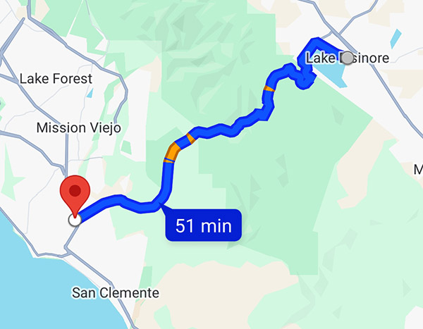
Route Details.  This is a perfect ride for a Sunday afternoon to wind down from the weekend. Fun switchbacks up through the Ronald W. Caspers Wilderness. The road has some beautiful pullouts for a panoramic view of the lake right before you descend down into the town of Lake Elsinore. This ride is popular with local riders so be aware of that as you travel through it and be mindful of speed traps.

    • Start to Finish Points: San Juan Capistrano to Lake Elsinore
    • Distance: 52 miles
    • Ride Time / Recommended Time: 2 to 4 hours
    • Recommended Time of Year: Year round
    • Main Point Of Interest(s): Lake Elsinore
    • Cautions / Dangers: Speed Traps
    • Important Contact Numbers:  CHP (San Juan Capistrano) 949-487-4000

Road Description.  Beautifully maintained roads where you can really practice cornering on your motorcycle. This road is more of a social route that will allow you to stop and chat with fellow riders and build new friendships than a long distance run. It’s close in proximity to LA which makes it a perfect ride on any day where you have a few spare hours and are in need of wind therapy.

Points of Interest.  Once you leave San Juan Capistrano there is nothing until Lake Elsinore, except for probably one of the coolest motorcycle bars I have ever visited, Hell’s Kitchen Motorsports Bar and Grill. This is a place you have to stop at along this road to meet other riders and get a beverage and a burger. There are also several hikes with waterfalls that are worth stopping by for a break and to stretch out.

    • The Ortega Waterfalls is a lovely place to rest and take a quick swim, located at 33382 to 32806 Ortega Highway in Lake Elsinore, California
    • Hell’s Kitchen Motorsports Bar and Grill is a great stopping point to meet other riders and car enthusiasts
    • Kristy’s Country Store is the only place along this route to get snacks or water

Where to Stay/Camp.  Surprisingly for such a short stint of road there are several wonderful camping opportunities either along the beach or in the hills along Route 74. All the campgrounds along this road are very clean and well maintained. These can allow for a weekend getaway that isn’t too far of a ride to get some air and enjoy a nice fire glowing off your motorcycle as you unwind from a week at work.

    • Doheny State Beach is a great location for beach camping
    • The Orange County Park area is a perfect campground with short hikes you can start right from your campsite; closer to Lake Elsinore, this campground also has some short beautiful hikes that are closer to the waterfalls

Conclusions

As you can see there is no shortage of beautiful roads in California. These routes listed along with the bars, restaurants, and tourist points are some of my favorites in the state. The experiences you embrace along these roads are sure to create some of the fondest memories that will stay with you for a lifetime. If you found this article useful or would like to share your favorite roads and experiences in California please feel free to share so we can work together to expand our knowledge on this unforgettable state.


Never miss an ExNotes blog:


Don’t forget: Visit our advertisers!


The Top Five Southern Colorado Motorcycle Roads

By Mike Huber

As an avid motorcyclist it’s easy to appreciate the beauty in each state and for many riders discovering amazing roads that many would overlook can become second nature to us.  Some might even say it’s an art form.  Throughout this vast and beautiful country called the United States of America we are fortunate enough to have a plethora of both paved and dirt roads that are meant to be sought out like the Ark of the Covenant.  These roads are meant to be experienced intimately the only way they can be, on two wheels. Experiencing them on a motorcycle can become a thirst that is never quenched, and although each state has its own unique characteristics, ultimately some will stand out more than others. One state that has that effect for me is Colorado.

Colorado is one of those states that as soon as you ride past the “Welcome to Colorful Colorado” sign the roads seem to present themselves to you like a feast on a golden platter with an endless amount of wine.   The rides we will review can each be completed in one or two days and are best ridden between late April and early October.  To help with prioritization since there are so many incredible rides we have developed a very complex mathematical rating system of 1 to 5 wheelies (5 being the highest).  The rating uses the following criteria:

    • Road conditions
    • Diversity of riding options
    • Activities along the route
    • Abilities to disperse camp/hotel access
    • Scenery

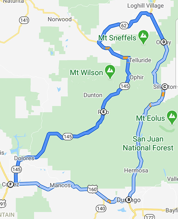
Route 550:  The Million Dollar Highway

Rated 5 Wheelies

Road Description.  This loop may be one of the greatest roads in all of North America. The road is paved and in immaculate condition.  It combines some of the tightest switchbacks one can expect to experience on a motorcycle. The full route per the map is ~355 miles and can be done in 1 day, but highly recommend taking at least 2-4 to fully experience and immerse yourself in this beautiful part of the country.  There are endless forest roads off 550 to get your fill of dirt riding littered with an infinite amount of beautiful dispersed campsites. Also some wonderful old mining towns rich with history, hiking, restaurants, hotels, and hot springs.

Points of Interest.  There’s no shortage of amazing places to stop along this road.  Below is a small list of the places you should not miss along this route.

    • Silverton is a great little mining town with wonderful people.  It’s a perfect place to load up on supplies if you are camping.  You can warm up after getting some miles in at the Brown Bear Café.
    • Ouray is a beautiful mountain town with several hikes to waterfalls, hot springs, and some wonderful restaurants. My favorite is the Ouray Brewery.
    • Rico is a really tiny town which consists of a great hotel and bar called the Enterprise Bar and Grill, with wonderful people, great food and cold beer.

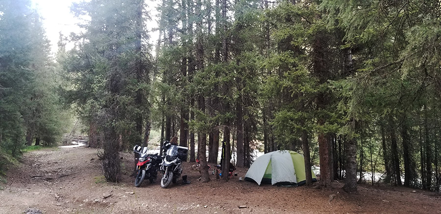
Where to Stay/Camp.  There is an immense amount of national forest land that can be used to camp on along this loop.  Really any dirt road you ride down will guide you to an epic campsite next to a creek. This makes for a relaxing post ride time to wind down in a hammock, while having a refreshing beverage. The towns of Silverton and Ouray have several hotels that are right in the heart of the town and a short walk to tourist activities and restaurants.

Off-Roading.  There is an endless amount of dirt roads to find here, this goes from flat well-groomed forest roads to find a campsite to the technical challenging mountain passes like Engineer or Imogene Pass (which I have not done due to the size of my GS1200 and conservative riding style).

Out of so many outstanding rides in the state of Colorado, the Million Dollar Highway should be on the top of any list.  This road and area really earn that 5 Wheelie rating due to exceeding each standard for riders of all ability levels. There are so many sights to see along this route that you will never tire of absorbing the beauty that surrounds you in this part of the state. If you are fortunate enough to have the time, doing the loop in reverse can be a great way to add a few more days to your adventure.

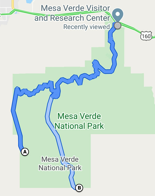
Mesa Verde National Park

Rated 5 Wheelies

Road Description.  As soon as you enter Mesa Verde National Park the road begins screaming up in elevation with some incredible views overlooking the valley below you will almost have a sense of vertigo overcome you.  What is wonderful about this feeling as it goes on and on as you travel through the park.  Although the distance from the park entrance to the furthest point is only 28 miles, those miles are filled with numerous overlooks and pullouts that can make this seemingly short ride take 2-3 days.  This is especially true if you are taking in the hikes along the way.  The only piece of concern for this ride is the numerous road snakes in some areas of this ride. Otherwise its full enjoyment as you have a 360 view of the valleys below that outstretch clear into Utah, New Mexico, and Arizona.

Points of Interest.  Since this is a National Park there are ample amounts of short hikes and tours to break up the day(s) you spend in this magical location. A few of the more popular ones are outlined below:

    • The Cliff Palace requires purchasing a tour ticket at Park Visitor Center, but even without one you can walk to the overlook to get a spectacular view of the houses the Hopi built into the cliffs which are all but hidden except from this vantage point.
    • The Balcony House also requires a tour ticket but is well worth it as you can walk through the ruins and really get a sense of the
    • The Knife’s Edge Hike is a great 2-mile hike with little elevation next to Morefield Campground that has incredible sunset views, which enable the rocks to really light up and glow.

Where to Stay/Camp.  Morefield Campground- This is the only campground in the park so making reservations ahead of time is recommended. It is one of the better National Park campgrounds I have stayed at and includes free showers, great Wi-Fi from most campsites (antennas are off the bathrooms), and a launderette, gas, and fully stocked store for all your camping and souvenir needs. There are also several wonderful hiking trails right next to the campground.

Off-Roading.  This is one of the drawbacks of a National Park, as there is no off-roading permitted within the park boundaries.  The beauty and activities from hiking and riding makes up for this shortcoming.

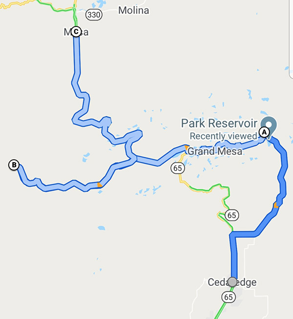
Route 65: Grand Mesa Scenic Byway

Rated 5 Wheelies

Road Description.  Yet another beautiful Colorado mountain road filled with switchbacks that rise in elevation and bring you to over 10,000 feet up and onto the World’s largest Mesa. There are several pullouts along this route to take in the views, but no gas stations from Cedaredge to Mesa (50 miles, but can be close to 100 miles if you are doing the off-road portion) plan accordingly.

Points of Interest. The main point of interest the mesa itself and the amazing views, alpine lakes, dispersed camping, and off-roading.

Where to Stay/Camp. Dispersed camping is plentiful along Rte125 where you can get a lakeside campsite with little issue and make it your own paradise for the evening as you watch the sunset glistening off one of the many alpine lakes. There are also plenty of campgrounds along this way if you are looking for less primitive camping.  Hotels are scattered along this route in the towns of Delta, Mesa, or driving to up Grand Junction for a greater variety of lodging.

Off-Roading.  Route 125 Surface Creek Road is a great 15-mile loop.  This road has you experience the mesa while passing crystal clear alpine lakes with numerous dispersed camping areas.  There is also a 10-mile dirt road in great condition to visit the Lands’ End Observatory. The views off the mesa looking down on the plateau can allow you to see into Utah on a clear day with awe inspiring views.

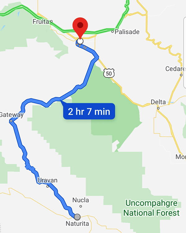
Route 141: Grand Junction to Naturita

Rated 4.5 Wheelies

Road Description.  This is a low elevation beautifully paved road that is 105 miles long.  This road will have you leaning your ride until you feel the mist kissing your windshield from Dolores River as you pass amazing rust colored mesas that stretch into the sky and rival that of Monument Valley. The road has very little traffic which will allow you to enjoy some solitude as you embrace the scenery you ride through. The only reason this route is rated as 4.5 is the lack of amenities.

Points of Interest.  This road is in quite a desolate area, outside the tiny town of Gateway.  Gateway Canyons General Store is owned and run by the preacher of the church next door to it.  This is the only place to gas up between Grand Junction and Naturita so be sure to check your fuel levels.

Where to Stay/Camp.  Dispersed camping here is plentiful but mainly in one area just south of Grand Junction, Divide Road. This road is a steep switchback dirt road that connects to numerous other roads which are great fun exploring for campsites to settle down in.  There are numerous dispersed sites with beautiful views over the canyon in which you can see the Dolores River running far beneath you.

Off-Roading.  Divide Road also encompasses numerous off-roading opportunities that sprawl out across this mesa.  This is a perfect place to explore for that unique dispersed campsite while hitting some fun dirt to enhance your day.  There are however areas of slippery clay, so if it is raining it can become slick in portions of this road.

Routes 160 and 149: Pagosa Springs to Lake City

Rated 4 Wheelies

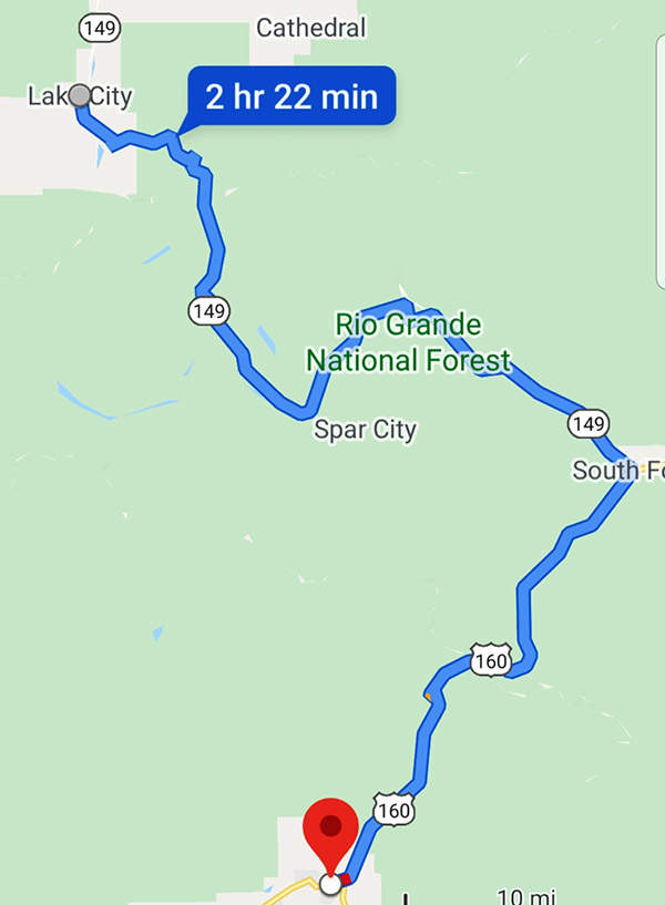
Road Description.  This route consists of 45 miles of a four-lane highway on Route 160 that will have you summit at over 10,000 feet.  The road will then drop you into South Fork, Colorado.  This is where you will turn left onto Route 149.  Route 149 will quickly whittle down to a tighter and quieter road for the next 75 miles, which are filled with mountain passes. South Fork is the only town between these areas so make sure you gas up and grab lunch before heading onto the second part of this amazing road.  The next portion will have you speeding across lower elevation prairies and then climbing high into the mountain tundra that will resemble something from another planet before descending into Lake City.

Points of Interest.  I specifically wanted this trip to begin (or end) in Pagosa Springs so you have an opportunity to experience the hot springs in Pagosa.

Where to Stay/Camp. Throughout the ride there is no shortage of camping in both dispersed and paid locations. In Pagosa there are numerous hotels. I prefer the hotel directly across the street from the spa as it is much more affordable then the spa and in a great location.  For Lake City, the Matterhorn is a beautiful Swiss style motel which will allow you a solid night’s sleep at a great price. It’s a perfect spot to recharge if you are going to take on some of the more challenging off-road portions in Colorado the following day.

Off-Roading.  Lake City is the starting point for some of the more serious off-roading mountain passes, such as a few of the most popular passes including Cinnamon and Engineer.  Both of these passes surpass 12,000 feet.  If you crave technical off-roading challenges with views that can’t be beat, these are the two passes I recommend.

Conclusions

Southern Colorado is a rider’s paradise, and a region that should not be missed for riders of all experience levels. Other avid motorcyclists have also recommended these roads to me, which reinforces my approval for these routes and motivated me to write this comprehensive layout to help others. I hope this breakout has been helpful and serves as a reason to visit Southern Colorado and have the riding experience of a lifetime.


Never miss an ExNotes blog:


Don’t forget: Visit our advertisers!


My New Home

By Mike Huber

Traveling and living mostly off my BMW GS1250 for the past six years has really taught me how to live in a minimalistic way, but travel with enough to be comfortable.  It is a rarity that I need anything more than what I have.  My organizational skills are honed to the point that I know where everything I own is at all times. Everything has a specific place and keeping items consistent with their location is key to organization.  I can get out of my tent at 2:00 a.m. and know not only which pannier any given item is located, but the exact location within that pannier.  It’s an art form that I take pride in. So you can imagine if things are flipped upside down and I am pushed into a new packing routine how it would take time to readjust my mindset to a new format.

This is exactly the place I have found myself in now.  Beginning January 10th I am converting from a motorcyclist to a backpacker as I begin a trip to Oceania for an unknown period of time.  Auckland, New Zealand will be my starting point and a 50 Litre Osprey Backpack will become my new home.  Relearning organizational skills as a backpacker will include a learning curve, albeit a fast one.  With a little bit of discipline my organization as a backpacker will become just as honed as my previous life was on the motorcycle.

Here’s my packing list:

Although this seems minimalistic it will be summer in the southern hemisphere so going light on clothing was an easy decision to make.  I am sure if I am missing anything it will be easier to pick it up along the way rather than carry the weight and bulk of unneeded items.  Being new to backpacking I am fully open to criticism and suggestions on anything I am missing or have over packed.  Let me know your feedback and items that you cannot live without that should be added to this list.


Read the Mike Huber New Zealand posts here:


Never miss an ExNotes blog:


Join our ExhaustNotes Facebook group!


Don’t forget: Visit our advertisers!